This is one of the most beautiful and unusual places in Ukraine where I have been. Aktovsky canyon is often called "Devil's Valley". The small river Mertvovod meanders between high rocks. According to legend, the ancient Scythians sent their kings down the river on the last journey. The rocks around it rise 50 meters. How and why such a place arose among the flat steppe is completely incomprehensible.This is a miniature American Grand Canyon. The landscapes here are incredibly beautiful, especially at dawn - with the first rays of the sun, the rocks turn peach-pink. Welcome to Devil's Valley.
Autumn should be met where it is especially beautiful. Last year it was such a place for us, now it is Aktovsky canyon. We had been going there for a long time and finally escaped, and even with tents, so we managed to shoot at dawn. Getting here is very difficult, but worth it. This is one of the most beautiful and unusual places in Ukraine where I have been. At the end of the post there is a map and a detailed description of how best to drive. Until then, enjoy the beauty.  2.
2.
To begin with, by tradition, the history of the place in two paragraphs. It is one of the oldest land areas in Eurasia, formed from volcanic rocks. The sea here dried up 60 million years ago. But that was too long ago, we are more interested in the present. Aktovsky canyon is located in the valley of the Mertvovod river. This is an influx. The entire canyon is about five kilometers long. The height of the rocks is up to 50 meters. In some places, sheer stone walls are formed. Huge boulders lie on the banks.  3.
3.
 4.
4.
Like the Aktovsky canyon and the entire bed of the Mertvovod River, it is included in the Bugsky Gard National Park. This place is called "Devil's Valley" and "Small Crimea" - granite-basalt rocks are very similar to the Crimean ones.  5.
5.
Rocks in the very village of Aktovo. This is the most popular section of the canyon. But, by the way, not the most beautiful. It will be better further)  6.
6.
For the first time I saw how tourist buses travel across an open field. It's beautiful here, but there are a lot of people. Therefore, we go further.  7.
7.
The place is very popular, but it is incredibly quiet and cozy here. Tourists rarely reach the canyon itself, confining themselves only to the rocks in the very village of Aktovo. It is difficult to drive further, only photographers, climbers and ecotourism lovers wander into the valley itself. That means we have a road there.  8.
8.
 9.
9.
 10.
10.
 11.
11.
 12.
12.
Dawn. The sun rises because of the landing opposite the canyon, so in the morning the rocks are pink.  13.
13.
 14.
14.
In these places, many rituals of the ancient tribes were performed. Most of the Scythian kings are buried in the valley. According to legend, the rulers were sent on their last journey along the stream of the Dead Man. Hence such a gloomy name. Herodotus calls this river Exampey, which literally means "dead water". 15.
15.
 16.
16.
There is another legend - during one of the Tatar raids, local residents boiled a poisonous broth and poured it into the river upstream of the Tatars' camp. The enemies drank the water and died. According to another version, the river got its name after the terrible battle of the Zaporozhye Cossacks with the Turks, after which the river water was not visible because of the bodies of the dead. 17.
17.
As for me, it is from this point that the best view of the canyon and the valley of the Mertvovod River opens.  18.
18.
The canyon is considered the only one in Europe, which in terms of geological and landscape indicators exactly repeats the famous canyons of North America. A kind of Grand Canyon in miniature. 19.
19.
 20.
20.
 21.
21.
The sun has risen and the rocks no longer seem peachy.  22.
22.
 23.
23.
I can't believe it, but a hundred years ago the river was navigable. The Soviet government decided to equip collective farms here - the channel in many places was blocked with dams, the banks were turned into fields. The course of the river slowed down, the bottom was silted up, the channel was overgrown with reeds. They say that the layer of silt and mud in some places reaches five meters, in some places the river has turned into a swamp that can be waded. But in some places there are still small murmuring cascades and even waterfalls.  24.
24.
 25.
25.
 26.
26.
The best place to camp. Convenient descent to the water, there is a place for a fire and tents. And around - the beauty.  27.
27.
 28.
28.
 29.
29.
Locals come here to fish.  30.
30.
 31.
31.
 32.
32.
 33.
33.
Local flora. They say that several hundred species of different plants grow here. Many of them are listed in the Red Book. I don't know what it is, but it looks pretty.  34.
34.
 35.
35.
 36.
36.
 37.
37.
 38.
38.
Finally - two panoramas. Pictures are clickable.
39.
How to get to Aktovsky canyon:
The road is not for the faint of heart. From Odessa it is best to go through Nikolaev, and further along the Southern Bug, through New Odessa and Voznesensk. At the exit from Voznesensk, in front of the church, turn right. The road to the village of Trikraty is quite tolerable. In the village itself there is a wonderful landmark - an old road paved with paving stones, you go there. In about 10 minutes the Arbuzinsky Canyon will appear on the right. We drive past, enter the village. The main road turns left and after five minutes it runs into a field. The most popular rocks are right behind it. The canyon itself is upstream. You need to go there along the fields and dirt road. Leave the village, near the tractor base to the right, then along the field to the landing - there will be a small passage through it. Then the road goes between the canyon and the forest. It's easier to show on a map than to explain. The only correct path from the village to the canyon is highlighted in orange. Yes, these are all primers. The ride is 20-30 minutes.

1 - the most popular rocks (photos 2-7), 2 - an impromptu parking lot, 3 - a tractor base, near it you need to turn right, 4 - a lake, 5 - here we dive through the landing, 6 - the steepest view of the canyon (photo 15- 23), 7 - another coolest place with a convenient descent to the water (photo 27-33), 8 - a small waterfall (photo 24-26).
P.S. Firewood for a fire can be found on the spot, but you need to go to the landing for them, everything on the shore has long been dismantled. So if you are too lazy to walk a lot - take coal with you) It is also advisable to take a folding brazier with you. There are few equipped places for fires, and the grass is dry all around - it can catch fire.
Liked? Click like and repost, let others see)
Photo reports from other canyons and quarries in the south of Ukraine.
You don't have to travel to distant Arizona to see the Grand Canyon! There is the same spectacular geological object in Ukraine - we mean the Aktovsky canyon. Of course, our canyon is much smaller than its North American counterpart, but its beauty is in no way inferior to it.
Excursions to Aktovsky canyon from Kiev, Dnieper, Odessa, Zaporozhye, Nikolaev, Kharkov and other cities are carried out by prior order by phone 050 515-88-86
096 095-99-69
Trips from Kherson take place according to Saturdays, holidays and individual orders.
Description
Once you get to the Aktovsky canyon, you will remember your rest here for a long time - the landscapes are fantastic! The flat endless steppe is crossed by a deep river valley with almost steep slopes and a narrow bottom; between the stone arches of the canyon, a river with the ominous name of the Dead River meanders. The height of the rocks reaches 40-50 meters - this is about a 15-20-storey building.
The history of the appearance of the Aktovsky canyon
Nikolaevsky Canyon is one of the oldest land areas in Europe, formed from volcanic rock (about 60 million years ago, the sea splashed here). The valley arose due to a break in a large granite shield - the age of the rock is more than four billion years. In addition to the Grand Canyon in America, these places are called the Small Crimea - granite-basalt rocks really resemble Crimean ones. Many also note the similarity of the relief with the canyon in Buki.
There are boulders at the entrance to the Vienna UN International Center, symbolizing the world's continents. The stone that symbolizes Europe was brought to the capital of Austria from the Nikolaev gorges!
Watch the Devil's Canyon from above in this video:
Features of the natural area
Aktovsky canyon, the photo of which you see, is a unique phenomenon, absolutely atypical for the hot Ukrainian steppes. It is a deep river valley - the only complex of rocks and granite boulders of all sizes in Europe. It is part of the Buzhsky Gard National Park and is regularly ranked among the country's natural wonders.

However, the Aktovsky canyon near Nikolaev is of interest not only for fans of geology and beautiful nature, but also for followers of esoteric teachings. It is believed that these places, as well as, were an important sacred center of Scythia - since ancient times, among the majestic rocks, they prayed to the gods and performed important rituals.
Vegetation
The climatic conditions here are atypical - it happens that even in winter violets bloom on the slopes and cows graze! In total, on the territory of the canyon (which is almost two and a half hundred hectares), there are more than 900 plant species (about 30 are listed in the Red Book).

Thickets of calamus on the slopes, rare species of ferns, wild rose hips, junipers, mosses and lichens - all this variety of flora can be seen when arriving in the Aktovsky canyon, excursions include walks in protected areas.
Not far from the place where the Arbuzinka river flows into the Mertvovod river, there is a reserved tract Trikratsky forest (consists of the tracts of Vasilyeva apiary and Labyrinth).

Man-made Trikratsky forest
As well, this is not a natural phenomenon - at the beginning of the 19th century the forest was planted by Count Viktor Skarzhinsky, a Kherson landowner, a provincial leader of the nobility and a famous practitioner of steppe afforestation. By the way, in the village of Trikraty, the estate of the Skarzhinsky family is still preserved - an atmospheric two-story building, built in the 18th century.
Having abandoned his military career, Skarzhinsky decided to arrange a dendrological park in the middle of the Nikolaev steppes - he brought more than 200 varieties of fruit trees, seedlings of oaks and poplars, thuja and tulip trees, mimosa and cedar. Fountains and paths were laid in the park - thanks to the intricate grid of alleys, part of the Trikratsky forest was called the Labyrinth.
Years passed, and the park turned into a real wild forest - here you can meet bison, deer, pheasants and other representatives of forest fauna. For example, gray herons nest in Myronova Grove - this is the only place of this kind on the map of the Nikolaev region. And in the Trikratsky forest there is a whole grove of ancient oaks - their age has long passed over a hundred!
In fact, Aktovsky canyon is a whole complex of canyons of various sizes. Beautiful photo-landscapes can be taken in the Arbuzinsky or Small Aktovoy canyon - its granite-basalt rocks were formed billions of years ago.

Basalt Rock Labyrinths
The Arbuzinka River flows along the bottom of a kilometer-long gorge, between huge boulders. Along its banks you can find many outcrops of granites - in Soviet times, granite quarries functioned in one of the most beautiful places in the Nikolaev region. Today all of them are abandoned, one of them is known under the name "Black Lake" - this is the main attraction of the village of Migia in the Nikolaev region.
Deadvod River
The mystical river Mertvovod (a tributary of the Southern Bug) flows along the bottom of the Aktovsky gorge.

Once upon a time in antiquity, along the course of this river, the Scythians fused the bodies of their dead leaders - perhaps the name Dead-Man came to us from those times. According to another version, the "dead" water became during the Tatar raids - allegedly local residents (in some retellings, Zaporozhye Cossacks) poured a poisonous broth into the river to poison the bassurman who camped nearby. However, some researchers associate this name of the river with a high content of hydrogen sulfide in its waters and a corresponding smell.
Weather in Aktovsky canyon
On the map of Ukraine, Aktovsky canyon is located at the very bottom, in the south - among the steppes drenched in the sun. You can come here at any time of the year:
- in winter Deadman freezes, and the overhanging rocks are covered with frost - why not the scenery for the next season of "Game of Thrones"?
- in spring, mountain tulips bloom here - the same can be seen only in southern Siberia and on the plains of Kazakhstan.
- in summer, the wind brings dizzying aromas of fragrant steppe herbs, and river lagoons beckon to swim. And it is also in the summer that you can see and experience "frying pans" - giant flat stones that are so heated in direct sunlight that it is quite possible to fry eggs on them.
- in autumn, the Trikratsky forest and Aktovsky canyon are painted in all shades of yellow and red - this is the most suitable time for leisurely picnics and beautiful photos of nature.
The average summer temperature in the local area is + 25C °, the average winter temperature is -1 ° C. However, even if the sun disappears during your visit, nature will not disappoint - cloudy weather gives the rocks a special, a little ominous charm. The video about the Aktovsky canyon clearly illustrates this:
Aktovsky canyon: how to get from Kherson?
On the map of Ukraine, Aktovsky canyon is indicated in the Voznesensky district of the Nikolaev region, near the settlement of Trikraty. The way from Kherson takes about three hours (180 km), but time flies by - very interesting views outside the window!
By car
Your main landmark is the village of Aktovo in the Nikolaev region (highways M14, P06). Coordinates - 47.72430 31.48206. We do not recommend driving a sedan with a ground clearance of less than 15 cm. The local landscape does not allow the confident use of a low-slung car. An excursion to the Aktovsky Canyon will not be complete without proper accompaniment and an expert guide.
By bus
By bus, you first need to get to the city of Voznesensk, where you change to a minibus to Trikraty - it will take you to the village. 10 minutes and you are there. The most difficult thing is to find all 3 canyons that are available on the Devil's Canyon tour. The distance between the gorges reaches several kilometers.
Tour program
The journey is very busy and takes a whole day. During this time, you will have time:
- bypass all three legendary canyons - Arbuzinsky, Maly Aktovsky and Bolshoi Aktovsky;
- descend to the bottom of Devil's Canyon;
- arrange a photo session against the backdrop of spectacular natural scenery;
- relax in the Trikratsky forest;
- visit 4 secret locations, not known to every guide!
Excursions from Kherson to Aktovsky canyon: an approximate plan
| 7:00 | The meeting point is (Suvorov st. 8). We leave from Kherson to Aktovsky canyon by bus. |
| 10:00 | Stop near the Skarzhinsky estate. WC. |
| 10:20 | Arrival to the Arbuzinsky Canyon. A walking tour about the formation of rocks, the Arbuzinka river, a story about local legends. |
| 12:00 | Moving to Kupalskaya Polyana (small canyon), free time and the opportunity to have a snack. You can order a delicious panini or granola with you on the road from our administrators. |
| 13:30 | Transfer to the big Aktovsky canyon. Visit to several locations in the Devil's Canyon and a walking tour. Free time to walk through the canyon, collect water from the spring or do some meditation in a stunning location. Time for photos, videos and selfies in the Ukrainian Grand Canyon. |
| 16:30 | Visit to the Trikratsky forest. Herbal tea in Kherson style and preparation for the road back. |
| 17:00 | Departure to Kherson. |
| 20:00 | Return to Kherson on Suvorov 8 or to the agreed place. |
| * The itinerary and travel time may vary depending on weather conditions and personal agreements with guests. |
Ideal for canyon travel. The tour is carried out by our partners. An experienced and charismatic guide will accompany you.
Prepare for your trip in advance! Here is a rough list of things you will definitely need on the road:
- comfortable clothes and shoes;
- headdress;
- swimsuit or swimming trunks (in the warm season);
- habitual snacking;
- drinking water supply.
We accept applications from Kherson, Odessa, Dnepropetrovsk, Kiev, Zaporozhye, Nikolaev and any other cities of Ukraine - book an excursion right now! The cost of a trip from Kherson is 650 hryvnia. The tour price includes:
- entry tickets;
- tea made from medicinal steppe herbs;
- insurance;
- excursion program.

Aktovsky canyon from Odessa
The cost of a trip to the Aktovsky Canyon is 985 hryvnia. The price includes the following services:
- transfer to the canyon and back;
- excursions according to the program and entrance fees;
- tasty dinner;
- escort on the route;
- insurance.
An excursion to Aktovsky canyon from Odessa follows the following program:
| 06:45 | Gathering the group at st. Bunin 15, corner of st. Pushkinskaya (near the regional Odessa Philharmonic). We leave at 07:00. |
| 10:00 | Arrival to the village of Trihaty. We go with a guide on an excursion to the Arbuzinsky Canyon, listen to the guide's story about legends and stories. Excursion along the Aktovsky canyon. |
| 14:00 | We visit the man-made forest of Count Skarzhinsky and get acquainted with the flora and fauna. |
| 14:30 | Lunch time. Approximate menu: pork shashlik, baked potatoes, vegetables, drinks. |
| 15:30 | Excursion to the tract "Labyrinth" in the Trikratsky forest. |
| 17:00 | Departure to Odessa. |
| 21:00 | Arrival in the city. |
| * Itinerary and travel times may vary due to weather conditions and time of year. |
The collection of tourist groups for excursions to the Aktovsky canyon from Odessa is scheduled for April.
Travel Schedule
Standard trips operate on Saturdays from early April to November. Select the desired date on the calendar and place your order online in 3 minutes.
An individual excursion can be ordered by calling 050 515-88-86.
Excursion to Aktovsky canyon: feedback from participants
For several years of regular trips to the Aktovsky canyon, we have collected reviews about this amazing place. Thanks to our guests who left a comment in the questionnaires after the tour. Feedback helps to improve the devil's canyon tour. We will be glad to read your review too!
200 mysterious and mysterious places of the planet Kostina-Kassanelli Natalia Nikolaevna
Devil's Canyon Equivalent to 8000 atomic bombs
Devil's canyon
Equivalent to 8000 atomic bombs
A huge round crater with a diameter of 1219 m and a depth of 229 m, located in the American state of Arizona, of course, is not a devil's hoof mark on the ground. Devil's Canyon was created about 50,000 years ago by a meteorite. Moreover, according to scientists, the meteorite was by no means gigantic in size: the diameter of the celestial body was only about 50 m, and the earth's shaft around the funnel, which it created by crashing into our planet, has the same height today.
According to astrophysicists' calculations, the ancient meteorite weighed 300,000 tons, and its flight speed was 45,000-60,000 km per hour. The power of the explosion from the fall of the Arizona meteorite was 3 times higher than the power of the famous Tunguska meteorite and was equal to the power of 8000 atomic bombs, similar to the one that the American Air Force once dropped on Hiroshima.
The fragments of a meteorite, consisting mainly of nickel iron, which were found in abundance near the colossal crater, have long been used by local Indian tribes who lived in these places. The Indians considered the crater a trace of the visit of the god of fire and sewed the smallest particles of meteorite into amulets, and also put them in the grave of the dead so that the god of fire could distinguish the sons of his people from others.
Canada has a meteorite crater 443 km in diameter. The largest crater is located in Antarctica, on Wilkes Land. The diameter of this crater is 500 km! So Devil's Canyon is far from the largest meteorite crater known on our planet, but it is the best preserved one. And today, thanks to the dry desert climate, the trail left by the distant space alien looks almost the same as it did 50,000 years ago.
Today, the crater is visited by crowds of tourists, who also hope to find a piece of a celestial body that has split into tiny parts near it. Of course, finding even a small particle of a meteorite is extremely difficult, but enterprising merchants constantly offer gullible visitors to Devil's Canyon to buy "a real meteorite found right here"!
Since, according to scientists, Devil's Canyon is the closest to the lunar landscapes, the training of American astronauts took place here, who were to land on a satellite of the Earth. The meteorite crater has served space specialists a great deal, because it was thanks to it that inaccuracies in the design of astronauts' suits were eliminated.
There is a museum on the edge of Devil's Canyon, where visitors can see an interesting selection of materials on meteorites and other celestial bodies, as well as admire photographs of astronauts in full "lunar" clothing.
This text is an introductory fragment. From the book "Baptism by Fire". Volume II: "The Struggle of the Giants" author Kalashnikov MaximPsycho Breakthrough: "Prairie Fire" and "Eldorado Canyon" What happens in reality? In March 1986, the Americans, taking advantage of Gorbachev's passivity, brazenly push, beat on the psyche. They are making a spy scandal and demanding the exile of a hundred Soviet UN employees. Then
From the book 2008_1-2 (551) author Newspaper DuelDEVIL'S HOOF All of our liberal rag-tag is wildly delighted with Bulgakov. Especially "Echo of Moscow" drags along. As he hears the name "The Master and Margarita", he is choking with happiness, calling this author the greatest of all the greats. They are Pushkin and Gogol never
From the book The Bermuda Triangle: Myths and Reality author Kushe Lawrence David54. The Devil's Sea The Bermuda Triangle is not the only place on the globe where ships and planes go missing more often than the laws of probability dictate. To the southwest of Japan lies the treacherous Sea of \u200b\u200bthe Devil, which the Japanese have come to fear like fire from behind
From the book Mysteries of the Bermuda Triangle and Anomalous Zones author Voitsekhovsky Alim Ivanovich"Devil's Sea" This area is located in the Pacific Ocean between Japan, the northern part of the Philippine Islands and the island of Guam (USA). This part of the largest ocean on the globe is considered a "cursed place" by sailors. Here storms and dead swells suddenly begin, which
From the book Literary Gazette 6305 (No. 4 2011) author Literary NewspaperThe universal equivalent of Biblioman. Book dozen The universal equivalent of Rolf Meinsinger. History of banknotes: secrets of paper money. - M .: FAIR, 2010 .-- 256? P.: Ill. - 2000? Copies. Paper money has existed on Earth for several centuries. People are so used to their existence,
From the book From Truman to Reagan. Doctrines and realities of the nuclear age author Yakovlev Alexander NikolaevichCHAPTER FIVE THE WHEEL OF ATOMIC PASSIONS In essence, the doctrines of war by themselves can attract few people except their customers. But they are still designed for the masses. That is why militarism and military propaganda in the United States is based on the thesis of "national interests." It blows from him
From the book The Matrix of Riot author Pustovaya Valeria EfimovnaDisciple of the Devil With renewed vigor, the question of the humanistic results of the era is posed in the novels of Pavel Krusanov "American Hole" and Mikhail Levitin "Bastard Bach" (both novels were first published in "October" in 2005: "American Hole" in No. 8-9, "Bastard Bach" in No. 6). In the center
From the book Freedom - a starting point [About life, art and about yourself] author Weill PeterLiberal and its monetary equivalent We can say that "liberalism" is a quantitative concept. In any case, its origin is as follows. We are talking about the amount of knowledge and the corresponding breadth of horizons, and hence, in the form of a consequence, the inability and impossibility
From the book of 100 famous mysteries of nature author Syadro Vladimir VladimirovichDEVIL'S TOWER Most often, unusual natural formations are given poetic names. But sometimes fantasy seems to be cheating on people and then Death Valley, Pyramid Lake, Devil's Tower are born ... Agree, it's unpleasant to live in such places. What caused such
From the book Atlantic Diary (collection) author Tsvetkov Alexey PetrovichTHE DEVIL'S ATTORNEY At one time, the Soviet dictator disparaged the Vatican, asking a rhetorical question how many divisions he had. He forgot that not so long ago he himself did not have one, as well as Lenin and Trotsky, but that this did not prevent them from making
From the book Newspaper Tomorrow 448 (26 2002) author Tomorrow NewspaperPLAGUE FROM THE DEVIL June 24, 2002 0 26 (449) Date: 25-06-2002 Author: Mikhail Supotnitsky PLAGUE FROM THE DEVIL (A little-known component of our victory over Japan) "... Ishii told me that after all the research conducted under his leadership, he came to conclude that deliberate distribution
From the book Newspaper Tomorrow 449 (27 2002) author Tomorrow NewspaperPLAGUE FROM THE DEVIL July 1, 2002 0 27 (450) Date: 02-07-2002 Author: Mikhail Supotnitsky PLAGUE FROM THE DEVIL (A little-known component of our victory over Japan. Ending. Beginning in No. 26) Bacteriological sabotage against the USSR began with the operations of special suicide squads even during
From the book Epoch and I. The Chronicles of a Bully author Kushanashvili Otar ShalvovichLady Gaga is the female equivalent of Otarik I have long wanted to call one of my brilliant articles "Chaka-chaka-boom-boom." I am the first who thought of replacing claims to metaphorism with this vigorous "Chaka-chaka-boom-boom". What an article about our Vietnamese show business
From the book Paper Radio. Podcast Haven: Letters and Sounds Under One Cover the author Gubin DmitryWesternism and pochvenism from the point of view of profit On the idea of \u200b\u200bapplying a common yardstick to Russia and on bringing Russian Westernizers and Slavophiles to a universal equivalent, which is money http://www.podst.ru/posts/3900/ In the eternal Russian dispute between patriots and cosmopolitans,
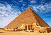
From the book of 200 mysterious and mysterious places of the planet author Kostina-Kassanelli Natalia NikolaevnaThe Grand Canyon A Journey Through Earth's Four Geological Eras Looking at this grand creation of nature, it’s impossible to believe that we owe it to the Colorado River. It was she who, over millions of years, has created a real miracle in the rocks. Length and depth
From the book Death of Rostov author Varenik VasilyThe fate of the "atomic refugees" These are the most unfortunate refugees of all times and peoples. Because everyone who escaped from the contaminated atomic zone becomes homeless overnight. Because they cannot leave anything of money and valuables with them and on themselves.
(G) 35.027222 , -111.022778Arizona crater
Arizona Crater (Barringer's Crater, Devil's Canyon) is a large meteorite crater (astroblema) in Arizona, USA, 30 km west of Winslow and 56 km from Flagstaff (Interstate 40, exit 233). It is a giant earthen bowl with a diameter of 1200 meters and a depth of 180 meters.
Crater origin
The crater appeared about 50 thousand years ago after the fall of a 50-meter meteorite weighing 300 thousand tons and flying at a speed of 45-60 thousand km / h. The explosion from the fall was three times more powerful than the explosion of the Tunguska meteorite and was similar in power to the explosion of 20 million tons of trinitrotoluene or 1000 atomic bombs similar to those dropped on Hiroshima. Fragments of meteoric nickel iron were found in and around the Arizona crater.
History of discovery and research
The location of the crater was known for a long time to local Indians, who used metal fragments of the meteorite for their own purposes. Local tribes have a huge number of legends and traditions associated with this sacred place. Scientists only became aware of the existence of the crater since a year.
View of the crater from space
Until the beginning of the 20th century, this crater was believed to be of volcanic origin, and only in 1902, a mining engineer from Philadelphia, Daniel Moreau Barringer, hypothesized that this giant crater was formed as a result of a meteorite impact. He acquired a piece of land where the crater is located, and quickly began drilling its bottom, because he was convinced that he would find the meteorite itself. Barringer spent 26 years of his life looking for a meteorite and convincing others that his crater was of extraterrestrial - meteorite origin.
The drilling turned out to be useless, and it could not be otherwise. The estimates of scientists, which may have caused Barringer's fatal heart attack, showed that the meteorite should have almost completely evaporated in the atmosphere and upon impact with the Earth. During his lifetime, Barringer failed to unequivocally prove to the scientific community the nature of the crater's origin.
His merits were not recognized until thirty years later, when convincing evidence that a crater in Arizona was caused by a meteorite impact was presented by Eugene Shoemaker, one of the world's foremost comet and meteorite specialists.
Astronaut training in the crater
The Arizona crater was recognized as the only place on Earth that most closely resembles the lunar landscape, and it was there, under the direction of Shoemaker, that all astronauts who were to go on a flight to the moon passed part of the training. And it was in this crater that the shortcomings of the spacesuits, in which the first earthlings were to leave their mark on the Moon, were revealed and eliminated.
Tourism
Crater bottom
It is impossible not to mention the museum, which stands literally on the edge of the crater and stores photographs of all "lunar" astronauts in full space attire. If you do not know that these pictures were taken literally two steps away from where you are standing, then you can believe that they are of lunar origin. Arizona Crater is one of the landmarks of the state of Arizona. Many tourists visit it every day. To attract tourists, locals regularly report numerous observations of this place of air glow and UFO hovering, as well as mysterious geomagnetic anomalies inside the crater.
Selling the meteorites found in this crater (or impersonating them) is thriving and quite profitable business. The cost of such meteorites in online stores is on average $ 1 for each gram of weight.
Comparison with other Earth meteorite craters
The meteorite crater in Arizona, often named after its discoverer Barringer Crater, is by no means the largest on Earth. In the Antarctic, on Wilkes Land, a meteorite crater with a diameter of 241 kilometers and a depth of 800 meters was discovered under a kilometer thick ice per year. In Canada, on the coast of the Hudson Bay, there is a crater with a diameter of 443 kilometers. However, unlike the largest, whose diameter is measured in hundreds of kilometers, the Arizona crater is the only one that has preserved its almost pristine appearance. According to the museum's official booklet, "although there are larger impact traces on Earth, the meteorite origin of this crater was the first to be proven and it is the best preserved its original appearance."
Links
- Impressions of a Russian tourist visiting the Arizona crater
Wikimedia Foundation. 2010.
- Kings Canyon
- Charyn river canyon
See what "Devil's Canyon" is in other dictionaries:
Devil's canyon - Mist. large meteorite crater in Arizona (USA). It is a giant earth bowl with a diameter of 1200 meters and a depth of 175 meters. Scientists estimate that the crater appeared about 40 thousand years ago after a meteorite that weighed 2 million fell ... Universal Additional Practical Explanatory Dictionary of I. Mostitsky
Canyons - Zion Canyon in Utah. Canyon (Spanish cañón "pipe, gorge") is a deep river valley with very steep, often steep slopes and a narrow bottom, usually completely occupied by the river bed. One of the largest canyons in the world, the Grand Canyon (English Grand ... ... Wikipedia
Arizona - state, USA. The name of the state of Arizona (Arizona) is derived from the name of the area Ali shonak place of a small stream in the language of the Pa Pago Indians (Uto Aztec family). Geographical names of the world: Toponymic dictionary. M: AST. Pospelov E.M. 2001 ... Geographical encyclopedia
Silica minerals - a number of mineral species, which are polymorphic modifications of silicon dioxide; stable at certain temperature intervals depending on pressure (see fig. and table). ... ... Great Soviet Encyclopedia
Arizona crater - Meteor Crater Arizona Crater ... Wikipedia
Shatura - This term has other meanings, see Shatura (meanings). This article is about the settlement. For the municipality, see the urban settlement of Shatura. City Shatura Flag Coat of arms ... Wikipedia
Shatursky district of the Moscow region - Shatura district Coat of arms Flag ... Wikipedia
Mayo, Virginia - Virginia Mayo Virginia Mayo ... Wikipedia
Virginia mayo - Virginia Mayo Virginia Mayo in the trailer for the film "The Best Years of Our Lives" Birth name: Virginia Clara Jones ... Wikipedia
Barringer's crater - Coordinates: 35 ° 01′38 ″ s. sh. 111 ° 01'22 ″ W d. / 35.027222 ° N sh. 11 ... Wikipedia
Daria Nessel | Apr 21, 2017
Throughout the history of their existence, people are constantly faced with unusual, mysterious, and sometimes frightening and inexplicable phenomena that took place around strange natural objects. And most often these phenomena were considered the tricks of the master of the underworld, and the objects were called "devilish".
It is noteworthy that among the property of the devil there are also many creations of human hands. It is believed that the dark forces actively participated in the creation of such buildings.
As time went on, many unknown and mysterious phenomena had a completely scientific explanation, but myths and legends about unusual objects continue to live. Just as their names are preserved, associated with the name of the devil.
Devil's tower
This natural object, formed as a result of the rise of a magmatic melt from the bowels of the earth, is located in the Bell Foursh River Valley of Cook County, Wyoming, US. Having escaped from the ground many millions of years ago, the column of molten magma congealed in the form of a huge column, the walls of which are "decorated" with deep grooves.
The mountain, which resembles a flat-topped tower, is superior in size. Its height is 264 meters, and it is the only hill in the territory of hundreds of kilometers. On clear days, the object is visible at a distance of up to 160 km.
The mountain is known among local residents as "Bear's House" ("Mato Tipi") and a very ancient legend is associated with it. According to an Indian legend, seven girls once climbed to the top of the mountain, fleeing a wild bear. Trying to reach the fugitives, the ferocious beast scratched the mountain, leaving deep furrows on it. And when he nevertheless managed to get to the top, the girls ascended to heaven, becoming the constellation of the Pleiades.
But the name of the devil appeared in the name of the mountain in connection with another no less ancient myth. It tells the story of an evil demon who lived at the top and beat a drum, generating thunder.
Myths are myths, but even today many locals are ready to swear that the mountain is unusual and mysterious. Many periodically see strange light phenomena of unknown origin on its top.
Another oddity: despite the low altitude, only a few managed to conquer the mountain. Even the most experienced climbers, once they started climbing, stopped it and never tried again.
Devil's sea
The Devil's Sea is a part of the Pacific Ocean in the north of the Philippine Sea, encircling the Japanese island of Miyakejima. Also known as the Pacific Cemetery, Devil's Triangle or Dragon's Triangle, it is considered the "little brother" of the Bermuda Triangle.
According to the stories of local fishermen and fans of the paranormal in the Miyakejima area, not only surface vessels, but also aircraft regularly disappear.
Scientists are sure that numerous typhoons and underwater eruptions are the cause of the shipwrecks and plane crashes that did take place. Natural disasters start unexpectedly and rapidly, which leads to accidents and human casualties.
However, some eyewitnesses claim that they have repeatedly seen UFOs here and seen ghost ships, which does not fit into the scientific interpretation of events.
In addition, the Sea of \u200b\u200bthe Devil has an interesting feature - its waters several times a day and quite unexpectedly can change color: from reddish in the morning, then dark brown closer to noon. It happens both light gray and bright green.
Devil's road
The Devil's Road is located in Bolivia and is one of the most anomalous roads in the world. This is a real graveyard of cars that, after accidents, remain at the accident site.
The road on which two cars hardly pass is a really creepy place. It often rains here, and the fog almost never dissipates at all. The road limit is not a shoulder, but a deep abyss. The depressing atmosphere is strengthened by numerous cars, among which there are both brand new and already rotten ones.
On average, accidents occur here almost every day, and at least 1 per week is fatal.
By the way, the area enjoyed a notoriety long before the arrival of Europeans in these lands. Mysterious disappearances of people and animals took place here regularly. Therefore, the native Indians have always considered this area cursed and said that everyone who goes there will find his death there.

Devil's gardens
The Devil's Gardens are vast areas of the Amazon jungle, in which, of all the diversity of flora, Duroia hursuta grows exclusively. Local residents blame the Chulyachaks, an evil spirit that lives here. That is why the places got their name.
True, scientists have relatively recently found the true reason for this "selectivity". The fact is that a species of lemon ants lives in these places, which destroy all trees in the vicinity, except for Duroia hursuta. Hollow leaves are used by ants to build nests. And to always have enough building material, ants destroy all plant competitors of "their" tree with the help of formic acid.

Devil's valley
In official sources, the Devil's Valley is known as the Aktovsky Canyon and is located in Ukraine.
Here, not far from the village of Aktovo (Voznesensky district, Nikolaev region), a river called Metrvovod flows. According to legends, the Scythians buried their leaders earlier in its waters. According to another version, the river got its name after local residents, defending themselves from the raids of the Tatars, poured a decoction of poisonous herbs into the water. Having drunk such water, the invaders who were camped nearby, according to legend, immediately died.
The river is bordered by rocks, many of which can reach 50 meters. Scientists still cannot unambiguously determine the time and reason for the formation of these hills.
Devil's lake
Another name for this reservoir, located in Chile, Red Lagoon. He got it for the blood-red color of the water. Scientists say that algae that live in the water column give this shade to the lake.
But the locals are sure that the lake is red because it is cursed and belongs only to the owner of the underworld.
The Devil's Lake is associated with the curse of the Aymar people, who have lived in the region since ancient times. According to legend, the Lagoon influences everyone who approaches it, and the Aymars practically disappeared from the face of the earth due to the fact that they drank water from it.
For centuries, the Aboriginal Indians managed to keep the secret of the location of the amazing lake. It wasn't even marked on any map. Therefore, until recently, none of the uninitiated knew anything about him. The reservoir was discovered by accident only about 8 years ago.
By the way, the Red Lagoon is surrounded by two other bodies of water. In one of them the water is yellow, and in the other it is green. Local residents claim that when bad people walk along their banks, the water begins to "react" - to bubble.
Devil's cave
It is located in Khakassia and is officially called Kashkulakskaya. Already in ancient times, its upper tier was used as a place for sacrifices. However, the cave received an ominous glory relatively recently - a little more than half a century ago, when active work began on its study.
In the vicinity of the Kashkulak Cave, popularly known as the Abode of the Devil or the Temple of the Black Shaman, you can hear stories about a group of missing explorers and two rescued, but crazy girls; about the ghost of a shaman who wanders in the cave labyrinths and drives uninvited guests out of it.
Many tourists, who decided to get to know the cave better, later said that they felt an unaccountable feeling of fear inside, and some even heard the echo of a shaman tambourine ...
Devil's waterfall
Located on the border between Argentina and Brazil, and is part of the Iguazu Falls complex. Locals call this waterfall the Devil's Throat, and it fully justifies its name.
The Devil's Throat is more than 10 powerful streams erupting from 350 feet high and constantly surrounded by a cloud of spray.
According to the Indian legend, the creator of the waterfall was the god Mboi - he was angry with his bride, who preferred him to a simple budget youth. Deciding to escape from the angry god, the girl and her lover decided to take a boat down the Iguazu. And Mboy, having learned about this, brought down part of the river, as a result of which the lovers died, and at the place of their death, the largest and most beautiful waterfall of the complex was formed.