In contact with
Attica in translation from the ancient Greek "coastal country" is the southeastern region of Central Greece, a connecting link between the Balkan Peninsula and the Archipelago, with an area of \u200b\u200bapproximately 3808 km², bordered in the north by Boeotia, in the west across the Isthmus of Corinth - with Megara and the entire Peloponnese. From the south it is washed by the Saronic, from the east - by the Petalian and northeast - by the Euboean gulfs of the Aegean Sea.
TUBS, GNU 1.2Geography
Most of Attica is covered with hills, consisting of limestone and marble, and is currently only bare, devoid of vegetation.
 CrniBombarder !!! , Public Domain
 Only the higher parts of Kiferon and Parnassus, as well as the northwestern slopes of Pentelikon, are covered with pine and spruce forests. The base of the entire mountain system is Kiferon (now Elatea, the so-called spruce hill, the highest point of which rises 1411 m above sea level).
Kiferon separates Attica from Boeotia with his main ridge; Attica is separated from Megara by its branch going south and bearing the name Kerata (horns); Parnassus (now Ocea), reaching 1413 m, merges with the southeastern spurs of Kiferon, which the northeastern ramifications, now bearing separate names (Belettsi, Armeni, Mavrovuno, Tsastany, Stavrokoraki, Kotroni), extending to the eastern edge of the region, form in this part Attica is a real mountainous country (Diacria or Epacria of the ancients).
The southern continuation of Parnassus is the Aegaleos rising much lower above the sea, which in the southern part, where it juts into the sea against the island of Salamis, is called Korydallos (now Scaramantha), and in the middle, where it is cut through by a gorge that connects the plains of Athens and Eleusis is called Pekilion.
 BishkekRocks, Public Domain
 In the northeast, the Athenian plain is bordered by Brilettos, or, as it is commonly called from the area lying on its southern slope, Pentelikon (now still Menteli). This is a pyramidal hill reaching 1110 m in height with extensive, still successfully exploited marble quarries, which deliver excellent white marble of the finest grain, which goes to buildings and statues. A valley 4 km wide in the south separates the foot of the Pentelikon from the southern belt, almost exclusively consisting of bluish-gray marble, which in ancient times was used for architectural purposes. This ridge - Gimet (now Trelovuno) - rises to 1027 m, is almost devoid of forest vegetation, but is covered with fragrant grasses and therefore is inhabited by wild bees that give excellent honey.
 H. Grobe, GNU 1.2
 The eastern edge of the region (at the ancient Paralia) is cut through by less high chains of hills, which to the south of Gimet, where the peninsula narrows, join into one ridge - the Lavrion Highlands, which is enclosed by a steeply sloping cape - Sounium, on which the ruins of the temple of Athena still rise , according to the columns of which the cape is still called by the sailors of Cap Colonnese.
 Apanag, CC BY-SA 3.0
 The mountains of Lavrion, in terms of their riches in silver, were of great importance to Attica in antiquity; but these mines, at first very profitable, were so intensively exploited that already immediately after the beginning of AD. e. I had to stop mining. Only at a later time did they try, and not unsuccessfully, to take advantage of the slags left over from previous works.
The mountains stretch partly directly to the sea, partly alluvial land accumulated to their soles, forming more or less wide coastal plains, of which many were known in antiquity.
 Rabe! , GNU 1.2
 The most remarkable of them is the Marathon Plain on the northern coast. It is a lowland 9 km long and 2-4 km wide, with a vast swamp to the northeast. Here in 490 BC. e. the Persian army was defeated by the Athenian army.
There are only three more significant plains, which either, starting at the coast, stretch far inland, or are completely separated from the sea, there are only three in the country: 1) the Athenian plain, often called simply "plain" (pedion); 2) the smaller Triassic Plain, separated from the Athenian Aegaleos Mountains (so called after the ancient area of \u200b\u200bTria) and 3) the plain between Gimet and the lower mountain ranges of the eastern coast, which connects to the Athenian plain through the valley that separates Pentelikon from Gimet.
Irrigation of the country is extremely poor. The most significant streams flow through the Athenian plain, namely: Kefiss, which begins at the southwestern foot of Pentelikon in the rich forest area of \u200b\u200bKefisia, fed by various tributaries from Parnassus. It flows through the plain in the southwest direction and to the west of the city is diverted into numerous canals for irrigation of vegetable gardens and plantations; Ilissus begins at the northern foot of the Gimet, flows at the eastern and southern sides of the city and to the south-west of it is lost in the sands. In addition to them, it is necessary to mention another Kefis of the Eleusinian Plain, the Enoe stream cutting through the Marathon Plain (so named for the ancient area lying to the north of Marathon) and Erasinos, which flows further south of the eastern coast, near the ancient area of \u200b\u200bArafen (now Rafina).
 Grzegorz Wysocki, GNU 1.2
 Story
The population of the country, not to mention some of the Pelasgic elements of the prehistoric era and the huge number of foreigners who subsequently permanently resided in Athens, belonged in antiquity to the Ionian tribe. The inhabitants called themselves autochthonous, that is, indigenous, since their ancestors originated directly from the soil of the country and from time immemorial the land was in their continuous possession.
Like all Ionic peoples, the inhabitants of Attica fell into four tribes or classes (phylae): geleons (noble), hoplites (warriors), aegikoreans (shepherds in general and goats in particular) and ergadei (farmers). According to legend, 12 independent cities or unions of communities have existed in the country since time immemorial. These were part of separate, even later existing settlements, such as Cecropia (later Athens), Eleusis, Dhekeleia and Afidna (the last two in the north of the country), Brauron (among the east coast), Torikos (in the southernmost part of the east coast), Kyteros (location unknown), Sfethos and Kefisia, part of the unions of several settlements, such as Epakria (northern mountainous country), Tetrapolis (union of four cities) on the Marathon plain and Tetrakomiya (union of four villages) in the very south of the Athenian plain. According to legend, Theseus united these 12 communities into one political entity, the capital of which was Athens.
 Hansueli Krapf, CC BY-SA 3.0
 Administrative division
On the map of prefectures (nomes), the decentralized administration of Attica is divided into 4 nomes (nomarchies), shown on the map below:
- Athens
- East Attica
- Piraeus
- Western Attica
Following the 2011 administrative reform, the decentralized administration of Attica consists of 65 municipalities.
Agriculture and Fossils
The soil of the country is almost entirely a light, rather thin layer of stony limestone, which is not very suitable for the cultivation of wheat, more - for barley and grapes, but especially for olive and figs, and therefore the latter, both in ancient times and now, are the main products of the country and items of its export. Cattle breeding is significant even today, and in ancient times, Attic wool enjoyed great fame. In the mountains, not to mention the already depleted silver mines of Lavrion, excellent marble is mined; the soil in many places, especially on the coastal strip running southwest of the harbor of Piraeus and the Falernian Bay and ending at the foothills of Kolias (now Gagios Kosmas), gives excellent clay for dishes, and therefore pottery was a flourishing branch of industry in ancient Athens and his products were very popular.
Photo gallery


Helpful information
greek Αττική
english Attica
Political structure in antiquity
Politically, Attica was the most centralized region of Greece in ancient times.
The main city was not only the seat of the administration, but the court, as well as the assemblies of the people, in whose hands, since the time of the democratic reforms begun by Cleisthenes and completed by Pericles, the supreme decision of all state affairs was concentrated.
The significance that Attica, thanks to its main city, Athens, had in the political and cultural life of Ancient Greece, can only be correctly estimated in connection with the presentation of the general history of Greece.
Administrative divisions in antiquity
The division of the people into 4 phylae remained both under the kings and under the archons. Even the legislator Solon did not abolish this division, but in parallel with it, partly wishing to reduce the influence of the ancient aristocratic families, partly in order to lead to a more equitable distribution of the tax burden among citizens, created a new division of citizens into 4 classes according to their property.
Only Cleisthenes abolished the ancient Ionian division by knees and put in its place the division of the people into 10 phyla, each of which bore the name of an ancient Attic hero (eponym).
Each of these phyla embraced a certain number of communities (demos) that lay in different parts of the country.
As a rule, each not very significant area constituted a special “demu”, while large ones, like the cities of Athens and Brauron, fell apart into several demu. The number of dem was not the same at different times: - at the beginning of the Christian era there were 371 of them.
Thanks to writers and inscriptions, the names of about 180 dem have survived to us, but the whereabouts of many are now impossible to establish. The total number of citizens fluctuated, judging by the censuses, during the heyday of the state, to the Peloponnesian War, within 80-100 thousand. The number of the Metoiks who stood under the auspices reached 40,000, the number of slaves reached 400,000, so that the total number of free and non-free population exceeded 500,000. The increase in the number of Phil (10) by two new ones took place in 307 BC. e.
Out of a desire to flatter Demetrius Poliorketa, the latter were named after him and the name of his father Antigonus - Antigonis and Demetriada. But the first one was renamed in 265 BC. e. in honor of the Egyptian king Ptolemy II Philadelphus in Ptolomais, the second in 200 in honor of the Pergamon king Attalus I in Attalis.
Finally, under the emperor Hadrian, the 13th Philae was annexed and named by Adrianides after this benefactor of the city of Athens.
What to spend your precious vacation time on - buying a chocolate tan or exploring the unexplored places of our planet? That would be to combine business with pleasure! Such a vacation is quite real, and in Europe. In the center of civilization and technological progress, it was still possible to preserve the cultural heritage of distant ancestors - the beautiful coast of Attica, the peninsular territory of Greece.
Warm summer in popular resorts: Crete and Rhodes from the travel agency Pegas Touristik WTC LLC. online 24/7. Installment at 0%.
Get a discount! Book a tour to Greece with Promotions: summer 2020. The best offers to Greece Family, youth holidays in the best hotels with a discount of up to 40%. Interesting excursions. from the travel agency TUI.
Departures from Moscow, issue an installment plan - 0%. Travel with TUI.
How to get there
It is easier to go to Attica from Athens, where regular international flights will take you from anywhere in the world. And then the acquaintance with the regions of this fertile part of the country can be continued with the help of a rather comfortable system of public transport: buses and ISAP (electric train).
In Athens, the suburban transport terminal is located at 100 Kiffissou Street. You can get there by bus no. 051, which departs from the stop at the intersection of Zinonos and Menandrou Streets (near Omonia Square). The bus runs every 15 minutes from 5 am to 11:30 pm.
In Attica, routes are operated by KTEL Atticis, which operates two bus stations:
- West Attica - near the Acropolis next to the Fiseos ISAP station,
- East Attica - on Egyptian Square (intersection of Alexander Avenue and Patision St., the nearest ISAP station "Victoria").
Search for flights to Athens (nearest airport to Attica)
Weather in Attica
It is best to go to Attica in August - October, when the sun no longer bakes, but gently warms, and the fruits are already ripe.
Beach resorts of Attica
So, the ticket is bought, the hotel is booked, you set foot on the ancient land trampled by the heroes of myths and legends, and we proceed to the first part of our plan: tanning, water procedures and languid idleness at the edge of the sea.
The ideal place for this is the so-called Athenian Riviera: Paleo Faliro, Glyfada, Kavouri, Vouliagmeni, Voula. And immediately the thought warms that you will lie down, smeared with aromatic oils, on the sands of the Apollo coast, the coast that includes these areas. Get used to the pretentious and slightly library dusty Greek names. Rest assured that in most cases, instead of the expected bare cliffs and austere huts, you will see luxury yacht clubs, well-maintained upscale beaches, expensive hotels and modern nightclubs that dot this part of Greece.
Vouliagmeni
Glyfada
A great place for a European holiday - Glyfada, 15 km from Athens, with a developed infrastructure, vibrant nightlife and golf courses.
Lagonissi
If you are relaxing with your family, it is better to settle in the small cozy resort town of Lagonissi on the shores of the Aegean Sea. The calm atmosphere, sandy beach and walks in shady lemon groves compensate for the lack of vitamin D and serotonin (mood hormone).
Loutraki
To enhance the benefits of "Greek therapy" for tired travelers will help the Loutraki hydropathic establishments. The combination of a mild climate, nature and the healing power of mineral waters, from which you, like Aphrodite from the foam of the sea, will be born again, will give you the opportunity to restore strength and restore peace of mind. There are waters for every taste: chlorine, alkaline, radon; temperature - +30 ... + 32 ° С.
Loutraki Triathlon Cup Stage
Sounion
But those who are chasing the novelties of cosmetology should pay attention to the Sounion resort. Here you can spend a lot of time trying unusual healing and rejuvenating treatments using Greek herbs, flowers, minerals, sea salt and algae. Relax your body in the aquaelixir hydro-toning pool or relaxing jacuzzi.
Popular hotels in Attica
Maps of Attica
Kitchen
The cuisine of Greece is so varied and colorful that each of your dates will open up new flavor horizons for you. And with Greek wine, the receptors will become even more sensitive. On a hot afternoon, the drink “himos portokali” - fresh orange juice, loved by the Greeks - will help to cope with the feeling of thirst. The cost of a glass is 2-4 EUR. Prices on the page are for October 2018.
The best way to get acquainted with the mentality of local residents is to spend an evening or two in a traditional tavern, where Greeks, open and welcoming people, spend their evenings lively, preferring noisy communication and dancing until the morning to TV and home gatherings.
Guides in Attica
Entertainment and attractions of Attica
After an intensive course of sunbathing and water procedures, having gained strength, you can proceed to the second part of the vacation program - immersion in the history of Greece. A lifetime is not enough to study all the mysteries and secrets hidden in the ruins and monuments of ancient architecture of this country - so great is the heritage of the ancient civilization inherited by the inhabitants of the sunny land. But you can touch some of them, and literally.
Athens
Shopping is very developed in Athens. This pleasure will become dear in the Kolonaki area, economical and practical - on Ermou Street, where the best shops of Greek companies are located. In the shops of Metropoleos street you will find furs and jewelry. The shopping streets of Aeolou, Patision, Monastiraki and Afinas Street, famous for their markets and bazaars, will not miss their customers.
But antiques, souvenirs, handicrafts are waiting for their buyers in the area of \u200b\u200bthe old part of the city, on Plaka. At the same time, you can refresh yourself here by choosing one of the many Greek taverns near the Lysicrates memorial. To describe the atmosphere of this square, it is enough to imagine the Moscow Arbat or the Parisian Montmartre. Distinctive features: a leisurely endless stream of tourists, national music coming from overcrowded cafes, antique tubs of olive trees displayed along the boulevards, an atmosphere of a relaxed holiday.
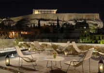
The night panorama of Athens sparkling with lights is a reward for those who reached the top of Lycabettus Hill, which is crowned by the white chapel of St. George. To save time and energy, it is better to use public transport by purchasing a single bus or trolleybus ticket, or by going down the metro.
The cost of a single ticket, which must be validated within 70 minutes from the date of purchase, is 1.4 EUR, a daily ticket costs 4.5 EUR, a 5-day ticket - 10 EUR. Trying to ride a hare is risky, the penalty for such a prank is too high - 60 times the cost of the ticket.
Daphni monastery
Having studied Athens, let's turn our inquisitive gaze to the suburban areas. 11 km from Athens is the Daphni Monastery - a monument of Byzantine religious architecture in Greece. Its history is unique. Created as a sanctuary for Apollo of Daphnia, the monastery welcomed Christian pilgrims into its arms, then was used as a fortress wall and finally became a psychiatric hospital. Now the restored monastery has the status of a monument. You can visit it daily from 08:30 to 15:00.
Temple of Poseidon
The second shining gem in the collection of Attica attractions is the Temple of Poseidon at Cape Sounion. The powerful giant, framed by slender columns, symbolizes the harmonious union of land and sea. Sailors and rulers of Greece made sacrifices to their patrons, believing in the connection between ordinary mortals and the inhabitants of Olympus.
Temple of Demeter
Another recommended place to visit is the Temple of Demeter at Eleusis. Mysterious rites dedicated to the cult of the goddess Demeter and her daughter Persephone were performed here in ancient times. The museum can be visited daily from 08:30 to 15:00, except Mondays and holidays.
tier (strip) above the main cornice in the antique façade.
(Ancient culture: literature, theater, art, philosophy, science. Dictionary-reference / Edited by V.N. Yarho. M., 1995.)
Excellent definition
Incomplete definition ↓
Attica
Attica, region in the southeast. parts Center. Greece. In ancient times, there were several. small settlements, to-rye gradually merged into the city-state of Athens. This process was completed by the 7th century. BC. Families of large landowners continued to live outside the city, although during the Peloponnesian War (431-404 BC) the countryside was often plundered by invading Spartans. Armenia was rich in natural resources, especially clay, which was necessary for a flourishing pottery industry, as well as marble, lead and silver, which were required to finance the Athenian fleet.
Excellent definition
Incomplete definition ↓
ATTIC
Titus Pomponius (110 - 132 BC) - wealthy and influential. Rome. horseman, received the name A. due to the fact that more than 20 years he lived in Athens. Being composed. landowner., merchant and financier, tried to take in troubled political. point of view time is neutral. position between confrontations. in batches. This is a fence. A. from encroachments on his condition and provide. mediator role. Letters written. Cicero, with whom A. connected. many years. friendship, represent the historian. document of that era. A. yavl. high-images. and enlightened. man, he won a well-known. publication and distribution. lit. manuf. For this purpose, he disposed educated. slave scribes. His own. op. "Chronicle" - a short chronological. essay on the history of Rome from the day of its foundation. A.'s life is described in detail. by his friend Cornelius Nepos.
Excellent definition
Incomplete definition ↓
Attica
peninsula in the south-east central Greece, bordering Boeotia in the north and Megara in the west; pl. peninsula 2200 km2, relief predominantly. mountain. Mountains Kiferon (1409 m) and Parnassus (1413 m) with spurs form natures. border of the Attic region. Other significant mountain peaks known for marble quarries are Pentelikon and Gimet. South the tip of the peninsula forms Cape Suniy. Athens is located in the flat part of the peninsula. Eleusis and Marathon. Pp. Kefis and Iliss, which tend to dry out in summer. Soils in A. preim. calcareous, therefore Ch. agriculture. crops in ancient times were grapes, olives and figs. Main mineral deposits were located in Lavrion, they mined pottery clay, silver and iron ore. The first inhabitants came to A. apprx. 1900 BC e. Since the great resettlement of the Doryans in the end. 2nd millennium BC e. A. was not affected, the inhabitants of this area considered themselves autochthonous. OK. 1000 BC e. the population of Albania was united under the rule of Athens. Other significant settlements in Armenia include Piraeus, Eleusis, Forikos, Bravron, and Ramnunt.
Excellent definition
Incomplete definition ↓
ATTICA
Ancient (´Attikn) - the area of \u200b\u200bDr. Greece. Inhabited since the Neolithic era. The spurs of Kyferon and Parnet divide Armenia into small plains: the Athenian, Eleusinian, Mesogean, and Marathon plains, which are suitable for the village. x-va. In addition to the flat, terrace farming was widespread. Ch. s.-kh. grapes and olives were the ancient cultures of Albania. The yields of barley and wheat were low, and there was not enough bread. Sheep and goats were raised on mountain pastures. Armenia was rich in salt, marble, clay, and silver (it was mined in the Lavrion mountains in the south of Armenia). Crafts were developed in Armenia (pottery, metalworking, and shipbuilding). The ruggedness of the banks of A., its middle position in Dr. Greece, the need to import bread contributed to the development of the pestilence. trade in A. (harbors - Piraeus, Phaleron). By the 5th century. BC e. A. gradually became the most developed socio-economic., Political. and the cultural area (center - Athens) Dr. Greece. In the present. Greece A. forms one of the administrative-terr. units - nom. Lit .: Kolobova K.M., Gluskina L.M., Essays on the history of Ancient Greece, L., 1958; Wrede W., Attika, Athen, 1934. - *** - *** - *** - Atticus of the time of Cleisthenes
Excellent definition
Incomplete definition ↓
Attic
Titus Pomponius Atticus) - a wealthy and influential Roman landowner, merchant and financier, historian, publisher and philanthropist of the 1st century. BC Born 110, died 32 BC Atticus, a representative of the equestrian class, was a highly educated and enlightened person; he received his nickname due to the fact that he lived in Athens for more than 20 years. Consisted of many years of friendship and correspondence with Cicero (the texts of these letters have survived to this day), also corresponded with Octavian and Mark Antony in the 30s. BC He became widely known among the educated strata of Roman society as a publisher and distributor of literary works, including the works of his contemporaries. For these purposes, Atticus kept a whole staff of educated scribe slaves at home. Titus Pomponius Atticus himself was the author of the "Annals" ("Liber annalis") - a work that was a short chronological outline of the history of Rome from the day of its foundation, as well as individual works on the genealogy of noble Roman families, now lost. The biography of Atticus, written by one of his friends, the historian Cornelius Nepotus, survived millennia.
Excellent definition
Incomplete definition ↓
Attic
1. Titus Pomponius (110 - 32 BC), wealthy and influential Rome. horseman, received the name A. due to the fact that he lived in Athens for more than 20 years. As a wealthy landowner, merchant and financier, he tried to borrow in troubled political life. point of view being a neutral position between the opposing parties. This protected A. from encroachments on his fortune and provided an intermediary. role. The letters written by Cicero, with whom A. had a long-term friendship, represent a historian. document of that era. A. was highly educated and enlightened. man, he gained fame for the publication and distribution of lit. works. For this purpose, he disposed of educated scribal slaves. His own. composition "Chronicle" ("Liber annalis") - a short chronological. essay on the history of Rome from the day of its foundation. A.'s life is described in detail by his friend Cornelius Nepos.
2. low built-up wall, located over the cornice crowning the structure (in Roman architecture, usually on triumphal arches) and is intended. for a bas-relief or inscription. It is also found in the art of the Renaissance, Baroque and Classicism.
Excellent definition
Incomplete definition ↓
Attica
from greek - coastal country)
peninsula, one of the largest areas in the southeast of the Middle. Greece. Its mountains are branches of Kiferon, a steep rocky ridge that formed the natural border of Africa with Boeotia and Megara. Among the mountain ranges are the plains: Eleusis, Kekrop, Mesogei and Marathon. The small rivers A. Kefis and Asop were shallow, the land was barren. But the industriousness of the farmers compensated for the scarcity of the land: olives, grapes, figs, millet, spelled, and barley were grown in Armenia. There was a lot of limestone and marble in the mountains, suitable for building. Silver, iron ore and clay were mined in Lavrion, which contributed to the early development of crafts, and thanks to the large reserves of table salt, the population began to preserve food, initiating the development of an entire industry.
The population of Albania considered themselves to be autochthonous. OK. X century. BC, under the legendary king Theseus, it began to unite under the rule of Athens, but this process was long and stretched for centuries. By the VI century. BC. Athens became the center of economic and political transformations in Armenia.The large centers of Armenia were Eleusis, Piraeus, Forikos, Ramnunt, and others.
(IA Lisovy, KA Revyako. The Ancient World in Terms, Names and Titles: Dictionary-Reference Book on the History and Culture of Ancient Greece and Rome / Scientific Ed. AI Nemirovsky. - 3rd ed. - Minsk: Belarus, 2001)
Excellent definition
Incomplete definition ↓
ATTIC
church in Constantinople, which was built in the IX century. in the traditions of eastern early Byzantine architecture, dating back to the throne rooms of the Babylonian and Assyrian kings in ancient Mesopotamia. Its Byzantine name has not survived. As the researchers suggest, the church was not intended for ceremonial cult actions, but was used as a prayer house. It was a five-nave cross-domed building with a low dome (5 m in diameter), which was not supported by pillars, but by massive walls with small openings leading to the corner rooms. Her plan was based on a square. From the original outer walls, only wide, squat apses have survived, each having three sides without protrusions and ornaments. At the eastern end of the cross there was an altar room, to which an apse adjoined. The worshipers were located in front of the altar at the lateral ends of the cross, spread apart in breadth, and the western end was longer than the north and south, which strengthened the direction towards the altar. The domed square and the narthex had vaulted ceilings, in the extreme side naves, turned into isolated chapels with images of saints, there were wooden floors. The masonry of Attica did not differ from similar religious buildings of this and subsequent eras: 6 - 6 rows of massive masonry made of stone blocks, characteristic of the architecture of Asia Minor, alternated with 4 - 4 rows of bricks. After the conquest of Byzantium, the Turks turned this church into a mosque, laying down the windows and destroying the extreme side aisles.
Excellent definition
Incomplete definition ↓
ATTIC
roman cognomen. The most famous was
1. T. Pomponius Atticus, born in 109 BC, came from an ancient family of Roman horsemen and received an excellent education. He was adopted by his uncle Q. Cecilius, and therefore was called Kv. Caecilius Pomponian A. To avoid participating in the strife during the unrest caused by Sulpicius and Cinna, he went to Athens and studied science there. He lived in Athens for many years and from this he got the name Atticus. The Athenians loved him (Ner. Att. 2) both for his generosity and sympathy, and for his generous support of the poor and needy, and expressed their respect for him by constructing in honor of his statues. When Sulla, upon his return from Asia, lived in Athens, A. enjoyed his great favor. Soon afterwards he returned, to the great sorrow of the Athenians, to Rome, about the time when he inherited the property of his uncle Q. Cecilia; Here, too, he used part of this property to support his friends, including Cicero and Hortensky, and did not refuse to help even those whose political conviction he did not sympathize with. A.'s position among the most influential men of his time was very peculiar. He did not interfere in politics; he managed at the same time to be on the best terms with the leaders of different parties; being a friend of Cicero, he enjoyed the favor of Antony, being in friendship with the younger Marius, he did not lose Sulla's respect. Thus, his good fame and his life did not suffer from the wild quarrels of the parties, because his courteous nature and his rare education put him above them. He never looked for positions and did not occupy. He died in 32 BC, at the age of 77, respected by all his contemporaries. He did a great service to literature by multiplying and distributing the works of his contemporaries and friends; were engaged in the correspondence of essays ( Nep. Att. 13) his many slaves. He himself wrote historical works, between which the liber annalis, dedicated to Cicero, contained the history of Rome from its founding to its time, arranged in chronological tables by officials. Nep. Att. 18 Cic. Brut. 3, 5. I. Nepos (18, 5) also mentions imagines and one Greek work on the consulate of Cicero. Cic. ad Att. 2, 1, 1. Plin. n. h. 35, 3, 11. wed: Boissier, Cicero and Friends;
2. Tib. Claudius Herodes, son of a wealthy marathon man, was born c. A.D. 103 and was engaged in rhetoric under Marcus Aurelius, who showed him great respect. Having been brought up by excellent teachers, A. entered the civil service and in 143 he held a consular post. Subsequently, however, he left the civil service and devoted himself entirely to scientific pursuits. He founded an oratory school, from which excellent students came, and was himself an excellent orator. Gell. 19, 12. Emperors L. Verus and Marcus Aurelius also used his training. About his relationship to Pediment, not always friendly, wed letters of the last p. 61. 111. 138. Of his many works, none have survived; the authenticity of the writings attributed to him cannot be proven. Its main advantage, it seems, was the simplicity and fluency of the language. Possessing great wealth, he was a benefactor of the poor and founded many splendid useful buildings in Athens, Rome and other cities. He died in 179 at Marathon.
Excellent definition
Incomplete definition ↓
ATTICA
? ?????? (from ?????, instead of ???????), previously also called ????, "Coastal country", and the poets have ???????, or ?????, or ?????????? and was the most important of the 8 regions that made up its own (middle) Hellas. It had the shape of a triangle, the apex of which was facing southeast, bordered in the north with Boeotia, in the east with the Aegean Sea, in the southwest with the Saronian Gulf (n.Aegin Bay), in the west with Megara and occupied the area in about 1960 sq. versts Armenia is a mountainous country and is covered by separate, but frequent, mostly bare groups of mountains and hills, between which there are only a few and insignificant plains. All mountains represent the spurs of Kiferon (????????, n. Of the same name, the highest peak is called Elatia), a wild, steep and rocky ridge reaching up to 4000 feet in height, known from the myths about the hunt for the Kiferon lion, about the hunt Actaeon and about Oedipus, and which formed the border of A. from the side of Boeotia and Megara. The sharp contrast between him and neighboring Helikon gave rise to the myth of two brothers turned into mountains; the meek and kind Helikon became the seat of the muses, the cruel Cithaeron, who killed his father and mother, became the seat of the Erinyes. A passage wound through the wildest places of Kiferon ?????? ??????? or?????? ???????, n. Gifto Kastro. To the south of Kiferon stretched a lower range of mountains, probably called ??????? ??????, representing the Megarian border and ending near the coast, opposite the northern part of Salamis with two horn-shaped peaks (n. ??????). To the east of Kiferon, the country is cut through by Parnephus (??????, n. Ozea), the most significant in height (over 4000 feet) and the length of the mountain range A. deciduous trees and shrubs, partly pine. It is rich in beautiful views. To the south, its continuation is a much lower range of mountains, n. ?????????, separating the Athenian plain from the Eleusinian plain from the west; the middle part of this chain, through which the sacred road to Eleusis led, had the name ??? ???????? ??????, extreme, southwestern part, with a cape ??????? - ??????????, one of the demos. From the summit of Koridall, Xerxes watched the battle of Salamis. Hdt. 8, 90. Brilette (?????????) or ??? ??????????? ??????, DeMouy ???????; he was famous for his marble. It is adjoined and directed to the south, but closer to the city, also rich in marble Gimette ???????, n. Trelo-Vuni, still famous today for its fragrant thyme and excellent honey. Gimette ends with a cape ?????? (n. Cape Helikes). Mount Lycabettus (??????????, n. Hagios Georgios) is a separate rocky cone reaching in the northeast to the walls of Athens; adjoining it, heading to the north, a rocky chain of mountains, probably ancient ????????. The southern part of Armenia is also covered with chains of mountains, which form the Lavrian Mountains (???????? or ???????) with rich silver mines ( Hdt. 7, 144. Plut. Them. 4), which constituted the main source of wealth for ancient Athens. There were three plains in A.
1. Eleusinian (?????????? ??????), between Kiferon and the marshy coast of the Gulf of Eleus, the granary of Athens, as a result of which, at the beginning of the Peloponnesian War, the first was devastated by the Spartans. The western part of it was called ´ ?????? ??????, eastern, most of - ???????? ??????; the part adjacent to Megara, the inalienable property of Demeter, bore the name ??? ???? or??????;
2. Cecrop plain, northeast of Athens, simply called ??? ?????? (n. Calandrian plain), was surrounded by Aigaley and Hymettus and irrigated by Kefis; in the northeast, Dekelia towered above it, which was occupied as a result of this by the Spartans in the Peloponnesian War;
3. Mesogean Plain (????????), n. Mesoghia, located in the east off the coast near Bravron.
In addition, there were even smaller plains - the Marathon and the plain at the mouth of the Asop. Irrigation of the country was scarce, almost all rivers and streams were very shallow in summer. A. belongs to Asop, flowing from Boeotia, in its lower course. The country's most important river, Kefis (??????? n.Kiphissos) flows from the southwestern slope of Brilette, connects with a few streams that originate in Parnef, and flows through the Kecrop plain, on the western side of Athens (cutting through long walls) ; in winter, it juts out from the shores at the estuary near Faler's harbor. Ilissos flows out of the Hymettus, joins the Eridanus stream, flows from the southern side of Athens and is lost in the plain. Another Kephis (n. Sarandopotamos), which originates from Kyferon, flows into the sea east of Eleusis. To the east of it were ´ ??????, flowing salt waters, fishing in which belonged to the Eleusinian temple. Athens and its environs were not richer in water than the rest of A. Good water was delivered, except for Ilis and Kephys, only the springs of Panop and Kallirroi (?????????, near Odeon), also called ?????? ?????? or?????????????; now this key also gives muddy water. Only Adrian (117-138) arranged an aqueduct from Ankhesma for the eastern part of the city. The rest of the wells gave bad water and therefore were sometimes also called ??????? ( Hdt. 8, 55). The Well Overseer (?????????? ???????) was an important person who made sure that no one drained water without having the right to do so. Of the bays, the most important were: on the east side - a shallow marathon bay, on the west side - the harbor of the city of Athens ( cm. below) and the Eleusinian bay. Although today it is difficult to form a correct understanding of the state of the country in antiquity, since due to the disappearance of forests and the shallowing of rivers, its dryness has reached a high degree, it can still be argued that Albania was not fertile in ancient times, with the exception of only a few parts of it; and now still noticeable terraced fields show that they tried to use every piece of land. The layer of fertile land (chernozem) was so insignificant that in the lease agreements it was forbidden to take away the land; however, the scarcity of soil was rewarded with the diligence of the inhabitants and an excellent climate. Agriculture, sanctified by religious regulations and the cult of the Eleusinian Demeter, was an honorable occupation even for the noble Athenians. The bread (barley) was excellent, but the harvest only yielded? grain necessary for the population (during the prosperity of the state, 500,000 inhabitants - 140,000 free and up to 400,000 slaves - destroyed 3 million medims of bread). In the same way, the olive oil, which was the subject of export, was excellent (in the temple of Athena Poliades, the first olive tree was planted by Athena herself, which remained unharmed even during the Persian wars. Hdt. 8, 55). Wine was plentiful, but not particularly good; better were the figs born in great numbers; hence the proverb: ??? ????? ???? ?????? to express something useless. The often mentioned prohibition on their export ( cm. ??????????, Sycophant) should be considered fiction. In addition, mulberry, laurel and almond trees, well-known omegas, etc., oak, beech, pine, spruce, cedar grew well; the latter covered the slopes of Parnephus and Citheron, from where the Athenians received firewood and coal (Aharna). The mountains are composed of limestone, slate and marble; Pentel marble was especially prized for its whiteness and its fine-grained composition. In the Lavrian region there were significant silver mines, so rich that every Athenian citizen annually received a net income of 10 drachmas (about 2.5 gold rubles). Good clay was mined at Cape Koliada; besides, emeralds and other stones and the famous Attic forces, golden paint like ocher. Salt mined in Albania was of such good quality that it became a proverb. Among domestic animals, especially sheep, goats were raised, horses were only on the marathon plain; draft animals, on the basis of ancient decrees, were dedicated to triptolemus; kept many donkeys and mules. Of the wild animals in former times, wild boars, wolves and bears were found in the mountains. Especially many owls nested in the crevices of the Acropolis (hence the proverb: ??? ???????? ???????, which had the same meaning as the above mentioned ??? ????? ???? ??????). The sea was full of fish. The climate in the plains is already suffocating from March, reaching in August the unbearable heat of 28-32 ° Rehom .; he is especially suffocating in Athens under the influence of the rocky Acropolis; however, in some areas cool sea winds moderate the temperature. When all the vegetation dries up, the shrill singing of countless fillies begins to be heard from the olives. Snow stays on the mountains for a long time in winter, and this time of the year is especially cool due to the moderate temperature. The air of A. is usually extremely pure; the light is distinguished by a peculiar brilliance due to the strong reflection of rays from the mountains, which are mostly treeless. The dry air contributed a lot to the preservation of ancient buildings and other art objects. The inhabitants of the Ionian tribe, in all likelihood, migrated by sea from Asia Minor, they were joined, in addition to other settlers, by the Peloponnesian Ionians. Before them, the country was probably inhabited by the Pelasgians, who were conquered by the Ionians and merged with them. At first, the population of Armenia was divided into 4 phyla ( cm. ????, Phil), then, since the time of Kleisfen, into 10 phyla, split into 174 demos ( cm. ??????, Demos); in addition, the country was divided by the nature of the terrain into ?????? - "Plain", north and northwest of Athens; ??????? or???? - "Coastal", a strip by the sea between Athens and Sounia (this strip was adjacent to ????????) and ??????? or??????? - "Mountainous country", which occupied most of the eastern coast. This division was also of political significance, cm. Pisistratus. ?, Pisistarat. ? ?????? there was 1) the Athenian plain with the city of Athens (?? ???????), the capital of Armenia and the greatest city of Greece. Athens consisted of two parts: the city and the harbors, which since the time of Cimon were connected by long walls (??? ?????). Nothing reliable can be said about the size of the city before the Persian Wars. The main founder of its greatness should be considered Themistocles, who, after the destruction of Athens by the Persians, restored the city in a more magnificent form, surrounded it with walls and built the important harbor of Piraeus. The direction of the walls erected by Themistocles is still clearly visible in the south and west, while in the north and east only insignificant traces of them are noticeable. Their perimeter was equal, according to Thucydides (2, 13), 174, 5 stadia or 30 versts, of which the harbor accounted for 56, 5 stadia, the long connecting walls 75, the city itself 43. Hence it is clear why Athens, almost equal in circumference of Rome, occupied only 0.25 of its area. In Athens, there were up to 10,000 houses ( Xen. Socrat. 3, 6, 14) and, according to Boeckh's calculation, 180,000 inhabitants, according to others - slightly more than 100,000. With the exception of public buildings, there were hardly many beautiful buildings; most of the houses were made of beams and adobe, especially in the western part of the city, inhabited by the poorest citizens; the streets were wrong and narrow (????????).
The names of the 11 city gates (counting from west to south) were:
1. Dipilus (???????), originally the Friasian or Kerameik gate, of considerable size ( Liv. 31, 24);
2. Sacred gate (?? ????? ?????), on the road to Eleusis;
3. The rider's gate (?? ??????? ?????), through which, probably, the periegetus Pausanias entered the city and from which he took his walk;
4. Piraeus Gate (????????? ?????);
5. Melita Gate (?? ????????? ?????);
6. Eton Gate (?? ??????? ?????);
7. Aegean Gate (?? ?????? ?????); probably near the Panathenian stage;
8. Diokharov's gate (?? ???? ????????? ?????),
9. Diomean gate (? ??????? ?????), on the way to Kinosarg;
10. Barrow gates (?? ????? ?????);
11. Acharn Gate (?? ????????? ?????).
The position of some of the gates is questionable. Almost in the middle of the city there was a huge steep cliff 150 feet high, accessible only from the western side and having an area at the top 900 feet long (from west to east) and 400 feet wide (at its widest point). On this rock, the Kremlin was built, which was called under the Pelasgians ??????, under Kekron ????????, under Erechtheus ??????, - later, when the city began to be called ????? ??, - ?????????. According to legend, the northern side of it was already fortified by the Pelasgians ( Hdt. 6, 137), while the southern one was fortified by Cimon. The space between these walls represented ´ ???? in the proper sense, and at all times constituted the center of the city in religious, artistic and political terms. On the western, accessible side of Pericles in 435-430. with the help of Mnesicles, he built for decoration and protection the famous magnificent Propylaea [The names of the buildings from which the remains have survived are indicated] (?????????) with a beautiful staircase leading from the Acropolis to the base of the rock. The Propylaea was a sumptuous building made of Pentel marble, with 5 aisles; their construction, which lasted 5 years, cost 2012 talents. On the right side - the entrance to the Propylaea, a small staircase leads to the bastion, on which is located a well-preserved small * temple of Athena Nike, usually called ???? ´ ???????. There were extensions on the right and left sides of the Propiley; the left, large (northern), well-preserved, served as an art gallery (??????????), which, among other things, contained the famous paintings of Polygnotus ( cm. pictores, Painting, 2); the right one, the smaller one (south), represented the quarters for the watchmen and gatekeepers. On the Acropolis Square, dotted with sanctuaries, sacred offerings, statues, etc., were placed: a colossal copper statue of Athena made by Phidias (?????? ????????), whose helmet and spear were visible in the distance distance ( Paus. 1, 28, 2), and two famous temples, the Parthenon and the so-called Erechtheus. * The Parthenon (????????), the temple of virgin Athena, was built of marble under Pericles in 438 by Ictinus and Callicrates. Despite the fact that the Venetians with their bombardment in 1687 inflicted great damage on the temple and at the beginning of the 19th century. Lord Elgin took away many metopes, bas-reliefs and other objects that adorned him (Elgin marbles in the British Museum), yet this magnificent building still causes our surprise today. In the Parthenon stood a statue of Athena, 26 Greek cubits (39 feet) high, made by Phidias from gold and ivory. The clothing of the statue, which was removed and weighed 44 talents, was stolen by the tyrant and demagogue Lahar in 299 during the time of Demetrius Poliorketus. Paus. 1, 25. On her right hand, the goddess held her face to the viewer, Nika, 4 Greek cubits high, made of ivory and dressed in a golden dress. The rear compartment of the Parthenon (???????????) served to store the sacred money of Athena and other gods and the state treasury ( wed: Michaelis, Der Parthenon, 1871 and architecti 4.5). To the north of the Parthenon was the most ancient temple of the Acropolis, which belonged to Athena Poliades and was usually named after one section of it * Erechtheus (?? ?????????). It was built during the Peloponnesian War; it contained: an ancient wooden image of Athena, the alleged tomb of Cecropus, a well with salt water (????????? ???????), formed from Poseidon's blow with a trident, and a sacred olive tree (? ??? ?????), planted by Athena herself. The city that surrounded the Acropolis was formed from a combination of several demos, which retained their names in subsequent times: Kerameika, in the northwest; Scambonides, Keiriad, Melita - in the west, Koyly, Colita - in the south-west; Kidafeneya - in the south; Agr and Diomei are in the east. To the west of the Acropolis rose a rocky hill ´ ????? ?????, Areopagus, at such a close distance from it that the Persians, with the help of burning arrows, lit the Acropolis from it, which then consisted of wooden buildings ( Hdt. 8, 52). On the eastern side of the hill was the court of the Areopagus and the temple of Erinius (??????? ????) with the tomb of Oedipus, near the hill - Kiloneus (?????????), built to atone for the killing committed by the Athenians Kilona ( cm. Cylon, Cylon) and his supporters; to the south of Kyloneus stood the temple of Areus, and closer to the Acropolis - the temple of the 12 gods and the statues of Harmodius and Aristogateon. On the outskirts of the city, in the south-western part of it, there was a high, rather steep rocky hill called Musey (?? ?????????), after the name of the singer Mussey buried there, according to legend. This hill was turned into a Macedonian fortress by Demetrius Poliorketes. Adjacent to this hill from the north is another elevation, commonly called Pnyx (????, Gen. ??????); this elevation served as a meeting place for the people. There and now you can still see the scaffolding carved into the rock, as it was believed, for the orators, facing the semicircular square designated for the people. But recently Welker, Urlichs, E. Curtius and others have given strong arguments in favor of the opinion that on the hill bearing the name of Pnyx, there was more likely an altar of Zeus (????? ?????????), and the name Pnyx (according to Curtius) was only another name for Museo and that the place of popular assembly was the plain between Museo and the Acropolis. Later, the Dionysus Theater was used for this. Between the Acropolis, Areopagus, Pnyx and Musey, there was an Agora (?????) decorated with many statues, in the part of the city called the inner Kerameik. On it was the Stoa Poikile, or picture gallery. with paintings by Polygnotus, Kolonos Agoraios, small mound, Stoa Basileios, office building of archon Basileus, Stoa of Zeus Eleutherios, temple of Apollo Patroos, temple of the mother of gods (????????), Council building (??? ?????????), where the council of five hundred met, and the so-called Tholos (?????) is a round building with a domed roof. Between the Agora and Pnyx stood the temples of Aphrodite Urania, Hephaestus and the sanctuary of Euryssacus. To the east of the Agora, on the southern slope of the Acropolis, lay: Odeon of Herodes Atticus ( cm. Atticus, 2, Atticus), built by this wealthy Athenian in honor of his wife, the temple of Asclepius, Stoa of Eumenes, * the main theater dedicated to Dionysus; this building was opened only in 1862 by a Prussian scientific expedition headed by Strack, E. Curtius and Betticher; from the south it adjoins the Lenion Theater, where the sloths were celebrated in honor of Dionysus; finally, on the southeastern slope of the rock occupied by the Acropolis, there was an Odeon built by Pericles for musical performances, smaller in size than the theater, but similar in shape, with a wooden hipped roof. In the part of the city lying to the east of the Acropolis (later called Hadrian's Castle), near the source of Kallirroi, by the Ilissa River, stood Olympion, the grandiose temple of Olympian Zeus, 4th stage in a circle, begun by Pericles, but ended only by Emperor Hadrian; 16 colossal columns of this temple still stand today. At the north-western end stood the Triumphal Gates of Hadrian, in the east - the temple of Aphrodite in the gardens (??? ??????). On the small island of Ilissa was the temple of Demeter and Cora; beyond Ilissus, therefore, outside the city limits, is the magnificent Panafenaikon Stadium, arranged by the orator Lycurgus for the Panathenian games and decorated with Pentelian marble by Herod Atticus; The stadium was so large that Adrian once arranged a hunt for 1000 wild animals. The rocky hill to the south of the Stadium was probably the Ardette (????????) on which the Heliast judges were sworn annually by lot. Somewhat to the east of the Pericles Odeon, where the street on the eastern side of the Acropolis turns to the north (Tripod Street), stands * the choregic monument of Lysicrates, now called Demosthenes Lantern, - a small beautiful temple, round in shape, with 6 slender Ionian columns, whose domed roof was crowned with a copper tripod, erected as a gift to the gods and in honor of one choregic victory ( cm. ??????????, 2, Liturgy); this temple was built in 334, Pritaneion, where ambassadors and honored citizens were treated, was located at the northeastern foot of the Kremlin, next to the Sarapis temple; to the west of it is the sanctuary of the Dioscuri (?????????, ?? ´ ??????), and above this sanctuary, at the northern slope of the Kremlin, is the sanctuary of Aglavra, in a grotto communicating through a crevice in the rock with the upper square of the Acropolis. To the west of here was (and still is) a cave with a source; the cave is the Grotto of Apollo and Pan, and the source was called ???????? or ??????, since it was thought that it flows underground from Athens to Phaler; by means of a water pipe, it was connected to the water clock of Andronicus Kirrest, a monument still known now under the name "Towers of the Winds"... Between Pnyx and Musaeus, the road to the Piraeus Gate ran in a southwest direction: there lay: the Gymnasium of Hermes, the temples of Hercules Alexicacus and Demeter, and Pompeion, which served as a repository of sacred gold and silver vessels that constituted the necessary accessory for solemn processions; between Pnyx and Areopagus there was another road in the northwest through the inner Kerameik to the gate of Dipilu; to the left of here was the so-called Hill of Nymphs (in ancient times it was probably ranked as Pnyx), to the right is the magnificent Stoa of Attalus, now unjustly called the Gymnasium of Ptolemy, and further, to the north of it, * Theseion, which is now unjustly considered by some to be the temple of Areus; the building is well preserved. To the east of it - * Stoa of giants, Hadrian's gymnasium and the sanctuary of Athena Archegetida. Outside the city, on the northwestern edge of the outer Kerameiko (this suburb was actually a residence for the poorest classes, but also served especially as a burial place for citizens who died in the war or provided other services to the state, for example Miltiada, Cimon, Thucydides; as a result, on both sides long rows of tombs with "Steles", that is, marble boards of a regular quadrangular shape, serving as gravestones and decorated with inscriptions and bas-reliefs) was 6 stages from the city wall Academy (?????????), a beautifully arranged gymnasium surrounded by a beautiful garden where he taught Plato; slightly to the north - Hippios Kolonos - the birthplace of Sophocles. Distinguished archaeologists Otfried Müller and Letronne are buried here. Behind the eastern Diomean gate, south of Lycabettus, was Kinosart (??????????), a gymnasium. dedicated to Hercules, taught by Antisthenes, founder of the school of cynics. To the south of here is Lyceion (???????) - an institution consisting of a park and gardens, at the temple of Apollo of Lycea, with a gymnasium where Aristotle taught. About the topography of Athens wed Leake, Topographie von Athen. 2 Aufl. ? bers, von Baiter und Sauppe (1844). Forchhammer, Topogr. von Athen (1842). C. Wachsmuth, die Stadt Athen im Alterthum (Bd. I. 1874). E. Curtius und Raupert, Atlas von Athen (1878). Long walls (?????? ????? or ??? ?????) from 456 connected the city with its harbors; north wall, 40 stadia long, ??? ??????? ??????? or??? ???????? (because it was more open to enemy attacks) went to the northern wall of Piraeus; the southern wall is 5 stadia shorter than the northern one, - ?? ?????? or????????? - led to Fahler. Between these two walls, however, another third was built 12 years later, ??? ????? ???????, which also went to Piraeus and had the purpose of maintaining the communication of the city with one of the harbors in the event that the other is in the hands of the enemy; this also explains the traces of internal fortifications between the two harbors. Since the construction of this inner wall, the Phaler wall has been abandoned. The harbors of Athens are mainly formed by a rocky spit, in the middle of which there is the Munychia Hill, and at the very end - the Piraeus Hill. On the southern coast of this peninsula, two almost circular natural basins open up, connected by narrow straits with the sea; the Munychia basin is more adjacent to the mainland, and the Zea basin stretches partly between the mentioned hills. Both harbors served as military ports (Zea housed about 200 ships), along with the Kanfar basin located on the other side of the peninsula (o ???????? ?????), which forms part of the vast Piraeus harbor; the rest, much more of this latter served for some commercial purposes (?????????). One branch, I think, was called Aphrodision. The general raid for warships was the vast Phaleron Bay, perfectly protected from storms. This bay was the oldest Athenian harbor; other harbors came into use only from 493; the last one was Piraeus. The whole part of the city could be fully surveyed from the Munichi hill. These superbly fortified harbors had their temples, theaters, etc. In Piraeus there was a large storeroom for goods (???????), a large ????????? (shop) Philo, a dockyard for 400 ships, an extensive grain store (?????????????) of Pericles and a theater: in Munychia, the alleged tomb of Themistocles was indicated (Plut. Them. 32, Paus. 1, 1, 2). Often mentioned judgment seat ??? ??? ????????? The ???????????, who tried people expelled for murder and accused of a second murder committed by them after the exile, was probably placed at the entrance to the Zeya harbor (the accused came to the court in boats). To the west of Piraeus lay still a small harbor o ?????? ?????, identical, no doubt, with the so-called ?????? ????? (thieves' harbor), one of the favorite sites of smugglers.
1. Of the places located on the Athenian plain, one must also name:
Aharny (???????), 60 stadia north of Athens, the most significant dem, engaged in agriculture and especially the burning of coal; Kefissia, near the Kefis springs near Pentelik; Pallena, with the famous temple of Athena, where Pisistratus defeated the Athenians ( Hdt. 1, 62); Gargett, near Hymettus, birthplace of Epicurus; Alopek, home of Aristides and Socrates, 10 stages east of Athens, on Anhesme; Galimunt, home of the historian Thucydides, north of Cape Coliada, famous for its potting clay; on the cape stood the temple of Aphrodite;
2. Eleusinian and Friassian plains, west of Athens, where a sacred road led, decorated with many all kinds of monuments.
Here were: Fria on the Eleusinian Kephis; Eleusis or Eleusis (n. Lepsina) on the northern shore of the gulf of the same name, opposite Salamis, is one of the oldest and most important cities in the country, famous for the magnificent temple of Demeter, built under Pericles, in which the great Eleusis was celebrated; Alaric destroyed it, but even now large ruins are still visible. Eleuthera, near the Boeotian border, on the Eleusinian Kephis, from where the cult of Dionysus of Eleutheria passed to Athens, in whose honor the Great Dionysias were celebrated; Oinoya, Drimos and Panacton - fortresses that defended the plain from the side of Boeotia; the last of them dominated one of the mountain passages of Citheron; Phila (n. Fili), a small mountain fortress, from where Thrasybulus set out to overthrow 30 tyrants, 100 stadia from Athens. Xen. Hell. 2, 4, 2. The last of the named places are reckoned in part already to II. Diacria, a northeastern mountainous strip that runs across the entire marathon plain. In it: Dekeleia, 120 stadia from Athens (Dekeleia is visible from there), - on the northeastern edge of the Athenian plain, - a very important fortified place during the Peloponnesian War (ruins at Tatoi); Oropus, who belonged now to the Athenians, now to the Boeotians, not far from the mouth of Asop, on its right bank, with the harbor of Delphinion; near it (to the southeast) the temple and oracle of Amphiaraus, which, according to legend, was swallowed up here by the earth, while fleeing from Thebes; Ramnunt (Tavrokastro), on Evripus, with the famous temple of Nemesis (Rhamnusia virgo); Afidna and further to the west of Trinemeus - at the main source of Kephis. Towns Tricorif (near Suli), Marathon (n.Vrana, cm. Marathon, Marathon), Oinoya (not to be mixed with the above) and Probalinf (N. Vasilipirgi) made up ??????? ??????????. On the now almost completely treeless marathon plain (about 2 hours long and 0.5-1 hour wide), where Theseus killed the marathon bull, one can see, in the southern part, an artificial earthen hill, about 200 feet in circumference and 36 feet in height probably the common grave of the Athenians who fell here in 490 BC; opposite another small burial mound, under which the bodies of the Plateians and slaves were buried ( Paus. 1, 32, 3), disappeared without a trace. The place of the battle was a narrow, flat valley, which favored the actions of a small army against a large one. Nearby are the source of Macarius and Mount Pana with a grotto and an oracle. III. In Paralia (western coast) and Mesogeia (slope south of Pentelikon and east of Paralia), as well as on the eastern coast: Gali Arafenid (???? ??????????), harbor of dema Arafen , south of the mouth of the Yerasin, famous for the cult of the Taurian Artemis. The nearby Bravron (n. Vraona) was, they say, the place where Iphigenia first entered the coast, returning from Taurida with the idol of Artemis; that is why the Tauride (Bravron) Artemis enjoyed a special veneration here and in her honor there were annual festivities (?????????); the oldest statue of the goddess was taken away by Xerxes. Dionysias were also celebrated here every 5th anniversary. Further south - Styria, where the Styrian road led from Athens; homeland of Feramenos and Thrasybulus; Prassia (Prassa at the bay of Porto Rafti) with the temple of Apollo and the tomb of Erisichfon, the son and heir of Kekrop; he died, however, before his father and Kranai seized power; Potamos with the tomb of Jonah; Torikos (Teriko), one of the oldest settlements in Attica, with a beautiful harbor (n. Porto Mandri) and an acropolis, at the foot of which there are still significant ruins. Sounion - in the north-west of the cape of the same name (n. Cap-Colonna), strongly fortified, with the famous temple of Athena now lying in ruins, at which naval battles with triremes were represented during Panathenes. In the mining district of Lavrione lay Anaflist (n. Anaviso) with a well-fortified harbor, at the entrance to which was the island of Eliussa (n. Lagonisi); further - Sfettos, Lampry, Fora, Anagirunt, near Cape Zostra, with the temple of the mother of the gods; from the fetid bush growing here ´ ???????? the saying goes back to ???????? ???????; Gala Exxonid with salt pans; Exona is a significant place, which has become notorious for the quarrelsomeness of its inhabitants; finally, aside from the Styrian road - Peania (n. Liopesi), the birthplace of Demosthenes. Of the islands belonging to Attica, the most significant is Salamis (??????? - ??, N. Kuluri), near the mainland, in the shape of a horseshoe, forming an Eleusinian bay with the coast. In ancient times, it was an independent state ( cm. Aeacus, Eak), then belonged to the Megaras and for a long time served as a bone of contention for the Megarians and Athenians, until he was conquered by Solon and, by the verdict of the Spartans, was recognized for Athens. It did not, apparently, constitute a deme, but was a special state, supremely dependent on Attica. The ancient main city stood on the southern coast, and later Novosalamis (n. Ambelaki) was founded in the east, opposite Mount Egaleos in Attica. The closest part of the island to Attica is the Kinosur spit, with the grave of the faithful Themistocles dog, which threw itself into the sea when the fleet sailed, and the trophy that Themistocles erected in honor of the great victory won by him (480) over the Persian fleet. The battle took place in a narrow strait between Novosalamin and Attica, the Athenians were locked in the Salamis bay. Hdt. 8, 84 sl. Near Salamis are the islands of Farmakus and Psittaley (N. Lipsoctali); on the last detachment of the Persian ground forces, Aristides was destroyed. Hdt. 8, 95. Aesch. Pers. 422. sl. The island of Gelena or Makrida (n. Makronisi) was close to Sounion, where, they say, Helen came ashore, either after her abduction, or on her return from Troy. wed generally Bursian. Geographie von Griechenland, I. 251 sl.
Excellent definition
Incomplete definition ↓
Decentralized Administration, Periphery
Lua error in Module: Wikidata on line 170: attempt to index field "wikibase" (a nil value).
Lua error in Module: Wikidata on line 170: attempt to index field "wikibase" (a nil value).
Lua error in Module: Wikidata on line 170: attempt to index field "wikibase" (a nil value).
Lua error in Module: Wikidata on line 170: attempt to index field "wikibase" (a nil value).
Lua error in Module: Wikidata on line 170: attempt to index field "wikibase" (a nil value).
Lua error in Module: Wikidata on line 170: attempt to index field "wikibase" (a nil value).
Lua error in Module: Wikidata on line 170: attempt to index field "wikibase" (a nil value).
Lua error in Module: Wikidata on line 170: attempt to index field "wikibase" (a nil value).
Lua error in Module: Wikidata on line 170: attempt to index field "wikibase" (a nil value).
Lua error in Module: Wikidata on line 170: attempt to index field "wikibase" (a nil value).
3 827 624 (1st place)
Lua error in Module: Wikidata on line 170: attempt to index field "wikibase" (a nil value).
Lua error in Module: Wikidata on line 170: attempt to index field "wikibase" (a nil value).
Lua error in Module: Wikidata on line 170: attempt to index field "wikibase" (a nil value).
Lua error in Module: Wikidata on line 170: attempt to index field "wikibase" (a nil value).
Lua error in Module: Wikidata on line 170: attempt to index field "wikibase" (a nil value).
Lua error in Module: Wikidata on line 170: attempt to index field "wikibase" (a nil value).
Lua error in Module: Wikidata on line 170: attempt to index field "wikibase" (a nil value).
Lua error in Module: Wikidata on line 170: attempt to index field "wikibase" (a nil value).
Lua error in Module: Wikidata on line 170: attempt to index field "wikibase" (a nil value).
Lua error in Module: Wikidata on line 170: attempt to index field "wikibase" (a nil value).
Lua error in Module: Wikidata on line 170: attempt to index field "wikibase" (a nil value).
Lua error in Module: Wikidata on line 170: attempt to index field "wikibase" (a nil value).
Lua error in Module: Wikidata on line 170: attempt to index field "wikibase" (a nil value).
Lua error in Module: Wikidata on line 170: attempt to index field "wikibase" (a nil value).
Geography
Most of Attica is covered with hills, consisting of limestone and marble, and is currently only bare, devoid of vegetation. Only the higher parts of Kiferon and Parnassus, as well as the northwestern slopes of Pentelikon, are covered with pine and spruce forests. The base of the entire mountain system is Kiferon (now Elatea, the so-called spruce hill, the highest point of which rises 1411 m above sea level). Kiferon separates Attica from Boeotia with his main ridge; Attica is separated from Megara by its branch going south and bearing the name Kerata (horns); Parnassus (now Ocea), reaching 1413 m, merges with the southeastern spurs of Kiferon, which the northeastern ramifications, now bearing separate names (Belettsi, Armeni, Mavrovuno, Tsastany, Stavrokoraki, Kotroni), extending to the eastern edge of the region, form in this part Attica is a real mountainous country (Diacria or Epacria of the ancients). The southern continuation of Parnassus is the Aegaleos rising much lower above the sea, which in the southern part, where it juts into the sea against the island of Salamis, is called Koridallos (now Scaramantha), and in the middle, where it is cut through by a gorge that connects the plains of Athens and Eleusis is called Pekilion. In the northeast, the Athenian plain is bordered by Brilettos, or, as it is commonly called from the area lying on its southern slope, Pentelikon (now also Menteli). This is a pyramidal hill reaching 1110 m in height with extensive, still successfully exploited marble quarries, which deliver excellent white marble of the finest grain, which goes to buildings and statues. A valley 4 km wide in the south separates the foot of the Pentelikon from the southern belt, almost exclusively consisting of bluish-gray marble, which in ancient times was used for architectural purposes. This ridge - Gimet (now Trelovuno) - rises to 1027 m, is almost devoid of forest vegetation, but is covered with fragrant grasses and therefore is inhabited by wild bees that give excellent honey. The eastern edge of the region (at the ancient Paralia) is cut through by less high chains of hills, which to the south of Gimet, where the peninsula narrows, join into one ridge - the Lavrion Highlands, which is enclosed by a steeply sloping cape - Sounium, on which the ruins of the temple of Athena still rise , according to the columns of which the cape is still called by the sailors of Cap Colonnese. The Lavrion Mountains were of great importance for Attica in ancient times for their riches in silver; but these mines, at first very profitable, were so intensively exploited that already immediately after the beginning of AD. e. I had to stop mining. Only at a later time did they try, and not unsuccessfully, to take advantage of the slags left over from previous works.
The mountains stretch partly directly to the sea, partly alluvial land accumulated to their soles, forming more or less wide coastal plains, many of which were known in antiquity. The most remarkable of them is the Marathon Plain (belor.)russian on the north bank. It is a lowland 9 km long and 2-4 km wide, with a vast swamp to the northeast. Here in 490 BC. e. the Persian army was defeated by the Athenian army. There are only three more significant plains, which either, starting at the coast, stretch far inland, or are completely separated from the sea, there are only three in the country: 1) the Athenian plain, often called simply "plain" (pedion); 2) the smaller Triassic Plain, separated from the Athenian Aegaleos Mountains (so called after the ancient area of \u200b\u200bTria) and 3) the plain between Gimet and the lower mountain ranges of the eastern coast, which connects to the Athenian plain through the valley that separates Pentelikon from Gimet.
Irrigation of the country is extremely poor. The most significant streams flow through the Athenian plain, namely: Kefiss, which begins at the southwestern foot of Pentelikon in the rich forest area of \u200b\u200bKefisia, fed by various tributaries from Parnassus. It flows through the plain in the southwest direction and to the west of the city is diverted into numerous canals for irrigation of vegetable gardens and plantations; Ilissus begins at the northern foot of the Gimet, flows at the eastern and southern sides of the city and to the south-west of it is lost in the sands. In addition to them, mention should be made of the other Kefis of the Eleusinian Plain, the Enoe stream cutting through the Marathon Plain (so-named for the ancient area lying north of Marathon) and Erasinos, which flows further south of the eastern coast, near the ancient area of \u200b\u200bArafen (now Rafina).
Story
The population of the country, not to mention some of the Pelasgic elements of the prehistoric era and the huge number of foreigners who subsequently permanently resided in Athens, belonged in antiquity to the Ionian tribe. The inhabitants called themselves autochthonous, that is, indigenous, since their ancestors originated directly from the soil of the country and from time immemorial the land was in their continuous possession. Like all Ionic peoples, the inhabitants of Attica fell into four tribes or classes (phylae): geleons (noble), hoplites (warriors), aegikoreans (shepherds in general and goats in particular) and ergadei (farmers). According to legend, 12 independent cities or unions of communities have existed in the country since time immemorial. These were part of separate, even later existing settlements, such as Cecropia (later Athens), Eleusis, Dhekeleia and Afidna (the last two in the north of the country), Brauron (among the east coast), Torikos (in the southernmost part of the east coast), Kyteros (location unknown), Sfethos and Kefisia, part of the unions of several settlements, such as Epakria (northern mountainous country), Tetrapolis (union of four cities) on the Marathon plain and Tetrakomiya (union of four villages) in the very south of the Athenian plain. According to legend, Theseus united these 12 communities into one political entity, the capital of which was Athens.
Administrative divisions in antiquity
The division of the people into 4 phylae remained both under the kings and under the archons. Even the legislator Solon did not abolish this division, but in parallel with it, partly wishing to reduce the influence of the ancient aristocratic families, partly to lead to a more equitable distribution of the tax burden among citizens, created a new division of citizens into 4 classes according to their property. Only Cleisthenes abolished the ancient Ionian division by knees and put in its place the division of the people into 10 phyla, each of which bore the name of an ancient Attic hero (eponym). Each of these phyla embraced a certain number of communities (demos) that lay in different parts of the country. As a rule, each not very significant area constituted a special "demu", while large ones, like the cities of Athens and Brauron, split into several demu. The number of dem was not the same at different times: - at the beginning of the Christian era there were 371. Thanks to writers and inscriptions, the names of about 180 dem have come down to us, but the location of many is now impossible to establish. The total number of citizens fluctuated, judging by the history of Thucydides and censuses, during the heyday of the state, to the Peloponnesian War, within 80-100 thousand. The number of those who stood under the auspices of the metecs reached 40,000, the number of slaves reached 400,000, so that the total number of free and non-free population exceeded 500,000. The increase in the number of Phil (10) by two new ones took place in 307 BC. e. Out of a desire to flatter Demetrius Poliorketa, the latter were named after him and the name of his father Antigonus - Antigonis and Demetriada. But the first one was renamed in 265 BC. e. in honor of the Egyptian king Ptolemy II Philadelphus in Ptolomais, the second in honor of the Pergamon king Attalus I in Attalis. Finally, under the emperor Hadrian, the 13th Phila was annexed and named by Adrianides after this benefactor of the city of Athens.
Political structure in antiquity
Politically, Attica was the most centralized region of Greece in ancient times. The main city was not only the seat of the administration, but the court, as well as the people's assemblies, in whose hands, since the time of the democratic reforms begun by Cleisthenes and completed by Pericles, the supreme decision of all state affairs was concentrated. The significance that Attica, thanks to its main city, Athens, had in the political and cultural life of ancient Greece, can only be correctly estimated in connection with the presentation of the general history of Greece.
Administrative division
On the map of prefectures (nomes), the decentralized administration of Attica is divided into 4 nomes (nomarchies), shown on the map below:
Following the 2011 administrative reform, the decentralized administration of Attica consists of 65 municipalities.
Agriculture and Fossils
The soil of the country is almost entirely a light, rather thin layer of stony limestone, which is not very suitable for the cultivation of wheat, more for barley and grapes, but especially for olive and figs, and therefore the latter, both in ancient times and now, are the main products of the country and items of its export. Cattle breeding is significant even today, and in ancient times, Attic wool was very famous. In the mountains, not to mention the already depleted silver mines of Lavrion, excellent marble is mined; the soil in many places, especially on the coastal strip running southwest of the harbor of Piraeus and the Falernian Bay and ending at the foothills of Kolias (now Gagios Kosmas), gives excellent clay for dishes, and therefore pottery was a flourishing branch of industry in ancient Athens and his products were very popular.
Write a review on the article "Attica"
Notes (edit)
Links
- Attica // Brockhaus and Efron Encyclopedic Dictionary: in 86 volumes (82 volumes and 4 additional). - SPb. , 1890-1907.
|
||||||||||||||||||||||||||||||||||||||||||||||
Excerpt from Attica
My head was spinning! .. Like a thirsty, satisfying my eternal hunger for knowledge, I eagerly absorbed the flow of amazing information generously given by the North ... And I wanted much more! .. I wanted to know everything to the end. It was a breath of fresh water in the desert scorched by pain and troubles! And I couldn't get enough of a drink ...- I have thousands of questions! But there is no time left ... What am I to do, Sever? ..
- Ask, Isidora! .. Ask, I will try to answer you ...
- Tell me, Sever, why does it seem to me that in this story, as it were, two life stories are combined, entwined with similar events, and they are presented as the life of one person? Or am I wrong?
- You are absolutely right, Isidora. As I told you earlier, the “powerful of this world” who created the false history of mankind “put” on the true life of Christ the alien life of the Jewish prophet Joshua, who lived one and a half thousand years ago (since the story of the North). And not only himself, but also his family, his relatives and friends, his friends and followers. After all, it was the wife of the Prophet Joshua, the Jewish woman Mary, who had a sister Martha and a brother Lazar, a sister of his mother Maria Jacobe, and others who were never near Radomir and Magdalene. Just as there were no other "apostles" next to them - Paul, Matthew, Peter, Luke and the rest ...
It was the family of the Prophet Joshua who moved one and a half thousand years ago to Provence (which at that time was called Gaul (Transalpine Gaul), to the Greek city of Massalia (now Marseille), since Massalia at that time was the "gateway" between Europe and Asia, and it was the easiest way for all "persecuted" in order to avoid persecution and troubles.
The real Magdalene moved to Languedoc a thousand years after the birth of the Hebrew Mary, and it was she who went Home, and did not run away from the Jews to other Jews, as did the Jew Mary, who was never that bright and pure Star, which was the real Magdalene ... The Jewess Mary was a kind, but narrow-minded woman, married very early. And she was never called Magdalene ... This name was "hung" on her, wanting to unite these two incompatible women into one. And in order to prove such a ridiculous legend, they came up with a fake story about the city of Magdala, which did not exist in Galilee during the life of the Jewess Mary ... All this outrageous "story" of the two Jesus was deliberately mixed and mixed up so that it would be too difficult for a common man to find out to the truth. And only those who truly knew how to think saw what a continuous lie was carried by Christianity - the most cruel and most bloodthirsty of all religions. But, as I told you earlier, most people do not like to THINK on their own. Therefore, they accepted and accept on faith everything that the Roman church teaches. It was so convenient, and it has always been so. The person was not ready to accept the real TEACHING of Radomir and Magdalene, which required work and independent thinking. But on the other hand, people always liked and approved of what was extremely simple - what told them what to believe in, what can be accepted and what must be denied.
For a minute I felt very scared - the words of the North were too reminiscent of the sayings of Karaffa! .. But in my "rebellious" soul, I did not want to agree that the bloodthirsty killer - Dad - could be at least something truly right ...
- This slavish "faith" was still needed by the same Thinking Dark ones to strengthen their dominance in our fragile, still nascent world ... to never allow him to be born again ... - Sever continued calmly. - Precisely in order to more successfully enslave our Earth, the Thinking Dark Ones found this small, but very flexible and vain Jewish people, understandable to them only. Due to its "flexibility" and mobility, this people easily succumbed to the influence of others and became a dangerous instrument in the hands of the Thinking Dark Ones, who found the Prophet Joshua who once lived there, and cunningly "intertwined" the story of his life with the story of Radomir's life, destroying the real biographies and planting false ones, so that naive human minds would believe in such a "story". But even the same Jewish Joshua also had nothing to do with the religion called Christianity ... It was created by order of Emperor Constantine, who needed a new religion in order to throw a new "bone" to the out-of-control people. And the people, without even thinking, gladly swallowed it ... This is still our Earth, Isidora. And it will take a very long time before someone will be able to change it. Very long time ago people will want to THINK, unfortunately ...
- Even if they are not ready yet, Sever ... But you see, people very easily open up to the “new”! So does this not show exactly that humanity (in its own way) LOOKS for a way to the present, that people strive for the TRUTH, which there is simply no one to show them? ..
- You can show the most valuable Book of Knowledge in the world a thousand times, but it will give nothing if a person cannot read. Isn't it, Isidora? ..
- But you TEACH your students! .. - I exclaimed with anguish. - They, too, did not know everything at once, before they came to you! So teach humanity !!! It's worth not disappearing! ..
- Yes, Isidora, we teach our students. But the gifted, who come to us, are able to do the main thing - they know how to THINK ... And the rest are still only "led". And we have no time or desire for them until their time comes, and they are not worthy of one of us to teach them.
Sever was absolutely sure that he was right, and I knew that no arguments could convince him. Therefore, I decided not to insist more ...
- Tell me, Sever, what of the life of Jesus is real? Can you tell me how he lived? And how could it happen that with such a powerful and loyal support, he still lost? .. What happened to his children and Magdalene? How long after his death did she manage to live?
He smiled his wonderful smile ...
- You reminded me now of young Magdalene ... She was the most curious of all and endlessly asked questions to which even our wise men did not always find answers! ..
Sever again "went" into his sad memory, again meeting there with those for whom he still so deeply and sincerely yearned for.
- She was indeed an amazing woman, Isidora! Never giving up and not feeling sorry for herself, just like you ... She was ready at any moment to give herself up for those she loved. For those whom she considered more worthy. And simply - for LIFE ... Fate did not spare her, bringing down the weight of irreparable losses on her fragile shoulders, but until her last moment she fiercely fought for her friends, for her children, and for everyone who remained to live on earth after her death Radomir ... People called her the Apostle of all Apostles. And she truly was him ... Only not in the sense in which the Hebrew language, which is alien to her in its essence, shows her in her “sacred writings”. Magdalene was the strongest Vedunya ... Golden Mary, as people called her, who at least once met her. She carried with herself the pure light of Love and Knowledge, and was completely saturated with it, giving everything without a trace and not sparing herself. Her friends loved her very much and, without hesitation, were ready to give their lives for her! .. For her and for the teaching that she continued to carry after the death of her beloved husband, Jesus Radomir.
- Forgive my meager knowledge, Sever, but why do you always call Christ - Radomir? ..
- It's very simple, Isidora, his father and mother once called him Radomir, and it was his real, generic name, which really reflected his true essence. This name had a double meaning - the Joy of the world (Rado - peace) and the Light of Knowledge that brings the world, the Light of Ra (Ra - do - peace). And the Thinking Dark ones called him Jesus Christ, when they completely changed the history of his life. And as you can see, it firmly "stuck" to it for centuries. Jews have always had many Jesus. This is the most common and very common Hebrew name. Although, funnily enough, it came to them from Greece ... Well, and Christ (Christos) is not a name at all, and that means in Greek it is “messiah” or “enlightened” ... the Bible says that Christ is a Christian, then how then can one explain these pagan Greek names that the Thinking Dark ones themselves gave him? .. Isn't it interesting? And this is just the smallest of those many mistakes, Isidora, which a person does not want (or cannot! ..) see.
- But how can he see them if he blindly believes in what is being presented to him? .. We must show it to people! They must know all this, Sever! - again I could not resist.
- We don't owe people anything, Isidora ... - Sever answered sharply. “They are quite happy with what they believe in. And they don't want to change anything. Do you want me to continue?
He again tightly fenced himself off from me with a wall of "iron" confidence in his righteousness, and I had no choice but to nod in response, not hiding the tears of disappointment that came through ... It was pointless even to try to prove anything - he lived in his " correct "world, without being distracted by minor" earthly problems "...
- After the cruel death of Radomir, Magdalena decided to return to where her real House was, where she was once born. Probably, we all have an inherent craving for our "roots", especially when, for one reason or another, it becomes bad ... So she, killed by her deep grief, wounded and lonely, decided to finally return HOME ... This place was in mysterious Occitania (today's France, Languedoc) and it was called the Valley of the Magicians (or also the Valley of the Gods), famous for its harsh, mystical majesty and beauty. And there was no person who, having once been there, would not have fallen in love with the Valley of the Mages for the rest of his life ...
“Forgive me, Sever, for interrupting you, but the name of Magdalene ... didn't it come from the Valley of Magicians? ..” I exclaimed, unable to resist the discovery that shocked me.
- You are absolutely right, Isidora. - Sever smiled. - You see - you think! .. The real Magdalene was born about five hundred years ago in the Occitan Valley of the Mages, and therefore they called her Mary - the Mage of the Valley (Mage of the Valley).
- What is this valley - the Valley of the Mages, North? .. And why have I never heard of such a thing? My father never mentioned such a name, and none of my teachers spoke about it?
- Oh, this is a very ancient and very powerful place, Isidora! The land there once gave extraordinary strength ... It was called the "Land of the Sun", or "Pure Land". It was created by hand, many millennia ago ... And there once lived two of those whom people called Gods. They protected this Pure Land from the "black forces", as it kept the Gates of the Interworld, which no longer exist today. But once, a very long time ago, it was the place of arrival of otherworldly people and otherworldly news. It was one of the seven "bridges" of the Earth ... Destroyed, unfortunately, by the stupid mistake of Man. Later, many centuries later, gifted children began to be born in this valley. And for them, strong, but unintelligent, we created a new "mateora" there ... Which was named - Raveda (Ra-Vedat). It was, as it were, the younger sister of our Meteora, in which Knowledge was also taught, only much simpler than we taught it, since Raveda was open, without exception, to all gifted ones. The Secret Knowledge was not given there, but only what could help them live with their burden, what could teach them to cognize and control their amazing Gift. Gradually, various gifted people from the most distant ends of the Earth, eager to learn, began to flock to Raveda. And because Raveda was open just for everyone, sometimes "gray" gifted ones also came there, who were also taught the Knowledge, hoping that one fine day their lost Light Soul would return to them.
The section is very easy to use. In the proposed field, just enter the desired word, and we will give you a list of its meanings. I would like to note that our site provides data from various sources - encyclopedic, explanatory, word-formation dictionaries. Also here you can get acquainted with examples of the use of the word you entered.
The meaning of the word attica
attica in the crossword dictionary
Encyclopedic Dictionary, 1998
attica
in antiquity, the region in the southeast Wed. Greece. In modern Greece, Attica is one of the nomes (center is Athens).
Attica
(Greek Attike), in ancient times a region in the southeast of Central Greece. The political unification of Armenia around Athens (synekism) took place, according to ancient Greek legends, during the reign of Theseus; in reality, this process lasted for several centuries. By the beginning of the 6th century. BC. Athens gained absolute economic and political predominance in Armenia (see Ancient Athens). In modern Greece, A. is one of the nomes of the same name (the center is Athens).
Wikipedia
Attica
Attica (, Atiki - letters. "Coastal country") - the southeastern region of Central Greece, a connecting link between the Balkan Peninsula and the Archipelago, with an area of \u200b\u200bapproximately 3808 km², bordered in the north by Boeotia, in the west across the Isthmus of Corinth - with Megaris and the entire Peloponnese. From the south it is washed by the Saronic Gulf, from the east - by the Petalia Gulf and from the northeast - by the Notios-Evvoikos Gulf of the Aegean Sea.
Attica (prison)
Attica - New York State High / Super High Security Prison, located in Attica, operated by the New York State Department of Corrections. After the completion of construction in the 1930s, many of the dangerous criminals of the time were kept there. A tear gas system has been installed in the canteen and production areas of the prison in order to suppress conflicts. Currently, the prison contains prisoners serving various sentences from short to life sentences, as well as prisoners transferred from other prisons due to disciplinary problems.
In 1971, a riot occurred in the prison, during which 43 people died, including 33 prisoners, ten jailer officers and civil servants. One of the guards died at the hands of mutinous prisoners at the very beginning of the conflict. The rest were shot dead during the storming of the prison by the state police and the National Guard. Overcrowding in the prison was one of the reasons for the riot. John Lennon's song "Attica State" from the album "Some Time in New York City" (1972) was dedicated to the suppression of this riot. Today the prison is also overcrowded. Some of the prisoners are held in pairs in small cells designed for one person.
Attica (disambiguation)
Attica
- Attica is a region in Greece
- Attica - a maximum security prison in New York state
Examples of the use of the word attica in literature.
The Council of Amphiktyony at Delphi continued to act as the highest court, but another, more extended council was created under the chairmanship of Philip, which was to be located in Corinth, that is, between Attica and the Peloponnese - and which was the real governing body of the coalition.
Once I saw Boreas, sweeping over Attica, daughter of Erechtheus Orifia and fell in love with her.
What did I do with Attica Theseus, is only the development of the thoughts and ideas of Hercules.
The great goddess Athena weaved the majestic Athenian Acropolis on her veil in the middle, and on it she depicted her dispute with Poseidon for power over Attica.