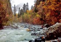
The Kuriles are the place where the End of the World is, at least that's what it is called Cape on Shikotan... The mysterious archipelago keeps a lot of unusual things - this is the Udachny stream with outlets of quartz gold, and the largest in Russia (140m) waterfall Ilya Muromets, and fire-breathing islands with volcanoes and geysers. The Kurils are compared to a large arboretum, where you can visit various natural zones, and where stone birches, lianas, dwarf cedar and bamboo thickets that exceed the height of a person coexist. Large bird colonies, bears, sables and foxes, whales and dolphins, underwater inhabitants - seals, squids, crabs and starfish - all this can be seen while traveling on these pristine islands.
Thermal springs are attractive for the traveler, volcanoes Alaid, Chikurachki, Fussa, Ebeko and others; and military history will reveal to you the secrets of its past times of the Kuril landing in 1945.
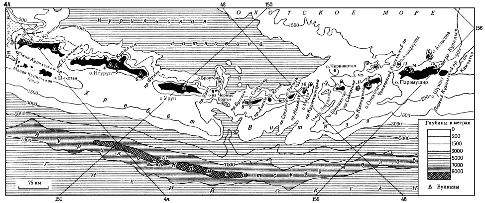
Great Kuril ridge- one of two parallel groups of islands in the Kuril archipelago. The Kruzenshtern and Bussol straits divide it into three parts:
The northern group includes the islands of Paramushir, Onekotan, Shumshu, Lovushki, Atlasova, Shiashkotan and others;
- middle - Simushir, Ketoy, Rasshua, Matua, Ushishir and others;
-the southern group includes the islands of Iturup, Kunashir, Urup.
The territory of the islands is inhabited unevenly and is uninhabited south of Paramushir Island and up to Iturup Island. In this regard, tourist routes mainly run along the islands of the Northern and Southern Kuriles. The most popular are Iturup, Paramushir, Shikatan, Shumshu, Kunashir, Matua.
Northern Kuriles
Severo-Kurilsk Is the main city of this group of islands. Until 1946 it was called Kashiva-bora. The city is located on the shores of the 2nd Kuril Strait in the northeast of Paramushir Island. Its population is 2,400 inhabitants (data for 2007). The seiner fleet is based here, there is a heliport, and the total length of roads is about 10 km.
The islands can only be reached by helicopter from Petropavlovsk-Kamchatsky or by PTR vessel. The main types of tourism include historical, educational and ecological. The remoteness of the islands is still an obstacle for mass tourism. Nevertheless, thermal springs, routes through war sites, volcanoes and the unusual flora and fauna of the Kuril Islands are attractions that attract an increasing number of tourists.
The volcanoes of the Kuril Islands are part of the Pacific Ring of Fire.
Ebeko volcano (1156m)... This active volcano is located on Paramushir Island, 7 km from Severo-Kurilsk. Being one of the most active in the Kuril Islands, it is interesting for the presence of several craters. On the southern part of the cone, there is an active crater that appeared after the eruption in 1965. In the northern part, in the crater, there is a small lake with greenish water. The Northern Crater, known from the literature, was filled with slag and volcanic bombs during the last eruption. And one more - the central one - is filled with a lake, which is replenished with water from a snowfield. The lake was once hot, but later lost contact with underground heat sources. Climbing the Evbeko volcano, you can see the Japanese sulfur plant and many fumaroles. These are the holes through which gases rise. Each fumarole is surrounded by intricate figures of native sulfur. Among the large fumarole fields stands out the northeastern field known as the Roaring Fumaroles or White Key.
Alaid volcano (2339m)... It is the highest active volcano in the Kuril Islands. It is located on Atlasov Island, 70 km from Kamchatka and 30 km from Paramushir Island. According to legend, Alaid used to be located in the south of Kamchatka. But other mountains drove him out, as he was the tallest among them and blocked the light. Since then, the volcano-island has stood alone. The shape of the Alaid cone is more correct than Mount Fuji. Its peculiarity is the presence of 33 secondary cinder cones on the slopes and at the base. Intense fumarolic activity takes place inside a young 250-meter cinder cone. Alaid is a double stratovolcano with a summit explosive crater 900-1300m in diameter and 200m deep.
Chikurachki volcano (1816m)- the highest point of Paramurshir, located in the southwestern part of the island, 60 km from Severo-Kurilsk. In the chain of volcanoes of the Karpinsky ridge, it is the northernmost. Chikurachki is a stratovolcano, standing on an ancient lava base, with a regular cone, the upper half of which is red. It is mainly composed of pyroclastic deposits.
Volcano Fussa (1772m)... This complex stratovolcano forms a peninsula in the southwestern part of Paramushir Island, 75 km from Severo-Kurilsk. It is a strongly truncated regular cone with a crater 700m in diameter and up to 300m deep. The crater has steep walls, steep in places, and the bottom, divided into two unequal parts, is strewn with snowfields. The volcano offers a breathtaking view of the rocky outcrops of Mount Arkhangelsky and Belousov, the gentle slopes of the Karpinsky caldera and the saddle between the volcanoes Lomonosov and Tatarinov.
Shumshu and Matua islands... These islands are especially interesting to visit from a historical and educational point of view. They are famous for the catacombs of the war years and the preserved fortifications, including numerous trenches, bunkers and rock holes, where the personnel of the garrison of the islands were hiding, and guns were installed.
South Kuriles
The most easily accessible and interesting to visit in this part of the Kuriles are the islands of Kunashir and Iturup. You can get to them by air from Yuzhno-Sakhalinsk or by motor ship from Korsakov. Due to constant fogs and weather changes, the An-24 plane, flying three times a week, can wait a long time for suitable weather. Therefore, the ship is a more reliable way of travel, although due to weather conditions it can also change the arrival schedule to the islands. A must to visit the South Kuriles is to issue a pass in Yuzhno-Sakhalinsk, since the islands are located in the border zone.
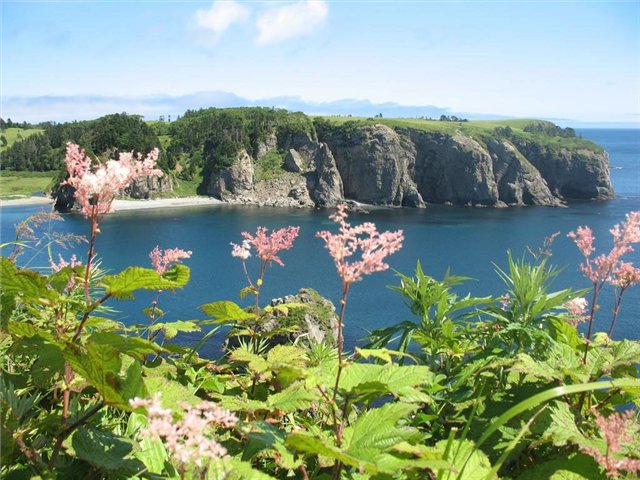
Kunashir Island... It is one of the largest and most southern island of the Greater Kuril ridge with the administrative center in Yuzhno-Kurilsk. In fact, it is a chain of volcanoes - Tyatya, Mendeleev, Golovnin volcano, which are connected by reclaimed sandstone. The Kunashirsky and Treason straits separate the island from Japan. The many thermal springs and waterfalls are also popular with travelers. Another place worth visiting is the Golovnin volcano caldera, where there are two lakes - Hot and Kipyashchee. The latter, formed in an explosive funnel, is considered the hallmark of the Southern Kuriles. The lake is famous for the fact that a boiling steam-water jet can suddenly hit from its bottom.
Cape Column Is one of the main attractions of Kunashir. Located on the shores of the Sea of Okhotsk, it was formed in the process of pouring out lava into the water column. Tall basalt pillars create ribbed walls that resemble a giant organ. Another highlight of the cape is the salmon spawning, which can be watched for hours as the fish overcome waterfalls, rapids and streams on their way to the spawning grounds.
Iturup Island... It is the largest island in the archipelago. From the east it is washed by the Pacific Ocean, from the west - by the Sea of Okhotsk. Of the 20 volcanoes on the island, 9 are active, and the highest is Stokap, 1634 meters in height. On Iturup, it is recommended to visit the Lion's mouth and three volcanoes - Berutarube, Atsonopuri and Kudryavy. Also there are more than 30 lakes, many waterfalls, hot and mineral springs.
Volcano Berutarube (1222m). In both craters of the volcano, active fumarolic activity takes place. At the summit there is a destroyed caldera with a diameter of more than 2 km.
Volcano Atsonopuri (1205m)... Due to the high porosity of the slag, a distinctive feature of the island is the complete absence of water. Atsonopuri is the so-called "volcano in a volcano", pushed far into the open sea. The correctness of the cone allowed it to take the 3rd place in the world after Fujiyama and Vesuvius.
Volcano Kudryavy (991m)... It is an active volcano with an isosceles triangle-shaped dome. The height of vertical columns of gas and vapor above the crater in calm weather reaches 1 kilometer. In addition, here is the only place in the world for the extraction of rhenium - rare earth metal.
Lion's Maw Bay... Located in the southwestern part of Iturup, the bay (caldera) resembles a broken ring. The caldera measures 7 x 9 km, and its rocky shores rise up to 400 meters. In the strait, at the entrance to the bay, there is a rocky island - Stone-Lion, which resembles a sleeping lion. The two promontories protruding into the sea are called Fang and Jaw.

The mysterious Kuriles are a paradise for any romantic traveler. Inaccessibility, uninhabitedness, geographic isolation, active volcanoes, far from a "beach climate", scanty information - not only do not scare away, but also increase the desire to get to the foggy, fire-breathing islands - the former military fortresses of the Japanese army, still hiding deep underground many secrets.
The Kuril arc connects two worlds - Kamchatka and Japan with a narrow chain of islands, like an openwork bridge. The Kuriles are part of the Pacific volcanic ring. The islands are the tops of the tallest structures of the volcanic ridge, protruding from the water only for 1-2 km, and going into the depths of the ocean for many kilometers.

In total, there are over 150 volcanoes on the islands, of which 39 are active. The highest of them is the Alaid volcano - 2339 m, located on the Atlasov Island. Volcanic activity is associated with the presence of numerous thermal springs on the islands, some of them medicinal.
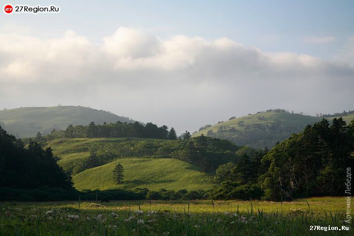
Experts compare the Kuril Islands with a huge Botanical Garden, where representatives of various flora coexist: Japanese-Korean, Manchurian and Okhotsk-Kamchatka. Here grow together - polar birch and millennial yew, larch with spruce and wild grapes, elfin cedar and velvet tree, interweaving of woody vines and carpet thickets of lingonberries. Traveling around the islands, you can visit various natural zones, get from the pristine taiga to subtropical thickets, from the moss tundra to the jungle of giant grasses.
The seabed around the islands is covered with dense vegetation, in the thickets of which numerous fish, mollusks, marine animals find refuge, and the crystal clear water allows fans of underwater travel to navigate well in the jungle of seaweed, where unique finds also happen - sunken ships and the Japanese military technology - reminders of military events in the history of the Kuril archipelago.
Yuzhno-Kurilsk, Kunashir 
GEOGRAPHY, WHERE ARE, HOW TO GET THERE
The Kuril Islands are a chain of islands between the Kamchatka Peninsula and the Hokkaido Island, separating the Sea of Okhotsk from the Pacific Ocean with a slightly convex arc.
The length is about 1200 km. The total area is 10.5 thousand km². To the south of them lies the state border of the Russian Federation with Japan.
The islands form two parallel ridges: the Big Kuril and the Small Kuril. Includes 56 islands. They are of great military-strategic and economic importance. The Kuril Islands are part of the Sakhalin Region of Russia. The southern islands of the archipelago - Iturup, Kunashir, Shikotan and the Habomai group - are disputed by Japan, which includes them as part of the Hokkaido prefecture.
The Kuril Islands belong to the regions of the Far North
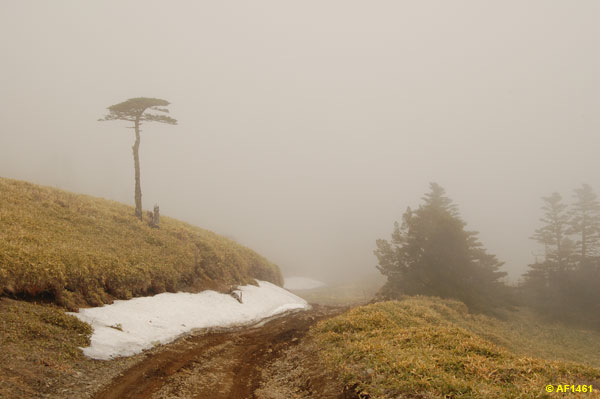
The climate on the islands is maritime, rather harsh, with cold and long winters, cool summers, and high air humidity. The mainland monsoon climate is undergoing significant changes here. In the southern part of the Kuril Islands, frosts in winter can reach −25 ° C, the average temperature in February is −8 ° C. In the northern part, winters are milder, with frosts down to -16 ° C and -7 ° C in February.
In winter, the islands are affected by the Aleutian baric minimum, the effect of which weakens by June.
The average August temperature in the southern part of the Kuril Islands is +17 ° C, in the northern part - +10 ° C.
Iturup Island, White Rocks Kuril Islands 
List of KURIL ISLANDS
List of islands with an area of more than 1 km² in the direction from north to south.
Name, Area, km², height, Latitude, Longitude
Great Kuril ridge
Northern group
Atlasova 150 2339 50 ° 52 "155 ° 34"
Shumshu 388 189 50 ° 45 "156 ° 21"
Paramushir 2053 1816 50 ° 23 "155 ° 41"
Antsiferova 7 747 50 ° 12 "154 ° 59"
Makanrushi 49 1169 49 ° 46 "154 ° 26"
Onekotan 425 1324 49 ° 27 "154 ° 46"
Harimkotan 68 1157 49 ° 07 "154 ° 32"
Chirinkotan 6 724 48 ° 59 "153 ° 29"
Ekarma 30 1170 48 ° 57 "153 ° 57"
Shiashkotan 122 934 48 ° 49 "154 ° 06"
Middle group
Raikoke 4.6 551 48 ° 17 "153 ° 15"
Matua 52 1446 48 ° 05 "153 ° 13"
Rasshua 67 948 47 ° 45 "153 ° 01"
Ushishir Islands 5 388 - -
Ryponkich 1.3 121 47 ° 32 "152 ° 50"
Yankich 3.7 388 47 ° 31 "152 ° 49"
Ketoy 73 1166 47 ° 20 "152 ° 31"
Simushir 353 1539 46 ° 58 "152 ° 00"
Broughton 7 800 46 ° 43 "150 ° 44"
Black Brothers Islands 37 749 - -
Chirpoy 21 691 46 ° 30 "150 ° 55"
Brother-Chirpoev 16 749 46 ° 28 "150 ° 50" Kuril Islands 
Southern group
Urup 1450 1426 45 ° 54 "149 ° 59"
Iturup 3318.8 1634 45 ° 00 "147 ° 53"
Kunashir 1495.24 1819 44 ° 05 "145 ° 59"
Small Kuril ridge
Shikotan 264.13 412 43 ° 48 "146 ° 45"
Polonsky 11.57 16 43 ° 38 "146 ° 19"
Green 58.72 24 43 ° 30 "146 ° 08"
Tanfilieva 12.92 15 43 ° 26 "145 ° 55"
Yuri 10.32 44 43 ° 25 "146 ° 04"
Anuchina 2.35 33 43 ° 22 "146 ° 00"
Atsonapuri volcano Kuril Islands 
Geological structure
The Kuril Islands are a typical ensimatic island arc at the edge of the Okhotsk Plate. It sits above a subduction zone in which the Pacific plate is being absorbed. Most of the islands are mountainous. The highest altitude is 2339 m - Atlasov Island, Alaid volcano. The Kuril Islands are located in the Pacific volcanic ring of fire in a zone of high seismic activity: out of 68 volcanoes, 36 are active, there are hot mineral springs. Large tsunamis are not uncommon. The most famous tsunami on November 5, 1952 in Paramushira and the Shikotan tsunami on October 5, 1994. The last of the major tsunamis occurred on November 15, 2006 in Simushir.
South Kuril Bay, Kunashir Island 
Earthquakes
In Japan, an average of 1,500 earthquakes are recorded per year, i.e. 4 earthquakes per day. Most of them are associated with movement in the earth's crust (tectonics). Over 15 centuries, 223 destructive earthquakes and 2000 - of average strength have been noted and described: These are, however, far from complete figures, since earthquakes began to be recorded in Japan with special instruments only since 1888. A significant proportion of earthquakes occur in the region of the Kuril Islands, where they are often manifest themselves in the form of seaquakes. Captain Snow, who hunted sea animals here for many years, at the end of the last century, repeatedly observed such phenomena. So, for example, on July 12, 1884, 4 miles west of the stones of Srednevo, the gusty noise and shuddering of the ship continued for about two hours at intervals of 15 minutes and a duration of 30 seconds. The waves of the sea were not noticed at this time. The water temperature was normal, about 2.25 ° C.
Between 1737 and 1888 in the area of the islands, 16 destructive earthquakes were noted, for 1915-1916. - 3 catastrophic earthquakes in the middle part of the ridge, in 1929 - 2 similar earthquakes in the north.
Sometimes these phenomena are associated with underwater lava eruptions. The devastating impacts of earthquakes sometimes raise a huge wave (tsunami) on the sea, which is repeated several times. With tremendous force, it falls on the shores, complementing the destruction from the shaking of the soil. The height of the wave can be judged, for example, by the case with the ship "Natalia", sent by Lebedev-Lastochkin and Shelekhov under the command of navigator Petushkov to the 18th island: “On January 8, 1780, there was a severe earthquake; the sea rose so high that the gukor (ship A.S.), standing in the harbor, was carried to the middle of the island ... "(Berkh, 1823, pp. 140-141; Pozdneev, p. 11). The wave caused by the 1737 earthquake reached a height of 50 m and hit the shore with terrible force, breaking rocks. Several new rocks and cliffs rose in the Second Straits. During the earthquake on the island. Simushire in 1849, all sources of ground water dried up, and its population was forced to move to other places.
Paramushir island, Ebeko volcano 
Mendeleev volcano, Kunashir island 
Mineral springs
The presence of numerous hot and highly mineralized springs on the islands is associated with volcanic activity. They are found on almost all islands, especially on Kunashir, Iturup, Ushishir, Raikok, Shikotan, Yekarma. On the first of them there are many boiling springs. On others, hot springs have a temperature of 35-70 ° C. They come out in different places and have a different debit.
On about. The Raikoke spring with a temperature of 44 ° C gushes at the foot of high cliffs and forms bath-like basins in the cracks of solidified lava.
On about. Ushishir, a powerful boiling spring comes out in the crater of a volcano, etc. The water of many springs is colorless, transparent, most often contains sulfur, in places deposited along the edges of yellow grains. For drinking purposes, the water of most sources is unsuitable.
Some springs are considered curative and are used for healing on the inhabited islands. The gases emitted by volcanoes along cracks are often also rich in sulfurous vapors.
Devil's finger Kuril Islands 
Natural resources
Industrial reserves of non-ferrous metal ores, mercury, natural gas, and oil have been explored on the islands and in the coastal zone. On the island of Iturup, in the area of the Kudryavy volcano, there is the richest known rhenium mineral deposit in the world. Here, at the beginning of the 20th century, the Japanese mined native sulfur. The total resources of gold on the Kuril Islands are estimated at 1,867 tons, silver - 9,284 tons, titanium - 39.7 million tons, iron - 273 million tons. Currently, the development of minerals is few.
Of all the Kuril straits, only the Frisa Strait and the Catherine Strait are non-freezing navigable.
Bird waterfall, Kunashir 
Flora and fauna
Flora
Due to the large extent of the islands from north to south, the flora of the Kuril Islands is extremely different. On the northern islands (Paramushir, Shumshu and others), due to the harsh climate, woody vegetation is rather scarce and is represented mainly by shrub forms (elfin trees): alder (alkhach), birch, willow, mountain ash, dwarf cedar (cedar). On the southern islands (Iturup, Kunashir), coniferous forests grow from Sakhalin fir, Ayan spruce and Kuril larch with a large participation of broad-leaved species: curly oak, maples, elms, seven-lobed kalopanax with a large number of woody lianas: petiolate hydrangea, Chinese actinida grapes, poisonous eastern toxicodendron, etc. In the south of Kunashir one can find the only wild type of magnolia in Russia - magnolia obovate. One of the main landscape plants of the Kuril Islands, starting from the middle islands (Ketoy and to the south), is the Kuril bamboo, which forms impenetrable thickets on the mountain slopes and forest edges. Due to the humid climate, tall grasses are common on all islands. Various berries are widely represented: crowberry, lingonberry, blueberry, honeysuckle and others.
There are over 40 species of endemic plants. For example, astragalus Kavakamskiy, wormwood island, Kuril edelweiss, found on the Iturup island; pusher Ito and Kuril Saussurea, growing on the island of Urup.
The following plants are protected on the Iturup Island: endangered Asian half-eared, flowering plants aralia mainland, heart-shaped aralia, calopanax seven-lobed, Japanese kandyk, Raita's viburnum, Glena cardiocrinum, reverse peony, rhododendron Fori, Sugeroki holly, bogweed pearl wolf-leaf, mountain peony, lichens of Japanese glossodium and nude stereocaulon, gymnosperms of Sargent juniper and acuminate yew, bryoxyfium saatye and alpine atraktylocarpus growing near Baransky volcano. On the island of Urup, Wright's viburnum, cordate aralia and the dumbest plagiottium are protected.
Alaid volcano, Atlasov island 
Fauna
A brown bear lives on Kunashir, Iturup and Paramushir, and a bear was also found on Shumshu, but during a long-term presence on the island of a military base, due to its relatively small size, bears on Shumshu were mostly knocked out. Shumshu is a connecting island between Paramushir and Kamchatka, and some bears are now found there. The islands are inhabited by foxes and small rodents. A large number of birds: plovers, gulls, ducks, cormorants, petrels, albatrosses, passerines, owls, falconifers and others. Many bird colonies.
The coastal underwater world, unlike the islands, is not only numerous, but also very diverse. The coastal waters are inhabited by seals, sea otters, killer whales, sea lions. Of great commercial importance are: fish, crabs, molluscs, squid, crustaceans, trepangs, sea cucumbers, sea urchins, seaweed, whales. The seas washing the shores of Sakhalin and the Kuriles are one of the most productive regions of the World Ocean.
On the island of Iturup, there are also endemic animals (mollusks): iturup lakustrina, iturup sharovka (Lake Reidovo), Kuril pearl mussel, on the Dobroe lake there are synanodont-shaped kunashiria and iturup shuttle.
On February 10, 1984, the Kurilskiy State Nature Reserve was established. Its territory is inhabited by 84 species included in the Red Book of Russia.
Kunashir Island, Pervukhina Bay
History of the islands
17-18 centuries
The honor of the discovery, exploration and initial development of the Kuril Islands belongs to Russian expeditions and colonists.
The first visit to the islands is attributed to the Dutchman Gerrits Fries, who visited Fr. Uruppu. Having called this land "Companys land" - Companys lant (Reclus, 1885, p. 565), Frieze, however, did not assume that it was part of the Kuril ridge.
The rest of the islands north of Uruppu to Kamchatka were discovered and described by Russian "explorers" and navigators. And the Russians opened Uruppa again at the beginning of the 18th century. Japan at this time only knew o. Kunashiri and the Small Kuril ridge, but they were not part of the Japanese Empire either. The extreme northern colony of Japan was about. Hokkaido.
The clerk of the Anadyr prison, Pentecostal Vl. Atlasov, who discovered Kamchatka. In 1697, he passed along the western coast of Kamchatka to the south to the mouth of the river. Golygina and from here "on the sea I saw as if there are islands."
Not knowing that trade with foreigners had been prohibited in Japan since 1639, Peter I in 1702 gave the task of establishing good-neighborly trade relations with Japan. Since that time, Russian expeditions have persistently made their way south of Kamchatka in search of a trade route to Japan. In 1706 the Cossack M. Nasedkin clearly saw land in the south from Cape Lopatka. On the order of the Yakut voivode about "holding" this land, the Cossack ataman D. Antsiferov and the captain Ivan Kozyrevsky in 1711 went to about. Syumusyu (Shumshu) and Paramusir (Paramushir), and upon their return they drew up a "blueprint" of all the islands. To draw the southern islands, they used the stories of Japanese fishermen who were thrown into Kamchatka by the storm and who saw the southern islands.
In the campaign of 1713, the captain Ivan Kozyrevsky again “visited” the islands beyond the “overflows” (straits) and drew up a new “blueprint”. Geodesists Yevreinov and Luzhin took a survey on the map in 1720 from Kamchatka to the Sixth Island (Simushiru). 10 years later, the brave leader of the "explorers" V. Shestakov with 25 servicemen visited the five northern islands. After him, captain Spanberg, Bering's assistant on his second expedition, carried out substantial work “for the sake of observation and finding a way to Japan”.
During 1738-1739. Spanberg mapped and described almost all of the islands. Based on his materials, 40 islands under Russian names were shown on the "General Map of the Russian Empire" in the Academic Atlas of 1745, for example, the islands of Anfinogen, Krasnogorsk, Stolbovoy, Krivoy, Osypnaya, Kozel, Brother, Sestra, Olkhovy, Zeleny, etc. As a result of Spanberg's work, the composition of the entire island ridge was first revealed and mapped. The previously known extreme southern islands (Kompaneiskaya Zemlya, Island of the States) were identified as constituent parts of the Kuril ridge.
For a long time before that, there was an idea of a certain large "Gama Land" to the east of Asia. The legend of the hypothetical Gama Land was forever dispelled.
In the same years, the Russians got acquainted with the small indigenous population of the islands - the Ainu. According to the largest Russian geographer of that time S. Krasheninnikov, on about. Shumushu by the 40s of the 18th century. there were only 44 souls.
In 1750 he sailed to about. Seamushiru is the foreman of the First Island of Nick. Storozhev. 16 years later (in 1766) foremen Nikita Chikin, Chuprov and centurion Iv. Black again tried to find out the number of all the islands and the number of people on them.
After Chikin's death on the island. Shimushiru I. Black spent the winter on this island. In 1767 he reached Fr. Etorofu, and then settled on about. Uruppu. Returning to Kamchatka in the fall of 1769, Cherny reported that on 19 islands (including Etorofu) 83 "shaggy" (Ainu) took Russian citizenship.
In their actions, Chikin and Cherny were obliged to follow the instructions of the Bolsheretsk Chancellery: “When traveling to distant islands and back ... describe their size, the width of the straits, which are on the islands, animals, also rivers, lakes and fish in them. .. Visiting about gold and silver ores and pearls ... offenses, taxes, robbery ... and other acts contrary to decrees and rudeness and prodigal violence should not be shown, expecting the highest mercy and reward for jealousy. " After a while, the Tyumen merchant Yak. Nikonov, as well as the sailors of the trading company Protodyakonov and other "explorers" delivered more accurate news about the islands.
In order to firmly and finally consolidate the islands and develop them, the main commander of Kamchatka, Bem, proposed to build on about. Uruppu fortification, create a Russian settlement there and develop the economy. To implement this proposal and develop trade with Japan, the Yakut merchant Lebedev-Lastochkin equipped an expedition in 1775 under the command of the Siberian nobleman Antipin. The expedition vessel "Nikolay" suffered an accident at about. Uruppu. Two years later, to Antipin on the island. The ship "Natalia" was sent to Urupp from Okhotsk under the command of navigator M. Petushkov.
After wintering on Uruppa "Natalia" went to Akkesi Bay on the island. Hokkaido and met a Japanese ship here. By agreement with the Japanese, Antipin and the translator, the Irkutsk posad Shabalin, appeared in 1779 with the goods of Lebedev-Lastochkin on the island. Hokkaido to Akkeshi Bay. Strictly remembering the instruction received by Antipin that “... having met with the Japanese, act courteously, affectionately, decently ... for mutual bargaining, make an agreement on some island, which would be guided for the future ... to establish a peaceful relationship with the Japanese, "the merchants counted on trade that would be profitable for both parties. But their hopes were not justified. In Akkesi, they were given the prohibition of the Japanese not only to trade on about. Hokkaido (Matsmai), but also swim at Etorofu and Kunashiri.
From that time on, the Japanese government began to oppose the Russians in every possible way on the southern islands. In 1786, it commissioned the official Mogami Tokunai to inspect the islands. Finding three Russians on Etorofu and interrogating them, Tokunai handed them an order: “Foreign nationals are strictly prohibited from entering Japanese borders. Therefore, I order you to return to your state as soon as possible ”. The movement of Russian merchants to the south for peaceful purposes was interpreted by the Japanese in a completely different way.
Severo-Kurilsk city 
19th century
Nikolai Rezanov, a representative of the Russian-American company, who arrived in Nagasaki as the first Russian envoy, tried to resume negotiations on trade with Japan in 1805. But he also failed. However, Japanese officials, who were not satisfied with the oppressive policy of the supreme power, made him understand with hints that it would be nice to hold a forceful action in these lands, which could bring the situation to a standstill. This was done on behalf of Rezanov in 1806-1807 by an expedition of two ships led by Lieutenant Khvostov and Warrant Officer Davydov. Ships were plundered, a number of trading posts were destroyed, and a Japanese village was burned down on Iturup. They were later tried, but the attack for some time led to a serious deterioration in Russian-Japanese relations. In particular, this was the reason for the arrest of Vasily Golovnin's expedition.
The first delimitation of the possessions of Russia and Japan on the Kuril Islands was made in the Shimodsky treatise of 1855.
In exchange for the right to own southern Sakhalin, Russia transferred all the Kuril Islands to Japan in 1875.
XX century
After defeat in 1905 in the Russo-Japanese War, Russia handed over the southern part of Sakhalin to Japan.
In February 1945, the Soviet Union promised the United States and Great Britain to start a war with Japan, subject to the return of Sakhalin and the Kuril Islands to it.
February 2, 1946. Decree of the Presidium of the Supreme Soviet of the USSR on the formation of the Yuzhno-Sakhalin Region in the Khabarovsk Territory of the RSFSR on the territory of South Sakhalin and the Kuril Islands.
November 5, 1952. A powerful tsunami struck the entire coast of the Kuriles, Paramushir suffered the most. A giant wave washed away the city of Severo-Kurilsk (formerly Kasivabara). It was forbidden to mention this catastrophe in the press.
In 1956, the Soviet Union and Japan adopted a Joint Treaty, officially ending the war between the two states and transferring Habomai and Shikotan to Japan. However, it was not possible to sign the agreement, because according to it, it appeared that Japan was giving up the rights to Iturup and Kunashir, which is why the United States threatened not to give Japan the island of Okinawa.
Church of the Holy Trinity, Yuzhno-Kurilsk 
The problem of belonging
At the end of World War II in February 1945, at the Yalta Conference of the Heads of Powers of the countries participating in the anti-Hitler coalition, an agreement was reached on the unconditional return of the southern part of Sakhalin and the transfer of the Kuril Islands to the Soviet Union after the victory over Japan.
On July 26, 1945, within the framework of the Potsdam Conference, the Potsdam Declaration was adopted, which limited the sovereignty of Japan to the islands of Honshu, Hokkaido, Kyushu, Shikoku. On August 8, the USSR joined the Potsdam Declaration. On August 14, Japan accepted the terms of the Declaration and on September 2, 1945, signed the Act of Surrender, confirming these terms. But these documents did not speak directly about the transfer of the Kuril Islands to the USSR.
August 18 - September 1, 1945, Soviet troops carried out the Kuril landing operation and occupied, among other things, the southern Kuril Islands - Urup, Iturup, Kunashir and the Lesser Kuril Ridge.
In accordance with the Decree of the Presidium of the USSR Armed Forces of February 2, 1946, in these territories, after their exclusion from Japan by Memorandum No. 677 of the Supreme Commander of the Allied Forces of January 29, 1946, the Yuzhno-Sakhalin Region was formed as part of the Khabarovsk Territory of the RSFSR, which on January 2 In 1947 it became part of the newly formed Sakhalin Oblast as part of the RSFSR.
On September 8, 1951, Japan signed the San Francisco Peace Treaty, according to which it renounced “all rights, legal grounds and claims to the Kuril Islands and to that part of Sakhalin Island and adjacent islands, over which Japan acquired sovereignty under the Treaty of Portsmouth of September 5, 1905 G." When discussing the San Francisco Treaty in the US Senate, a resolution was adopted containing the following clause: would damage the rights and legal foundations of Japan in these territories, just as any provisions in favor of the USSR with respect to Japan, contained in the Yalta Agreement, will not be recognized. In view of serious claims to the draft treaty, representatives of the USSR, Poland and Czechoslovakia refused to sign it. The treaty was also not signed by Burma, DRV, India, DPRK, PRC and Mongolian People's Republic not represented at the conference.
Japan makes territorial claims for the southern Kuril Islands Iturup, Kunashir, Shikotan and Habomai with a total area of 5175 km². These islands are called the "northern territories" in Japan. Japan justifies its claims with the following arguments:
According to Article 2 of the Shimoda Treaty of 1855, these islands were incorporated into Japan and they are the original possession of Japan.
This group of islands, according to the official position of Japan, is not included in the Kuril Ridge (Chishima Islands) and, having signed the act of surrender and the San Francisco Treaty, Japan did not abandon them.
The USSR did not sign the San Francisco Treaty.
However, the Shimoda treatise is considered canceled due to the Russo-Japanese War (1905).
In 1956, the Moscow Declaration was signed, which ended the state of war and established diplomatic and consular relations between the USSR and Japan. Article 9 of the Declaration states, inter alia:
The USSR, meeting the wishes of Japan and taking into account the interests of the Japanese state, agrees to the transfer of the Habomai Islands and the Sikotan Island to Japan, however, that the actual transfer of these islands to Japan will be made after the conclusion of the Peace Treaty.
On November 14, 2004, Russian Foreign Minister Sergei Lavrov, on the eve of the visit of Russian President Vladimir Putin to Japan, announced that Russia, as a successor state to the USSR, recognizes the 1956 Declaration as existing and is ready to conduct territorial negotiations with Japan on its basis.
It is noteworthy that on November 1, 2010, Russian President Dmitry A. Medvedev became the first Russian leader to visit the Kuril Islands. President Dmitry Medvedev stressed then that “all the islands of the Kuril ridge are the territory of the Russian Federation. This is our land, and we must develop the Kuril Islands. " The Japanese side remained intransigent and called this visit regrettable, which in turn provoked a response from the Russian Foreign Ministry, according to which there could be no changes in the status of the Kuril Islands.
Some Russian official experts, in search of a solution that could satisfy both Japan and Russia, offer very peculiar options. So, academician K.E. Chervenko in April 2012, in his article On the Possibility of the Final Settlement of the Territorial Dispute between the Russian Federation and Japan, voiced an approach in which the countries participating in the San Francisco Treaty (states that have the right to determine the international legal status of South Sakhalin with the adjacent islands and all the Kuril Islands) recognize the Kuril Islands de facto the territory of the Russian Federation, leaving Japan the right to consider them de jure (under the terms of the aforementioned treaty) not included in Russia.
Cape Column, Kunashir Island 
Population
The Kuril Islands are extremely unevenly populated. The population resides permanently only in Paramushir, Iturup, Kunashir and Shikotan. There is no permanent population on the other islands. At the beginning of 2010, there are 19 settlements: two cities (Severo-Kurilsk, Kurilsk), an urban-type settlement (Yuzhno-Kurilsk) and 16 villages.
The maximum value of the population was observed in 1989 and amounted to 29.5 thousand people. In Soviet times, the population of the islands was significantly higher due to high subsidies and a large number of military personnel. Thanks to the military, the islands of Shumshu, Onekotan, Simushir and others were inhabited.
As of 2010, the population of the islands is 18.7 thousand people, including 6.1 thousand people in the Kuril urban district (on the only inhabited island Iturup, also includes Urup, Simushir, etc.); in the South Kuril urban district - 10.3 thousand people. (Kunashir, Shikotan and other islands of the Lesser Kuril ridge (Habomai)); in the North Kuril urban district - 2.4 thousand people (on the only inhabited island Paramushir, also includes Shumshu, Onekotan, etc.).
Onekotan island 
Economy and development
On August 3, 2006, at a meeting of the Government of the Russian Federation, the Federal Program for the Development of the Islands from 2007 to 2015 was approved, which includes 4 blocks: the development of transport infrastructure, the fish processing industry, social infrastructure and the solution of energy problems. The program includes:
The allocation of funds for this program is almost 18 billion rubles, that is, 2 billion rubles a year, which is equivalent to about 300 thousand rubles for each inhabitant of the islands, which will increase the population from 19 to 30 thousand people.
Development of the fishing industry - currently there are only two fish factories on the islands, and both are state-owned. The Ministry of Economic Development and Trade of the Russian Federation proposes to create 20 more new fish hatcheries to replenish biological resources. The federal program provides for the creation of the same number of private fish hatcheries and the reconstruction of one fish processing plant.
On the islands, it is planned to build new kindergartens, schools, hospitals, develop a transport network, including the construction of a modern all-weather airport.
The problem of the shortage of electricity, which is four times more expensive in the Kuril Islands than in Sakhalin, is planned to be solved through the construction of power plants operating on geothermal sources, using the experience of Kamchatka and Japan.
In addition, in May 2011, the Russian authorities announced their intention to additionally allocate 16 billion rubles, thereby doubling the funding for the development program of the Kuril Islands.
In February 2011, it became known about plans to strengthen the defense of the Kuriles by an air defense brigade, as well as a mobile coastal missile system with Yakhont anti-ship missiles.
__________________________________________________________________________________________
SOURCE OF INFORMATION AND PHOTOS:
Team Wandering.
Photo: Tatiana Selena, Victor Morozov, Andrey Kapustin, Artem Demin
The Russian Academy of Sciences. Institute of Geography RAS. Pacific Institute of Geography, Far Eastern Branch of the Russian Academy of Sciences; Editorial board .: V. M. Kotlyakov (chairman), P. Ya. Baklanov, N. N. Komedchikov (chief editor), etc .; Resp. ed.-cartographer Fedorova E. Ya. Atlas of the Kuril Islands. - M .; Vladivostok: IPC "DIK", 2009. - 516 p.
Department of Natural Resources and Environmental Protection of the Ministry of Natural Resources of Russia for the Sakhalin Region. Report "On the state and protection of the environment of the Sakhalin region in 2002" (2003). Retrieved June 21, 2010. Archived from the original on August 23, 2011.
Sakhalin Region. Official site of the governor and government of the Sakhalin region. Retrieved June 21, 2010. Archived from the original on October 7, 2006.
Makeev B. "The Kuril problem: the military aspect". World economy and international relations, 1993, No. 1, p. 54.
Wikipedia website.
Solovyov A.I. Kuril Islands / Glavsevmorput. - Ed. 2nd. - M .: Publishing house of Glavsevmorput, 1947 .-- 308 p.
Atlas of the Kuril Islands / Russian Academy of Sciences. Institute of Geography RAS. Pacific Institute of Geography, Far Eastern Branch of the Russian Academy of Sciences; Editorial board .: V. M. Kotlyakov (chairman), P. Ya. Baklanov, N. N. Komedchikov (chief editor), etc .; Resp. ed.-cartographer Fedorova E. Ya .. - M .; Vladivostok: IPC "DIK", 2009. - 516 p. - 300 copies. - ISBN 978-5-89658-034-8.
http://www.kurilstour.ru/islands.shtml
There are about 100 more underwater volcanoes in the water area of the Kuril Islands. Active volcanoes include volcanoes that have erupted in people's memory, and potentially active volcanoes that are showing signs of activity at the present time.
Active and potentially active volcanoes of the Kuril Islands
| Name | Height, m | Location, Island |
Last thing eruption |
|---|---|---|---|
| Alaid | 2339 | Atlasova | 1986 |
| Ebeko | 1156 | Paramushir | 2009 |
| Chikurachki | 1816 | Paramushir | 2008 |
| Tatarinova | 1530 | Paramushir | - |
| Fussa | 1772 | Paramushir | 1854 |
| Karpinsky | 1345 | Paramushir | 1952 |
| Nemo | 1019 | Onekotan | 1906 |
| Krenitsyn | 1324 | Onekotan | 1952 |
| Severgin | 1157 | Harimkotan | 1933 |
| Chirinkotan | 724 | Chirinkotan | 2004 |
| Ekarma | 1170 | Ekarma | 1980 |
| Synarka | 934 | Shiashkotan | 1878 |
| Kuntomintar | 828 | Shiashkotan | 1927 |
| Raikoke | 551 | Raikoke | 1924 |
| Sarychev | 1446 | Matua | 2009 |
| Rasshua | 948 | Rasshua | 1846 |
| Ushishir | 388 | Yankich | - |
| Pallas | 990 | Ketoy | 1960 |
| Prevost | 1360 | Simushir | 1st floor XIX century. |
| Zavaritsky | 625 | Simushir | 1957 |
| Burning Sopka | 873 | Simushir | 1883 |
| Black | 624 | Chirpoy | 1857 |
| Snow | 395 | Chirpoy | 1982 |
| Berg | 980 | Urup | 2005 |
| Curly | 986 | Iturup | 1999 |
| Little Brother | 562 | Iturup | - |
| Chirip | 1589 | Iturup | - |
| Bohdan Khmelnytsky | 1585 | Iturup | 1860 |
| Baransky | 1134 | Iturup | 1951 |
| Ivan groznyj | 1159 | Iturup | 1989 |
| Stockup | 1634 | Iturup | - |
| Atsonupuri | 1205 | Iturup | 1932 |
| Berutarube | 1223 | Iturup | - |
| Rurui | 1485 | Kunashir | - |
| Tyatya | 1819 | Kunashir | 1973 |
| Mendeleev | 886 | Kunashir | - |
| Golovnina | 541 | Kunashir | - |
Write a review on the article "Volcanoes of the Kuril Islands"
Notes (edit)
Literature
- Atlas of the Kuril Islands / Russian Academy of Sciences. Institute of Geography RAS. Pacific Institute of Geography, Far East Branch, Russian Academy of Sciences; Editorial board .: V. M. Kotlyakov (chairman), P. Ya. Baklanov, N. N. Komedchikov (chief editor), etc .; Resp. ed.-cartographer Fedorova E. Ya .. - M .; Vladivostok: IPC "DIK", 2009. - 516 p. - 300 copies. - ISBN 978-5-89658-034-8.
Links
- SVERT -
- Global Volcanism Program - (eng.)
- KVERT -
| Sakhalin Region | This is a draft article on the geography of the Sakhalin region. You can help the project by supplementing it. |
| |||||||||||||||||||||||||||||||||||||||||||||||||||||||||||||||
Chirip is an active volcano located on Iturup Island, Chirip Peninsula of the Greater Kuril Ridge, in the north of the Two-Hump Ridge. To the south of it, 4 kilometers away is the volcano Bogdan Khmelnitsky.
It is a Holocene stratovolcano composed of basalts and andesites. Its height reaches 1,589 meters.
The western slopes of Chirip are steep and steep, the height of their plumb lines is 500 - 600 meters. In the eastern part, its slopes are more gentle and overgrown with dwarf trees. At the top there is a crater with a freshwater lake.
To date, thermal and fumarolic activity has been observed on the volcano. Chirip belongs to the category of active volcanoes, as it has been recorded outflows of thermal waters and emissions of gases.
Coordinates: 45.37722200,147.91222200
Volcano Kuntomintar
Kuntomintar is one of the active volcanoes on Shiashkotan Island, located in the Great Kuril Ridge, Sakhalin Oblast in Russia. Kuntomintar is a complex stratovolcano located in a caldera. Its height is 828 meters. The volcano is located in the central region of the Nikonov Peninsula.
In 1927, the last, so far, eruption of Kuntomintara took place. The eruption in 1872, during which the Ainu village was wiped out from the face of the earth, is mistakenly attributed to him. In fact, the eruption took place on the nearby Sinarka volcano. For the first time this was confirmed by the Soviet scientist Georgy Gorshkov, who stated that the Ainu village was actually located in the northern part of the island of Shiashkotan.
At the moment, thermal and fumarolic activity is recorded on the volcano.
Coordinates: 48.75828200,154.01423000
Volcano Uratman
Uratman is a long-extinct stratovolcano located in the northern part of Simushir Island, in the Great Ridge of the Kuril Islands. Uratman is a somma-type volcano.
Not far from the volcano is Broughton's Cove. Vegetation of the taiga type, thickets of birch, cedar and alder dwarf trees, evergreen Kuril bamboo grow from its top to the bay. Among the animals at the foot of the volcano are foxes, arctic foxes, small rodents and some species of birds such as cormorants, seagulls, puffins.
According to recent research results and independent expert estimates, the last eruption on Uratman took place about three thousand years ago.
Coordinates: 47.12083300,152.24611100
Rasshua volcano
Rasshua is a currently active volcano located on the eponymous island of Rasshua, in the Kuril archipelago, Sakhalin region of the Russian Federation.
Rasshua is a complex, pronounced stratovolcano located in a caldera. Its height is 948 meters, and there are two cones in its crater. On the slopes of the volcano, herbaceous vegetation, meadows, thickets of alder and dwarf creeping birch forests prevail.
Only one eruption of Rasshua is known and studied, in 1846. In 1957, an increase in the activity of fumaroles was noted on its surface. At the moment, fumarole and thermal activity is recorded on the volcano.
Coordinates: 47.75805600,153.02472200
Volcano Trident
Trident is a volcano located in the South Kuril District of Russia, Sakhalin Oblast. It is located on the Urup Island of the Great Range of the Kuril Islands.
The height of the Trident is 1.220 meters. The volcano is active, but there is no information on recent eruptions. There are hot springs and solfatars on the education.
The slopes of the volcano are covered with alder, thickets of Kuril bamboo and dwarf cedar. Foxes, small rodents live here, as well as cormorants, gulls and puffins.
To date, fumarole and thermal activity, emissions of gases and thermal waters have been recorded on the Trident volcano.
Coordinates: 46.11667300,150.20000300
Volcano Golovnin
On the island of Kunashir there is an active volcano Golovnin. It is the southernmost volcano in the Kuril Islands; its last eruption occurred in 1998.
The volcano is located in a caldera with a diameter of up to 4.7 kilometers, surrounded by a ridge with a height of 541 meters. At the bottom of the caldera there are 2 explosive craters with lakes Boiling and Hot and 4 volcanic domes.
Hot springs, steam-gas jets and mud boilers beat in the caldera. Their chemical composition contains sulfur dioxide, carbon dioxide, hydrogen chloride and hydrogen sulfide. The chlorine-sulfate composition of hot springs and lakes is due to the fact that gases dissolve passing through the water. Sulfur and its compounds with water metals constantly fall out - the surface of Lake Kipyushchee is covered with black sulphide-sulfur foam, the shores of the lakes are covered with yellowish-black sand.
The volcano arose at the bottom of the sea, throwing out large amounts of pumice. From this, a large cone grew, but due to new eruptions and the emptying of the magma chamber, as a result of the collapse, a volcanic basin appeared in the place where the volcanic mountain was, which was filled with the waters of the lake. The waters left the caldera into the Sea of Okhotsk, after which extrusive domes grew in the caldera. They grew and exploded. A Boiling Lake appeared in one of these craters. All this happened hundreds and thousands of years ago.
Coordinates: 43.84443600,145.50631200
Volcano Nemo
Nemo is a beautiful active volcano on Onekotan Island, part of the Kuril Islands. Despite the largest size of the volcano at 1018 meters, the volcano makes a strong impression on tourists.
The memorable name "Nemo" was given to the volcano in honor of the hero of the novel, Jules Verne. English captain Henry Snow gave the name to the volcano, like other places on the island. Paganel Cove, Blakiston Cove, and Cape Camberlaine have the “Julesvern” names.
In the area of the Nemo volcano, silence and tranquility reign. This is a great place for ecotourism. On the island in the area of the Nemo volcano, people do not live, but foxes do.
Coordinates: 49.66051700,154.80749100
Volcano Karpinsky
Volcano Karpinsky is an active volcano on the Paramushir Island of the Big Kuril Ridge of the Sakhalin Region. It is located in the southern part of the Karpinsky ridge. The height of the volcano is about 1345 meters. By age, it belongs to the era of the Upper Pleistocene - Holocene. It was named after the geologist A.P. Karpinsky.
The volcano consists of two gentle cones with craters. It is composed of andesite-basaltic and andesite rocks. The volcano erupted in 1952. Thermal and fumarolic activity is observed today. In the eastern part of the volcano, there are fountains of liquid sulfur and hot gases. Jets of hydrogen sulfide and sulfuric gases - solfatars form sulfur cones, the height of which reaches 3-5 meters. The slopes of the volcano are cut by traces left by ancient glaciers.
Coordinates: 50.13003600,155.37001400
Krenitsyn volcano
Krenitsyn Volcano is not just an active volcano located on the Kuril island of Onekotan on Sakhalin. It is the largest volcano in the world with a height of 1324 meters. Its size is five times the size of the Eiffel Tower and almost twice the size of the tallest skyscraper Burj Khalifa. Therefore, the volcano is worthy of the attention of even the most sophisticated travelers. The stunning nature of the Ring Lake surrounding the volcano and the cleanest air around makes a trip to the Kuril island of Onekotan healthy and makes an unforgettable impression for a lifetime.
Coordinates: 49.42526700,154.69762800
Raikoke volcano
Raikoke is an active volcano at the moment, located on the island of the same name, in the northern part of the Great Ridge of the Kuril Islands, Sakhalin Region of the Russian Federation.
Raikoke is a stratovolcano with a pronounced summit crater. Its height is about 551 meters. The main rock from which the volcano is composed is basalt. The volcano's crater reaches about 700 meters in diameter, and in some places its depth is 200 meters.
The most famous and studied local eruptions were recorded in 1760, 1778 and 1924. At the moment, the volcano is showing thermal and fumarolic activity.
Coordinates: 48.29305600,153.25000000
Fussa volcano
Fussa volcano is located in the Sakhalin region, on the Paramushir island, which belongs to the Great Kuril ridge. Forms the Fussa Peninsula off the southwestern coast of the island. Named in honor of the mathematician N.I. Fuss. It is a stratovolcano with a crater on top. The height of the volcano is 1772 meters. Age about 40-50 thousand years.
The volcano is composed of such volcanic rocks as andesites, it is a regular truncated cone. The crater has a diameter of about 700 meters and a depth of about 300 meters.
The last violent eruption of the volcano occurred in 1854. Nowadays, it shows fumarolic activity.
Coordinates: 50.26836600,155.24166500
Kudryavy volcano
Kudryavy is an active volcano located on the Iturup Island of the Great Kuril Islands. It is located in the north of the island, in the center of the Bear Ridge, two kilometers southwest of Mount Bear.
It is a complex stratovolcano composed of two-pyroxene andesites and several craters. Its height reaches 986 meters.
The dome of the volcano, with a height of 350 meters, resembles an isosceles triangle in its shape. Its southwestern slope is quite steep, and the northeastern one is almost gentle. There are 2 solfatara craters at the top. Their bottom is uneven and dissected by bridges due to the fact that the Japanese mined sulfur there. The southwestern crater has fumaroles. Both craters are separated by a distance of 450 meters.
In 1779 and 1883, eruptions took place from the volcano, and phreatic explosions in 1946 and 1999. To date, fumarolic activity has been observed on Kudryavi.
In 1992, a rhenium deposit was discovered on the volcano. It is represented by a fumarole field, on which sources of high-temperature deep-seated fluids are constantly acting. This means that the field is still being formed.
Coordinates: 45.38388900,148.81305600
Smirnov volcano
Smirnov Volcano is an underwater volcano of the Great Ridge of the Kuril Islands, located on Kunashir Island, 12 kilometers northwest of Makanrushi Island. It was named after S.S.Smirnov, a famous Russian geologist and academician. The height of its summit is 1,189 meters.
This volcano includes the Rurui stratovolcano and the Smirnov stratovolcano. Ruurui is considered the main one due to the fact that he is higher.
The southern part of the volcano is overlain by volcanic and volcanic-sedimentary deposits. The northern foot is overlain by sedimentary deposits with a thickness of at least 1,000 meters. The flat top of the volcano is located at a depth of 950 meters; it is overlain by horizontally layered sediments 100 - 150 meters thick.
Coordinates: 44.41972200,146.13472200
Volcano Black
Black Volcano is an active stratovolcano located on Chirpoi Island, in the middle of the Big Ridge of Kuril Islands.
The Chernyi stratovolcano has a summit crater, its height is 624 meters. It is located in the central part of the island.
The last recorded eruptions took place on the volcano in 1712 and 1857. At the moment, strong thermal and fumarolic activity is recorded on the volcano directly in the crater and on its western slope.
The volcano is named after the Russian centurion Ivan Cherny, who described the islands of the Black Brothers group in 1770.
The flora and fauna here is rather scarce and is represented mainly by herbaceous vegetation, thickets of dwarf cedar and nesting birds, puffins and cormorants.
Coordinates: 46.52194400,150.86638900
Volcano snow
Snow Volcano is an active volcano located on Chirpoi Island, one of the islands of the Black Brothers group, in the middle of the Great Ridge of Kuril Islands.
Snow is a gentle stratovolcano, its height is 395 meters, it is located in the southern part of the island.
In history, only four eruptions of this volcano were recorded, in 1811, 1879, 1960 and 1982. At the moment, its activity is dying out rather quickly, and weak thermal and fumarolic activity is recorded in the crater and on the slopes.
The volcano is named after the famous English industrialist GJ Snow.
The flora and fauna of the Volcano is rather scarce, and is mainly represented by thickets of dwarf cedar, as well as nesting birds, gulls and puffins.
Coordinates: 46.51083300,150.86861100
Volcano Ushishir
Ushishir is an active volcano located on Yankicha Island, which is part of the Ushishir group of islands and the Kuril archipelago.
The caldera of the volcano has a diameter of about 1.5 kilometers, and its maximum height is 388 meters. The volcano was formed about 9400 years ago, later its southern wall was flooded, which was filled with water, and was named Crater Bay. In the center of the bay there are two small domes of andesite lava. The other two more ancient domes are connected by a sandbank to the southern wall of the volcano's caldera.
The last recorded eruption of Ushishir took place in 1884. At the beginning of the XXI century, strong thermal and fumarolic activity is recorded here.
Coordinates: 47.51222200,152.81444400
Volcano ekarma
Ekarma is a large active volcano on the island of the same name in the Sea of Okhotsk. The height of the Ekarma volcano is 1170 meters. The volcano last erupted back in 1980, but its thermal activity is still recorded.
Volcano Ekarma is a stratovolcano with a central extrusive dome. The volcano occupies most of the territory of the entire uninhabited island of Ekarma. Few tourists come here, and you have a great chance, visiting the island of Ekarma, to take the best photos in private with nature.
Coordinates: 49.06306900,153.95605100
Volcano Lesser Brother
Little Brother is a volcano located in the Sakhalin region, on the Iturup island of the Great ridge of the Kuril Islands. It is located in the northeast of the island, in the west of the Bear Ridge, two kilometers west of the Kudryavy volcano.
It is an active volcano with an extrusive dome with three craters. Its height reaches 562 meters, diameter - 600 - 700 meters. The Lesser Brother has the form of a cinder cone, which merges at the base with the cone of Kudryavy volcano. Its width increases to 1,300 meters due to the fact that a thick mantle of breccia surrounds the base of the volcano. There are two craters on the top, which are separated by a distance of 500 meters. The northwestern crater is badly destroyed, while the southeastern one has a closed contour and a diameter of 70 meters.
The dome of the formation is covered with three relatively fresh lava flows. To date, thermal activity has been noticed on the volcano.
Coordinates: 45.38361100,148.78333300
Rurui volcano
The Rurui volcano is located on the Kunashir island, it is active and belongs to the Great Kuril ridge. It is a complex stratovolcano with a height of 1,485 meters.
The crater of the volcano is open to the north, this is the northern end of the linear-cluster volcanoes of the Dokuchaev Ridge. There is no information about historical eruptions, but on the western slopes of the Ruuruya, at an altitude of 150-350 meters above sea level, fumarolic activity was noticed, in the coastal part - hydrothermal activity.
This volcano also includes the Smirny stratovolcano, but Rurui is considered the main one, since its height is greater.
Coordinates: 44.45416700,146.13944400
Ebeko volcano
Ebeko volcano is located in the north of Paramushir island in the Sakhalin region. The height of the volcano is 1156 meters. The volcano has three craters with thermal springs, hot lakes and solfatars. It is composed of rocks such as basalts and andesites. It is an active volcano, one of the most active in the Kuril Islands. Ebeko volcano has erupted several times.
Volcanic eruptions have been recorded since 1793. The last activity of the volcano was noted in February 2013, when it threw out a cloud of gas to a height of about 200 meters. During eruptions, the main danger is represented by vapors of sulfur and hydrogen sulfide, ash emissions, volcanic mud flows. The many side craters of the volcano are centers of thermal and fumarolic activity
According to studies in the 1950s and 1960s, groundwater extracts elements such as aluminum, iron and manganese from volcanic rocks. Numerous streams flow down the slopes of the volcano, connecting to the river. The river brings to the Sea of Okhotsk about 65 tons of aluminum dissolved in water and about 35 tons of iron per day.
Coordinates: 50.68614500,156.01388400
Tatarinov volcano
Tatarinov volcano, located in the Sakhalin region, on the island of Paramushir, belonging to the Kuril ridge, was named after the Major Seconds Mikhail Tatarinov. The volcano is located in the northern part of the Karpinsky ridge, in the north it merges with the Chekurachki volcano, on the south side - with the Lomonosov volcano. The volcano is located in the northern part of the Karpinsky ridge. It is an active stratovolcano.
The age of the volcano is attributed to the Upper Pleistocene-Holocene epoch. The height of the Tatarinov volcano is 1530 meters. It is a collection of cones connected to each other. The volcano has side craters and several peaks. The last eruption of Tatarinov volcano dates back to the 17th century. Today it shows thermal activity.
On the Kuril Islands, there are 800 volcanic edifices of various types, sizes, ages and preservation that have arisen over the last 2-2.5 MA (Newest and modern volcanism in Russia, 2005). Most of these formations are poorly understood. The total productivity of the volcanoes of the Kuril-Kamchatka island arc is about 20% of the volume of material erupted by volcanoes in the world. C http://geoportal.kscnet.ru/volcanoes/ |
Volcanoes of the Greater Kuril Islands: 1. Vlodavetsa and Vetrovaya. 2. Ebeko. 3. Bogdanovich. 4. Vernadsky. 5. Fersman. 6. Chikurachki. 7. Tatarinova. 8. Lomonosov. 9. Karpinsky. 10. Fuss. 11. Apa-id. 12. Fly. 13. Nemo. 14. Krzhizhanovsky. 15. Crenicin. 16. Severgin. 17. Sinarok. 18. Kuntomintar. 19. Makanrushi. 20. Ekarma. 21. Chirinkotan. 22. Raikoke. 23. Sarycheva. 24. Rasshua. 25. Ushishir. 26. Caldera Ketoy. 27. Pallas. 28. Uratman. 29. Prevost. 30. Ikanmikot. 31. Caldera Zavaritsky. 32. Mile. 33. Chirpoy. 34. Chirpoy Second. 35. Black. 36. Snow. 37. Brother Chirpoev. 38. Broughton. 39- 40. Underwater volcanoes. 41. Airborne. 42. Three-headed. 43. Gorge. 44. Antipina. 45. Nameless. 46. Berga. 47. Trident. 48. Bell. 49. Borzova. 50. Three Sisters. 51. Rudakova. 52. Peter Schmidt. 53. Iwao. 54. Kamui. 55. Demon. 56. Caldera Bear. 57. Curly. 58. Si-betoro. 59. Caldera Circus. 60. Wind caldera. 61. Baransky. 62. Tebenkova. 63. Ivan the Terrible. 64. Chirip. 65. Bohdan Khmelnitsky. 66. Petrel. 67. Stockup. 68. Atsonupuri. 69. Caldera Urbich. 70. Lionmouth Caldera. 71. Berutarube. 72. Tyatya. 73. Rurui. 74. Smirnova. 75. Giedroytsa. 76. Williams. 77. Mendeleev. 78. Caldera Golovnin. 1. Alpine folding: a-island boulders; b - underwater areas. 2. Fields of the newest effusive rocks: a-surface; b-underwater. 3. Epimesozoic and older platforms: a - above-water; b- underwater. 4. Edge ridges, oceanic uplifts and ridges on the ocean floor. 5. Deflections of sea depressions - basins. 6. Deep ocean basins. 7. Deep water troughs. 8. Surface and underwater volcanoes. 9. Deep faults. -http: //www.zoodrug.ru/topic3288.htm |
|
1. Water. 2. The newest formations. 3. Faults. 4. Sedimentary layer. 5. Granite-metamorphic layer. 6. Basalt layer. 7. Subcrust mantle. 8. Substitution of lithospheric plates and blocks. Source: http://www.zoodrug.ru/topic3303.html |
Volcanoes are designated by numbers: 1 - Golovnina; 2 - Mendeleev; 3 - Tyatya; 4 - Ivan the Terrible; 5 - Baransky; 6 - Curly; 7 - Bell; 8 - Milna; 9 - Zavaritsky; 10 - Sarycheva; 11 - Severgin; 12 - Krenitsyn; 13 - Fussa; 14 - Chikurachki; 15 - Ebeko; 16 - Alaid - http://www.www.ecosystema.ru/rusgeo/6_3_2_6.html |
Sarychev peak volcano. Kuril Islands |
Shikotan |
Shikotan |
shikotan |
Shikotan |
shikotan |
The Small Kuril Ridge consists of several low-lying islets, rocks in the ocean, and the only large island of Shikotan. Much here is different from the islands of the Great Ridge. Soft smooth relief instead of cones and rocks of volcanoes, forest steppe instead of severe dark coniferous taiga, no bears and other large animals. Previously, it was assumed that the Shikotan Mountains are volcanoes destroyed by time, but now they believe that these are rocks displaced upward by the mutual movement of lithospheric plates. One way or another, Shikotan is a different world, different from the mainland, Sakhalin, and even from Kunashir, located only 60 kilometers away. |
shikotan |
shikotan |
Shikotan |
shikotan |
Shikotan This tree could hardly have grown on Shikotan - the trees here are relatively small; it was brought from somewhere by the sea. |
shikotan |
Trees on a steep slope - shikotan |
The highest point of the island - Mount Shikotan - has a height of 406 meters |
Typical Shikotan landscape - flattened mountains, forests and meadows on them |
One of the bays of the southern coast - Shikotan |
Shikotan |
Almost the entire coast of the island is shikotan cliffs. |
The coast is being destroyed by the ocean - part of the oil storage tanks near Malokurilskoye has already fallen down |
Lighthouse at the exit from the Shikotan Bay |
|
|
|
|
|
Shikotan. |
Shikotan, Dimitrov Bay |
|
|
Shikotan, Dimitrov Bay |
View of "Four hundred and twelfth" (412 -max. Elevation on Shikotan Island) |
"Four hundred and twelfth" |
|
|
|
|
|
|
|
|
|
|
|
Shikotan Island Cape "Edge of the World" |
Shikotan - http://af1461.livejournal.com/195999.html |
Shikotan |
Shikotan |
Shikotan |


Source: http://www.zoodrug.ru/topic3303.html
The Kuril island arc was formed at the boundary between the Paleogene and the Neogene, when a system of linear troughs was formed along deep faults; in the course of evolution, the structure of these troughs became more complicated, and geo-anticlinal uplifts of the island arc were formed.
The large arc represents the peaks and crests of a large underwater ridge with a width of 100 to 200 km and rises above the bottom of the South Kuril deep-water depression by more than 5000 m.
The Kuril Islands are composed almost exclusively of volcanic rocks.
Young volcanoes are absent on the Malaya Kuril Ridge. The ridge islands are flat, sea-leveled land areas that rise only 20-40 m above sea level. The only exception is the largest island in the ridge, Shikotan, which is characterized by a low-mountain (up to 214 m) relief formed as a result of the destruction of ancient volcanoes.
In the north, shallow lakes prevail, with low, swampy shores. Lakes of marine origin, fenced off by sand dunes, stretch along the northeastern coast.
The Small Kuril Ridge is represented by the islands of Shikotan, Polonsky, Zeleny, Yuri, Tanfilyev, Anuchin and continues by the underwater Vityaz ridge along the western side of the Kuril deep-water trench, and in the southeast direction it passes into the structures of the Nemuro Peninsula (Hokaido Island).
The thickness of the earth's crust under the Kuril arc is 30-40 km, and in the flank zones up to 10 km. Two layers are distinguished - the crystalline crust and the "sedimentary" cover. The latter has a more distinct layering, but its thickness is approximately 2 times less than that of the crystalline layer. In the "sedimentary" cover, the seismic wave velocities do not exceed 5.5 km / s, and in the crystalline layer - 6.0 - 7.2 km / s. The crystalline layer is characterized by the presence of a transition zone at the boundary between the earth's crust and the mantle, which has a reduced speed of propagation of seismic waves (7.6 - 7.9 km / s), which makes it impossible to establish the border of Mohorovichich.
The thickness and structure of the earth's crust of the arc are heterogeneous. The continental crust of the Northern Kuriles is replaced by the suboceanic crust in the center of the Kuriles; here, in the region of the Simushir Island, the oceanic crust comes close to the island arc. Further south, a subcontinental type of crust appears.
An important role in the formation of the relief of the islands is played by sea terraces of different altitude levels: 25-30 m, 80-120 m and 200-250 m.
The main type of volcanic structures are stratovolcanoes - layered cones, consisting of interbedded lava flows and pyroclastic material and tuffs. Calderas and lava domes are widespread.
The most widespread rock of the Kuril Islands is basalts, among them the calc-alkaline potassium-sodium type prevails, which makes up 89.2% of the total number of basalts. Tholeiitic and subalkaline basalts are sharply subordinate to them. Dacites are in second place in terms of frequency of occurrence, followed by andesites.
The magmatic process of the Kuril Islands is characterized by a distinct cyclical nature.
Volcanoes erupt on the earth's surface products of three types: gaseous, solid and liquid. Gaseous products consist mainly of water vapor, carbon dioxide, hydrogen sulfide, sulfur dioxide, chlorine, ammonia, hydrochloric acid, etc. are present in a smaller amount.
Solid products are pieces of rock, from the smallest dust to lumps and fragments of old lava. Liquid products of volcanism are viscous fiery liquid lava.
Volcanism of island arcs.
Island arc volcanic belts are global planetary structures unconformably superimposed on older formations. Their characteristic features are blockiness, heterogeneity of the structure associated with the heterogeneity of their basement and determining a significant diversity of volcanic manifestations against the background of a natural lateral zoning associated with the Benioff zone. An anomalous structure of the bowels is observed under the island arcs, which is expressed, first, in the absence of a sharp boundary between the crust and mantle; secondly, in the complex structure and uplift of the asthenospheric layer; third, in disturbances in the equilibrium state of the earth's crust and lithosphere, which should be compensated for by the decompaction of the mantle to depths of at least 400 km; fourthly, in an increased heat flow, which directly correlates with zones of magmatic and tectonic activity.
The large scale of anomalies and their stability indicate that the disturbances that cause them originate in the deep layers of the Earth.
Island arcs differ in the nature of the basement.
The arcs are distinguished, which are developed on the crust of the continental type (ensialic) and developed on the crust close to the oceanic type (ensimatic). A typical example of ensialic island arcs is the western part of the Aleutian, Kuril, and Kamchatka island arcs.
The manifestation of volcanism in island arcs is intermittent, pulsating, alternating with long stages of sedimentation; its intense outbursts are preceded by uplifts, which, as volcanogenic complexes are formed, are replaced by subsidence.
Everywhere, island-arc volcanism acts as a "through-crust" process, and the foci of volcanic feeding lie beyond the limit of the earth's crust - in the upper mantle.
The composition of volcanic lavas is almost independent of the composition of the earth's crust. The source of the diversity of lavas is the magma itself and its processes.
There are two classes of volcanic rocks, one of which develops from the melts of the oceanic crust, and the other - in the region of island arcs and on the continents.
Lavas of terrestrial volcanoes are dominated by calc-alkaline rocks; As we move from the island arc towards the continent, the alkalinity of lavas increases (on continental platforms, basalts are replaced by trachybasalts and alkaline basalts, and felsic dacites and rhyolites by trachytes and phagolites.
The Kuril island arc was formed on the oceanic crust. Within its limits, the surface of Mokhorovichich forms an asymmetric trough with maximum subsidence between the Lesser Kuril Islands and the deep-sea trench, the thickness of the earth's crust reaches 30 km.
The large Kuril Islands are subdivided into three groups - Northern, Central and Southern, each of which consists of more or less large island blocks with autonomous tectonic development.
The volcanic belt of the Greater Kuril Islands lies on the western, gentle slope of the trough of the Mokhorovichich surface. The thickness of the earth's crust under the South and North Big Kuril Islands is 20 -25 km. In the middle part of these islands, it decreases to 10-15 km. Under all the Greater Kuril Islands, there is a weakly expressed zone of decompaction of the upper mantle, which is more clearly traced under Kamchatka and Japan. Under the Northern Big Kuril Islands, the earth's crust is subcontinental and in places continental, with a "granite" layer up to 7 km thick. Under the Central Big Kuril Islands there is an oceanic crust. Under the Southern Big Kuril Islands, it becomes subcontinental.
The thickness of the volcanic sedimentary layer within the Kuril Islands ranges from 1 to 9 km, which is typical for island arcs.
The modern fold-block structure of the arc was formed at the end of the Pliocene - the beginning of the Pleistocene. It is a horst-anticlinorium composed of echeloned blocks of island boulders displaced along transverse and diagonal strike-slip faults. The arc is dominated by tholeiitic and alumina lavas of andesite and andesite-basaltic composition. Acid Pleistocene volcanics are developed only on the northern and southern Kuril Islands, under which there is a "granite" layer, and in some calderas. Geochemical data on the composition of lavas indicate the mantle origin of all rock series. There is a consistent increase in the alkalinity of lavas across the strike of the arc from normal tholeiitic rocks to alkaline basalts in submarine volcanoes in the Sea of Okhotsk.
The Kuril arc consists of an outer horst-anticlinal belt, an intermontane graben-syncline, and an inner horst-anticlinal belt.
The outer belt is formed by an underwater ridge. Vityaz, Small Kuril Islands and Nemuro Peninsula in Hokkaido. Within its limits, the latest volcanism ceased in the Pliocene.
Inner belt-chain of the Greater Kuril Islands. Here, the latest volcanism developed inherited during the Miocene, Pliocene, Pleistocene and Holocene.
A large number of volcanoes are still active. There are 104 volcanoes on the Kuril Islands, not counting underwater ones. 39 island volcanoes are active.
On the Bolshoi Kuril Islands from north to south, the following block structures can be distinguished: Paramushirskaya and Onekotan-Shiashkotanskaya in the Northern Big Kuril Islands; Matua-Simushirskaya and Chirpoisko-Urupskaya on the Central; Iturup and Kunashir on the South Big Kuril Islands.
For the Quaternary volcanism of the islands, one can assume a single magmatic cycle with the evolution of volcanoes from shield to stratovolcanoes with subsequent formation on the latter calderas. A great influence on the structure of volcanoes within the Greater Kuril Islands is exerted by their location relative to island boulders. So, in the central parts of the blocks there are destroyed shield volcanoes, on the periphery - ancient stratovolcanoes and calderas. In the sea, near the island boulders, there are young stratovolcanoes of the pre-caldera stage
The Kuril arc is young, but more mature than the Aleutian. It was laid down on the oceanic crust at the end of the Cretaceous (70 MA). The "granite" layer in the section of the earth's crust forms small lenses in island boulders on the northern and southern flanks of the arc and is absent in its middle part. Volcanism has undergone a multicyclical development in the Kuril Islands. The Middle Pleistocene-modern stage of its development is characterized by andesite-basaltic and andesite magma and its relatively small differentiation. The latter occurred mainly on the flanks of the arc, where the lenses of the "granite" layer were formed in the earth's crust.
Paramushirskaya island block and its surroundings
Within the region, young volcanoes are located on the island. Paramushir. To the west of the island, in the Sea of Okhotsk, there are large stratovolcanoes. Atlasova (Alaid), Antsiferova (Shirinki).
Onekotan-Shiashkotan island block
This block of islands is limited by the Fourth Kuril Strait. in the north and stra. Kruzenshtern in the south. L. its 190 km. The block is lowered, and only the highest parts of it rise above sea level. They form the islands of Onekotan, Harimkotan, Shiashkotan, Lovushka rocks. In the Late Pleistocene (25-17 thousand years ago), these islands were united into a single narrow island - the volcanic ridge. on the axis of the Onekotan-Shiashkotan block. Around it, the sea has developed a wide terrace, which is now flooded and is located at Ch. 130 m.
To the west, in the Sea of Okhotsk, relatively young volcanoes - islands rise: Makanrushi, Ekarma, Chirinkotan. These are the tops of Pleistocene underwater volcanoes. Onekotan Island is formed by a series of merged volcanoes
The Matua-Simushir island block stretches for 250 km from the Krusenstern Strait to the Bussol Strait. In the chain of the Greater Kuril Islands, it is lowered below the others. The Pacific slope of the block is bordered directly by the deep-water Kuril-Kamchatka trench, and the Okhotsk slope has no volcanoes.
The Urup block is a transitional part from the central submerged part of the island arc of the Greater Kuril Islands to its uplifted southern flank. The Urupskaya block is uplifted relative to Matua-Simushirskaya.
Iturup island block extends from the strait. Frieze in the northeast to Catherine Strait in the southwest. The width of the surface is 40 km. The width of the underwater is 80 - 90 km, the area of Iturup Island is 6725 sq. km. The Iturup block is characterized by large recent uplifts. From the north-east to the south-west the following blocks are distinguished: Bear ridge, Grozny, Chirip peninsula, Bogatyr ridge and Roka massif. On Iturup there are 40 large volcanoes in varying degrees of preservation and more than 160 small volcanic apparatuses.
The Kunashir island block forms a transitional step from the Kuril arc to the Sakhalin-Japanese arc, its length is 123 km. The area of the Kunashir Island is 1550 sq. Km. The southern part of Kunashir Island is formed by two blocks composed of Upper Pliocene and Lower Pleistocene sediments. Dacite pyroclasts and Pliocene pumice are predominant. These blocks are crowned by the Mendeleev and Golovnin volcanoes.
The newest and modern tectonic movements in the area of the islands are of a differentiated nature. The coasts of some islands are sinking; on the island of Iturup, for example, the sea invaded the crater of a destroyed volcano, forming a bay. Many other islands are experiencing uplifts, as evidenced by young terraces with heaps of fin.
Active tectonic movements are combined with modern volcanism, which manifests itself in the form of ground and underwater eruptions associated with faults and ruptures of the earth's crust. Of more than a hundred volcanoes of the Kuril ridge, 38 are active; among them are such large volcanoes as Alaid on Atlasov Island, Tyatya on Kunashir Island, Sarychev Volcano on Matua Island. During the eruption of Sarychev volcano in 1946, lava flows reached the sea. The glow could be seen 150 km away, and the ash fell 800 km from the eruption site, in Petropavlovsk-Kamchatsky.
The islands have deposits of sulfur, copper ores and other metals.
http: //site/paramushirphotoalbum.html
http: //site/paramu6irphotoalbum.html
http: //site/kuronecotanphotoalbum.html
http: //site/kurmatuaphotoalbum.html
http: //site/kuruurupglibaphotoalbum.html
http: //site/kuriturupglibaphotoalbum.html
http: //site/kurkuna6irglibaphotoalbum.html
http://www.caas.ru/kurili.html