Recently, I have been literally attacked with questions about proper acclimatization for climbing Elbrus. Many of my friends are going to run the Redfox Elbrus flight and the Adidas Elbrus world flight around Elbrus, with a preliminary ascent. Usually these people are limited in time, so we are also talking about the minimum terms of acclimatization.
I'll try to write something like a manual based on my own experience. And I will present the acclimatization program that I followed myself before the race to the top.
Acclimatization is important
It is very important to follow the acclimatization program! Some of my friends were in very good physical shape, and they had all the chances to climb, if for some reason they had not knocked down the program (most often because they were fucking, they simply did not attach any importance to it). As a result, they were demoralized by the terrible state and refused to climb.
Of course, there cannot be one program for all people. Everyone has different organisms, everyone tolerates altitude in different ways. There are people who come from Moscow and immediately run up to Elbrus in one day, and there are those who have a limit of 4000 m. Above, it begins to die, no acclimatization helps. But these are all unique cases. Those who come to the top on the fly are those who have been walking in the mountains all their lives, and they have a lot of experience and residual acclimatization.
We will rely on a physically developed, trained person, but without any high-altitude training. It just so happened that we do not live in La Rinconada or even in Lhasa, and not so far from sea level. Therefore, arriving at 2000 meters in Terskol, we are already giving the body some stress. And there is no need to rush to run up the mountain right away, nothing good will come of forcing events.
Step acclimatization
We use the method of stepwise acclimatization, like a "saw". It consists in the fact that each time to go to an ever greater height, spend the night there, and then immediately go down. Expose yourself to stress, and then allow yourself to recover. This is how you get used to the lack of oxygen.
I want to warn you right away that it will be difficult. It may be very difficult. And even with excellent acclimatization, you won't feel at home at 5000. Having lived for 2 months at 4000 and having climbed at 7000, it was still hard for me to climb 5-6 thousand each time. Yes, it was no longer bad, but a heavy step, shortness of breath, muscle fatigue - all the attributes of high-altitude mountaineering remained with me until the end of the season) And in one or two weeks there is nothing to say, you will not get used to this altitude. It will be hard, bad and very slow. So be prepared to be patient))
Geographic names
Now let's agree on the names of geographical objects, which we will operate in the future. You can see them on maps and diagrams. We are considering a classic route from the south, along which the race to the top takes place.
 - the lower part of the ski slope, is a large area surrounded by slopes, with parking, hotels, cafes, and the starting stations of two cable cars. Height 2300.
 "Horizon"- intermediate station of cable cars, height 3000m. Several cafes.
 "Peace"- the upper station of the pendulum and gondola, height 3500 m. Several cafes, a parking lot for snowmobiles and snowmobiles, the lower station of the Garabashi chairlift.
 "Barrels", Garabashi - the upper station of the chairlift, several huts and huts for climbers. In the summer there is a parking lot for snow groomers. Height 3750m.
Shelter 11- several houses located on a stone ridge, on the opposite ridge - a hut of the Ministry of Emergency Situations and several huts where you can also spend the night. Height 4050-4100m.
Rocks of Pastukhov- rocky outcrops at an altitude of 4600-4700 m. The last separate stone spot on the slope up to the eastern summit.
Oblique shelf- a path made by climbers from 5100 to the saddle, 5400 m.
Observatory Terskol... A summer road from the village leads here. Height 3000.
Ice base- an abandoned building at an altitude of 3900m
105 picket- an abandoned house on the same ridge, at an altitude of about 3400m.
Ascent: Day one
1 day. So, you have arrived in Terskol. There is no need to go anywhere today. But you can't sit for a long time either. Remember, it's better not to sit at all during the acclimatization process. You need to constantly move, no matter how lazy, sleep at night. Take a walk around the area, go to the Azau glade, towards the observatory, to Narzany. Overnight in Terskol.
Digression about housing: The cheapest option is to live in a tent near the river, on the way from Terskol to the Azau glade. In the summer, there are campsites with little amenities. At the beginning of May, nothing works yet, while at night it is rather cold, in bad weather to wash in the river is a below average pleasure. And in general, living for a long time in Spartan conditions in the vicinity of civilization is at least simply inconvenient. In short, I would not recommend it. The next most affordable option is to rent an apartment in Terskol. Usually payment is charged per person, in the region of 500 rubles per day. And of course the hotels. in Terskol or right on the Azau glade. You can only live in a hotel in a clearing, putting up a tent is not an option here.
Ascent: Day two
2nd day. Ascent to 105 picket, overnight. Why here and not along the route? Wasn't it dull to chop the saw back and forth on a fermented ski slope? And here it is beautiful and deserted. The dirt road begins right in Terskol, which is typical, in order to get on it, you need to go through the farmyard. And further along the serpentine towards the observatory. In May, on the way to the Maiden Spit waterfall, most likely the road will already be covered with snow. We'll have to trail. Get out early, if there is a lot of snow, the trail will be delayed. You need to spend the night in a house on the second floor. But it is better to put up a tent right there, blowing from all the cracks. Take care in advance that the tent is set up without guy ropes or stakes.
Ascent: Day three
3rd day. Ascent from the 105th picket to the base of glaciologists. Cats may be needed in May. In the morning we got up, went light-handed to the base, here the glacier already begins, and immediately we go down to Terskol. That's it, now you need to eat, drink and relax in every possible way. Overnight in Terskol. 
Ascent: Day Four
4th day. We sleep until our eyes open themselves. You need to sleep well. Then we continue to eat and relax until lunchtime. In the afternoon we will move to Azau. Today we plan to spend the night at 4100, Shelter 11. You can either go up there from the bottom, or get to the Mir station by cable car, and then on foot. We took a lift to save time and energy.
You can spend the night in a hut at the shelter. At the Ministry of Emergencies or on the opposite ridge. The price of the issue is 500 rubles per night. There are wooden bunks, you need to have a sleeping bag and a rug. In the summer, I guess there may be problems with the seats. Then grab your tent.
You can go to this place in any weather. You can't go further into the blizzard. Most of the accidents occur on Elbrus due to the weather.
Ascent: Day 5
Day 5. Perhaps this night was difficult. In the morning you can walk back and forth. If the condition allows, take a walk upstairs a little. AND DROP DOWN! In any weather, in any condition. A second overnight stay here is unacceptable! If you feel bad (and most likely you don't feel so well), it will only get worse! We go down, we eat, we relax. Overnight in Terskol.
Ascent: Day six
6th day. Repeat 4 days. In the late afternoon we set out for shelter 11. On the last cable car flights. The last flight upstairs seems to be at 17:00. Overnight at the shelter.
Ascent: Day 7
7th day. Climbing. Exit time is a controversial point. It depends on your preparedness and on the timing of the release of other groups. It is better to go out in a crowd, not alone. We started our first ascent at 2:30 am. And they did not lose. We reached the summit at around 11 am. After lunch, the weather turned bad. We would definitely turn back halfway if we got off at 8. So the best time to get off is between 2 and 4 in the morning. You will walk very slowly. You need to give yourself a margin. Before the race, the route is marked with often stuck flags, it is difficult to get lost. In summer, a wide road is trampled here. In May, the oblique ledge is rather a hard firn slope. But the trail as a whole is visible. From the saddle the trail to the western summit is fixed with handrails. They will definitely be on the race. There really is where to fly. After the ascent, it is better to descend directly to Terskol.
As you can see, there are no spare days for bad weather in this plan. And there is. This is a rather forced acclimatization program. And it remains to hope for the sky that the weather will allow all this to be done. It is advisable to have another eighth and ninth day, so that if on the seventh day something goes wrong and the ascent fails, you have time to descend, rest and make a second attempt.
If you are going to participate in the race, a couple of days should pass after the ascent before the competition. And do not be under the illusion of making the first ascent in the race. You simply will not meet the HF. You will be deployed on the saddle. It will be a shame. Moreover, even the second time, it will be very stressful to meet the HF. And starting at 7 am from the barrels is a very late start for your level of altitude training.
God forbid you to show up for the race from the Azau glade! This challenge is not for those who have spent one week in the mountains! On the good, for a normal performance in Elbrus flight, you need to have two ascents to the top before. Or one ascent and an overnight stay on the saddle. There is a metal hut there. It will be very cold at night, but it won't blow. As you can nestle with a tent. Do not spend the night on the Shepherds - they constantly tear up tents there.
Equipment
A few words about equipment. It is, of course, highly dependent on the time of year. Elbrus in January and Elbrus in August are two different mountains. In January there will be a real harsh mountaineering. If we are talking about Redfox Elbrus flight, then this is the beginning of May. And here it is not the beginning of spring, but the end of winter. Therefore, also get ready to have a full set of climbing clothes: boots, crampons, storm pants and jacket, leggings, puff, fleece, harness with a mustache, ice ax, glasses with 4 protection, trekking poles. The weather can change dramatically and terribly. At one moment, even in a swimsuit, sunbathe, and at another, everything is tightening, a blizzard rises, gives frost, wind, snow falls to the waist. You need to be ready for this. Forget the spiked sneakers. Only leaders run in them, these people live in the mountains and are part of the skyrunning teams. It's their job to run uphill. You won't be able to maintain such a pace that your fingers won't be cut off later.
If you feel like a week is too long to acclimatize and you only have three days, then. You can go in three days in advance if you acclimatize in other mountains. For example, for the new year, go to the Tuy Ksu or Ala-Archa alpine camp in the Tien Shan and get good acclimatization up to 4500, then the Aklem program on Elbrus can be shortened. You will also master the beginnings of mountaineering techniques. As if on Elbrus it is not needed, if force majeure does not happen. Now, if, for example, you fly off an oblique shelf, catching a cat on a cat, not being able to walk in them, then you will break on stones for one or two, if you do not know how to hack to death. So this is a philosophical question. The classic route is on foot, but falling in some places is highly discouraged)

Watch a video about climbing Elbrus
Despite the existing hiking experience, until recently, I somehow did not take mountain hiking seriously. On the water with equipment it is easier, you can take with a margin, you do not need to drag anything on yourself - everything floats by itself. On mountain rivers, you don't really need to row, drive a little, and that's all :) I had some prejudice towards hiking ...
Last year, reading other people's enthusiastic reports on hiking in the mountains, I suddenly thought - what the hell? Maybe I'm depriving myself of something important and right? After all, you can argue about the taste of oysters only with those who have tried them.
Resolved, I'm going to Elbrus. Why Elbrus? To amuse your CSV, of course, because the highest point in Europe is included in the seven peaks. Well, small "feats" are needed in life, they stimulate further movement.
For normal people, purely technical questions begin further - to find a guide, agree on a vacation, withdraw money from the card. We are going the other way. I am dubious about commercial trekking groups and even more dubious about the guides. Although I understand perfectly well that in some cases it is impossible to do without the help of a professional. In general, the point is such, strangely explainable. And, what is interesting, this fad applies absolutely exactly to various instructors. The fad does not allow to go to the mountains with a commercial group, but take lessons from a windsurfing or alpine skiing instructor - please :)
In short, no guides! I needed a partner.
Dad, I'm on Elbrus in June. Are you coming with me?
- You can go ...
2. Then there was theoretical training. A slanting ledge, a saddle, a shelter 11 and even, what a nightmare, a corpse collector - these words excited the imagination. The acclimatization schedule was gradually drawn. But with the practical experience of mountain hiking it was not very good. It was completely rotten with practice, I would say :) We both, at one time, went to the water five in the Sayan Mountains. Plus, my father went to the Topographers Peak, in the Sayan Mountains. Well, plus a downhill skiing, but it's all up to 3000 meters.
Okay, we'll figure it out on the spot. We move towards the M4 highway, outside the open pit window with yellow walls. Not only careers, of course, but they too: 
3. The path along the M4 has been traveled a thousand times, everything is the same. We left late, so we spent the night somewhere near Rostov and the next day we turn off onto the M29 "Caucasus" and head for Mineralnye Vody. The very first hill in the area of the turn to Pyatigorsk enjoys increased attention, well, what to take from the flat inhabitants :) 
4. We enter the KBR and turn into the Baksan gorge. There is a constant and decent climb. Traffic cops with machine guns and in armored vehicles, armored vehicles and concrete blocks at the posts, between which you need to pass a snake. And just unreal, unearthly beauty on the sides. Baksan river: 
5. We did not book anything in advance, as we originally planned to set up with a tent at the local “camping”. But I didn’t like the camping, plywood houses with amenities on the street for 300 rubles from the nose somehow didn’t impress either. As a result, we settle in a junior suite with a shower and a refrigerator on the Cheget glade, having knocked down the original price exactly twice, solely thanks to the charm and bargaining skills of my partner (well, yes, I knew who to call :) At about 6 pm we throw things away and follow the idea of active acclimatization let's go for a walk around: 
6. “Around” somehow by itself turned into a road to Cheget :) In general, on the first day after arrival, the ascent to Cheget was planned (there was another option for a cable car up and legs down, so as not to load frail lowland organisms with an exorbitant load) , but the road made its own adjustments and we arrived at six in the evening instead of the planned mid-afternoon: 
7. Before dusk we manage to rise to about 2500, get into a cloud and run down. The whiskey somehow “itches and itches”, I noticed a similar reaction of the body back in Dombai. And this is only 2500 meters. I am beginning to be afraid of further tricks of the body at the height. Yes, a photo about loneliness: 
8. The next day, it is planned to go light up to picket 105 past the Maiden Spit waterfall and the observatory. The trail is located very quickly, thanks to the GPS navigator, and goes between the local farm buildings. Sounds and smells come from buildings :) 
9. The walk is easy enough, there are other tourists along the way. The most different, they are united only by goodwill. An Indonesian photoblogger was dragging a huge tripod upstairs. There are five of them, including two guides (sort of like). We met in the evening downstairs, in the Cheget glade, and were not seen again. I hope that the Indonesian tripod, together with its stubborn owner, still reached the top: 
10. Whiskey no longer "itches" and generally the state of health is vigorous, which pleases. And just don’t tell me that the shower helped the day before :) 
11. The weather is changing rapidly. This frame is only 40 minutes away from the previous one: 
12. A giant billiard pocket right in the center of the frame: 
13. Slowly we reach the waterfall. Morning, and only mid-June, the glacier is melting badly, so the hair is so-so: 
14. What can you think about when you look at the waterfall? 
15. Of course, only about how he has it inside :) 
16. The clouds disappear somewhere quickly again, we make a small halt under the waterfall: 
17. Almost immediately after the waterfall, the observatory is visible. By the way, Ukrainian. Visokogirna with a steep base: 
18. In general, the route is popular, it is quite crowded even now, when the season has not really begun yet. We meet a married couple who are going to Elbrus the next day. We remembered that we took out a huge bunch of bananas from the bowels of our backpack, for which they instantly receive the nickname “banana”. It clearly follows from the conversation that the guys are completely new to tourism. More "banana" was not met: 
19. After talking with fellow travelers, we feel a little more cheerful, because when we went here, we assumed that every second "Snow Leopard" was here, and every tenth had a "Crown of the Earth" on his head. And between them "mutants", running to the top from Azau in 3 hours and 4 minutes: 
20. The observatory remains below, 105 pickets ahead. The road is covered with snowfields in some places. The snow is wet, it’s somehow not good to go. Cut as much as we can: 
21. I come across a monument to the cavalrymen who fought here with the Edelweiss division. From August 21, 1942 to February 13, 1943, there were German flags on both peaks of Elbrus. And I have a suspicion that some of the dilapidated stone walls nearby are directly related to those times: 
22. They did not go down to the building, they sipped some soup and set off on their way back. A serpentine road to the ice base is visible. Terskol-105 picket-ice base-shelter 11 - the classic southern route to Elbrus before the appearance of cable cars and other snow groomers: 
23. We meet Chelyabinsk residents, they also go to Elbrus. The words “The Chelyabinsk guys are so harsh ...” are interrupted by exclamations “We know! Enough…". Look what it means to become an Internet meme :) 
24. It's cold and purple clouds are walking around without interruption: 
25. Suddenly, for a very short time, our goal for the next few days becomes visible. Sign, not otherwise: 
26. About 24 kilometers covered in a day (measured with a ruler in Google Earth). The climb was about 1200 meters. It turned out to be harder to go down than up :) 
27. Everything. To be continued… 
P.S. Leaving photo 1000 on the long side?
Elbrus. No guides
105 picket is an abandoned house, a former mountaineering hut and a transshipment base for the construction of Shelter 11.
One of the most beautiful abandoned places I've visited. From the outside there is a large wooden house, battered over the years by snows and winds.
The rocks were ruined by the Soviet people

Tourists still stay on the second floor. At the entrance, through their efforts, a small exhibition of the culture and everyday life of glaciologists, who studied glaciers, was also simpler.

Science penetrated the eternal ice of Elbrus with a steel phallus.

The ancient teapot from which the grandfathers who fought may have drank

Terrible instruments of torture

Green mug - I had one too. Soviet, strong. It is better not to touch the pieces of iron, they fall.

In general, beauty. And then all the ice and stones, it’s boring, but here it’s so awful.

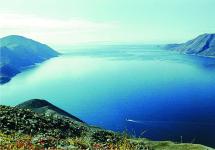
Around beauty - Terskol glacier

Passes from Terskol to Irikchat somewhere there

The toilet is of itself, functioning

View from the window of picket 105

Inside it's dark and slightly littered, they spend the night in the attic

It's getting dark, the clouds are rising

Black and gray

Climbed up the hill behind the toilet next to the house, there is a small plateau on the hill, the remains of power lines


105 picket on the background of Elbrus. Behind the picket there is a moraine, along the clone of which the road goes further like a serpentine. Somewhere at the top of the moraine Ice base, which we never reached. From it there is a road along the glacier to Shelter 11.

Again the walls of the machine gun nests. It is unlikely in this form that they survived the war, most likely restored for the reconstruction of the battle or filming the film, but the atmosphere has been preserved.

Sunset colors of the mountains

Elbrus from 105 picket

Monument next to the picket

A simple and beautiful monument to the cavalrymen who were sent to fight with the mountain special forces

Elbrus slopes

The comrades were returning along the old road, but I went along the ridge towards the observatory. The ridge is very conditional, the descent is not very steep, it is easy to go.

Stone sculptures filmed on the rise, on the other side

And one more view of the glacier ...

Tourist routes
On the way of the builders of the Shelter of Eleven
 (Settlement Terskol - "New horizon" - "105th picket" - "Ice base" - settlement Terskol. Length - 26 km, duration - 3 days.)
The route follows a pedestrian road, built in 1938. It was used to deliver construction materials for the building of the Shelter of Eleven. The place where the road ends was named "Ice Base" (3,800 m). From here, along the ice fields of Elbrus, a four-kilometer sled road was laid to the construction site, building reliable bridges over ice cracks. Until the launch of the EKD, this was the most popular route to the Shelter of Eleven. Now they use a simpler and shorter pedestrian road from the Mir station.
The beginning of the hike coincides with route No. 2. It is best to spend the night at the Novy Krugozor shelter (2900 m) or in tents near it to admire the evening panorama of the mountains. In the pink rays of the sunset, they are especially effective in the lateral (western) illumination of the summit of the Main Caucasian Ridge. If, in addition, the Baksan Valley is filled with clouds, then there is a unique feeling as if you are on a steep shore of a gray foaming sea.
They go out on the route in the morning. They rise to the ridge of the spur and move along it towards Elbrus. An hour later, tourists come to a small drop in the ridge, on which the houses of the weather station are located. This is the "105th picket" (3300 m). It is located on the 105th 100-meter section of the road from Terskol.
On the way to the meteorological station, to the right of the road, there is a monument to the cavalrymen of the 214th regiment, who defended the approaches to Elbrus during the Great Patriotic War. On a wide rocky ridge, firing points, remnants of fortifications and dugouts have been preserved. Military operations were conducted here from mid-August to early November 1942. The first to take the blow were the mountain rangers of the Edelweiss division, who were rushing from the slopes of Elbrus to the Baksan valley, were the cavalrymen of the 214th regiment. By the end of September, they were replaced by soldiers of the 897th Infantry Regiment. The heroic events of that time are described in detail in the book by O. L. Opryshko "The Transcendental Front of the Elbrus Region".
Above the "105th picket" the path is in places heaped with stones, covered with landslides, but it is not difficult to walk along it. From it you can clearly see the Terskol River valley and the glacier of the same name, dotted with cracks, hanging over the valley, as well as the southeastern spur of Elbrus with the dominant Terskolak peak (3787m). Tourists climb to the top of an ancient lava flow. Both Elbrus peaks and the Garabashi glacier are perfectly visible. In 3 hours the way from “Novy krugozor” we go to the “Ice base” - a flat moraine area near the upper reaches of the Terskol glacier. There is a small house of the tourist shelter and the buildings of the scientific station "Ice Base". The Shelter of Eleven is clearly visible. It is a 1.5 hour walk to it, but it is dangerous to go there without special equipment and walking skills on closed glaciers. In addition, this requires a permit from the Elbrus KSS.
Elbrus is located in the lateral ridge of the Main Caucasian ridge, it has a rounded shape with a diameter of 18 km at the base and 1.2-1.5 km at an altitude of 5300 m.
Two intergrown volcanic cones rise higher: the Western peak - 5642.7 m (the highest point in Europe) and the Eastern peak - 5621 m. The distance between the peaks is 1450 m. The bridge between the peaks - the "saddle" lies at 5376 m.
The beginning of the route for climbing Elbrus goes along the pedestrian road, laid in 1938. Construction materials for the building of the Shelter of Eleven were delivered along it. The place where the road ends was named "Ice Base" (3800 m). From here, along the ice fields of Elbrus, a four-kilometer sled road was laid to the construction site, building reliable bridges over ice cracks. Until the launch of the cable cars, this was the most popular route to the Shelter of the Eleven. Now they use cable cars "Elbrus" and "Gara-Bashi", then a simpler and shorter pedestrian road to Priyut-11.
Climbing route to Elbrus: pos. Terskol - wpd. Maiden's braids - 95 picket - 105 picket - Ice base - Shelter 11 - Pastukhov rocks - saddle - peak.
The road to the abandoned "Ice Base" of Moscow State University goes along the slopes of the lava flow between the Terskol and Garabashi valleys.

From the fork in the road in the valley of the river. Terskol serpentines gain height in a beautiful pine forest. The road goes west. The slopes of Elbrus are visible

Above the forest, the road passes by the Maiden Spit waterfall. An excellent view of the waterfall itself and the surrounding mountains opens directly from the road.

From a distance, it seems small, but getting closer you can fully appreciate its size. Trails lead to the foot of the waterfall, you can walk up and take a dip in the refreshing streams, or just sit nearby and admire the landscape.

Soon after the waterfall, the vegetation ends and endless deposits of lava fragments and other traces of Elbrus eruptions begin.
To the left of the road there will be the remains of a building called "95 picket", from which the paths go to the left from the main road, so as not to make an extra detour, it is better to turn onto the path that starts from the ruins.

Ascending higher into the mountains, the road passes the observatory, and making a detour goes to the ice base.


The trail that started from "95 picket" again goes to the road, which rises like a serpentine along the debris of the lava outlet. On the way you will see another almost destroyed building - "105 picket". It was an intermediate station during the construction of Shelter 11 on the slope of Elbrus. It got this name because it is located on the 105m section of the road from Terskol (each section is 100 meters).
At this altitude, even in summer, there are snow blows that have not melted since winter and areas of the glacier covered with stones and sand.

Climbing the road higher, we reach the building of the old meteorological station, which is located very close to the beginning of the glacier and the Ice Base. This is a metal booth with two rooms and a small kitchen. The rooms have bunks where you can spend the night. To this place you can leisurely and with backpacks climb from Terskol in 1 day.

The ruins of the Ice Base are located within walking distance from the weather station. All structures are in a dilapidated state, without windows and doors. Almost all the premises are covered with snow, so it will not be possible to spend the night there. In general, the base makes a rather depressing impression and depressing ...


A glacier begins immediately behind the ruins. There are many cracks on the glacier, so you need to walk in bundles. Shells or cartridges are periodically thawed from the glacier - the "echo of war". Also in the snow and ice, the bodies of soldiers who died during the Second World War are still found.
Following the glacier to the northwest, the route leaves to Shelter 11.


To reach the top, the camp is best set up in the area of Shelter 11 on the rocky coarseness left by the lava flow.