Geography of Africa
Click to enlarge
In the south, Africa is washed by the Mediterranean Sea, in the northeast, the Sinai Peninsula is washed by the waters of the Suez Canal and the Red Sea, in the east and southeast, the continent is washed by the Indian Ocean, and in the west by the Atlantic Ocean.
Geographic features of Africa
Atlas
The Atlas Mountains system stretches from southwestern Morocco along the Mediterranean to the eastern border of Tunisia. It includes several smaller mountain ranges, namely the High Atlas, the Middle Atlas, and the Seaside Atlas. The highest point is Mount Toubkal, located in the western part of Morocco, with a height of 4,167 meters.
Congo river basin
The Congo Basin, located in central Africa, spans most of the Democratic Republic of the Congo as well as the neighboring Republic of the Congo. In addition, it extends to Angola, Cameroon, the Central African Republic, and Zambia. The area of \u200b\u200bthis fertile basin is approximately 3,600,000 square kilometers, and it is home to about 20% of the world's tropical forests. The Congo River is the second largest river in Africa, and the network of its tributaries and streams serves as a transport function for the population of the interior countries of Africa.
Great rift valley
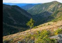
A sharp deepening of the Earth's surface, approximately 6,400 km long, extending from the Red Sea, near the border with Jordan in the Middle East, south to Mozambique. Essentially, this valley is the result of a series of geological faults caused by large volcanic eruptions many centuries ago. These same faults have resulted in numerous sheer cliffs, mountain ranges, rocky valleys, and very deep lakes throughout the considerable length of the valley. In the immediate vicinity of the valley are many of Africa's highest mountains, including Kilimanjaro, Kenya, and Stanley.
Ahaggar Highlands
Ahaggar is a high-mountainous region in the central part of the Sahara, in the southern part of Algeria - 1,500 km away. south of the country's capital, and west of the city of Tamanrasset. The region is mostly a rocky desert, with an average elevation of over 900 m above sea level. The highest point is Mount Takhat (3,003 m.).
Kalahari Desert
The desert is about 259,000 square kilometers and covers most of Botswana, southwestern South Africa, and all of western Namibia. This desolate plateau has many dry river estuaries, and dense shrubs grow in abundance. There are several small mountain ranges in the area, including Karas and Hans. The Kalahari-Gemsbok National Park, located in South Africa, bordering Namibia, is home to large herds of wild animals.
Namib Desert
Namib is a coastal desert in the southern part of the African continent, stretching over 2,000 km in length along the Atlantic coast. The desert begins in Angola, runs through Namibia, and ends at the Oliphants River in the Western Cape in South Africa. To the east of the Atlantic coast, the desert is gradually gaining height, up to 200 km. at the foot of the Bolshoy Ustup mountains.
Annual precipitation ranges from 2 mm. in the driest areas of the desert up to 200 mm. on the hills, because of which Namib can be considered the only true desert in southern Africa. The Namib is also the world's oldest desert, geologically composed of dune (sandy) seas in coastal areas, while gravel plains and rocks prevail in the interior.
Sand dunes of the desert, some of which reach 300 m in height and 32 km. in length, they are the second largest in the world, second only to the Badyn-Jaran dunes in China.
Sahara Desert
Covering almost one third of the entire African continent, the Sahara is the largest desert in the world, with an approximate total area of \u200b\u200b9,065,000 square kilometers. Topographically, the desert includes rock-strewn plains, shifting sand dunes, and numerous dune (sand) seas.
The height of the desert varies from 30 m below sea level to 3 350 m above sea level (mountain peaks in Ahaggar and Tibesti). At the regional level, from the Sahara, the Libyan Desert, the Nubian Desert, and the Western Desert in Egypt, west of the Nile, are distinguished.
There is practically no precipitation in the Sahara, but several underwater rivers flowing on its territory, originating in the Atlas Mountains, help to irrigate isolated oases. In the east, the waters of the Nile help fertilize small areas of the desert.
Sahel
The Sahel is a wide swath of land stretching across the entire width of northern central Africa, at the southern edge of the ever-expanding Sahara Desert. This border region is a transitional zone between the dry regions of the north and the tropical regions of the south. There is very little rainfall in this area (15 - 20 cm per year), and the vegetation here is represented mainly by scanty grass cover and shrubs.
Nile River system
The continent of Africa is the second largest on the planet after Eurasia. It occupies over twenty percent of the entire land area and is almost entirely located in the hemisphere in the south.
The mainland is washed by several oceans: the Atlantic and Indian. The territory is divided between fifty-five countries.
African countries and their capitals
African countries are usually divided into five groups. The list looks like this:

In terms of economic indicators, the most developed and richest is South Africa, located in the south of the mainland. At the same time, residents of many states, in particular the central part of the mainland, are below the poverty line, in particular the CAR, DRC, Burundi - the poorest countries in Africa.

The largest state in terms of territory is Algeria, and the smallest is Mayotte. The most numerous is Nigeria, and the lowest population in the islands is the Seychelles.
African states acquired their sovereignty in the middle of the twentieth century. Most of the modern names appeared at the same time.
For example, until 1985 Côte d'Ivoire was called the Ivory Coast, and Djibouti until 1977 had an official status and name in the form of the French Territory of Afars and Issa. Such changes have affected almost half of the territorial units of the mainland.
Characteristics of Africa
The area is equal to twenty-nine million square meters. km. The prevalence from the north downwards is eight thousand kilometers, and from the west to the left - seven and a half.

Physical map of Africa (click to enlarge)
There are several variants of the origin of the name. The most common ones are:
- Afri - people who lived near Carthage, later the Romans began to call the whole region that way, and then the continent of Africa.
- From the Latin aprica - sunny.
- From the Greek afrkn - no cold.

Note: Africa is considered to be the ancestral home of Homo sapiens, it was there that the remains of the most ancient ancestors, in particular hominids and sahelanthropines, were discovered.
The continent has long attracted Europeans, as the history of the discovery showed, active study began in the fifteenth century, when Vasco da Gama circled Africa on his way to India.
From the late nineteenth to the mid-twentieth centuries, the mainland was divided among the great powers:
- the north is part of the Ottoman Empire;
- south - Spain, Portugal and other colonialists.
After World War II, the map changed as the wave of independence began. Today, there are several territories on the African mainland under European control, in particular the Canary Islands, Madeira, the Chagos Archipelago.
Extreme points of Africa
About which point is the most northern, southernmost, which is the most eastern, and where the westernmost is located, the following image tells well:

Population
More than one billion people live on the mainland today. Along with this, the largest increase in the number and life expectancy is observed. Demographic estimates predict that the population will double in the next thirty years.

There are two main races in Africa:
- negroid - in the center;
- caucasians - mainly in the north and in the South African Republic.

The most common people are Arabs. The population density is low compared to Europe and Asia. Today interethnic conflicts continue.

Its useful to note: the level of urbanization in countries is low, but its rate is the highest in the world.
As for religion, the leading world movements are generally widespread, but all other religious movements are also represented. Traditional beliefs are still prevalent in the central part.
Climatic zones
Africa is considered the warmest continent, and the warmest place is located here - Dallol. The entire territory is distributed in warm climatic zones.

The main ones and their characteristics:
- Equatorial - heavy rains and in fact there is no change of seasons, there is constant summer.
- Subequatorial - two main seasons, rainy summers, winters characterized by dry trade winds.
- Tropical - almost no precipitation, deserts are widespread.
Minerals
Africa is rich in minerals that have a high price.

In particular, the main ones include:
- gold;
- oil.
The northern coast is also rich in manganese, iron ores and phosphorites.
Flora and fauna
The organic world of Africa is characterized by exceptional diversity.

In tropical areas, there are a variety of large animals, in particular, rhinos, elephants, lions, zebras, monkeys and others.

Large birds also live on the continent, such as flamingos, ibises.

The north is dominated by lizards and snakes that have adapted to the climate of the Sahara. The “big five” is the trademark of the south of the mainland: buffalo, lion, leopard, elephant and rhino.

The climatic conditions of northern Africa have contributed to the adaptation of many plant species. In the south, there are over two and a half thousand flowering plants - this is almost ten percent of the world's wealth.
Geographic objects

Atlas mountains
The main objects of geography of Africa include:
- Atlas Mountains;
- Basins of Congo (lowest point) and Nile;
- Rift Valley;
- The Ethiopian and Ahaggar Highlands;
- deserts - Kalahari, Namib and Sahara.

In addition to the oceans, the mainland is washed by one sea - the Red and Suez Canals.
Rivers and seas
One of the longest rivers in the world is located in Africa.

The length of the Nile is almost seven thousand kilometers.
Other major rivers include:
- Niger;
- Congo;
- Zambezi, Limpopo and Orange.

Africa is also rich in large lakes: Victoria, Nyasa, Tanganyika and Chad. The latter is the largest saline body of water inside the mainland.
Plains
Plains in Africa are represented by plateaus (East African) and trenches (Chad, Congo, Kalahari).

The plateaus are high plains, along with them the pits are low.
Mountains of africa
Mostly Africa is a continent on the plains, there are enough mountains on it:
- Atalas - in the north;
- Ahagar and Tibeste - in the Sahara Desert;
- Effiop Highlands - in the east;
- Kapsky and Drakonovs - in the south.

The highest point is volcano Kilimanjaro, its height is five thousand nine hundred meters.
In conclusion, I would like to focus on the concepts of "continent" and "continent". There are only six continents on Earth, they are all well known. But there are only four continents.
"Continent" translated from Latin means "continuous". Since Eurasia and Africa are connected together by the Suez Canal, they are not separated from each other, because they are not separately continents.
Africa is a unique continent that combines the diversity of flora and fauna. Most of the states are at the stage of economically developing countries, partly due to the long-term colonization of the region.
Etymology of names of physical and geographical objects in Africa
Gulf of aden... Gulf of the Indian Ocean. The name was given to the city of Aden in the south of the Arabian Peninsula. According to one version, the toponym is based on the Arabic root meaning "settledness". According to another interpretation, the name was formed by a term from the ancient Semitic-Hamitic languages \u200b\u200bedinu - plain, steppe, which clearly reflects natural features.
Azores... Archipelago in the Atlantic Ocean. Belongs to Portugal. Named by the Portuguese Ilhas dos Azores - "Hawk Islands" for the abundance of these birds off the coast and on the archipelago.
Amirant Islands... Archipelago in the Indian Ocean. Discovered by the expedition of Admiral Vasco to Gama and named in his honor llhas de Almitante - "Admiral's islands".
Annobon. Island in the Gulf of Guinea. Named by the Portuguese Anno Bon - "Good Year" (New Year), tk. they first set foot on the island on January 1, 1474.
Atlas. Atlas mountains. In the northwest of Africa. The name has a direct connection with the name of the mythical titan Atlas, who holds the earthly firmament on his mighty shoulders. The ancient Greeks deified these mountains, worshiping a mountain spirit in the form of a petrified giant supporting the Earth. So the legend says. Apparently, this was facilitated by a possible primary source from (the Berber word "adrar", which means "mountain"
Augrabis. Waterfall on the r. Orange. The name comes from the Hottentot aukrebis - "big noise".
Afar. Tectonic depression in Djibouti. The lowest place in Africa (-153 m above sea level). The name comes from the Afar people living in Djibouti, Eritrea and Ethiopia.
Ahaggar. Mountain range in Central Sahara. The name comes from the name of the Tuareg tribe Kel-Ahaggar. The ethnonym is apparently based on the Arabic term "akhgar" - a cave, that is, "ahaggar" - "cave dwellers", "cave spirits".
Bab el-Mandeb strait... Separates Africa and the southwest of the Arabian Peninsula. The name comes from the Arabic words "bab" - gate, "mandib" - tears, ie. means "gate of tears". The toponym-metaphor reflects the difficult navigation conditions in the strait.
White Nile. The name of the middle course of the Nile before the confluence of the Goluboy. The Arabic name of the Bahr-el-Abyad river is "white river". According to experts, the definition of "white" refers to either the cloudy color of the water, or corresponds to an unknown color orientation.
Benguela current... Cold current in the Atlantic Ocean. The name is given for the city of Benguela in Angola: in one of the Bantu languages \u200b\u200bbenguela is "the land of reeds".
Benue. Ley tributary of the river. Niger. The name comes from the Batta language, where be - "water", nue - "mother", i.e. means
"mother of waters"
Bioko. Island in the Gulf of Guinea. The Portuguese, having discovered Bioko, called it Formosa - "Beautiful" for the abundance of lush vegetation and the presence of fresh water. Later, the island was called Fernando Po in honor of the Portuguese discoverer, and in the 70s of the XX century, - Macias Nguema Biogo and the honor of the President of Equatorial Guinea. Bioko is a modified name, so it is difficult to call the true meaning.
Bush. Common name for shrub formations in South Africa. The Dutch and English geographic term bush is "bush".
Vaal... River, right tributary of the river. Orange, The name was given by the Dutch Borax colonists for the color of the water: vaal - "muddy", "gray". The toponym is included in the name of one of the provinces of South Africa - Transvaal - "behind Vaal".
Wadi, waddah... The general name of the channels of temporary watercourses in North Africa, filled with water only during the rainy season. The Arabic geographic term "wadi", "wedd" - dry riverbed, valley.
Weld. The name of the arid plateau in southern Africa. In Dutch and Afrikaans (Afrikaans), veld is a popular geographic term meaning "field".
Victoria. Lake in East Africa, the largest on the mainland. Unlike the Victoria Falls, named by D. Livingstone in honor of the Queen of Great Britain, the name of Lake Victoria was given by the traveler D. Speak. Therefore, at present, in the young African countries located on the shores of the lake, other names are proposed: Umoja - "unity", Uhuru - "freedom", Shirikisho - "unification", Uhuru na Umoja - the state motto of Tanzania, inscribed on the coat of arms of the state.
Victoria. Waterfall on the r. Zambezi. It was discovered by the outstanding English traveler David Livingstone and named after the Queen of Great Britain. Locals call the waterfall Mosi-oa-Tunya - "thundering smoke", or Seongo - "place of the rainbow".
Virunga. Volcanic mountains in East Africa. The name in the language of the Nyoro people means "volcano".
Volta. River in West Africa. The name Rio-da-Volta - "the river of return" was given by the Portuguese, because in the XV century. their ships stopped at the mouth of the river before returning to their homeland. In Ghana on the river. Volta created a reservoir of the same name - one of the largest in the world (8480 km 2).
Guardafui. Cape in the east of the Somali Peninsula. Scientists believe that the name is derived from the Portuguese word guardafu, distorted by the Arabs, meaning "beware", which is associated with dangerous navigation conditions. There has long been a legend that, as if at the very eastern end of the Somali peninsula, there is a magnetic mountain, which attracts the iron parts of ships approaching it. As a result, the ships, approaching it, crashed on the rocks. In fact, this is the narrowest shelf zone. With strong winds, high waves, poor visibility, ships were often carried to the peninsula, and they crashed on the coastal reefs. The word "guardafui" was a warning to the sailors who sailed past this cape.
Gulf of Guinea. Gulf of the Atlantic Ocean off the western coast of Africa. Named for the historical and geographical region of Guinea, washed by it. There are several versions of the origin of the toponym Guinea. According to one of them, the name is based on the name of the Berber tribe Kinava (the Arab scientist Ibn Yakut in the 13th century mentioned the Kinava region). Another point of view is based on the fact that the toponym is formed by the Berber words "agvinau" - "black" or "iguaven" - "dumb" (ie, do not know the Berber language) and referred to the territory inhabited by black tribes. Later Europeans distorted the original word in Gunua, Ginua, and finally in Guinea.
Strait of Gibraltar. Separates Africa from the Iberian Peninsula of Europe. Named for the rock of Gibraltar on the European side of the strait. The modern form of the name of the rock arose as a result of the centuries-old use and transformation of the primary Arabic Jebel el-Tariq - "Mount Tariq".
Blue Nile. The largest tributary of the Nile. In Ethiopia, the river is called Abbay - “the father of waters, and in the Arab countries Bahr el-Azrak -“ blue river. ”The color name, according to some scholars, reflects the color of the water in the river carrying bluish silt.
Good Hope... Cape in southern Africa. Discovered in 1488 by the Portuguese navigator B. Dias and named Cabo Tormentoso - "Cape of Storms". The name did not like the King of Portugal, João II, and at his behest the cape was renamed Cabo da Vona Esperanza - "Cape of Good Hope", meaning the hope of reaching a fabulously rich and attractive for Europeans India. Some historians believe that in B. Diash immediately named the cape by the name of Good Hope, and the above version is only a historical legend. However, it is impossible to prove or disprove this hypothesis due to the lack of sources contemporary to Dias' voyage.
Dragon mountains... Located in South Africa. It is assumed that the mountains are named after one of the European colonizers of the Drakenstein harrow. Etymologically, the surname consists of two words: draken - "dragon", stein - "stone".
Zambezi. River in South Africa. Previously, the name of the river was conveyed on maps in a variety of ways; Ambezi, Luambezi, Liambey, etc. According to modern place names, the primary form of the name is Ambezi (or Ambey), which in the local Bantu languages \u200b\u200bmeans "big river". The same meaning has the name of the river in the middle course in the Tonga language - Murongo-Mucuri, which is a tracing of the main toponym.
Zanzibar.An island in the Indian Ocean off the east coast of Africa. The toponym comes from Persian, the term "bar" - "coast", "edge" and the ethnonym "zinj", based on the Arabic or Persian "zang", "zeng" - "black". Zinji is a collective name for the Negroid tribes of East Africa in medieval Muslim literature.
Cape Verde. Located on the peninsula of the same name to the east of Cape Almadi. Named in 1445 by the Portuguese D. Dias Cabo Verde - "Cape Verde", because was the first land covered with tropical flora seen by sailors, in sharp contrast to the sands of the Sahara.
Cape Verde Island. Archipelago in the Atlantic Ocean. Named after m. Zeleny, opposite which it is located. The transfer of the name of the islands into other languages \u200b\u200bis accepted in the form of translation, in contrast to the name of the state located on them.
Needle.Cape, the southernmost tip of Africa. Discovered in 1488 by B. Dias and named by him Cabo Sao Brandao - Cape of St. Brandan, because the opening took place on the day of this saint. However, the name was soon changed, and the cape was mapped under the name Agulhas - Agulary. The word agulha in Portuguese means "needle", "arrow". Modern toponymists see the Portuguese metaphorical term agulha as the basis of the name in the meaning of "peak", "summit". Proceeding from this, the toponym is interpreted as "cape of peaks", and the reason for the nomination was the sharpness of the rocky cape.
Go-Amin-Dada; Edward. Lake in East Africa. Opened in the 19th century. and named Edward in honor of the Crown Prince of Great Britain. In 1971, President Idi Amin Dada came to power in Uganda, and the lake was named after him. To this day, both names have survived for the reservoir.
Cabaret. Waterfall and national park on the river. Victoria Nile in Uganda. The waterfall was opened in the 19th century. and named Murchison in honor of Rodrick Murchison, a distinguished geologist, president of the Royal Geographical Society of London. In 1962, it was renamed in honor of the national hero of Uganda, a fighter against the British colonialists Cabareg Chwa II.
Kalahari. Semi-desert region in South Africa, At the heart of the toponym is a geographic term from the Hottentot language karaha - "an area of \u200b\u200bsand and stone". The widespread in the past interpretation of the name from the Tswana language, where karri-karri - "tormented by thirst" or "tormenting", is now recognized by toponymists as unlikely. The Dutch Boers called the semi-desert Bosjeveld - "a field of thorny bushes", which reflected the specifics of vegetation.
Cameroon. Volcanic massif in Equatorial Africa. The Portuguese slave merchant Fernand Gomij, sailing past the coast of Africa in the equatorial waters of the Gulf of Guinea, noticed a high mountain, which he wanted to learn more about. He sent a detachment of daredevils deep into the mainland. On their way, they encountered an obstacle in the form of a small river with clean, clear water, which was very useful, since they needed to replenish their supplies of drinking water. Having filled the casks with delicious water, the sailors saw an abundance of crabs in the river, after which, for fun, they caught crabs and shrimps and brought them to the ship. And the river flowing in close proximity to the mountain was named Rio des Camaroes (Camarues), which is translated from Portuguese as "river of crabs". At the same time, Mount Cameroon received the same name, and later the state was named so. Locals have long had a superstitious fear of the snowy volcanic peak of Cameroon and call it "Maongo ma Loba, which means" mountain of heaven "or" mountain of God ".
Canary Islands. Archipelago in the Atlantic Ocean. Belongs to Spain. The islands were known in ancient times under the Latin name Insulas Fortunatae. The Spaniards, who visited the archipelago at the beginning of the 15th century, called them islas Canarias - "dog islands". According to one version, the sailors saw a large number of dogs on the shores of the islands, which was the reason for the appearance of the toponym. According to another version, the archipelago was named after the main island of Gran Canaria. and the island - according to the fabulous country of Canaria, mentioned in medieval European legends.
Canary current.Cold current in the Atlantic Ocean. Named for the Canary Islands.
Cape Mountains. Located in southern Africa. Named after the Cape Colony founded by the Dutch, which was named after its original location on Cape of Good Hope (Dutch Kaar - "cape"). With the expansion of the colony, the name spread to the mountains. Folk etymology connects the toponym with the Dutch kaar - "profit", i.e. the colony was allegedly named so because it brought a large income to the treasury. However, there is no scientific evidence for this interpretation.
Karoo. Common name for semi-desert plateaus and intermontane depressions in South Africa. The name is based on the Hottentot geographical term karusa changed by the Boers - "dry", "waterless", which clearly reflects the natural conditions.
Kenya. Volcanic massif in East Africa. Toponymists see the Masai term "kee-niyya" - "white mountain" as the basis of the toponym, which is associated with the presence of glaciers and snow on the top of the mountain.
Kilimanjaro. Volcanic massif in East Africa. The highest point of the mainland. Scientists associate the origin of the name Kilimanjaro with a word from the Swahili language, distorted by Europeans, meaning "mountain of the god of cold", or, according to another version, "a mountain that shines".
Comoros. Archipelago in the Mozambique Channel of the Indian Ocean. The islands have been known to the Arabs since the 8th century, and it was they who named the Dzhezair al-Komr archipelago - the "Islands of the Moon", which was associated with the spread of the cult of this luminary. The Portuguese borrowed the Arabic name in a distorted form of Sotoges, which stuck on European maps.
Congo; Zaire.River in Equatorial Africa. The mouth of the river was opened in the 15th century. Portuguese D. Can and named it Rio da Padrao - "padran river" (padran is a stone pillar that the Portuguese put in honor of discoveries, carving on it the coat of arms, the name of the king and discoverer). The name was not fixed, and the river was renamed Congo - this was the name of the country and the people who lived in it before the arrival of the Europeans. Locals call the river differently in different parts of the current: Nzadi or Nzari - "the river that swallows all others" or "great river" (a distorted form of Zaire appeared from this name), Zembere - "mother of waters"; Kulla is "great water", and in the upper reaches of the Lualaba is "great rhea".
Red sea. Indian Ocean Sea between Africa and the Arabian Peninsula. In ancient Egypt, the Great Greens were called, later - the Arabian Gulf, among the Greeks Pelagos Eritre ("erythros" - "red"), from where it got into European languages \u200b\u200bin translation. There are several versions of the origin of the toponym. According to one of them, the name was given for the red tint of the water in the sea. Another version is based on the ancient color orientation of the peoples of the East, where the south was indicated by red. Another version of the toponym interpretation was noted - from the ethnic name of the ancient tribe of the Hamarites, which meant "red".
Kruger. National park in South Africa. Named after Stephanus Kruger, President of the Boer Republic of the Transvaal: Commander of the Boer Army in the 1899-1902 War with Great Britain.
Libyan Desert. Located in the Sahara. The name is given by the ancient name of Africa - Libya, which comes from the ethnonym "libu".
Livingstone waterfalls... Located in the lower reaches of the river. Congo (Zaire). Named after the outstanding explorer of Africa, Scottish by origin, D. Livingston.
Limpopo. River in South Africa. The etymology of the name is unknown. The Dutch Boer colonists called the Crocodil River - "Crocodile River" for the abundance of these reptiles in its waters.
Mauritius. Island in the Indian Ocean. The Dutch, having captured the island, named it Mauritius - Mauritius in honor of the Dutch prince Mauritius (Mauritius; Maurice) of Orange.
Maghreb. The common Arabic name for northwest Africa since the early Middle Ages is "maghrib" - west.
Madagascar. Island in the Indian Ocean. Known to Arab sailors as Jezira al-Komr - "the island of the moon", which is associated with the cult of this star. In the XVI century. the Portuguese named the island Sao Lourenzo - St. Lawrence, because saw the land of Madagascar on the day of this saint. The French, having conquered the island in the 19th century, called it Ile Dauphine - "the island of the Dauphin" (ie the heir to the throne). Malagasy call their homeland Nossi Damba - "the island of wild boars" or Tani-Be - "great". The toponym Madagascar in the distorted form Madeigaskar is first encountered by Marco Polo (XIII century). According to scientists, it is based on the ethnic name of Malagasy, as the inhabitants of the island are now called.
Madeira. Archipelago in the Atlantic Ocean. Belongs to Portugal. The Portuguese called Maderia - Forest, because was indeed covered with forests, later completely cut down. The earliest names for the archipelago: among the Carthaginians Al-Agnam - "island of goats" (for the abundance of these animals), among the Romans Insulae Purpurinae - "islands of purple" (for the paint obtained there).
Manyara. National Park in Tanzania. Named for the lake. Manyara, around which is located. The etymology of the hydronym is unknown.
Mascarene Islands.Archipelago in the Indian Ocean. Opened in the 16th century. Portuguese expedition Pedro di Machareñas (Mascareñas) and is named after him.
Mobutu Sese Seko. Lake in East Africa. Opened in the 19th century. by the British and named Albert in honor of the consort of Queen Victoria. In 1973, it was renamed in honor of the President of Zaire, Mobutu Sse Seko. Locals call the reservoir Mbutan Nzighe - "the reservoir of dead shells" for the abundance of shellfish on the shores, or Nyasa - the geographical term "lake" in Bantu languages. Perhaps one of these names will become the new official one, which is associated with the death of President Mobutu.
Mozambique Channel. Divides Africa and Fr. Madagascar. Named for the state of Mozambique. Similar origin of the name of the warm Mozambican current in the Indian Ocean.
Nakuru. National park in Kenya. Named for the lake. Nakuru, within which he was created. The etymology of the hydronym is unknown.
Namib. Desert in southwest Africa. There are two versions of the origin of the toponym from the languages \u200b\u200bof the Hottentot tribes. According to one of them, namib - "shield"; on the other - "what is bypassed" (dangerous, lifeless). The second version of interpretation reflects the complexity of the natural conditions in the desert,
Nasser. Reservoir on the river. Nile in Egypt. Named after Egyptian President Gamal Abdel Nasser, during whose reign a reservoir was created and the Aswan Dam was built.
Ngorongoro. Reserve in Tanzania. Named after volc. Ngorongoro, in the crater of which it is located. The etymology is unknown.
Niger... River in West Africa. The name is a distorted by the Portuguese and other Europeans the Berber name of the river H "Egiren -" river. "In different parts of the course it has different names in local languages: in the upper reaches of the Djolib -" big water "; in the middle and lower Kuara -" river ", Issa Bari - “great river”; Mayo - “river.” The explanation of the name from the word niger in the meaning of “black” from European languages \u200b\u200bis considered incorrect by modern toponymists.
Nile. The longest river in Africa and the whole world. The most ancient form of the name of the river Aur is "hidden" (that is, with an unknown source). The Egyptians called her Hapi after the god of fertility and harvest. Modern Arabs call the river El-Bahr - "river". The toponym Nile in the form of Neilos was first encountered by the ancient Greeks. The Romans borrowed it as Nilus. According to one version, the toponym is based on the ancient Semitic term "nagal" - "river", changed by the Greeks. According to another version, the Greeks borrowed the word lil - "water" from the Libyan tribes, distorting it into nil. Philologists note the possibility of such a transformation.
Nubian desert... Located in northeast Africa. Named for the historical region of Nubia, located between the Nile rapids. The toponym is based on the ancient Egyptian word "nuba" - "gold". In ancient times, the largest mines were located here, from where gold came to the palace of the pharaohs.
Nyasa; Malawi. Lake in East Africa. The toponym is formed by the popular geographical term from the Bantu languages \u200b\u200bnyasa - "lake". In the Republic of Malawi, the lake is officially called Malawi by the main people of this country.
Orange. River in South Africa. The Hottentots called it Kai Garib - Big River, the Dutch settlers of the Boers Groat River with the same meaning. At all times, people often gave names to objects (rivers, lakes) by the color of the water or the coast. But the name of the Orange River has nothing to do with color. This name was given to her by settlers from the Netherlands (Holland) Boers in honor of the princes of Orange - the then rulers of the Netherlands. With someone's light hand, and perhaps through transformation, the name Orange turned into Orange.
Principe. Island in the Gulf of Guinea. Opened in the 15th century. Portuguese expedition and named Principi - "first", because was the first island this expedition discovered. According to another version - "prince".
Reunion. Island in the Indian Ocean. Named at the end of the 18th century, by the French Reunion - "Connection", tk. the inhabitants of the island decided to unite with Fr. Mauritius into a single administrative region. The name has changed several times: in the XVI century. Portuguese Santa Apollonia (in honor of St. Apollonia), in the XIX century. - Bonapart (in honor of Napoleon), Ile de Burbon - "Bourbon Island" (in honor of the dynasty of kings). Since 1848 - reunion again.
Rwenzori. Mountain range in East Africa. The height of the mountains is reflected in their name: in the local languages \u200b\u200bBantu ruwenzori - "the lord of the clouds". A national park in Uganda is named after the mountains.
Savannah. Borrowed by the Spaniards at the end of the 15th century. from the language of the Caribbean (or Arawak) Indians, where sabana - "high grass plain", "open space". The general name for the zonal type of landscape.
Sao Tome. Island in the Gulf of Guinea. Opened by the Portuguese on the day of St. Thomas (Thomas) and named Sao Tome in his honor.
Sahara. Desert in North Africa. The name is formed by the Arabic geographical term "sahara" - "desert" in the plural form, i.e. Sahara - "deserts". According to philologists, the term is based on the Arabic "ashar" - "reddish", which reflects the dominant color and color background of the desert.
Sahel. A strip of semi-deserts and deserted savannas in North Africa. The name was appropriated by the Arabs in the Middle Ages; "Sahel" - "coast", "edge", "border", or rather - "desert coast".
Saint Helena island. Located in the Atlantic Ocean. Opened by the Portuguese on St. Helena and is named after her. It gained worldwide fame as a place of exile and death of Napoleon Bonaparte.
Seychelles. Archipelago in the Indian Ocean. Named in the 18th century. French in honor of the Minister of Finance Moro de Setelle (Seychelles)
Senegal. River in West Africa. According to one version, the toponym is based on the name of the Berber tribe of Senega, go Sankhai. Other place names believe that the name of the ancient city of Senegan passed to the river. In the past, the toponym was explained as "navigable", but due to lack of evidence, modern scientists do not consider this option.
Serengeti.National Park in Tanzania. Named for the Serengeti plateau, within which it is located. The toponym is based on the term from the Maasai language serenget - "space", which fully corresponds to the geographical realities - the vast savannas on the plateau.
Socotra. Island in the Indian Ocean. The name of the island was given by Indian sailors: Dvipa Sakhadara - "the island of the portent of good luck." Later, this name, reflecting the importance of the island as the most important nodal point on the ancient sea routes from India to the west, was transformed under the influence of the Arabic language in Socotra.
Detailed solution paragraph § 27 on geography for grade 7 students, authors Korinskaya V.A., Dushina I.V., Shchenev V.A. 2017
Questions and tasks
1. What are the most significant geographical features of South Africa.
Zambezi, Kalahari Semi-Desert, Drakensberg and Cape Mountains.
2. On a comprehensive map, highlight the main types of economic activities in the countries of South Africa.
Agriculture and mining.
3. What are the main features of the nature and economy of South Africa.
South Africa is a country of diverse natural complexes and enormous natural resources. Most of the country is a flat plateau, which gradually rises in steps to the south and east, giving way to mountains. Savannah prevails in the country. Natural conditions, as in all of South Africa, change not only from north to south, but also from east to west.
South Africa, with its wide variety of landscapes, has a very rich fauna. In many areas, hunting and fishing are still the main occupation of the local population. But with the arrival of the Europeans, the number of wild animals decreased markedly and many of their species almost disappeared. The number of herbivores has especially decreased - antelopes, zebras, giraffes, elephants, large black buffaloes, rhinos. Lions and leopards have almost completely disappeared.
In order to save wild animals from complete extermination, as well as natural complexes in general, reserves and national parks have been created in South Africa. The largest of them, the Kruger National Park, contains all the animal species found on the mainland.
Fertile lands in the country belong to white farmers who own private agricultural enterprises. Farms make extensive use of machinery and fertilizers and therefore receive high yields. They grow corn, wheat, legumes, sugarcane, citrus fruits, cotton and other crops. Sheep and cattle farms are located on high plateaus with good pastures. Pasture animal husbandry occupies the most important place in agriculture.
The bowels of South Africa are rich in a variety of minerals. This country is called a geological miracle. South Africa is one of the first places in the world in terms of reserves and production of diamonds, gold, platinum, uranium and iron ores. The country's economy is dependent on the British and American monopolists, who lead the development of minerals and receive huge profits.
There are many factories and plants in the country, and industry is developing rapidly.
4. Compare the nature, population and economic activities of North and South Africa. What are the similarities and differences? Explain the reasons for the differences.
North Africa is part of the Middle East and is sometimes even included in it. North. Africa is an undoubted and inseparable part of the Muslim Arab world, predominantly desert territories and is inhabited mainly by Arabs, Berbers and other Semitic-Hamitic tribes along with the traditional African population of Africa. South Africa is classic Africa, except that it is more developed, along with North Africa, compared to other parts of Africa due to the greater presence of the white population there due to its mineral-rich lands.
GENERAL KNOWLEDGE ON THE TOPIC
1. What are the main features of the structure of the surface of Africa. How are they explained?
By the type of relief, Africa can be divided into two parts: low is in the north and west, high in the east and south. The relief of the mainland is dominated by plains and plateaus with a height of 200 to 1000 m, the largest territory of which is occupied by the East African and South African plateaus. The uplifted areas of the mainland alternate with depressions, the largest of which are the Congo Basin and the Kalahari Basin. The highest parts of the mainland are the Ethiopian Highlands (up to 4500 m) and the Drakensberg Mountains (over 3000 m). Such features of the relief of Africa can be explained by the fact that most of the continent was formed on the ancient Arabian-African platform; within the platforms, the relief is represented by plains. Atlas, Cape and Drakensky mountains are confined to folded belts of different ages. In the east of Africa there is a large fault in the earth's crust - the continental rift. In the rift zone, heat fluxes emerge and material rise from the mantle, the formed hollows are occupied by lakes, along which the cones of volcanoes rise. It is here that the highest peak in Africa is located - Kilimanjaro Volcano (5895 m).
The well-known statement "Africa is the hottest continent" can be explained by the fact that the continent is located in the warmest climatic zones of the Earth (equatorial, subequatorial, tropical and subtropical). Africa is located on both sides of the equator, within latitudes that receive significant amounts of solar radiation from 160 kcal / cm² to 200 kcal / cm². The temperature on the mainland is above + 20⁰С throughout the year. The greatest amount of precipitation falls at the equator, since a belt of low atmospheric pressure forms here, in which ascending air currents form clouds saturated with moisture. The smallest amount of precipitation occurs in the tropical belt, where, on the contrary, cloud formation does not occur in the belt of high atmospheric pressure. The climate of the coasts of the mainland is influenced by warm and cold currents.
2. What are the features of the climate in Africa? What do they depend on?
The peculiarities of the climate in Africa were formed as a result of the action of a system of various factors. Most of the continent is located between the tropics, and therefore the climate of Africa is characterized by high values \u200b\u200bof total solar radiation. Accordingly, a significant part of the mainland has high temperatures, and therefore Africa is considered the hottest continent. There are areas here where the air temperature sometimes exceeds 50 ° C.
In the latitudes of Africa, constant winds dominate over the ocean - the Tradewinds, which significantly affect the distribution of precipitation. The Southeast Passat blows from the Indian Ocean, therefore it brings in moist air masses. The Northeast Passat is from Eurasia and causes dry weather. The southwestern ones hold up the Cape Mountains, which affect the redistribution of precipitation: coastal regions receive a large amount of them, there is little precipitation beyond the mountains.
Sea currents play a significant role in shaping the climate of the African coast. Therefore, low humidity is typical for the north-west coast (due to the cold Canary Current), south-west, east (Somalia). On the contrary, the western and southeastern shores are well moistened due to the warm currents (Guinea and Mozambique, respectively).
In the central part of the continent, the air warms up evenly throughout the year. Temperature fluctuations are clearly manifested only in tropical and especially subtropical latitudes. The climate differs mainly in the amount and mode of precipitation. The largest number of them falls on the Equatorial regions: the basin of the Congo River (Zaire) and the coast of the Gulf of Guinea - 2000–3000 mm per year, and on the mountain slopes - up to 9000 mm. North of 20 ° Mon. sh. and south of 18 ° S. sh. the climate of Africa is tropical, in the Northern Hemisphere, desert, very dry. In the Sahara, the amount of precipitation decreases to 100 mm or less per year; Eastern Sahara is the driest region in Africa (10–20 mm of precipitation per year).
Africa lies within seven climatic zones. Due to the fact that the equator crosses the continent in half, the climatic conditions are mirrored from the equator to the edges of the continent. On the territory of Africa, the Equatorial, two subequatorial and two tropical zones are distinguished. The extreme southern and northern parts of the mainland are located in subtropical zones.
The equatorial belt stretches in a narrow strip along the coast of the Gulf of Guinea and further inland to the eastern coast of Lake Victoria. In this zone, constantly humid and uniformly hot equatorial air reigns throughout the year. The air temperature here is high throughout the year: 26 ° С - + 28 ° С. The total annual rainfall is more than 2000 mm, which are evenly distributed throughout the year.
3. List the main features of the rivers in Africa. Which of them depend on the relief, which - on the climate?
The longest river in the world is the Nile (6671 km). It begins on the East African Highlands and flows through Lake Victoria. In the upper course, the river, rushing down the gorges, forms rapids and waterfalls. Coming out to the plain, it flows slowly and calmly and receives the name White Nile. Near the city of Khartoum, the river merges with the waters of the largest tributary, the Blue Nile, which flows from the Ethiopian Highlands. After the confluence of the White and Blue Nile, the river becomes twice as wide and receives the name Nile. In the middle reaches, the Nile cuts through a plateau composed of hard rocks, so there were rapids that interfered with navigation. Now, thanks to the dam built at Aswan, navigation conditions have improved. In the lower reaches, the river flows calmly. When it flows into the Mediterranean Sea, it forms a large delta, in the place of which a few tens of thousands of years ago was the Gulf of the Mediterranean. The deepest and second longest river in Africa is the Congo (Zaire) (4320 km). In terms of abundance and basin area, it is second only to the Amazon. The river crosses the equator in two places and is full of water all year round. Congo (Zaire) flows along the terraces of the plateaus, so there are many rapids and waterfalls on it. Navigation is possible only in certain areas. The river, in contrast to the Nile, does not form a delta; its muddy fresh waters in a wide stream extend far into the Atlantic Ocean. The third longest and third largest river in Africa is the Niger. In the middle course it is a flat river, and in its upper and lower reaches there are many rapids and waterfalls. In a significant part, the river crosses arid territories, therefore it is of great importance for irrigation, for this purpose dams and irrigation canals have been built on the river. The Zambezi is the largest of the African rivers flowing into the Indian Ocean. Here is one of the world's largest waterfalls - Victoria. The river in a wide stream (1800 m) falls from a 120 m high ledge in a narrow gorge that crosses its channel.
The source of the river is located in the black swamps region of northwest Zambia, among the forested hills at an altitude of about 1,500 meters above sea level. To the east of the source there is a belt of uplands with rather steep northern and southern slopes, lying between 11 and 12 degrees south latitude. This belt is the watershed between the basins of the Congo and Zambezi rivers. It clearly separates the Luapala River basin (the main tributary of the upper Congo) from the Zambezi. In the vicinity of the source, the watershed is implicitly expressed, but these two river systems are not connected. The Zambezi is a powerful river. Although the Zambezi occupies only the fourth place in Africa in terms of length, it takes the second place in terms of annual flow and is second only to the Congo River. The Zambezi mainly receives food from heavy summer rains (in these latitudes, summer lasts from November to March). At other times of the year, the river is much less full-flowing. The river regime is characterized by a rapid decrease in the water level in March and a subsequent rise in November. In order to prove the relationship between inland waters and relief, it is necessary to trace the nature of the flow of rivers and the shape of lakes. Mountain rivers differ from the plain ones by their fast current, high banks, the presence of rapids and waterfalls. Lake Tanganyika, located along the African Great Rift, has a shape elongated in the meridional direction. The length of the lake is almost 10 times its width. The nature of the climate determines the high flow of rivers and lakes, the regime of their filling with water. Precipitation is one of the main sources of food for rivers and lakes. Therefore, we can safely say that rivers and lakes located in the equatorial climate are more deep than rivers and lakes located in the tropical desert climate. The shallow lake Chad, located within the subequatorial climatic zone, periodically changes its shape, increasing and decreasing by half. Such a transformation is associated with the periodicity of the incoming water from the rivers flowing into the lake. Thus, we see a clear relationship that exists between relief, climate and inland waters.
High floods all year (Congo), or dependence on downstream rains and high floods (Nile).
4. What natural areas prevail in Africa? What are their features and how are they explained? Which zones are most favorable for agriculture?
Africa is a predominantly flat continent. Mountain systems occupy only the northwestern (Atlas Mountains) and southern (Cape Mountains) outskirts of the mainland. The eastern part of Africa (High Africa) is occupied by the East African Plateau, which is highly uplifted and fragmented by crustal shears. The highest peaks of the continent are located here - the giant extinct and active volcanoes of Kilimanjaro, Kenya, etc. The peculiarities of the development of Africa have determined the main features of the structure of its surface. Most of the continent is characterized by a flat relief with a wide development of flattening surfaces from Permian-Carboniferous and Triassic to Neogene and even Quaternary, with blocky and volcanic mountains protruding separately among them. Due to its geographical position (mostly in the hot zone of illumination) Africa is the hottest continent on Earth. Due to its geographical position (mostly in the hot zone of illumination) Africa is the hottest continent on Earth. It receives more solar heat and light than any other continent. It is the only continent that extends approximately the same distance from the equator into the northern and southern hemispheres. The sun throughout the year between the tropics is high above the horizon, and twice a year at any point is at its zenith. The main features of the climate are determined, first of all, by the position of the main part of the continent in tropical and equatorial latitudes. Against the background of constantly high air temperatures, the main differences in the climate of individual regions are determined by the amount of precipitation and the duration of the rainy season. In tropical latitudes, there are huge deserts, closer to the equator there are areas of summer rains, in the equatorial zone precipitation falls throughout the year. Large spaces are severely lack of moisture. The continentality of the climate is especially pronounced in the northern part of Africa due to its large size and the close proximity of Eurasia. The western shores of the continent in tropical latitudes are washed by cold currents - the Canary and Benguela currents, cooling the air lying above them so much that its lower layers, up to a height of about 500 m, become noticeably colder than the overlying ones. This excludes the possibility of the development of ascending currents and precipitation. Therefore, along the western shores in tropical latitudes, there are oceanic deserts. The southeast coast, on the other hand, is washed by the warm Mozambican Current, which increases the instability of air masses and contributes to precipitation on the mountain slopes of East and South Africa. Most of Africa is influenced by the trade winds of both hemispheres. The northern hemisphere trade winds, coming from land, carry continental air with low relative humidity. The trade winds of the southern hemisphere, coming from the Indian Ocean, carry masses of humid unstable air to the eastern edge of the continent. The distribution of the river network and runoff over the continent is extremely uneven, which depends mainly on the difference in climatic conditions, relief and the nature of the rocks of certain regions. Along with the regions with a dense hydrographic network and large lakes, the vast expanses of Africa are almost or completely devoid of a local river network. Many rivers do not reach the ocean and end in inland drainless basins. Almost all the rivers of the continent are fed by rain. Only in deserts and semi-deserts their food is ground, and on the high peaks of the Atlas Mountains and East Africa, the river sources are also fed by melted snow and glaciers. In the extreme north and south, there are zones of rigid-leaved evergreen forests and shrubs, followed by zones of semi-deserts and deserts, savannas, variable and permanently moist forests. Latitudinal zoning is violated only on the territory of mountains and highlands, but there are few of them on the mainland.
The nature of the savannah is most favorable for agriculture. A distinctive feature of savannas is the alternation of dry and wet seasons, which take about six months, replacing each other.
5. Name some of the most outstanding natural sites in Africa.
Sahara, Kilimanjaro Volcano, Victoria Falls, Nile River.
6. What natural resources does Africa have?
Crude oil, natural gas, iron ore, phosphates, uranium, lead, zinc, manganese, limestone, gypsum, talc, asbestos, lead, copper, diamonds, gold. chrome ore, tungsten, mica, silver, hydropower resources, fish, salt.
7. Give examples of changes in the nature of Africa by man. What would you suggest for ending the desert advance on the savannah.
Back in the 19th century. Africa was presented as a continent of virgin nature. However, even then, the nature of Africa was significantly changed by man. The area of \u200b\u200bforests has decreased, which have been uprooted for centuries and burned down for arable land and pastures. Especially great damage to the nature of Africa was caused by the European colonialists. Hunting, carried out for profit, and often for sporting interest, led to the mass extermination of animals. Many animals have been completely destroyed (for example, some species of antelopes, zebras), while the number of others (elephants, rhinos, gorillas, etc.) has greatly decreased. Europeans exported expensive timber to their countries. Therefore, in a number of states (in Nigeria, etc.) there was a danger of the complete disappearance of forests. The territories on the site of the deforested forests were occupied by plantations of cocoa, oil palm, peanuts, etc. This is how savannas were formed in place of equatorial and variable-wet forests (Fig. 59). The nature of the primary savannas has also been significantly changed. There are huge areas of plowed land and pastures. Due to improper farming (burning, overgrazing, and cutting down trees and shrubs) for many centuries savannahs give way to deserts. In the last half century alone, the Sahara has moved significantly southward and has increased its area by 650 thousand km2. The loss of agricultural land leads to the death of livestock and crops, and to people's hunger.
Stop cutting down forests, start planting vegetation, watering deserts, and streamline economic activities.
8. What do you think will happen to the boundaries of natural zones if measures are not taken to protect the nature of Africa?
The zone of savannas and equatorial forests will shrink, and deserts, including the Sahara, will expand.
9. What maps will you use to describe the nature of Madagascar? What data can be obtained from each card?
Physical (relief), climatic (precipitation, average January and July temperatures, currents), a map of natural zones (vegetation, animals).
10. What peoples inhabit Africa and how are they distributed on the mainland?
Africa is inhabited by diverse peoples. Over the course of a long history, other peoples have been added to the indigenous people, whose roots of origin are not connected with this continent. The colonization of Africa contributed to the resettlement of peoples living in Asia, Europe, America. Arab peoples inhabit the north of the mainland. The central and southern regions are inhabited by the peoples of the Negroid race. Descendants of Europeans live in the north and south of the mainland: the French, the British, the Dutch.
11. What changes have occurred on the political map of Africa over the past 40-50 years? What do these changes indicate?
Many of the countries have gained sovereignty. This indicates that the peoples have got a chance to build their states.
12. Name the states of Africa and their capitals known to you.
Algeria, capital of Algeria. Ghana, capital of Accra. Nigeria, capital Abuja. Ethiopia, capital of Addis Ababa. Republic of South Africa, the capital of Pretoria. Egypt, capital Cairo, Tunisia, capital Tunisia.
13. Select among the countries of Africa those that are located on the plains, and those that lie in the mountains.
The plains are located: Egypt, Tunisia, Libya, Sudan, Algeria. The mountains are located: Namibia, Botswana, South Africa.
14. What parts of Africa would you like to travel to? Why?
I would like to travel all over the continent of Africa to see with my own eyes all the features, similarities and differences.
Africa is the second largest continent, located in all four hemispheres. The area of \u200b\u200bAfrica is 30 million km2.
Extreme points of Africa:
- northern: Cape Ras Engela (38 ° N, 10 ° E);
- southern: Cape Agulhas (35 ° S, 20 ° E);
- western: Cape Almadi 1 (5 ° N, 17 ° W);
- eastern: Cape Ras Khafun (11 ° N, 51 ° E).
From the west, Africa is washed by the waters of the Atlantic Ocean, from the east - by the Indian, from the north - by the waters, from the northeast - by the Red. Previously, it was connected by a 120 km wide isthmus, now the Suez Canal passes through it. It is separated from the mainland by the Strait of Gibraltar.
The African coast is relatively weakly indented, there is a large Gulf of Guinea in the west and Aden in the east, a large peninsula - peninsula. Located in: Madeira, Cape Verde, etc. There is a large island in the east of the mainland - besides it, there are clusters of small islands - the Comoros, etc.
The specificity of the relief of Africa lies in the large number of plains and plateaus. Most of the north of the mainland is occupied by the highlands of Ahaggar and Tibesti. There are two notable mountain ranges: the Atlas Mountains in the north and the Cape Mountains in the south. In the east of Africa there is a large East African Plateau. This structure of the relief is explained by the fact that most of the mainland is located on a single ancient African-Arabian platform, which in ancient times separated from the common continent - Gondwana. The northern and southern ridges are formed in the collision zone of this platform with other large plates.
Lakes in Africa are large enough, formed in rock faults and therefore are very narrow, long and deep: (maximum depth - 1400 m), (700 m). The lake, on the other hand, is shallow, feeds mainly on precipitation, and its area is greatly reduced during dry periods.
Since most of the mainland is located in tropical, subequatorial and belts, it is warm here. Summer and winter mean monthly temperatures differ insignificantly, the seasons differ in the amount of precipitation: the rainy season is in summer, while drought occurs in winter. There are tropical forests - the basin, the east coast of Africa, where falls up to 3000 mm. precipitation. There are arid areas - savannas, deserts.
Natural areas of Africa are expressed quite clearly and are located accordingly. At the equator and in the Congo, a zone of humid equatorial forests has formed. There is a huge variety of trees and shrubs, well-marked layering. Reds are forming. Monkeys, small ungulates, and many birds live in the forests.
Equatorial forests almost immediately turn into savannahs - a special species with lonely trees found. This natural area in Africa occupies a vast area. There are many herbs, acacia trees and baobabs are found among the trees. The soils are red-brown. There are many large ungulates (giraffes, buffaloes, antelopes, zebras, rhinos), there are also predators (lions, cheetahs, hyenas).
An equally large natural zone is tropical deserts, represented by two large deserts: Namib in the south and Sahara in the north. The Sahara Desert is a huge desert located in the northern part of the mainland. The dry trade winds prevailing here raise sand particles, so sandstorms are not uncommon for the desert, literally paralyzing all living things. even in the shade it rises to + 50 ° С, the sand heats up to + 70 ° С. At night, the temperature drops sharply, it can drop to 0 ° C. In this regard, survival is very difficult, people live exclusively in oases that arise due to the proximity of groundwater. Most of the animals are nocturnal, hiding in burrows during the day.
The zone of subtropical rigid-leaved evergreen forests stretches in two narrow strips on the northern and southern coast of the mainland. Beech, oak, citrus, many conifers and shrubs grow here. The animals are mostly medium-sized: foxes, small deer, wild boars.
In the XIX-XX centuries, Europeans actively destroyed the unique nature of Africa, cutting down valuable forests, exterminating animals. Many species died out on their own due to the destruction of their natural habitat. This has led to the fact that the territories occupied by forests are sharply reduced, while the territories of deserts, on the contrary, are increasing. To preserve and increase populations of wild animals, many of them have become world famous - Kruger, Serengeti.