The place is harsh. Extreme climatic conditions, difficult communications with the mainland, a double island mark-up for imported goods (and almost everything is brought), the constant threat of natural disasters in the form of eruptions, earthquakes and tsunamis.
(you) Only a truly strong person in every sense, who is crazy about this difficult land, can live here. And there really is something to be crazy about here.
In the Kuril Islands, on a territory slightly smaller than Israel, Slovenia, about half of Belgium, only ~ 20 thousand live. people, of which a little more than half - in three settlements - Severo-Kurilsk, Kurilsk and ... yeah, Yuzhno-Kurilsk. It is curious that the first two have the official status of a city, despite the fact that in total in terms of population they are inferior to the third, which is an urban-type settlement. There are also a number of villages and seasonal fishing settlements that come to life in the summer and are preserved in the winter.
How does it live in the Kuril Islands?
I don’t know, I didn’t live. Not easy, I suspect. Especially from the point of view of a resident of Moscow. We spied on this life only out of the corner of our eye and at the height of the local summer. And here's what there is to tell.
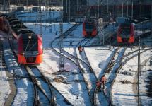
On the way from north to south along the Kuril ridge, stop number one is Severo-Kurilsk, Paramushir island. The journey takes one night by motor ship from Petrovavlovsk-Kamchatsky. Immediately I remembered the Moscow-Helsinki trains: I sat down in the evening, slept well (or didn't get enough sleep, but had a great time), in the morning on the spot (I had to travel in the late 90s). The regular air traffic no - due to the lack of an airport. Whether helicopters fly here from Kamchatka - I do not know, I doubt - it will be expensive, very expensive. ABOUT! However, they fly - according to Wikipedia, there is a heliport in the city!
 Photo by L.K.


It won't be possible to come to Severo-Kurilsk just like that because of the “wanted”. However, as in the rest of the Kuril settlements. The Kuriles are a border zone and therefore, in order to familiarize themselves with their beauties, you need to obtain permission from the relevant federal service in advance, and upon arrival, the first thing to do is to check in.
It was with this procedure that our acquaintance with the city and the people of Kuril began. At the agreed place X on the Paramushir volcanic beach we were met by a stern border guard. He slowly checked the list of all arrivals, carefully comparing photographs and names. I immediately stopped the attempts of some tourists to joke with the phrase "I will ask without sarcasm" and looked so that it became immediately clear that he was not joking about the inadmissibility of jokes :)

The lists, passports and the faces of their owners coincided, the formalities were quickly closed, we were put on a bus and taken to the city.
By the city tragic story... It was founded right on the coast from the ocean side of the island. In 1952. the city was washed away by the tsunami, killing half the population. During the Soviet era, this information was classified and was first published only in the early 90s. After the tsunami, Severo-Kurilsk was rebuilt in a safer place away from the coast, but the memory of this tragic event remained.


The old city, destroyed by the tsunami, is now a gloomy sight - the skeletons of houses, sunken ships, washed up on the shore by the tsunami, overgrown swampy streets, rusty mechanisms and other traces of an old disaster. Just left to rust and rot forever. A depressing impression, especially at dusk, under the fine cold rain that watered us almost all day.


The "new" city seems to be quite a habitable place. Life, of course, is not a key here - but for some reason I expected a much worse sight. Surprisingly - shops, a beauty salon, playgrounds, a kindergarten and a school, monuments, a church, a newly renovated clinic and even one hotel for not very demanding taste. Well, of course, everything is far from being as glamorous and fluffy as the inhabitant of the European part of the country is used to, but almost everything is there.


The housing stock is partially newly renovated, the other part makes a depressing impression, especially in the nasty weather, which seems to be here all the time ... Somehow it is not even very clear how one can survive the harsh Kuril winter in such barracks. Well, somehow they are worried!


And winters here are not only cold, but also windy and snowy. Sometimes for local residents the morning begins with a useful and inevitable exercise - to clear the entrance to the house from snow from within... Here is a photo from the personal archive of L.K. (who took us around the island and Ebeko volcano all day):

Roads here are made of reinforced concrete (a little) or ride on a dirt road (a lot). Therefore, the car park is appropriate - mostly elderly right-handed SUVs from the southern neighbor on the highest cross-country tires, and ATVs.


And there is also a hydroelectric power plant! Aha! They say that the idea to use a small waterfall on the outskirts of the city came to the Japanese, and they had some kind of machine with them. The hydroelectric power station was recently renovated, a concrete road was installed, judging by the noise - it works!

Paramushir is a highly volcanic island and it was a sin not to use it. It is meant to direct the thermal water from volcanism to the needs of public utilities. In Soviet times, there were several attempts to drill wells, but, alas, nothing came of it and therefore they are still fired mainly with coal.


The volcanic present of Paramushir is not very good for the environment. Locals say that due to the abundant sulfuric fumes and ash, the water and air in the city ... are far from environmental standards. I didn’t notice anything like that, because the constant rain and wind caused much more inconvenience.
But people here ... well, others just don't survive here. It is understandable, without mutual assistance in such parts of the world you will not live long. Very different fates, often incredible fate, but there is always a feeling that they love this land, are insanely proud to live here and are happy to show this to the gentle Moscow office plankton :)
What the population lives here are three main occupations. This is fish, fish and fish again. There is also a customs office and a border outpost - everything is like on the other inhabited islands of the Kuril ridge.
There is practically no tourism here, judging by the fact that on the huge volcano Ebeko, besides us, no other tourists were observed. The climate is harsh, the rain is cold, the wind is blowing away - so they rolled down in a state of slight fucking and shallow chills. There is practically no time left to inspect the city - so there is some blurry impression from Severo-Kurilsk. Next time I need to stay at the Fisherman's House for a couple of days, since besides Ebeko there is still something to see.

For example, the island of Shumshu - as they say, is a unique place, very beautiful (in sunny weather), the only flat island of all the Kuriles.
 Photo by L.K.
Paramushir is one of the northern islands Kurilov and is located at a slight distance from the Kamchatka Peninsula. This area has a rather harsh climate. Refers to the territory of Russia, the name of the island is translated as "big". This is how the Ainu called him, the people who lived in former times on Japanese islands... According to other versions, the name means "crowded". Although now it is difficult to call it such. The only settlement on the Paramushir Island is Severo-Kurilsk, the number of inhabitants of which barely exceeds two and a half thousand people.
Description
Paramushir belongs to the northern group of the Kuril ridge of islands along with such as Onekotan and Lovushki. Nearby, even farther north, there is a smaller area. Adjacent territories are separated by the Second Kuril Strait. The area of \u200b\u200bParamushir Island is about two thousand kilometers, it is one of the largest in the archipelago.
There are volcanoes, mountains, several lakes, the most famous of which is Zerkalnoye. Climatic conditions are distinguished by strong winds at any time of the year, sometimes they reach more than 200 km per hour. Therefore, there are few trees and large shrubs on the island, the forest zone is practically absent. It is not easy for people here too: in winter time the year the snow level exceeds the limit norms. Often, residents have to shovel the snow-covered entrance to the dwelling with a shovel. Other problems: possible and recurrent floods, earthquakes, eruptions.
From the history
Until the beginning of the 18th century, the Ainu lived on the island of Paramushir, who did not accept the power of Russia. The people refused to pay the state tax in kind until the armed Cossacks arrived on the territory. Then the Ainu submitted to the authorities. Since the 1930s, they adopted the Orthodox faith, entered into citizenship. In the future, the population began to die out. The smallpox epidemic is believed to be the cause. In 1875, Paramushir was transferred to the Japanese, and the area began to be settled again. The first city appeared (now Severo-Kurilsk). The Japanese were engaged in fishing, they founded a port. And during the Second World War, the territory was occupied by the military. Artillery was installed here, an airport was established for air defense.
In 1945, Soviet paratroopers arrived at Paramushir, and the Japanese had to surrender. The territory became part of the Soviet Union. The settlements were renamed, the Russians began to move there, equip their homes, and run a household. But the peaceful existence did not last long. In 1952, a tsunami struck Paramushir.

The lack of a warning system caused a large number of victims of the disaster. The settlements were destroyed. The recovery was slow. Severo-Kurilsk was practically rebuilt.
Severo-Kurilsk
The settlement was founded in the northern part of the island, not far from it - the ruins of a Japanese airfield during the war. Previously, the city had the name of Kasiwabor. At a distance of several kilometers, the Ebeko volcano rises. Its peak is located at an altitude of 1037 m. A little in the distance is Mount Nasedkina, ten meters above the volcano. Others stayed on the island settlements, there are about eight of them, but after the tsunami, the existing buildings were not restored. Therefore, the villages are still empty. Residents of the city are mainly engaged in fishing, there is a plant for its processing and processing of seafood.

On the island of Paramushir there are schools for children, including a music school; in the mid-70s of the last century, a House of Culture was opened, where concerts and festive events are held. A new hospital appeared in the 90s. Now there is even a small museum dedicated to the nature and history of the region.
Flora and fauna
If we compare the species diversity of plants and living creatures of the Paramushir Island and the Kamchatka Territory, the number of species in the second territorial zone is much higher. Island vegetation is scarce. Of the shrubs, there is practically only one variety - the Uda willow. The plant is resistant to cold and wind. It also grows in China, Yakutia. Most often it can be found near rivers.
In the warm season, residents collect blueberries and lingonberries. Alder and a variety of lilies, locust also grow. On the slopes of the hills you can find a widespread in Russia and unusually useful plant ivan tea. As for the animals, a unique animal lives in these parts - the Paramushir shrew. You can meet foxes, white hares, brown bears dangerous to humans. There are a lot of fish, most of all are caught pink salmon and sockeye salmon. Deep sea near the island - habitat
Chikurachki volcano
On the Karpinsky Ridge, far from the city, you can see a stratovolcano. It is still active, periodically covering the surrounding area with ash. One of his last "awakenings" took place in July 2016. The ash reached an area 100 km from the volcano, covered houses and cars in Severo-Kurilsk with a thin layer. Among the recorded, the last eruption was noted in 2015. Experts say that the volcano does not pose a great danger to the residents of the city: it is located quite far away. But there is a definite threat to flying planes.

The duration of recent eruptions of a weak character usually ranged from several days to a couple of weeks. The last of the powerful ones happened in 1986. Then the volcano threw out lava flows, and the ash rose to a height of 11 kilometers. The process lasted at least three weeks.
Cape Vasiliev on Paramushir Island
Crossing the island along its length, you can reach Cape Vasiliev. On the way, you will meet the Karpinsky volcano, several rivers that you will have to wade through. There are many wartime equipment and structures left on the cape. There is also a lighthouse where several people live permanently. There are old hangars for aircraft, a former Japanese airfield, pillboxes and other buildings in the area. You can see in these places Soviet tanks, tractors, various weapons used in World War II and later abandoned. The technique is rusty and is now unusable.
Behind Cape Vasiliev on the Paramushir Island of the Kuril Islands is Cape Kapustny (if you follow the direction from Severo-Kurilsk).
The element does not sleep
There are frequent earthquakes in these parts. The locals are used to them and know what tactics should be followed. In September 2017, there was a large flood on Paramushir Island. Part of the buildings and equipment in Severo-Kurilsk were hidden under water. The flood was caused by an increase in the water level in the river after prolonged rains. The channel changed and went straight to the city. Such incidents often happen in Paramushir. But the most terrible threat is another tsunami or typhoon. However, people have already learned to predict such phenomena. And, if something threatens human lives, everyone will be notified and prepared in advance. Even temporary evacuation is possible.
How to get there?
You can sail to the island on a specially rented seagoing vessel. For example, on a small motor ship for twenty to thirty seats. However, the cost of renting such a vehicle is quite high. The starting point of the route is usually Petropavlovk-Kamchatsky, from the bay of which ships sail off. Getting from Yuzhno-Sakhalinsk is problematic: the distance is more than 1300 km. Near the islands, passengers are transferred to inflatable boat... While the ship is undergoing the registration procedure, the passengers on the boats dock to the shore.

Subsequently, the groups of tourists should also undergo border checks. The main thing is to have a passport with you (foreign - for residents of foreign countries). Another way to get to Paramushir Island is by helicopter. But changeable weather allows you to do this only on certain days. The price of a flight (renting an aircraft) is also extremely high.
What to watch?
First of all, tourists come to Paramushir to see the unique places of untouched nature. The raging sea, numerous waterfalls, peaks of mountains and volcanoes create an amazing landscape. Can be done great photo on the island of Paramushir, if there is good weather... Which, by the way, happens quite rarely. It is best to visit places in August, this month is considered the warmest of the year. A visit is undesirable in February: severe frosts and a significant layer of snow will not allow you to enjoy the beauty of nature.
Travelers interested in the history and technology of wartime will look with interest at the fortifications left over from the times when the land belonged to Japan.

But you should be careful when walking around the island: old shells that did not have time to explode may lie on the ground. Another danger is associated with meeting bears. However, animals try not to be seen by people. Do not forget about the likelihood of eruptions. You can find out about the rules of behavior in such situations from your guide or local residents.
Island walks
Before the trip, you need to stock up on food and medicine, as well as warm clothes and the most comfortable shoes. Tourists who set as their goal a multi-day hike with ascents should take into account that on the route they will have to wade rivers and streams. The lowlands are usually damp and foggy. Drizzling rains here are a constant tourist companion. Carefully pass the Japanese wartime trenches. Some of the holes are already overgrown, and it is easy to fall through them.

Crossing the territory to Cape Vasiliev, it is unlikely to meet people on the way. Not far from the city there are small waterfalls up to 15 meters high. If you walk along the coastline, then you can see the 50-meter waterfalls of the Paramushir Island. Where they are can be identified by the nearby rivers.
: 50 ° 23'00 ″ s. sh. 155 ° 41'00 "in. etc. / 50.38333 ° N sh. 155.68333 ° E etc./ 50.38333; 155.68333 (G) (I)
Paramushir (Japanese 幌 筵 島 paramushiru something:, from the Ainu " wide island») - one of the islands of the Northern group of the Great ridge of the Kuril Islands. With an area of \u200b\u200b2053 km², it is the second largest island in the archipelago after Iturup. It is about 120 km long and up to 30 km wide. There is a Lake Mirror on the island.
General information
Administratively, the island is a part of the North Kuril urban district of the Sakhalin region of Russia. Located between Shumshu and Onekotan islands. In the north of Paramushir, there is the city of Severo-Kurilsk (2,400 inhabitants in 2011) - the administrative center of the region and the only residential settlement of the island at the beginning of the 21st century. Non-residential settlements - Podgorny and Shelikhovo. The settlements that existed on the island Antsiferova, Vasilyevo, Galkino, Kamenisty, Kitovy, Mayorovo, Okeanskoye, Pribrezhny do not have a permanent population according to the 2002 census, some [what kind?] of them were destroyed during the devastating 1952 tsunami.
The nature and geography of the island
Paramushir is one of the northernmost islands of the Kuril ridge. Being the second largest Kuril island (2053 km² in area), Paramushir island stretches over 100 kilometers in length, from northeast to southwest. The average width of the island is about 19-22 kilometers. FROM northwest it is washed by the Sea of \u200b\u200bOkhotsk, from the southeast by the Pacific Ocean. From the sea side, the island is higher and more precipitous, less indented by bays, the coastal strip is narrow. On the ocean side, on the contrary, the coast is flatter and more difficult in relief, with low-lying coastal areas, bays, steep headlands and many rocky reefs thrust into the ocean for 2-3 kilometers. Paramushir Island is the most mountainous of large islands Kuril ridge. In the north and south of the island mountain range higher, and in the middle part it is somewhat lowered, forming, as it were, a gentle saddle with many peaks. In the north of the island, the main high points are the mountain Nasedkina (up to 1152 meters) and mountain Windy (up to 1088 meters). Mountain spurs Windy in the north they descend to the sea and form a promontory Pathfinder - the northernmost point of the island. Between these peaks, in a chain of ridge Vernadsky, 6-7 kilometers from the city of Severo-Kurilsk there is an active volcano Ebeko (up to 1156 meters). The highest point of this ridge, the mountain itself Vernadsky (up to 1183 meters). On the southern tip of the island, in the same direction from north to south, there is another, larger ridge Karpinsky... It was formed by such main peaks as a volcano Chikurachki - the highest point of the island (up to 1817 meters), mountain Lomonosov (up to 1681 meters), mountain Arkhangelsk (up to 1463 meters), mountain Ax (up to 1199 meters), volcano Karpinsky (up to 1345 meters), mountain Barkova (up to 1314 meters). The south of the island ends with a cape Cabbage and the tip of the peninsula Vasilieva, cape Gilyak (other name You man - the southernmost point of the island), between which there is a bay Vasilieva... West of the ridge Karpinskyprotruding into the sea as a peninsula Fussa, there is a detached, large (up to 1772 meters) volcano Fussa , with its spurs forming the westernmost point of the island, the cape Unmatched... There are 23 volcanoes on Paramushir, 5 of which ( Ebeko, Chikurachki, Tatarinova, Fussa and Karpinsky) acting. The very same east point islands, is located in a low-lying area full of water bodies, a cape Ozerny... Paramushir is separated by the Alaid Strait from Atlasov Island, located 20 kilometers to the northwest; The Second Kuril Strait - Shumshu Islands, located 2 kilometers to the north-east; the Luzhin Strait (Third Kuril) - from the Antsiferov island, located 15 kilometers to the west; The fourth Kuril Strait - from the Onekotan Island, located 54 kilometers southwest. There are also several small islands, rocks and reefs near the island: Chaikins, Isle Whale, Isle Chick, Isle Market, Isle Barrier, Isle Smoke, rock Junkies, rock Uno, rock Dangerous, rock Sly, rocks Khmyr, rocks Foamy other. A group of small islands Avianotherwise Brothers (Isle Market, islands Two Loons, Isle Baklaniy), located in the northeast, opposite the cape Levashova and separated from Paramushir by a strait, also named after the navigator Mikhail Dmitrievich Levashov. All three islets are part of a volcanic caldera protruding from the water. Their old Japanese names are: more southern high (up to 47 meters) - Togari (Ganimushir), more northern and lower - Kotani (Kotanimushir) and Ciri (Tsirimusir). The islets got their present names thanks to numerous bird colonies and nesting grounds for guillemots, puffins, fulmars, gulls and cormorants.
The island is inhabited by more than 100 individuals of the brown bear, the fire fox, the hare, the ermine, and the sea otter on the coast. Endemic Paramushira - Paramushir shrew.
Story
A Japanese iodine plant existed in Suribatsi Bay (now Kolokoltsev Bay), and a Japanese naval fortified post with a significant garrison was established on the island.
On the Vasiliev Peninsula there is an air defense company, a frontier post, a marine reconnaissance company and a lighthouse (on the Khmyr rock).
Volcanoes of Paramushir Island
There are several volcanoes on the island, 5 of them are active or potentially active.
- Chikurachki: 1816 m, 50 ° 19'00 ″ s. sh. 155 ° 28'00 "in. etc. / 50.31667 ° N sh. 155.46667 ° E etc./ 50.31667; 155.46667 (G) (I) - the highest peak of the island
- Fussa: 1772 m, 50 ° 16'00 ″ s. sh. 155 ° 15'00 "in. etc. / 50.26667 ° N sh. 155.25000 ° E etc./ 50.26667; 155.25000 (G) (I)
- Tatarinova: 1530 m, 50 ° 18'00 ″ s. sh. 155 ° 27'00 "in. etc. / 50.30000 ° N sh. 155.45000 ° E etc./ 50.30000; 155.45000 (G) (I)
- Karpinsky: 1345 m, 50 ° 08'00 ″ s. sh. 155 ° 22'00 "in. etc. / 50.13333 ° N sh. 155.36667 ° E etc./ 50.13333; 155.36667 (G) (I)
- Ebeko: 1156 m, 50 ° 41'00 ″ s. sh. 156 ° 01'00 "in. etc. / 50.68333 ° N sh. 156.01667 ° E etc./ 50.68333; 156.01667 (G) (I)
Write a review on the article "Paramushir"
Notes
Links
Excerpt from ParamushirThe little man, with weak, awkward movements, continually demanded another pipe from the orderly for this, as he said, and, scattering fire from it, ran ahead and looked at the French from under the little hand.- Crash, guys! - he said, and he himself picked up the guns by the wheels and unscrewed the screws. In the smoke, deafened by the incessant shots that made him shudder every time, Tushin, without letting go of his naso-warmer, ran from one gun to another, now taking aim, now counting the charges, now commanding the change and harnessing of dead and wounded horses, and shouted to his weak thin, an indecisive voice. His face became more and more animated. Only when people were killed or wounded, he winced and, turning away from the killed, angrily shouted at the people, as always, hesitating to lift the wounded or the body. The soldiers, mostly handsome fellows (as always in a battery company, two heads taller than their officer and twice as wide), all, like children in a difficult situation, looked at their commander, and the expression that was on his face was invariable reflected on their faces. As a result of this terrible hum, noise, need for attention and activity, Tushin did not experience the slightest unpleasant feeling of fear, and the thought that he could be killed or hurt hurt did not occur to him. On the contrary, he became more and more cheerful. It seemed to him that a very long time ago, almost yesterday, there was that moment when he saw the enemy and fired the first shot, and that the patch of field on which he stood was a familiar, kindred place for him for a long time. Despite the fact that he remembered everything, understood everything, did everything that the best officer in his position could do, he was in a state similar to a feverish delirium or the state of a drunk man. Because of the deafening sounds from all sides of their guns, because of the whistle and blows of enemy shells, because of the sight of the sweaty, flushed, hurrying servants near the guns, because of the blood of people and horses, because of the haze of the enemy on the other side (after which everyone once a nucleus flew in and hit the ground, into a person, into a tool or into a horse), because of the sight of these objects, his own fantastic world was established in his head, which was his pleasure at that moment. The enemy cannons in his imagination were not cannons, but pipes from which an invisible smoker released smoke in rare puffs. - See, puffed again, - said Tushin in a whisper to himself, while a puff of smoke was leaping from the mountain and blowing to the left in a stripe, - now wait - send the ball back. - What do you want, your honor? - asked the fireworks, who stood near him and heard that he was muttering something. - Nothing, a grenade ... - he answered. “Well, our Matvevna,” he said to himself. Matvevna imagined in his imagination a large extreme, old-fashioned cannon. The French appeared to him as ants near their guns. The handsome man and the drunkard, the first number of the second gun in his world, was an uncle; Tushin looked at him more often than others and rejoiced at his every move. The sound of a fading, then again intensifying rifle firefight under the mountain seemed to him someone's breath. He listened to the fading and heating of these sounds. “Look, I’m breathing again, breathing,” he said to himself. He himself imagined huge growth, a powerful man who hurls cannonballs at the French with both hands. - Well, Matvevna, mother, don't give it out! - he said, moving away from the gun, as an alien, unfamiliar voice rang out over his head: - Captain Tushin! Captain! Tushin looked around in fright. It was the headquarters officer who drove him out of Grunt. He shouted to him in a breathless voice: - What are you, crazy. You have been ordered to retreat twice, and you ... "Well, why are they me? ..." Tushin thought to himself, looking with fear at his boss. “I… nothing…” he said, putting two fingers to the visor. - I… But the colonel did not finish everything he wanted. A cannonball flying close made him, diving, bend over on his horse. He fell silent and was just about to say something else, when the core stopped him. He turned his horse and galloped away. - Retreat! Everyone retreat! He shouted from afar. The soldiers laughed. A minute later the adjutant arrived with the same order. It was Prince Andrew. The first thing he saw, driving out into the space occupied by Tushin's cannons, was a horse unharnessed with a broken leg, neighing beside the harnessed horses. Blood poured from her leg as from a key. Several dead were lying between the limbs. One cannonball after another flew over him as he approached, and he felt a nervous shiver run down his spine. But one thought that he was afraid raised him again. I cannot be afraid, he thought, and slowly dismounted from his horse between the guns. He passed the order and did not leave the battery. He decided that he would remove the guns from position and withdraw them. Together with Tushin, striding over the bodies and under the terrible fire of the French, he began cleaning the guns. - And then the authorities came just now, they were more likely to fight, - said the fireworks to Prince Andrey, - not like your honor. Prince Andrey did not say anything to Tushin. They were both so busy that they didn't seem to see each other. When, having put on the surviving two of the four guns on the limbs, they moved downhill (one broken cannon and the unicorn were left behind), Prince Andrew drove up to Tushin. “Well, goodbye,” said Prince Andrey, holding out his hand to Tushin. - Goodbye, my dear, - said Tushin, - dear soul! goodbye, darling, ”said Tushin with tears that, for some unknown reason, suddenly came into his eyes. The wind died down, black clouds hung low over the battlefield, merging on the horizon with gunpowder smoke. It was getting dark, and the clearer was the glow of the fires in two places. The cannonade became weaker, but the clatter of guns from behind and to the right was heard even more often and closer. As soon as Tushin with his guns, going around and running into the wounded, got out of the fire and went down into the ravine, he was met by his superiors and adjutants, including the headquarters officer and Zherkov, who had been sent twice and never reached the Tushin battery. All of them, interrupting one another, gave and passed orders on how and where to go, and made him reproaches and remarks. Tushin did not give orders and silently, afraid to speak, because at every word he was ready, not knowing why, to cry, rode behind on his artillery nag. Although the wounded were ordered to be abandoned, many of them dragged behind the troops and asked for guns. The same brave infantry officer who jumped out of Tushin's hut before the battle was, with a bullet in his stomach, laid on Matvevna's carriage. Under the mountain, the pale hussar cadet, supporting one hand with the other, went up to Tushin and asked to sit down. | ||||||||||||
Paramushir one of the northernmost among the Kuril Islands Sakhalin region... Translated from the Ainu language, its name means "vast island", it is really the second in area after Iturup. The island is about 120 km long. On its territory there are five operating and more than ten extinct volcanoes... In addition, here you can admire the beauty of 46 waterfalls. And you can get here only from Petropavlovsk-Kamchatsky.
In the north of Paramushir at the foot of ebeko volcano the city of Severo-Kurilsk is located, the only place on the island where people constantly live. The rest of the land is uninhabited, only occasionally fishermen enter these limits. Therefore, in the mouths of some rivers, there are similarities of hunting winter quarters. The largest river Paramushira Tuharka, its length is 20 km, and its width in the area of \u200b\u200bthe mouth is more than 40 m. Red salmon, coho salmon and pink salmon enter the river for spawning. The place is very beautiful, in summer the local Kuril ivan tea blooms along its banks, with flowers as large as those of garden phlox.
On Paramushir, the absence of Kuril bamboo, which is almost business card the rest of the ridge islands. Most of the woody vegetation is represented by rugged alder forests. Large areas are covered with large meadow grasses with a large number of flowering plants, which gives the island a certain charm. But alas, on the banks of rivers and numerous lakes, as well as on the endless pebble expanses local beaches it is not possible to find anything worthwhile in order to make a more or less decent fire.
A kilometer from the Transparent River, two waterfalls at a distance of 50 meters from each other hit from more than 20 meters. Near the Puishariya river, the next waterfall falls from a height of 50 meters. Behind the Vysokaya Cape Impassable cliff, the Kamenistaya River falls into the ocean with an 8-meter waterfall, and a kilometer away there is another 50-meter waterfall. Beyond the Okeanskaya River, you can see a two-stage 30-meter waterfall. There are many picturesque streams in Paramushir, flowing in mountain canyons, with significant height differences and many waterfalls from 5 to 15 m.
At Cape Okeansky, history buffs will find many interesting objects to explore. A concrete strip of an abandoned airfield stretches to the remains of a hangar next to which heaps of scrap metal, once the former Japanese technology, and fragments of aircraft. There are also several pillboxes. There are many such abandoned corners on Parmushir, belonging to different stages of its history, including the military one. Some of the abandoned, and in fact destroyed by the wave of 1952, settlements from afar seem to be residential.
In the south, in the area of \u200b\u200bCape Kapustny, there is an amazing place where miniature lava islands are concentrated, covered with an arctic flower, reminiscent of daisies in the middle strip, and all this in the middle of the sea. In the same part of the island, 14 most picturesque waterfalls are concentrated. This area is called so - "Shore of waterfalls"... Rhododendrons and arnica bloom near the sea.
Here, in the southern part of the island, the best volcanic landscapes. Numerous peaks create a unique, breathtaking picture. Among them, one of highest peaks Kuril Islands volcano Fuss (1789 m.)
At its base there are a lot of wild rose, shiksha, lichen, blueberry and honeysuckle, which the island is rich in. Already at an altitude of 600 m, breathtaking landscapes with views of the Alaid peak and the nearby ridges open up. A belt of 5-6 meter alder begins here. There is no vegetation above 1370 m, only volcanic bombs and slag.
In the southeast of the Fuss volcano there is a five-kilometer caldera of Karpinsky volcano, to the north is the red cone of another giant Chikurachki (1572 m.) Adjacent to the Tatarinov volcanic massif, which consists of several merged peaks, planted on a destroyed Early Pleistocene volcano.
Paramushira lakes will leave unforgettable impressions of the Kuril Islands. In the interior of the island, inside the volcanic caldera between the Antsiferov and Fersman mountains, there is a picturesque lake Glukhoe, which is the largest body of water here. In the upper reaches of the Bird River, another pearl of Paramushir - the most beautiful lake Emerald. And in the upper reaches of the Yuryev River, among the lava flows cut by waves, you can plunge into mineralized hot springs.
All the pleasures of Paramushir are available only to people with good physical fitness, unless, of course, we are talking about expensive transfers by boats and helicopters, since hiking programs recreation in this part of the Sakhalin region are distinguished by high complexity of routes. Therefore, not every tourist will be able to see the Bogdanovich crater with Lake Malovodnoye, the caldera of the Karpinsky volcano, hot springs in the upper reaches of the Yuryev River, Lake Izumrudnoye and Glukhoye, or visit the peaks of Ebeko and Chikurachki.