The idea of \u200b\u200bskiing in the mountains in winter is quite obvious for any tourist. There is even a kind of tourism - "ski tourism". Our fathers and grandfathers, and great-grandfathers too, walked in the mountains in winter. Recently, this kind of sport is usually called "ski touring" in the Western manner.
I'm not a great ski touring expert (only walked six or seven times), but I really like this sport! If everything is done correctly, then on skis, in winter, in the mountains, you can go very beautiful hikes and at the same time, thanks to modern equipment, you do not spend a lot of energy. From personal experience, the passage of the same route on a ski tour is twice, or even three times faster than, for example, on snowshoes. The secret is simple - unlike walking on snowshoes, while walking on a ski tour, like on any ski, you do not need to raise your legs, you can simply move them with slippage. And, secondly, this is a special charm - on the downhill skiing you can roll (!!), and not walk in the case of snowshoes.
Slowly but surely I am moving towards a dream - walking real mountain hikes on winter mountains... In the spring of 2012, I went two short one-day ski tours in the vicinity of Krasnaya Polyana - to Khmelevskie lakes and from Medoveevka to Krasnaya Polyana, and last winter my friends and I made a trip to the Adylsu gorge (Elbrus region), where we already tried real ski mountaineering! In short, I was ripe for the first hike with an overnight stay in the vicinity of Krasnaya Polyana.
Max Kirin volunteered as a partner for this campaign. Or did I volunteer to be his partner? :))
After guessing a couple of days of good spring weather and having previously agreed on the route with the administration of the reserve (we are going on a task - checking the walking ability and timing of this route for ski tourists), we set off!
Day one: Pikhtovy Shelter - Cold camp
It is good to be able to go to the mountains according to the forecast! So yesterday's weather forecast did not disappoint, and the morning greeted us with a bright sun and a temperature of +12 already at 9 am.
Binding to the operating time of the cable car is perhaps the main disadvantage of this route. I would like to start skiing with the first rays of the sun, at 6-7 am, but the Gazprom cable cars only start working at 9 am .. I have to lose two of the most beautiful morning hours, but there are no other options ..
At the station of the cable car "Alpika-Service", located directly near railway station, we sit down in a large trailer, which immediately throws us to a height of 1600 meters without a change. The upper station of the cable car is called Pikhtovy Shelter. This is where our trip begins.
As in summer, you can go up from here in two alternative ways: along the path that goes directly along the forest ridge of the Tabunnaya mountain spur or along a dirt road. Both routes converge at the Bear Gate, the place where the forest ends on the ridge. The first option (along the path) is shorter, the second (along the road) is slightly longer, but more gentle. The first option is more interesting for snowshoes, the second is more logical for skis. We chose the second option.
Having glued the kamus to the skis, we begin the ascent. The road goes through the forest, in half an hour going out to meadows with rare trees and houses. Here you need to turn off the road, which traverses the slope further, and turn sharply to the left and up. It is almost impossible to find this turn here and our new road covered with snow. We walk from memory, approximately the way we walked in the summer.
 |
 |
The first meters of the way |
|
For the last few hundred meters, the road leaves the forest into the zone of alpine meadows, traversing the southern slope of Mount Tabunnaya. In the case of high avalanche conditions, this is a bad option for climbing the Bear Gate and it is better to follow the forest path along the ridge. But in our case, there was no snowfall for more than 10 days, and there was practically no snow left on the southern slope.
We leave to the benches at the Bear's Gate. According to Max, until recently they were completely covered with snow, but now the spring sun has melted the snow and the resting place is visible from afar! For a light snack - tea, halva, some nuts - we spend half an hour.
Here is an important point! If in summer you can walk from here to the Bzerpinsky cornice in two ways, in winter the main, equipped, “lower” path is completely covered with snow and is not passable. Moreover, this trail passes through a steep rocky area. If you fall off on it, you will fly three hundred meters into an impassable canyon. In addition, the trail goes along a traverse, cutting off the slope well, which provokes avalanches. In general, they don't go like that in winter.
We choose the “correct” winter option - a path that goes up the ridge towards the top of Mount Tabunnaya right from the benches on the Bear Gate. It is interesting that if in summer the lower part of this trail goes among thickets of rhododendron, now all vegetation is covered with a thick layer of snow.
In the upper part, the slope is quite steep, so we gain height by zigzagging. You have to constantly change the direction of movement by sharply turning the skis. Quite a tedious story if there is no habit. With this style of ascent, the camus should have a width that matches the width of the ski as much as possible, because when moving along a traverse on a steep slope, the ski touches the slope only with the very edge, and if there is no camus in this edge zone, the ski will slide and slide down. At the top of the ridge, where the slope becomes too steep, we decide to take off the skis and walk the last meters of the ridge on foot. It's faster and more logical this way.
Hurrah! We went to Tabunnaya! For today, now only down!
We approach the northeastern slope. I call this place "Herd Vidyka", since it is from here that a fantastic view opens up, for which many people love to climb this peak.
Straight ahead, in the east, with a beautiful regular pyramid, rises Sugar Pseashkho (3189 m). Now, in winter, it is hard to believe that in summer, with good weather, climbing Sakharny Pseashkho does not present any technical difficulty and is within the power of any physically strong tourist-pedestrian. In the direction from which we came, the best view of Krasnaya Polyana opens up and ski slopes resort. To the right, in the northwest, one can see the pre-summit glacier of another three-thousand-meter peak in the vicinity of Krasnaya Polyana - Mount Chugush. And, finally, a view to the north-east - the most beautiful valley of the Pseashkho pass, from the northern slopes of which the Urushten River originates. This is where we go down today, but first we need to go down to the houses on the Bzerpinsky cornice ...

I'm at the top of Tabunnaya. Photo: (c) Max Kirin
To gain time, and at the same time for a ride, we decide to go down one of the small couloirs of the eastern slope. Walking around, according to the "summer" option, through the main peak of Tabunnaya is long and not interesting. The main thing at the start of the descent is not to collapse the snow cornices formed here due to the frequent southwestern winds. In track number 2 (edited, the link to the track is at the end of the story), the route still follows a long path.

The descent was not great, but positive! In just 10 minutes we were at the houses on the Bzerpinskiy cornice. Skiing has proven its effectiveness again - descending three times faster than on foot in summer;)

Descent along the northeastern slope of Mount Tabunnaya. Photo: (c) Max Kirin
We have a bite to eat in one of the houses (there are no people, there is silence and bright sun all around) and we leave in the direction of the Pseashkho pass. For the umpteenth time today we choose a path that is different from the summer one. In order not to traverse the southern slope of Mount Tabunnaya, heated by the sun, we simply roll right along the stream bed, covered with snow. Cool! Unusual skiing. And very beautiful.

Play of light and shadow. Halt at the Pseashkho pass
In just 40 minutes (15 minutes of which we spent on stops for photographing) we go out to the wide and gentle saddle of the Pseashkho Pass (2014 m), and, without stopping, following further to the northeast, in 20 minutes we reach a small booth in the form of a two-slope canopy with benches. Here you can wait out the sharply deteriorated weather, but the place is not suitable for spending the night. Having discussed the options, we decide that today we will roll directly to Kholodnoye, and we will go to Lake Dzitaku tomorrow, on the way back.
In less than an hour, delicately maneuvering between the tops of thickets of dwarf birch (most of the height of the trees is covered under snow), we go down to the bridge across the Kholodnaya River. Somewhere on the opposite bank, in a small clearing above the river, there should be houses from the Kholodny camp. We cross the bridge in an embrace with skis (I was still waiting for some excess!) And here we are!

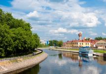
Valley of the Urushten River in front of the Cold camp
The new booths and the huntsman's house are empty. The house for tourists is excellent - the same format as on the Bzerpinsky cornice. It has two floors and can easily accommodate 15-20 tourists sleeping at the same time. We stay in the huntsman's house, as it has a stove! In summer, such a chance is unlikely to fall - in the summer, from June to October, when the reserve is open to tourists, it is always crowded here, and the huntsman keeps order.
In between exits from the house for another portion of the reserved snow-white snow for making tea and soup, we photograph the north-western wall of the Pseashkho massif, warming itself with the last rays of the setting sun. A beautiful end to a cool day out on the road!
PS At night it was about -5 on the street, and in our house, in a heated house, about + 5 + 10. We slept like dead people. I had a funny dream about timeshares :)) That's really a "miner"! Although the altitude is ridiculous, it is only 1700 meters above sea level.

IMPORTANT! Dear tourists! If you, like us, are lucky enough to spend the night in this house, remember that this house is the result of the tremendous efforts of a number of people. Please treat the house with love and respect and it will answer you with warmth and reliable protection in bad weather. You just have to do nothing: 1) take all the trash with you, 2) when leaving, close the door tightly with a bolt so that the bear does not crawl through and does not cover the snow. 3) in the house you will probably find food supplies (crackers, cookies, tea). Try not to waste them. Perhaps someday they will save someone's life!
Timing of the day:
9:10 am - boarding the cable car
9:35 am - station "Shelter Pikhtovy"
9:50 am - put on kamus, start of the ascent
11: 00-11: 30 - rest at the "Bear Gate"
12:30 - Herd species
13: 10-14: 40 - lunch at the houses on the Bzerpinsky cornice
15:20 - saddle of Pseashkho pass
15: 40-16: 00 - halt at the booths with the sign "South Pole, North Pole, ..."
16:50 - camp is cold
# Conclusion of the day: SKITUR IS A CAIF! Sparkling snow, warm sun, ringing silence and you can ROLL DOWN !!!
# Moral of the day: I understand why ski touring is so expensive! Because if ordinary skiing it's a thrill, but usual hiking - this is beauty, then ski-tour is a thrill of beauty !! And for such a double buzz, you have to pay at higher rates :))
Day two: Camp Cold - Krasnaya Polyana
After having a good night's sleep and having a hearty breakfast, going out. The sun has risen more than two hours ago, and it's warm and sunny outside! I don't even want to leave, but I must. At 9:45 am, we set out on the way back.
From the very beginning, we develop truly cosmic speed, despite the fact that we are going uphill! The combination of temperatures above zero during the day and below zero at night forms an excellent dense crust on the surface of the snow cover, called crust. This very crust is hated by freeriders (who loves to ride on the crust?), But tourists-skiers adore it - no need to trail !! Having estimated the speed of movement and the route of today, we decide to make a radial - go into the side valley and see how Lake Dzitaku look in winter.

About an hour of extra time was spent on this "hook". All around is white silence. Complete silence. Even the usual omnipresent wind in the mountains and that verse. The sun is hot as if you were shoved into the microwave. I think during these two days we received as much solar vitamin D as the average Muscovite in a year;)) It's good that the cream was not forgotten this time. Without him, for lunch, we could be served as a roast for dinner for reserved bears;)))

Conclusion on the Dzitaku lakes: there is nothing to do here in winter - all the lakes are hidden under a thick layer of snow (more than 3 meters now, in mid-March), and this is not the snow season that you succeeded in.

Urushten river
Having filmed a bunch of cool videos (I hope I'll post it someday) by 12 noon, we go out to our yesterday's tracks in front of the Pseashkho pass. Taking off our skis and sitting on a bench, we eat nuts, finishing them off with chocolate. It's a pity the tea was not boiled in the morning! We just drink it with water, which has been boiled since the evening.

By lunchtime, we go to the good old Bzerpinsky cornice. I was surprised by the fact that with the current state of the snow (excellent crust, skis fail a couple of centimeters maximum) it is easier and faster to follow not in the footsteps of a partner, but in a parallel course. So half a day went - not one after another, but in parallel courses;)

Lunch in the house dragged on for an hour and a half. This is due to the large stocks of delicious food, which I really didn’t want to move up to Tabunnaya;))
Having looked at the clock (time is exactly three o'clock in the afternoon!) I was afraid that we would be late for the cable car. This is not funny. Once we have already done this in the Alps, during acclimatization before climbing Mont Blanc. Then it added us three good pawn hours down the boring road. Fortunately, Max recalled that in winter the Gazprom cable car is open until six and we still have three whole hours!
After leaving the houses we look at the circus of Mount Tabunnaya. By eye we estimate the avalanche hazard (ATTENTION! It is better not to do this !!) as low and decide that we will not climb to Tabunnaya through the saddle, but straight ahead, almost along the path of yesterday's descent. We ascend first by a long traverse along a barely noticeable ledge, and then along the crest of one of the small circuses on the northeastern slope of Tabunnaya.
The tactics did not disappoint. Only half an hour of sports ski-tour-uphil and now we are standing on the plateau-like summit of Tabunnaya. Here we are moose! And there were also stops - in one place the snow began to stick to the kamuses, we had to stop and clean it off.
IMPORTANT: Despite our success, I advise future skaters to go around, on a safer route (indicated in the track). You will lose a little time, not more than an hour, and add security significantly!
Once again, checking the watch, we understand that there is a lot of time. There is still 2.5 hours before the cable car closes, and now we are just going down! There is time to throw your backpacks into the snow, sit and look at the surrounding slopes and peaks, and come up with ideas for future hikes. The conclusion is simple: there are a lot of options for walking, walking - do not go! It is necessary to go up to Perevalnaya, and finally to go to the Bzerpi peak!
Before starting the descent, I "tune" my "fashionable" ski touring boots: to increase their rigidity (useful on the descent), I insert additional plastic inserts into the boot tongue area. The thing really works - the boot becomes much more rigid. Subjectively, from 30 to 70 units on the universal scale of boot stiffness.
The only freeride site to date - the descent from the top of Mount Tabunnaya to the road (with a short stop at the Medvezhy Gates) takes just over 10 minutes! In addition to the fun of riding on the face and awesome efficiency. Pedestrians and snowshoes on this stretch alone would waste us a lot of time, not to mention the pleasure of skiing versus the monotonous downhill walking!
As Max predicted, at exactly 17:00 we were sitting on the open veranda of the Khmeli-Suneli restaurant, looking at the route of our descent from Tabunna. From here, from the restaurant, the descent line looks cool!
Enjoying a bottle of life-giving beer ("For an acquaintance!", "For a successful trip!") We make plans for future joint trips. The Caucasus is so big that a lifetime is not enough to bypass it all. And that's great !!
Timing of the day:
Ascent - 7:30
Departure from the Cold camp - 9:45
Jitaku Lake - 11:20 am
Halt at the booth in front of the Pseashkho pass - 12: 10-12: 40
Lunch on the Bzerpinsky cornice - 13: 40-15: 00
At the top of Tabunnaya -15: 35-15: 55 (climbed head-on, at a sporting pace)
Bear Gate - 16: 05-16: 10
"Priyut Pikhtovy" station of the Gazprom cable car - 17:00
Technical photos from the route

Section of the route from Mount Tabunnaya (vidka) to the Pseashkho Pass. Green - descent, red - ascent


Useful information on the hike
UPDATE from 12/02/2016. As of this moment, administration of the Caucasian State biosphere reserve started issuing passes for hiking on this route in winter time of the year (December-May). it good news... The bad thing is that you can walk ONLY IN THE ACCEPTANCE OF GUIDES. Amateur tourists unaccompanied by guides are not issued passes. The reserve explains this by concern for the safety of tourists. I partially agree with them (avalanches are a serious matter). But on the other hand I do not agree. We go to other mountains at our own peril and risk, why are there different rules here?
P.S. general information about routes, weather and other nuances of hikes in the vicinity of Sochi, Krasnaya Polyana and the territory of the Caucasian Biosphere Reserve - in my homemade guide to Sochi and Krasnaya Polyana for outdoor and hikers. Read it, I think it will be useful.
conclusions
General conclusions along the route:
- Hike along the route from the upper station "Shelter Pikhtovy" of the cable car "Gazprom" (Krasnaya Polyana) to the Kholodny camp through Bzerpinsky cornice and the Pseashkho pass - the most beautiful of the most accessible routes for any tourist, passing through the territory of the Caucasian State Natural Reserve. It takes two days to complete the route under favorable weather conditions, with one overnight stay in tents or a house in the "Cold" camp.
- Unlike most routes in the Caucasus mountains, this route is unique in that it is, in fact, the first experience of creating a route "for people". The length of the route in one direction is about 12 kilometers (24 kilometers round trip). The maximum height is 2300 meters (the top of Mount Tabunnaya). The route starts at the Shelter Pikhtovy cable car station (Gazprom), 1600 meters high. On the key points of the trail, there are signs and maps of the route, and along the entire trail there are four tourist parking lots with benches, shelters from the weather, and even two parking lots with houses. All this not only increases the comfort of the hikes, but also the safety. In the event of a serious deterioration in the weather in such houses, you can wait out the elements with a sufficient share of comfort.
- Since the route passes through the territory of the Caucasian State Nature Reserve (the site of the reserve), you need to obtain a pass to pass it. Pass cost: 200 rubles per person for each day of being on the route. This can be done in any of the offices of the reserve. The route usually opens in mid-June and closes in early November, after the first snowfall. At this stage, the reserve does not issue passes for hiking in the winter season. We took this route as a test group. Perhaps someday the route will be open for winter hikes!
- The route is almost autonomous. Cellular communication is available only at the beginning of the route to the top of Mount Tabunnaya and on the very edge of the Bzerpir cornice. Further cellular communication no. Calculate your strength correctly !!
Conclusions on the winter passage (ski tour):
- If the passage of the route in the summer (see my story) does not present any particular difficulties, then the winter option described on this page, like any winter hike in the mountains, places increased demands on the participants of the hike. You need to know and be able to navigate in the snowy mountains, independently and correctly choose the line of movement (trails and signs are often under the snow!), Have equipment appropriate for the weather conditions.
- “Pikhtovy Shelter - Cold Camp” is a very logical, beautiful, ski-tour route that is affordable for any group. If the weather conditions do not fail, and the physical fitness of the participants is not lower than average, 6-8 hours are enough to complete the route in one direction, taking into account an hour's lunch break on the Bzerpinsky cornice. In case of a large amount of fresh snow, the time can significantly (up to two times!) Increase !!
- Ski touring in March has a lot of advantages. If you catch the weather with daytime temperatures above zero, but with subzero nights, it will be crust in the mountains! Sucks for freeride, but great for ski touring! Firstly, there is no need to trace, which facilitates movement in coordinates. Secondly, thanks to the ice crust, you can roll even on a very slight slope, where, with thick snow, you will not need to walk, but even trail! For example, we skied all 4 km of the section from the Pseasho pass to the Kholodny camp despite, in general, a slight slope of the Urushten valley in this place. And finally, thirdly, it is usually warm in March both night and day, which means you can carry less warm clothes!
- Avalanche on the route, in my opinion, is average. There is only one potentially dangerous area - the ascent and descent from Mount Tabunnaya. As always, when entering ski touring routes, the group should have a full set of avalanche equipment and be proficient in the skills of rescuing from an avalanche. On the days of snowfall and the first two days after it, the route is not recommended for passage due to avalanches from the snow that fell.
- My personal conclusion on the ski touring set that I put together this winter: everything is awesome in weight (less than 5 kg per set of skis + boots + bindings) and convenience (walking is comfortable, the leg works naturally, I want to go and go!), But the fact that the mounts do not work in the head strains on serious off-piste descents. I would like, of course, the full-fledged work of fastening not only in the heel, but also in the toe. Alternatives - Diamir Vipec 12? Marker Kingpin? Stops only space prices for these mounts ...
A short video about the hike
And this spring, Max and his friends had a great walk with skiing in the area of \u200b\u200bthe Bzerpinsky cornice. Better to watch with sound!
The route to the Cold camp
The route from Pikhtova Polyana to Kholodny Camp begins at an altitude of 1600 meters. From the starting point to the highest point of the route, the top of Mount Tabunnaya (altitude 2300 meters), the route goes uphill quite steeply. The final climb for the first 3.5 km of the route is 700 meters. Due to such a large climb, this section may take 2 to 3 hours. Further, up to the Cold camp only go down. First, go down to the houses on the Bzerpinsky cornice (about 30 - 40 minutes), and then, in 2-3 hours, first to the Pseashkho pass, and then down along the Urushten river, go down to the confluence of the Urushten and Kholodnaya rivers, to the place where the route ends.

Key point coordinates:
- (1) The beginning of the trail near the Shelter Pikhtovy station of the Gazprom cable car - N43 ° 41.659 "E40 ° 21.033"
- (2) Benches in the parking lot "Bear Gate" - N43 ° 42.019 "E40 ° 21.850"
- (3) The top of Mount Tabunnaya - N43 ° 41.967 "E40 ° 23.084"
- (4) Houses on the Bzerpinsky cornice - N43 ° 42.573 "E40 ° 22.580"
- (5) A canopy, benches and a sign at the Pseashkho pass - N43 ° 44.343 "E40 ° 23.719"
- (6) Bridge across the Kholodnaya River - N43 ° 45.572 "E40 ° 25.017"
- (7) House in the Cold camp - N43 ° 45.764 "E40 ° 25.093"
Infrastructure facilities indicated on the map:
- (A) Rosa Khutor terminal station of the Adler - Krasnaya Polyana railway
- (B) Office of the Caucasian Biosphere Reserve in the Aviary Complex
- (C) Lower station of the cable car Gazprom
- (D) Lower station of the cable car Alpika-Service
- (E) Rosa Khutor (hotels, shops, restaurants, cafes, embankment)
- (F) center of Krasnaya Polyana village
Additionally:
- Routes and key points of the area for viewing in Google Earth - download
- GPS track of the winter route (
Hike budget
- Products for 2 days - 450 rubles
- Gas cylinder - 250 rubles
- Train "Sochi - Krasnaya Polyana" - 350 rubles (in summer - 115 rubles)
- Ticket to the reserve for 2 days - 400 rubles (200 rubles per person per day)
- Ascent to cable car - 850 rubles (the descent is included in the price)
Office addresses of the Caucasian Biosphere Reserve
to get a pass for the route:
- Adler, Karl Marx St., 8. Working hours: from 9-00 to 17-00, except weekends and holidays.
- Krasnaya Polyana, Aviary complex (2 km along the road from the Gazprom cable car). Working hours: from 9-00 to 17-00, without weekends and holidays.
- The telephone of the tourism department for information on routes and organization of hikes 8-988-150-0102
Ski touring equipment
Skitouring is a fairly new sport. Unlike tourists-skiers, who go skiing mainly on the plains or in the middle mountains, ski touring means hiking and climbing on a pronounced mountainous terrain with descents on unprepared slopes. Accordingly, the equipment used in ski touring is quite specific! The classic ski touring kit includes:
- skis with metal edges, similar to classic alpine skis, but lighter
- boots, also similar to ski boots, but lighter and of a special design that makes it easier to walk in them
- bindings, of course, lightweight (!) and having, in addition to the riding mode, several walking modes
- camus, preventing skis from slipping back when driving uphill
- a set of avalanche equipment. At least an avalanche sensor, probe and shovel
The high cost of modern ski touring equipment is, in my opinion, the main obstacle on the way of a tourist's transition to ski tourists ... The cost of a new ski tour set, which includes skis, boots and bindings, starts at $ 1500. But having skiing equipment alone is not enough! Walking in the mountains in winter is a serious investment in your avalanche preparation. And this is not only a standard set of avalanche equipment - a shovel, probe and beeper, but also high-quality training both in assessing the avalanche hazard of slopes and choosing a route, and in finding someone caught in an avalanche. In short, ski touring is a serious thing!
Especially for the report, I got confused and took a photo of the equipment that I took on this trip. Here's what happened:

My gear for this ski tour
Special ski touring equipment
- Ski boots (instead of skistop)
- Mountings
- Camus
- Telescopic poles
- Safety elastic sling for ski loss insurance (instead of ski-tops)
- Ski ties just in case :)
Avalanche equipment
- Avalanche sensor ("beeper") [not pictured]
- Avalanche probe
- Snow shovel
Tourist equipment
- Travel backpack
- Sleeping bag
- Seat
- Gas stove
- Gas bottle
- Bowl, cup and spoon
- Drinking bottle
- Sunglasses in a case
- Headlamp
- Folding knife with additional functions ("multitool")
- Matches and Cherkash in a sealed aluminum case
- Sunscreen cream
- Hygienic lipstick
- Documents and money
- Spare batteries for flashlight and navigator
- External battery for charging the phone / camera
Products
- Garbage bag ("trash bag")
Running clothes
- Thermal T-shirt
- Thermal underwear
- Ski socks
- Fleece jacket
- Trousers running softshell
- Thin gloves
- Headband
- Beanie
- Nasal raft
Clothes for bad weather
- Membrane jacket
- Membrane self-discharge trousers
- Warm self-dumping pants
- Puff
- Membrane mittens
- Spare socks, warm
- Balaclava [not pictured]
Sleepwear
- Sleep pants
- Jumper for sleep
- Warm socks for sleep
Other
- Paper card [not pictured]
- GPS Navigator [not pictured]
- Phone / camera / notebook [not pictured] - APPLE iPhone 5
- First aid kit [not pictured]
- Sponsor's flag!
NOTE. We did not take a tent and rugs, as we originally planned to spend the night in the house. The final weight of the backpacks was about 8 kg, unfortunately, it was not possible to weigh more accurately.
Other ski touring trips in Krasnaya Polyana and the Caucasus
You may be interested
subscription to the newsletter site
Once a month, the most interesting new thing on the site. No spam
At the foot of the grandiose northern wall of Pseashkho lies the Karov-valley glacier Kholodny, giving life to the stream of the same name. The view of the Kholodny glacier was captured in photographs, calendars, and albums. The Pseashkho massif is bounded from the west by a trough valley with the Pseashkho pass (2014.2 m, n / a). This five-kilometer valley, about 500 m wide, was developed by an ancient glacier that does not exist today. It stretched in the direction of the Yuuz-Ssv. The longitudinal slope of the valley is so small that the passage of the pass point (Pseashkho lane) can be overlooked. Two spurs extend from the summit of Northern Pseashkho (3256.9 m). A short, steep northern ridge cuts deeply into the Mramorny Glacier, here the division of the glacier into the western and central parts is outlined. The northwestern ridge also slopes steeply downward, bordering the western edge of the Mramorny glacier. After the saddle, which is the upper reaches of the couloir, along which stones constantly fall on the Kholodny glacier (for which this couloir received the nickname "garbage chute"), the spur rises sharply upward with two sharp rocky teeth. These prongs are clearly visible from the Kholodny camp. The western tooth has a mark of 2936.4 m, the eastern one is 30-40 meters lower. Further, the spur goes downward to the northwest, dividing the basins of the Kholodnaya and Mramornaya rivers.
The hike to the Cold Camp, located not far from the glacier of the same name in the vicinity of the Pseashkho massif, partially coincides with the route to the Bzerpinsky Karniz and, along with it, is one of the most successful1 solutions for exploring the mountains. The path to it does not require significant physical training: the trails are good and for the most part run along the gentle expanses of the Hanging Valley. There are a number of monuments along the route: during the Great Patriotic War, it was in the area of \u200b\u200bthe Kholodny camp that fierce battles for the Pseashkha pass broke out, as a result of which the enemy was stopped and did not reach Sochi.
The route to the Kholodny camp is designed for three days with an overnight stay in tents and radial exits1 to the Kholodny glacier, to the Mramornaya mountain, the Stone Castle, to the Dzitaku lake valley (Semiozerie valley). During the hike, you can admire the glaciers and peaks of the Pseashkha massif, which are still visible from the village of Krasnaya Polyana, from the closest possible distance.
Route description:
Day 1
Ascent from the village of Esto-Sadok on the 3S cable car from the Alpika-Service GPP to the Pikhtovoy shelter (height 1660 m) at the Gazprom GTZ. The walking part of the route starts from the cable car station 1. On a dirt road, and then a well-packed mountain path, we pass to the Medvezhye Vorota tract, located on the slope of Mount Tabunnaya Yuzhnaya. From here you can see the Aibga ridge (Southern Lateral ridge), the Assar ridge and the Chugush massif - a massive three-thousanders with the lowest glaciers in the Caucasus. Then the trail goes by traverse (a direction perpendicular to the direction of ascent or descent on the mountain) for about an hour with a gradual climb until it turns out to be on the Bzerpinsky cornice, where we have lunch. After lunch - trekking along the Pseashkho valley to the Cold Camp itself. The length of the walking part of the path is 11 km. Overnight stay.
Day 2
Early rise and radial hike to Mramornaya, Kholodny glacier, Kamenny Zamok (options). Overnight at the Kholodny camp. The length of the walking part of the path is 5-9 km.
Day 3
Get enough sleep, moderately early rise. Collecting the camp. Return trip with a visit to the Jitaku valley with swimming in the lakes (optional). After coming to the Bzerpinskiy cornice - lunch, rest. Descent to the cable car. The cable car takes you back to the village of Esto-Sadok. The length of the walking part of the path is 11 km.
In the upper reaches of the Urushten River, one of the cordons of the Caucasian Nature Reserve is located - Camp Kholodny. This place is named so for a reason. Near the camp, the Kholodnaya river flows into Urushten, taking its sources on the Kholodny glacier.
The icy breath of the glacier brings coolness to the inhabited meadow in summer, chilling wind in autumn and spring, and violent cold in winter.
Camp Cold is a legendary place. Located at the junction of two river valleys: Urushtena and Kholodnaya, it became a place of fierce battles with the hated fascist invaders during the Great War of Helm. It was here that the soldiers of the 20th Mountain Rifle Division defended the approaches to Krasnaya Polyana, defended the hospital at the cost of their lives.
Their feat is announced to those who came to the valley of the Kholodnaya River by a memorial stele installed here in last years Soviet power. Members of the military-patriotic organizations of the city of Sochi and city tourist clubs regularly watch the stella.
The Kholodny camp has enjoyed a well-deserved popularity among tourists in recent years. A number of improvements and transformations have made Kholodny a convenient place for tourists to rest, and active advertising in recent years has attracted tourists from all over our Motherland.
What makes Cold camp convenient for tourists?
- a good, well-equipped path leads to the camp.
- basic amenities are made here: a toilet is equipped, a two-storey wooden alpine house was built
- a huntsman service is constantly on duty here, monitors the order and observance of the reserved regime
- there is a spring near the camp with delicious water
- several radial routes lead from here to the natural sights of the Caucasian Reserve

Radial routes from the Cold camp
- the official route of the Caucasian reserve. Up the Kholodnaya river, a path leads to the left side. It rises up the valley and ends near a beautiful roll. If you have the courage, you can walk across the rocks to the Kholodny glacier and walk along its tongue. It is cold here even on the hottest day, white waves of fog are streaming over the body of the glacier, carrying with them the dank dampness of ancient ice.
For climbing the stone steps and walking on the glacier, and even more so for going down into the valley, it is advisable to have good trekking shoes that support the ankle.

- the route to the lake valley Jitaku will not leave you indifferent. Here bowls rest in a bosom of lush alpine vegetation blue lakes attracting thousands of fans with its beauty active rest... In fame and beauty, they compete in something with - the pearl of the Caucasian reserve.

Urushten river canyon - if you go down the stream of the Urushten River, then literally 1 (one) kilometer from the Kholodny camp there is a beautiful canyon. The Urushten River washed away the soft limestone and bursts down the narrow throat of the gorge. Wild gray stones are washed by the bubbling stream of a turbulent river. In terms of beauty, the Urushten canyon competes with, but being located in the very heart of the Caucasian reserve, we rarely visit and are little studied.
Valley of the Cold River - rising to the upper reaches of the Kholodnaya river on the right side of the valley, you get to the Mramorny glacier. There is a convenient ascent to the Mramorny pass from which a beautiful view of the Chistaya river valley and the peaks of the Chilipsin mountain cluster and the Pseashkho ridge opens.
1st day:
- Ascent to the cornice of the Bzerpi river (height 2000 m.) (Cable car + on foot), accommodation in the camp, 2 hours rest, lunch.
- 14:00 climbing Mount Perevalnaya, South peak.
- 16:00 Descent to the camp, rest, tea.
- 17: 30-20: 00 sightseeing tour of the valley of the Pseashkho mountain range. Horizons to the peaks of Sugar Pseashkho, the glacier of the Pslukh river, entry to Lake Maloe, swimming in a mountain lake, if desired. Return to the camp.
2nd day:
- 07:00 departure from the Bzerpi camp, trekking along the trail to the lake valley Dzitaku, viewing the valley and seven lakes, swimming.
- 11:00 return to the trail to the "Cold" camp.
- 12: 00-13: 00 accommodation in the camp, rest.
- 15:00 radial hike (hike from the camp without backpacks) under the Kholodny glacier, voklyuz (exit of the underground river outside), the Kholodnaya river valley, access to the lower part of the glacier, with shoes and the necessary physical. preparation (rope-free passage of the rocks, crossing the moraine, access to the lower part of the glacier, a group of no more than 3 people). Return to camp, rest.
- 07:00 departure from the camp, return to the Bzerpi camp.
- 10: 00-14: 00 rest.
- 14:00 descent to the cable car. Krasnaya Polyana and home.
For you
Yoga and lots hiking will bring us both physical and spiritual pleasure. And to work out the emotional part of our self, we included work with a transpersonal trainer in the program. Personal growth training "On the Edge of Potential" allows you to escape from the routine, to look at yourself, your family, your work from a different angle. To see the prospects of today, to solve the problems of yesterday, to fill the day with good luck, happiness and wisdom.
In the training program:
- Creation of individual talismans of good luck;
- Drawing Mandalas;
- Formation of a positive picture of the world through work with visual images;
- Working with internal resources;
- Ways to achieve goals ("Walt Disney's Creative Strategy").
More about the area
Krasnaya Polyana has long been considered the most beautiful place in the Caucasus. The mountain peaks Aigba and Achishkho in the south and north compete with the majesty of the view of the Main Caucasus Range. Most high points around Krasnaya Polyana go up to 3000 meters. The mountain slopes completely covered with snow from November to March, the proximity of the sky, the crystal fast Mzymta - all this gives the impression of crystal clear clarity.
Pseashkho (Pseashkha) - mountain range in the Western Caucasus, 20 km from the village of Krasnaya Polyana, in the upper reaches of the Urushten, Malaya Laba, Pslukh rivers, on the territory of the Caucasian Nature Biosphere Reserve. Belongs to the Main Caucasian ridge.
The toponym "Pseashkho" is translated from the Adyghe as "abounding mountain", apparently due to the fact that several rivers fed by glaciers originate on the slopes of the massif.
The Pseashkho massif is bounded in the west by a trough valley with the Pseashkho pass (2014 m). This valley, about five kilometers long SW-NNE and about 500 m wide, was developed by an ancient glacier. The longitudinal slope of the valley is so small that the passage of the Pseashkho pass is imperceptible.
From the southwest, the Pseashkho massif is bounded by the Pslukh river valley, from the east by the valleys of the Malaya Laba and Chistaya rivers, and from the north by the valleys of the Kholodnaya and Mramornaya rivers. The southern end of the massif can be considered the Aishkha pass (2401 m), the northern end - the Mramorny pass (about 2800 m).
The Pseashkho massif is a complex mountainous knot with ridges of different directions and peaks from 2500 m. The following peaks are distinguished in the main massif: Northern Pseashkho (3256.9 m) - the main peak of the massif; Southern Pseashkho (3251.2 m), Uzlovaya (3196 m), Sugar Pseashkho (Sugar Loaf village) (3188.9 m), Western Pseashkho (2899.8 m)
The Pseashkho massif is interesting for its 11 glaciers. The largest of them - the Pseashkho glacier - is the largest glacier in the Krasnodar Territory. Karovo-valley glacier, 3 km long and 1.5 km² in area. To the north of the highest peak of the Northern Pseashkho, there is the Mramorny Glacier, which gives rise to the Mramornaya River. Also on the northern slopes there is the Kholodny glacier, from which the Kholodnaya river flows, which flows after a few kilometers into the Urushten river. A feature of the glaciation of the Pseashkho massif is that the first glaciers of the southern macroslope of the Greater Caucasus appear here from the west. Over the past decades, the area of \u200b\u200bglaciers has been decreasing.
The Dzitaku Ridge is the territory of the Caucasian State Biosphere Reserve. The Dzitaku Valley is of the pass type, that is, the Main Dividing Range runs along the bottom of the valley. Five lakes, located at an altitude of 1900 meters above sea level, are located close to each other and attract with their purity and beauty. The most significant lake - Bolshoye - with an area of \u200b\u200b20,000 m2 maximum depth up to 10 m. The phenomenon of another lake - Two-Face - is that the flow from it is carried out both to the northern slope and to the southern, that is, in the basins of the Urushten and Laura rivers. This is a very rare occurrence. The Jitaku ridge rises above the valley from the west. Dzitaku is translated from Abkhaz as "waterless hill". The Dzitaku peak is 2819 m. It offers a panoramic view of the North (3257 m) and South (3251 m) peaks of the Pseashkho massif, the Cold glacier and the valley of the river of the same name, the valley of the Urushten, Chugush and Achishkho rivers, Aibga.
The Kholodny glacier is located on the northern slopes of the Pseashkho ridge. An area of \u200b\u200b0.5 km² From it flows the Kholodnaya River, which flows into the Urushten River.
What do we do
From morning until late at night, we will walk and enjoy the unique views, we will breathe crystal clear air and live with full breasts. Practicing yoga in the midst of all this greatness, under the very sky will help us absorb the unbridled energy of mountain rivers, the silence of mountain lakes and the power of mountains. Better than mountains can only be mountains ...
Copied from the site "Samopoznanie.ru"
Immediately after sudden cranopoly snowfalls this autumn, we got to the Caucasian reserve. To the "cornice", Lake Dzitaku and to the Cold camp. To say "beautiful" is to say nothing. A few photos and words below them - below.


On Bzerpinsky cornice you can go round and round in a day, thanks to the Gazprom-Laura ski lift, which immediately lifts you to 1100 meters relative to the valley level, and literally in half an hour or an hour you walk through the alpine zone.
But, if there is enthusiasm, then it is better to go with an overnight stay.

Against the background of the sky - ridge Aibga (from right to left: Gorki Gorod, Alpika and Rosa Khutor). Well, in the foreground is Gazprom-Laura, with which you start moving.

Literally after 1.5 hours of a leisurely walk, you are already on the "cornice". The circular panorama is good. Perhaps it is here, at the observation points of the "cornice" (Tabunnaya, Perevalnaya, Kogot) best views in Krasnaya Polyana! Although, someone can, or the circuses of GorkiGorod, I admit.

The guys from the Krasnopolyansky Mountain Club (KGK), who support the camping on the cornice, wrote to me that "goes down the path".
Yes, it does. Still, 35-40 cm at above-zero temperature, not a joke. It is not surprising that at least 4 small avalanche bodies (LS, size 1) had to be crossed on the 500-meter section of the trail. But the period of avalanche danger has passed, the slopes have already been unloaded, you can stomp calmly.


And here is the camping of the Krasnopolyansky Mountain Club. The guys this season supported 2 permanent camps: on the Bzerpinsky cornice and in the Cold camp. That is, in the most correct places in the reserve, from the public. For very sane money, you can come and spend the night here without carrying tents, rugs, sleeping bags with you (mega-option, in fact!). That is, you can make a 2-3 day excursion to beautiful places reserve generally light, taking only a thermos, warm clothes and snacks.

Wardroom. Here you can cook yourself, or use the cooked meal option. Conveniently. Well, in the evening to sit, talk "for life", of course.

From this camp on the cornice, you can make radials, to observation points (Perevalnaya, Kogot), to lakes (Small and Big Dzitaku). Well, if you want to go deeper into the mountains, look at the glacier closest to Krasnaya Polyana, then take a walk to the Kholodny camp.

Autumn is coming ...

Jitaku lakes.

There are many places along the paths (well-groomed, I must say) - signs, stands, benches. We put all this in preparation for the Olympics, but it is in working order, although 4-6 meter snow cover in winter makes itself felt ... So if you see fallen stands somewhere and so on, especially on the slopes, do not be surprised , these are not vandals, but mother nature. Few things can handle this kind of snow load in humid climates.

In several places there are sheds and even shelters (here they are called "alpeshki"). This season, the reserve has hung locks on alpeshki, so that the "courtyard" is over (living in houses costs 500 per person, you have to pay when buying a permit to visit the reserve). But awnings, tables, benches, it all remains available to the public. And it helps a lot when you want to "finally sit down, have some tea"with some freaky look.

Many monuments and signs about events The great Patriotic... After all, it was here that, with extremely small forces, it was possible not to let through and stop the German rangers going to the Black Sea through the Caucasus. The heroism of those soldiers commands respect. Read the information on the stands, and here are these metal books on stones (see the photo). This is not an emasculated story, but a real one, you read and see "this hill, which was held by 21 people for a month".


I have never met such a number of commemorative signs of the Second World War in any place in the former USSR, although celebrating such things is one of my regional geographic hobbies. There was an unwritten tradition to install them in large numbers. Each holiday home, tourist camp and construction brigade considered it their duty to put them on any anniversary of some battle or feat. Therefore, on one historical site they could be formed in 10-15 pieces, easily.
But, the most surprising (and, again, causing wild respect!) They continue to do this even now! For example, this stele was placed near the Kholodny camp in the early 2000s. And this is not an isolated case.

Here comes camp Cold. This season it is already closed (winter is coming), the guys have closed their farm. So there's no one here ... grace. Only bears and red deer, well and restless Misha, make preparations for the winter)).


Here comes glacier coldin your bowl. You can walk directly to it, the walk up the valley is not very long, just knead the rolls.


In general, while it rains everywhere and "From St. Petersburg with apathy and indifference", we have golden days here. So, those who are still thinking how to spend the fall should think about whether they can come for a week to take a walk in the golden Krasnaya Polyana autumn)).
___________________
receive pass to Caucasian Reserve can be in