The study of the Black Sea began in ancient times. Already in the IV century BC, periplas were drawn up - ancient sailing directions of the sea. Another milestone in the study of the Black Sea was in 1696, when the "Fortress" ship sailed from Azov to Constantinople. Peter I ordered to carry out cartographic work during the voyage, a drawing of the Black Sea from Kerch to Constantinople was drawn up, and depth measurements were made. A more serious study was carried out in the 18-19 centuries. In 1816 F.F.Bellingshausen compiled full description The Black Sea coast, in 1817 the first map of the Black Sea was issued, in 1842 - the first atlas, in 1851 - the Black Sea route.
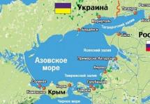
The shores of the Black Sea are scarcely indented and, mainly, in its northern part. The only large peninsula is Crimean. The largest bays: Yagorlytsky, Tendrovsky, Dzharylgachsky, Karkinitsky, Kalamitsky and Feodosia in Ukraine, Varnensky and Burgas in Bulgaria, Sinop and Samsunsky - near the southern coast of the sea, in Turkey. The Black Sea is a unique nature, the most northern subtropics. Flora and fauna of the sea is diverse. Most of the modern inhabitants are brought from the Mediterranean. The fauna is represented by 2.5 thousand species of animals. Among the small marine life are mussels, oysters, a mollusc predator of rapana. Among the fish are sturgeon (beluga, sturgeon), various types of gobies, anchovy, red mullet, sea urchin, mackerel, haddock, horse mackerel, herring. Among mammals, the Black Sea is represented by two species of dolphins - the common dolphin and the bottlenose dolphin, as well as the white-bellied seal.
& nbsp & nbsp & nbsp & nbsp & nbsp & nbspWith Russian access to the Black and The Azov seas in the time of Peter I, the period of systematic study of these reservoirs begins. By order of Peter I in 1696, the depth of the Azov Sea was measured, which turned out to be very shallow. Many valuable observations and measurements were made by the "Fortress" ship on the way from Kerch to the Bosphorus. Based on these data, a map of the sea was compiled with depth marks and it was proved that south of Kerch there is great depths, in the central part of the Black Sea there are no shoals, as previously thought.
& nbsp & nbsp & nbsp & nbsp & nbsp & nbspBased on the observations made at the "Fortress", which laid the foundation for the hydrographic study of the Black Sea, in 1703 an atlas of the Black and Azov Seas was published with a navigational map of the route from Kerch to Constantinople.
& nbsp & nbsp & nbsp & nbsp & nbsp & nbspAfter the annexation of the Crimean Peninsula and Northern Black Sea region a powerful Black Sea fleet is being created to the Russian state, new ports are being built. Systematic hydrographic studies also began. In 1820 a Franco-Russian expedition describes the shores of the Black Sea. In 1825 - 1836. a special expedition led by E.P. Manganari maps the Black Sea and Azov shores in detail, as a result of which the first substantial atlas of the coast was published in 1842.
& nbsp & nbsp & nbsp & nbsp & nbsp & nbspExploration of the coast and measurement of the depths of the Black Sea continues on the orders and instructions of the famous Russian navigator and naval commander Admiral M.P. Lazarev. The Russian expedition (tenders "Hasty" and "Fast") during the exploration off the Turkish coast is accompanied by Turkish ships.
& nbsp & nbsp & nbsp & nbsp & nbsp & nbsp chemical composition the Black Sea water with the accuracy available for the analytical methods of that time. The Russian chemist I. Gebel established (1842) that the salinity of the Black Sea is much lower than the salinity of the ocean: in a water sample taken far from the coast, south of Feodosia, he obtained a dry residue equal to 17.666 g per 1 liter of water. In 1871 - 1876. F. Wrangel and F. Mandel were the first to measure the temperature and density of surface sea water off the coast of the Crimea. Studies have determined that the density of the Black Sea water is lower than the density of the ocean, and this confirmed the opinion expressed by the ancient authors about the greater freshwater content of the Black Sea in comparison with the Mediterranean Sea.
& nbsp & nbsp & nbsp & nbsp & nbsp & nbsp The beginning of systematic, detailed studies of the Black Sea was laid by two scientific events of the late 19th century. - study of the Bosphorus currents (1881-1882) and carrying out two deep oceanographic expeditions (1890-1891).
& nbsp & nbsp & nbsp & nbsp & nbsp & nbspThe concept of the underwater relief of the central part of the Black Sea, in contrast to the depths of the coastal part, continued to remain extremely unsatisfactory. The assumption of the existence between the Crimea and the Turkish coast of an underwater threshold dividing the Black Sea basin into the western and eastern halves gave rise to the Russian geologist I.I. Andrusov, who worked on the problems of the origin of the Black Sea and its geological history, to conceive a detailed study of the relief of the Black Sea bottom. At the end of the XIX century. on his initiative, a systematic and comprehensive study of the Black Sea was started. On December 30, 1889, at a congress of Russian naturalists and doctors in Moscow, Andrusov, in his extensive report, proved the need to study the relief of the Black Sea bottom.
& nbsp & nbsp & nbsp & nbsp & nbsp & nbspIn 1890, the first deep-measuring expedition was carried out. Studies have shown that the bottom of the central part of the Black Sea is a flat basin. It was sensational that all the samples taken from the bottom did not bring living creatures, the vessels only carried the smell of hydrogen sulfide. This proved that the depths of the Black Sea are lifeless. It has been proven that in all parts of the sea at a depth of more than 200 m, the water contains hydrogen sulfide.
& nbsp & nbsp & nbsp & nbsp & nbsp & nbsp in-depth study the physical and chemical characteristics of the Black Sea waters play a big role in the Black Sea stations and research institutes: the Azov-Black Sea Institute of Fisheries and Oceanography in Kerch, the Institute of Biology southern seas, Marine Hydrophysical Institute in Sevastopol.
& nbsp & nbsp & nbsp & nbsp & nbsp & nbspData on the relief and geological structure of the Black Sea depression were clarified as a result of research carried out in 1956 - 1958. By the Institute of Oceanology of the USSR Academy of Sciences on the ships "Akademik S. Vavilov" and "Akademik Shirshov". About 40 thousand km of echo sounder lines and over 1000 km of seismic lines were made. The Institute of Geophysics of the Academy of Sciences of the Georgian SSR was also engaged in the study of the Black Sea.
& nbsp & nbsp & nbsp & nbsp & nbsp & nbspAs a result of comprehensive studies, a more accurate map of isobaths, geophysical maps, and a geomorphological map of the Black Sea were compiled.
& nbsp & nbsp & nbsp & nbsp & nbsp & nbspUnder the leadership of the outstanding oceanologist V.P. Zenkovich, long-term studies of the dynamics and morphology of the Black Sea basin coastal area were carried out. A doctrine was created about the dynamics of the Crimean coast, which is currently developing in Ukraine.
& nbsp & nbsp & nbsp & nbsp & nbsp & nbspThe relief of the Black Sea bottom and the sediments covering it are being investigated with more and more advanced methods. The analysis of samples taken from the bottom with the help of a specially designed device called "vibro-piston tube" gives a lot of new and interesting things.
& nbsp & nbsp & nbsp & nbsp & nbsp & nbspThe coastal underwater slope to a depth of 15 - 20 m was studied using aerial photography, and some areas were examined by scuba divers under the direct supervision of V.P. Zenkovich. Based on paleontological data and with the help of radioactive carbon, the age of the underwater terraces of the Black Sea shelf off the coast was determined.
& nbsp & nbsp & nbsp & nbsp & nbsp & nbspIn April and May 1969, as a result of comprehensive studies of the Black Sea basin on the Atlantis 2 vessel, American oceanologists determined the age of the three upper sedimentary layers: 3, 7, 25 thousand years, respectively. It was found that modern sedimentation processes at the bottom of the Black Sea basin are 10 times more intense than at the bottom of the Atlantic Ocean. It turned out that the salinity of fossil waters in bottom sediments at a depth of up to 2 m is equal to 7 - 8%, that is, it can be concluded that the sediments were formed under almost freshwater conditions.
& nbsp & nbsp & nbsp & nbsp & nbsp & nbsp In the summer of 1975, the American special vessel "Glomar Challenger" performed three deep-water drilling in the Black Sea: one - in the deepest part of the Black Sea basin, the second - 50 km north-east of the Bosphorus, the third - 135 km south-west Sevastopol. The most interesting were the data from the last drilling: Pliocene deposits were found at a depth of 3185 m, and the thickness (thickness) of the Quaternary layer was 1075 m.
& nbsp & nbsp & nbsp & nbsp & nbsp & nbspIf we compare the height of the Pliocene sediments in the Burgas Lowland and the upper boundary of such sediments, achieved during drilling in the sea southwest of Sevastopol, we get a difference of 3385 m.
IN coastal zone coarse-grained bottom sediments: pebbles, gravel, sands; with distance from the coast, they are quickly replaced by fine-grained sands and silts. In the northwestern part, shell rocks and modern shell banks are widespread, inhabited by mussels, oysters and other molluscs. The slope and bottom of the depression are characterized by pelitic silts, the carbonate content of which increases towards the center of the sea (in some places it exceeds 50%); coccolithophorids play a significant role in the carbonate material. In the southeastern part of the sea, at depths of up to 2000 m, there are deposits of silt and sand carried by turbidity flows.
According to character wind activities over the sea, strong waves most often develop in autumn and winter in the northwestern, northeastern and central parts seas. Depending on the wind speed and wave acceleration wavelength, waves with a height of 1–3 m prevail in the sea. In open areas, the maximum wave heights reach 7 m, and in very strong storms it can be even higher. The southern part of the sea is the calmest, strong waves are rarely observed here, and there are almost no waves over 3 m high.
Seasonal changes in sea level are mainly due to intra-annual differences in river flow inflow. Therefore, in the warm season, the level is higher, in the cold season - lower. The magnitude of these fluctuations is not the same and is most significant in areas affected by continental runoff, where it reaches 30–40 cm.
The highest value in the Black Sea is observed for surge level fluctuations associated with the impact of stable winds. They are especially often observed in the autumn-winter time in the western and north-western parts of the sea, where they can exceed 1 m. In the west, strong surges cause east and north-east winds, and in the north-west - southeast. Strong surges in the indicated parts of the sea occur with north-westerly winds. At the Crimean and Caucasian coasts, surges and surges rarely exceed 30–40 cm. Usually, their duration is 3–5 days, but sometimes it can be even longer.
In the Black Sea, seiche level fluctuations up to 10 cm in height are often observed. Seiches with periods of 2–6 hours are excited by the effect of wind, and 12-hour seiches are associated with tides. The Black Sea is characterized by irregular semi-daily tides.
Ice formation usually begins in mid-December, with maximum ice spread in February. The duration of the ice period varies greatly: from 130 days in very severe winters to 40 days in mild winters. The thickness of the ice does not exceed 15 cm on average; in severe winters it reaches 50 cm.
Ice forms annually only in a narrow coastal strip of the northwestern part of the sea. Even in severe winters, it covers less than 5%, and in moderate winters - 0.5–1.5% of the sea area. In very severe winters, fast ice extends along the western coast to Constanta, and floating ice is carried to the Bosphorus.
Water circulation throughout the year it has a cyclonic character with cyclonic gyres in the western and eastern parts of the sea and the main Black Sea current that bends around them along the coastal current.
The main Black Sea current and cyclonic gyres are most pronounced in winter and summer. In spring and autumn, the circulation of water becomes weaker and more complex in structure.
The general circulation of sea waters has a unidirectional character down to a depth of about 1000 m. In deeper layers it is very weak, and, in general, it is difficult to speak about its nature.
An important feature of the main Black Sea current is meandering, which can lead to the formation of isolated eddies that differ in salinity temperature from the surrounding waters. The size of the eddies reaches 40–90 km. The phenomenon of vortex formation is essential for water exchange not only in the upper, but also in the deep layers of the sea.
Inertial currents with a period of 17-18 hours are widespread in the open sea. These currents have an effect on mixing in the water column, since their velocities even in a layer of 500–1000 m can be 20–30 cm / s.
.gif) Water temperature on the sea surface in winter rises from -0.5 to 0 ° С in coastal areas in the northwestern part to 7–8 ° in the central and 9–10 ° С in the southeastern part of the sea. In summer, the surface water layer warms up to 23–26 ° С. Only during the surges can there be short-term significant drops in temperature (for example, near the southern coast of Crimea).
Water temperature on the sea surface in winter rises from -0.5 to 0 ° С in coastal areas in the northwestern part to 7–8 ° in the central and 9–10 ° С in the southeastern part of the sea. In summer, the surface water layer warms up to 23–26 ° С. Only during the surges can there be short-term significant drops in temperature (for example, near the southern coast of Crimea).
Salinity in the surface layer throughout the year, the minimum is in the northwestern part of the sea, where the bulk of river water flows. In the estuarine areas, salinity increases from 0–2 to 5–10 ‰, and in most of the water area open sea it is equal to 17.5–18.3 ‰. Deep waters in the layer from 1000 m to the bottom (more than 40% of the sea volume) are characterized by high constancy of temperature (8.5-9.2 ° С) and salinity (22-22.4 ‰).
In the cold season, vertical circulation develops in the sea, by the end of winter it covers a layer with a thickness of 30–50 m in the central regions to 100–150 m in the coastal areas. Waters are cooled most strongly in the northwestern part of the sea, from where they spread by currents at intermediate horizons throughout the sea and can reach areas farthest from cold centers. As a consequence of winter convection, a cold intermediate layer forms in the sea during the subsequent summer warming up. It persists throughout the year at horizons of 60–100 m and is distinguished by temperature at the boundaries of 8 ° С, and in the core –6.5–7.5 ° С.
Convective mixing in the Black Sea cannot spread deeper than 100–150 m due to an increase in salinity (and, consequently, density) in deeper layers as a result of the inflow of salty marble sea waters there. In the upper mixed layer, salinity increases slowly, and then sharply increases by 100–150 m from 18.5 to 21 ‰. This is a permanent salinity jump layer (halocline).
Starting from horizons of 150–200 m, salinity and temperature slowly rise to the bottom due to the influence of the saltier and warmer marble sea waters entering the deep layers. When leaving the Bosphorus, they have a salinity of 28–34 ‰ and a temperature of 13–15 ° C, but they rapidly change their characteristics, mixing with the Black Sea water. In the bottom layer, a slight increase in temperature also occurs due to the geothermal inflow of heat from the bottom of the sea.
Thus, the main components are distinguished in the vertical hydrological structure of the Black Sea waters:
- upper homogeneous layer and seasonal (summer) thermocline, associated mainly with the process of wind mixing and the annual cycle of heat flux through the sea surface;
.gif) - a cold intermediate layer with a minimum temperature in depth, which in the north-west and north-east of the sea arises as a result of autumn-winter convection, and in other regions is formed mainly by the transfer of cold waters by currents;
- a cold intermediate layer with a minimum temperature in depth, which in the north-west and north-east of the sea arises as a result of autumn-winter convection, and in other regions is formed mainly by the transfer of cold waters by currents;
- constant halocline - a layer of maximum salinity increase with depth, located in the contact zone of the upper (Black Sea) and deep (Marble Sea) water masses;
- deep layer - from 200 m to the bottom, where there is seasonal changes hydrological characteristics, and their spatial distribution is very homogeneous.
The processes occurring in these layers, their seasonal and interannual variability, determine the hydrological conditions of the Black Sea.
The Black Sea has a two-layer hydrochemical structure... Unlike other seas, only the upper well-mixed layer (0–50 m) is saturated with oxygen (7–8 ml / L) in it. Deeper, the oxygen content begins to decrease rapidly, and already at horizons of 100–150 m it is equal to zero. At the same horizons, hydrogen sulfide appears, the amount of which grows with depth to 5.3–6.6 ml / l at the 1500 m horizon, and then it stabilizes to the bottom. In the centers of the main cyclonic gyres, where the water rises, the upper boundary of the hydrogen sulfide zone is located closer to the surface (70–100 m) than in the coastal areas (100–150 m).
On the border between the oxygen and hydrogen sulfide zones, there is an intermediate layer of the existence of oxygen and hydrogen sulfide, which is the lower “boundary of life” in the sea.
The diffusion of oxygen into the deep layers of the sea is impeded by large density gradients in the contact zone of the Black Sea and Marmara Sea waters. At the same time, water exchange in the Black Sea occurs throughout the entire water column, albeit slowly.
Diverse vegetableand animal world The Black Sea is almost entirely concentrated in the upper layer 150–200 m thick, which makes up 10–15% of the sea volume. The deep water column, deprived of oxygen and containing hydrogen sulfide, is almost lifeless and inhabited only by anaerobic bacteria.
About 350 species of unicellular phytoplanktonic algae (including approximately 150 species of diatoms and peridiniaceae) and about 280 species of benthic macrophytes (129 red, 71 brown and 77 green algae and several species of sea grasses - mainly zostera) are known from plants. Particularly abundant are the brown algae cystoseira and the red algae phyllophora, which forms huge accumulations at a depth of 20–50 m in the northwestern part of the sea (it is of commercial importance, reserves are more than 5 million tons). The fauna of the Black Sea is about three times poorer than the Mediterranean.
Among the animals, benthic species predominate (about 1700). The most characteristic biocenoses of mussel and phaseolin (after the mollusk Modiola phaseolina) silts: the first, mainly at a depth of 30–70 m, the second - 50–200 m. Mediterranean invaders prevail by origin (more than 30% of species); a lesser role is played by the relics of the Pliocene brackish-water Pontic basin and freshwater invaders living in the most desalinated areas. About 12% are endemic species. In total, 2000 species are known: about 300 - protozoa, 650 different worms (including 190 polychaetes), 640 - crustaceans, more than 200 - molluscs, 160 - fish and about 150 - animals of other groups (including 4 species - mammals - seals and 3 species of dolphins). Due to the low salinity, many groups of stenohaline marine animals are few in number (for example, echinoderms of 14 species, radiolarians - 10 or absent (cephalopods, brachiopods, etc.).
Ichthyofauna The Black Sea has formed from representatives of different origins and has about 160 species of fish. One of the groups is fish of freshwater origin: bream, crucian carp, perch, rudd, pike perch, ram and others, found mainly in the northwestern part of the sea. In freshened areas and brackish-water estuaries, there are representatives of the ancient fauna that have survived since the existence of the ancient Ponto-Caspian basin. The most valuable of them are sturgeon, as well as several types of herring. The third group of Black Sea fish is made up of immigrants from the North Atlantic - cold-loving sprat, whiting, prickly katran shark, etc. The fourth, largest fish group - Mediterranean invaders - has over a hundred species. Many of them enter the Black Sea only in summer, and winter in the Marmara and Mediterranean seas. Among them are bonito, mackerel, tuna, Atlantic horse mackerel, etc. Only 60 species of fish of Mediterranean origin that constantly live in the Black Sea can be considered Black Sea. These include: anchovy, garfish, mullet, horse mackerel, red mullet, mackerel, kalkan, stingrays, etc. Of the 20 commercial species of the Black Sea fish, only anchovy, small horse mackerel and sprat, as well as katran shark are important.
The current state of the Black Sea ecosystems unfavorably. There is a depletion of the species composition of plants and animals, a decrease in the stock of useful species. This is primarily observed in the shelf areas experiencing significant anthropogenic pressure. The greatest changes are observed in the northwestern part of the sea. A large amount of biogenic and organic substances coming here from the continental runoff causes the massive development of planktonic algae ("bloom"). In areas affected by the Danube River runoff, the phytoplankton biomass increased by 10–20 times. When the supply of oxygen to the bottom layers of the sea water is limited, its deficiency develops - hypoxia, which can lead to the death of bottom organisms (killing). Deterioration of water quality and oxygen regime is one of the main reasons for the decline in the number of commercial fish in the northwestern part of the Black Sea.
There are no proven oil and gas deposits in the Russian sector of the Black Sea. There are only promising areas. On the shelf adjacent to the southern part of the Taman Peninsula, within the depths of the seabed of 100–200 m, local uplifts were identified, which are the western continuation of the folds of the Kergensko-Taman trough, to which oil and gas fields of the Krasnodar Territory are confined.
On a small estuary - Lake Solenoe - located southeast of Cape Zhelezny Rog on the coast of the Taman Peninsula, a typical beach placer, composed of fine-grained sands with a heavy fraction (7.5–30%), in which the content of garnets reaches 68%, has been revealed.
Is of great importance water protection The Black Sea. The sea is most polluted by oil and oil products, phenols and detergents. Especially contaminated with oil west Side seas, where the routes of vessels run along the lines Odessa – the mouth of the Danube – Istanbul and Odessa – the mouth of the Danube – Varna, as well as coastal waters. Work is underway to prevent the discharge of untreated industrial and domestic wastewater into the sea; the discharge of oil, oil products and other substances that pollute water is completely prohibited.
Mild climate, good heating of water in the warm season, rich and varied vegetation, availability historical monuments the cultures on the coast contribute to the active recreational and resort use of the Black Sea. The main resort areas: Southern coast of Crimea (Ukraine), Black sea coast Caucasus (Russia, Georgia), Golden Sands and Sunny Beach (Bulgaria), Mamaia (Romania).
.gif) |
|
| Novorossiysk and environs (space image) |
Since 1774, Crimea, separated from the Turkish Empire, became available for research. In 1782 V. Zuev crossed the Steppe Crimea from Perekop to the city of Karasubazar (now Belogorsk) at the northern foot Crimean mountains... WITH Mountain Crimea Zuev got a glimpse of himself, having visited only some sections; he summarized the basic information from the words of people "experienced there." But he was the first to draw attention to the asymmetry of the forward part of the Crimean mountains (the so-called cuesta): “The layers of the main mountains correspond ... to the advanced ones and rise from the north towards noon, rising at an angle of 17 degrees from the horizon”. And he noted that most of the Crimean rivers originate on the northern slopes of the mountains, and the Chatyrdag massif is a watershed: to the east of it the rivers flow into the Sivash, to the west - into the Black Sea.
In 1783 the Crimea was incorporated into Russia and Karl Ivanovich Gablits was appointed vice-governor of the new Taurida province. For two years he explored the peninsula in detail and compiled its first scientific description. Gablitz correctly distinguished three orographic regions there: “flat”, mountainous and flat-hilly Kerch Peninsula with steep and high banks. He was the first to propose a three-member division of the Crimean mountains, now generally accepted: the North, or Outer (according to the Table, "advanced"), Middle, or Inner, and South, or Main ridges. The southern slopes are steeper than the northern ones; open valleys are located between the mountains. The southern ridge in the Chatyrdag region is divided into two parts by a transverse valley; in the ridge he found traces of volcanic activity. K. Gablits explored the Crimean rivers, noting their large slopes and the presence of waterfalls. He also described minerals, including the Kerch iron ores.
Immediately after the annexation of Crimea, by order of Catherine II, a frigate under the command of the naval sailor Ivan Mikhailovich Bersenev went to the peninsula to choose a harbor near southwest the coast. Having examined the bay near the village of Akhtiar in April 1783 (in ancient times the city of Chersonesos-Taurichesky was located here, see vol. 1, ch. 5), I. Bersenev recommended it as a base for ships of the future Black Sea Fleet. Soon a fortress and a port were laid on its banks, in 1784 named by Catherine II “ A majestic city"(Sevastopol). In the same year, I. Bersenev, commanding four ships, described the western and south coast Crimea from Cape Tarkhankut to Kerch Strait (500 km). In 1786 and 1787. K. Gablitz published two works about the Crimea, bringing to the second four maps of the south of European Russia. On them the outlines of the peninsula are close to modern ones: probably K. Tablits used the materials of I. Bersenev.
In 1793-1795. PS Pallas visited Crimea. He described the Southern Ridge in much more detail than K. Tablits and identified the highest part in it - from Balaklava to Alushta. Highest point he considered the ridge Chatyrdag (1527 m; now - Roman-Kosh, 1545 m). Then P.S.Pallas crossed over to the Taman Peninsula and gave his first detailed description: “Taman is a ruptured area covered with hills and planes ... Various branches of the Kuban and many bays and lowlands covered with water make Taman a real island. The central [it] part ... between the Kuban and Temryuk estuaries, is more elevated ... ”PS Pallas described the mud hills of Taman and noted in some of them the presence of oil.
The work of I. Bersenev was continued by an English sailor in the British and then Russian service Joseph (Joseph Iosifovich) Billings, a participant in D. Cook's third circumnavigation of the world. After the completion of the North-Eastern Expedition (see Chapter 17), in the summer of 1797 I. Billings performed hydrographic work near the Taman Peninsula, near the southern and western coasts of Crimea. And in the summer of the following year, he described the northwestern coast of Crimea and the Black Sea coast of European Russia from Tarkhankut to the Dniester estuary and back - a section about 1,000 km long, which was of paramount importance for the Russian state at that time. In 1799, I. Billings published the "Atlas of the Black Sea"; the maps that he compiled were significantly superior to their predecessors in accuracy, since they relied on numerous astronomical points determined by him.
Under different wind conditions.
This manual can be used by mariners in order to choose the most beneficial sailing routes, in design and construction organizations, in research institutions when solving various problems that require knowledge of the regime and accounting for currents, as well as in educational practice in the preparation of specialists in the field of hydrometeorology.
Atlas data cannot be used to account for currents in dead reckoning, as well as to assess the regime of currents in the coastal areas of the sea with depths less than 200 m.
When compiling the atlas, materials of oceanographic expeditions for the period 1951-1977 were used, as well as previously published manuals and results of works and articles published in recent years on the regime of currents and winds of the Black Sea.
The Atlas was compiled at the 453 Hydrometeorological Center (453 HMC) under the general guidance of the head of the Hydrographic Service of the Red Banner Black Sea Fleet, Candidate of Naval Sciences Rear Admiral L.I. head of the hydrometeorological detachment, captain of the 2nd rank-engineer V. N. Stetyukhno; and captain of the 1st rank-engineer of the reserve | I. Ryndenkova |.
The development of methodological issues, management of the processing and generalization of materials, as well as the analysis of the results obtained were carried out by senior engineers of 453 GMC, captain of the 1st rank, retired
| R.I. Ivanov), N.I. Zhidkova and a retired lieutenant colonel-engineer K.V. Shutilov. Scientific and methodological guidance of the atlas was carried out by the head of the department of the Marine Hydrophysical Institute of the Ukrainian SSR Academy of Sciences (MGI of the Ukrainian SSR ) Doctor of Physical and Mathematical Sciences S.G. Boguslavsky.
The processing, generalization and design of the materials were carried out by employees of the 453 State Medical Center and the Moscow State Institute of the USSR Academy of Sciences with the participation of VB Titov, senior researcher of the Southern Branch of the Institute of Oceanology of the USSR Academy of Sciences.
The atlas was edited and prepared for publication in the 280th Central Cartographic Order of the Red Banner of Labor produced by the Navy by M.A.Kislova.
All reviews, suggestions and comments on the atlas, please report to the Main Directorate of Navigation and Oceanography of the USSR Ministry of Defense at the address: 199034, mountains. Leningrad, B-34.
Explanations for the atlas
The highest flow rates
Unstable wind and constant currents
Type No. 1, schemes No. 11 - 14
Northeast wind and wind currents
Types No. 21-27, schemes No. 21-27
East wind and wind currents
Types No. 31-35, schemes No. 31-35
Southeast wind and wind currents
Types No. 41-44, schemes No. 41-44
South and southwest winds and wind currents
Types No. 51-58, schemes No. 51-58
West wind and wind currents
Types No. 61-65, schemes No. 61-65
Northwest wind and wind currents
Types No. 71-75, schemes No. 71-75
North wind and wind currents
Types No. 81-86, schemes No. 81-86
Cyclonic wind and wind currents
Types No. 91-92, schemes No. 91-92