The mainland part of the southern half of the Far East is washed by the Sea of \u200b\u200bOkhotsk and Japan, and the southeastern coast Kuril Islands - The Pacific Ocean.
Of the administrative territories and regions included in our description, only the Amur Region does not have maritime boundaries... As for the Primorsky and Khabarovsk Territories and, in particular, the Sakhalin Region, the sea is one of the most important natural factors in their economic development.
Sea of \u200b\u200bOkhotsk. Most of its water area is washed by the coast Khabarovsk Territory and Sakhalin region, and in the north, outside the description, the coast of the Kamchatka and Magadan regions, in the south for 450 km, the Japanese island of Hokkaido; the share of the Soviet shores washed by the Sea of \u200b\u200bOkhotsk accounts for 10,000 km. From the east, its border is the Kuril Island Ridge and the western coast of Kamchatka. From the Penzhinskaya Bay in the north to the Sakhalin Bay in the south, its shores are continental.
It connects with the Sea of \u200b\u200bJapan by the Strait of Nevelskoy. The western border of the Sea of \u200b\u200bOkhotsk runs along the coast of about. Sakhalin. The second connection of the Sea of \u200b\u200bOkhotsk and the Sea of \u200b\u200bJapan takes place through the La Perouse Strait.
The area of \u200b\u200bthe Sea of \u200b\u200bOkhotsk is 1496 thousand km 2. The Sea of \u200b\u200bOkhotsk is divided into three parts in depth: in the northern part, they do not exceed 500 m, in the middle, they range from 500 to 2000 m. The deep-water part, which constitutes only 10% of the total area, adjoins the Kuril island ridge, south of the 50th parallel with depths from 2000 to 3657 m. On Sakhalin the sea forms a number of bays - Aniva, Terpeniya, Sakhalinsky. On the mainland there are deeply protruding lips: Ulbansky, Tugursky, Udskaya, Shelikhova, Gizhiginsky, Penzhinsky bays (the last three are beyond the description). There are few islands in the Sea of \u200b\u200bOkhotsk, except for Sakhalin and the Kuril Islands, the larger ones are Shantarskie. The great powerful Amur River and a number of shorter ones flow into the Sea of \u200b\u200bOkhotsk: Uda, Okhota and others from the mainland and the Tym and Poronai rivers from Sakhalin. Bottom sediments near the mainland coast of the Okhotsk mop and in the eastern Sakhalin coastal part are sandy-pebble, in terms of mineralogical composition, similar to the rocks that make up the coast. Sections of the bottom adjacent to the Kuril Islands are enriched in volcanic material.
In the open sea, sediments carried from land are in equal proportion with silts of organic origin. In the northeastern part open sea an admixture of volcanic material is noticeable.
The surge fluctuations in the Sea of \u200b\u200bOkhotsk are especially strong in small areas (for example, the Amur estuary). Winds blowing from the north draw a lot of water into the Amur estuary; sea \u200b\u200blevel rises so much that water floods low shores and sometimes creates catastrophic floods. Southerly winds can lower the water level in the estuary so much that ships cannot enter it. The general movement of waters in the Sea of \u200b\u200bOkhotsk goes counterclockwise. Along the northern shores of the sea, the waters move from east to west, at Okhotsk they turn to the southwest and reach the Sakhalin Bay, where the current desalinated by the Amur waters joins them; it turns south along the eastern shores of Sakhalin. In the La Perouse Strait, it is deflected to the northeast by the warm Tsushima current coming from the Sea of \u200b\u200bJapan.
The Okhotsk waters move further northeast along the northwestern coast of the Kuril Islands, feeding on the Pacific through the straits, and then, retreating somewhat from west coast Kamchatka, move parallel to it. The Sea of \u200b\u200bOkhotsk through the straits of the Kuril Islands exchanges waters with the Pacific Ocean, so its salinity is close to that of the ocean and is 33-35 ‰ at a depth, and at the surface 29-32 32. Only the parts adjacent to the mouths of large rivers, as well as the Sakhalin Bay, where the entire Amur runoff flows (“ Far East", 1961).
According to I.A. Belinsky and Yu.V. Istoshin (1956), the amount of fresh water supplied from all rivers per year is 585 km 3 (the sea level rise is 37 cm), of which the Amur gives 370 km 3. In addition, 50 cm of atmospheric precipitation falls into the sea per year, evaporation is 35 cm.
The Sea of \u200b\u200bOkhotsk is very cold. In winter, the water temperature to a depth of 150 m is kept from -1 ° to -1.8 °. In summer, only the surface water layer has positive temperatures; temperatures deeper than 25 meters are negative. An exception is the region of the Kuril Islands, where warm Pacific waters penetrate and at the depths in summer the water is warm.
In winter, everywhere in the Sea of \u200b\u200bOkhotsk are formed local ice, in the summer the sea is completely cleared of them, the longest ice remains in the area of \u200b\u200bthe Shantar Islands, but in August and there it disappears.
The Sea of \u200b\u200bJapan washes the shores of the Soviet Primorye and Sakhalin. Soviet part length coastline The Sea of \u200b\u200bJapan is 3700 km long with a total length of 7600 km. The water exchange between the Sea of \u200b\u200bJapan and the Sea of \u200b\u200bOkhotsk is carried out through the La Perouse Strait, the depth of which is 50 m. The Strait of Nevelskoye is shallow (no more than 15 m), and therefore no water exchange occurs through it.
In the Sea of \u200b\u200bJapan, depths over 2000 m prevail. Maximum depth 4036 m. Depths of 2000 m from the Primorskie shores are at a distance of 1.5-2 nautical miles.
On the shores of the Soviet Primorye there are many small bays: De-Kastri, Sovetskaya Gavan, Olga, Vladimir, and others. There are few islands in the Soviet waters of the Sea of \u200b\u200bJapan (Moneron, Askolda, Russky and a number of others, close to the coast).
The bottom sediments of the Sea of \u200b\u200bJapan also consist of sands, gravel and silt, which predominate in the shallow coastal part of the sea and along with organic, diatomaceous and carbonate; silts are developed in the area of \u200b\u200bthe continental slope and on great depths... Sea area close to Japanese islands, enriched with volcanic material.
In the Sea of \u200b\u200bJapan, diurnal, semi-diurnal and mixed tides are observed. The amplitude of tidal movements in the sea is small - does not exceed
3 m. It reaches its maximum values \u200b\u200bin the north of Sakhalin in Aleksandrovsk, where it averages 2.3 m and 2.8 m at Cape Tyk. In these places, the tides are semi-daily. Near the coastal shores, which are characterized by diurnal and only occasionally mixed tides are observed, their height does not exceed 0.5 m.
In the Sea of \u200b\u200bJapan, due to abrupt changes in atmospheric pressure, seiches with periods measured in minutes are observed, but their amplitudes are small.
Surge movements have an annual period of fluctuation. In summer, the southeastern winds increase the level in the Tatar Strait near the northwestern shores by 25 cm, in the southeast the level also decreases. These winds prevent the Amur waters from flowing into the Tatar Strait, but direct them to the Sea of \u200b\u200bOkhotsk.
In autumn, the winds are mainly in the north-western direction, and the waters from the Sea of \u200b\u200bOkhotsk through the Tatar Strait pass into the Japanese Strait, sometimes in winter fresh Amur water also flows there. Wind waves are large only in autumn with northwestern winds and typhoons, which occur in August-September.
The warm Tsushima Current, penetrating the Sea of \u200b\u200bJapan from the south, following to the northeast, presses against the Japanese Islands and therefore is of little importance for the Soviet coast, heating only the coast of southern Sakhalin. Off the coast of Primorye, a cold Primorsky current moves from northeast to southwest towards Tsushima. In summer, it snuggles close to the coast and has a negative effect on the climate of the coastal strip, contributing to the formation of persistent fogs. In winter, the Primorsky Current brings ice and cold waters from the northern regions.
The salinity of the waters of the Sea of \u200b\u200bJapan is uniform, it is 34 ‰. This is the saltiest sea in the Soviet Union. In the Tatar Strait in spring, when the ice melts, salinity drops to 32 ‰. At a depth, it is 34-34.3 ‰. (The Far East, 1961).
There are no areas of strong freshening in the Sea of \u200b\u200bJapan. The sea water is blue, the transparency is 30 m. In the western part the water is cold, in the eastern part it is warm. At a depth of 50-100 m japanese coast the water temperature is 15-16 °, at the seaside it reaches only 5 °. From a depth of 500-600 m, temperature contrasts near the western and east coast become invisible. At a depth of 1500 m, the water temperature is about 0 °.
In winter, ice forms only in the northwestern part of the Sea of \u200b\u200bJapan. Along the mainland coast from Cape Povorotny to Cape Belkin in winter ice occurs in the form of fat and sludge. In the middle part of the Tatar Strait, there are fields of large and small broken icethat are constantly moving by the wind; at moments of short calm, the ice freezes into large fields, which break again at the first wind. Under the influence of northwestern winds, ice recedes from the mainland coast to Sakhalin, and form hummocks. Ice rarely appears in the La Perouse Strait; in December, ice penetrates into Aniva Bay from the Sea of \u200b\u200bOkhotsk, but almost never approaches Cape Krillon.
The southeastern coast of the Kuril island arc is washed by the Pacific Ocean.
At the bottom in this part of the Pacific Ocean, an area of \u200b\u200bthe Kuril-Kamchatka deep-water depression is traced, with depths of up to 10,382 m (Udintsev, 1955), stretched parallel to the Kuril island ridge and the southern part east coast Kamchatka. The continental shelf off the Kuril Islands is narrow; it is somewhat wider only in the region of the Lesser Kuril Islands. The fall in depths to 5000 m is very sharp. Sources of sedimentation at the bottom of the Kuril-Kamchatka depression are sediments carried by rivers, abrasion and volcanogenic materials.
There are few rivers on the Kuril Islands, so their outflow plays a small role. Demolition from Hokkaido affects only the southern part of the basin. The second source of sedimentation - marine abrasion - primarily destroys soft tuffaceous rocks. Ice abrasion is weak here, as ice fast ice is poorly developed. Clastic material is carried into the Kuril-Kamchatka depression only by ice penetrating from the Bering and Okhotsk seas. The role of modern volcanic material is very significant: ash and lavas of the Kuril, Kamchatka and, to some extent, Aleutian volcanoes.
Among organogenic sediments, there are no organisms with carbonate skeletons, since this is impeded by temperature and chemical conditions (Bezrukov, 1959), but there are conditions for the development of diatoms that require free silicic acid. The seismicity of the area creates conditions for the movement of sediments deposited on the shelf into deep-water depressions. Through the strait between Kamchatka and the Commander Islands, the waters of the Pacific Ocean are exchanged with By the Bering Sea, and through the Sangar Strait - with the Sea of \u200b\u200bJapan. This part of the Pacific Ocean has a complex system of tidal and constant currents. The Kuril cold current runs along Kamchatka and the Kuril Islands. The warm Kuro-Sio current passes further from the Kuriles and, before reaching Kamchatka, turns to the east.
Underwater earthquakes cause catastrophic waves - tsunamis.
The salinity of the part of the Pacific Ocean adjacent to the Kuril Island Ridge is very constant. There is almost no surface desalination here (salinity at the surface is 33.3 ‰), and salinity at a depth of 1000 m is 34.4 ‰ and at a depth of 9000 m it changes only by 3 tenths of a ppm, amounting to 34.7 ‰.
Temperatures change with depth as follows: at the beginning of summer in the surface horizon (from 0 to 60 m) the temperature is 2-3 °, from 60 to 200 m -0.3 °, from 200 to 850 m - 3.5 °. Temperatures at a depth of 1,000 m are 2.4 °, at a depth of 4,000 m they decrease to 1.5 °, deeper they gradually increase and at a depth of 8,500 m are 2.0-2.2 ° (Far East, 1961 ).
Wealth of the seas.The seas washing the southern half of the Far East are distinguished by an exceptional variety of animal and flora... So, in the Sea of \u200b\u200bOkhotsk there are 270, and in the Japanese - 603 species of fish, many of which are of commercial importance.
Pacific herring is one of the main and oldest commercial objects. She forms local herds in the Far East. The greatest commercial value is currently the Yuzhno-Sakhalin herring (caught in the north of the Sea of \u200b\u200bJapan, in the northeastern part of the Sea of \u200b\u200bOkhotsk, near the northern Kuril Islands and south coast Kamchatka) and Okhotsk herring (kept in the western part of the Sea of \u200b\u200bOkhotsk). An equally important commercial object of the Far Eastern seas is anadromous fish, which only enter rivers for reproduction. These include Pacific salmon: pink salmon, chum salmon, sima.
Two species of smelt are of lesser commercial importance; they are also anadromous fish. Their craft is not well developed.
Of the other anadromous fish, which are not yet sufficiently hunted, mention should be made of the Pacific lamprey.
Since 1947, in the Sea of \u200b\u200bJapan, fishing has been opened for very nutritious and tasty mackerel fish, which is caught on the high seas by high-speed vessels - seiners only in summer timewhen it enters the sea for feeding from more southern latitudes (Primorsky Krai, 1958).
In the summer, tuna appears in the Sea of \u200b\u200bJapan and the Pacific Ocean - a fish related to mackerel. Fishing for tuna in the Pacific Ocean from high-speed clipper vessels is still being mastered. In coastal waters, tuna fishing has been mastered.
Saury fish is caught both in the Sea of \u200b\u200bJapan and in the Pacific Ocean. Unlike mackerel and tuna, which predominantly breed in the southern latitudes, outside our seas, it can breed in the waters of the USSR. To catch saury, light is used as an attractive means.
Of the cod fish, cod fish is of commercial importance, which lives in the Sea of \u200b\u200bOkhotsk and the Sea of \u200b\u200bJapan. Fishing is carried out in winter using the ice method and has prospects for expansion. There are also prospects for expanding the fishery for another cod fish - pollock, which is found throughout the Sea of \u200b\u200bJapan. Abundant in the northern Sea of \u200b\u200bJapan. cod is caught. Many species of flounders have a large share in the marine fishery of the Sea of \u200b\u200bOkhotsk. Anchovy, capelin, greenling and sea ruffs have high taste, their fishery is still underdeveloped, but has prospects for expansion.
Of the fish that are important not only for the food industry, mention should be made of the Far Eastern gobies used as fertilizers, three species of sharks, from the liver of which fortified fat is extracted, and the skin is used in industry for grinding.
The seas washing the southern half of the Far East, in addition to fish, are also rich in cetaceans, which come here in the spring and stay in them until autumn. Currently, the fishery is carried out by two whaling fleets - "Aleut" and "Second Far East".
Pinnipeds, mainly in the Sea of \u200b\u200bOkhotsk, are harvested for seals (larga and akiba). Fishing for bearded seal, sea lion and fur seal is limited.

Seals - important object thoughts
Of the crustaceans in the Sea of \u200b\u200bOkhotsk and the Sea of \u200b\u200bJapan, two types of crabs live: Kamchatka and blue. The fishery for shrimp, common in the Sea of \u200b\u200bJapan, is not yet developed. Scallops are obtained from edible shellfish.
The edible mussel lives in both seas, but its fishing, like the oysters living in the Sea of \u200b\u200bJapan, is not developed.
Squids and octopuses found in the Sea of \u200b\u200bJapan are good food. Echinoderms - trepangs and sea cucumbers - are fished by divers. These animals are dried and harvested for export.
Of the plants that are rich in the seas washing the southern half of the Far East, algae - anfelcia, which is harvested mainly along the shores of Peter the Great Bay, where it is thrown by a storm wave, or a trawl from. this bay and in some other places. Anfeltia produces a gelatinous substance used in food, textile, paper and other industries.
Laminaria - seaweed - is widespread both in the Sea of \u200b\u200bOkhotsk and in the Sea of \u200b\u200bJapan, it is mined and used as a food product and, mainly, in medicine, as well as in fur farms for fattening valuable fur animals. It is also valuable as a fertilizer. Sea grasses are used in the furniture, textile and paper industries. Some areas of the coast of the Sea of \u200b\u200bJapan are of sanatorium importance as mud baths and beaches for holidaymakers. In the seawater of the Amur Bay and in other places of Primorye there are very few sodium and chlorine ions, there are ions of magnesium sulfates, iodine, calcium and bromine. Swimming in such places is very beneficial.
The Far East is located off the coast of the Pacific Ocean and consists of mainland, peninsular and insular parts. In addition to the Kuril Islands, it also includes the Kamchatka Peninsula, Sakhalin Island, the Commander Islands and other single islands located on the eastern borders of Russia.
The length of the Far East from the northeast (from Chukotka) to the southwest (to the borders of Korea and Japan) is 4.5 thousand kilometers. Its northern part is located above the Arctic Circle, so there is practically all year round there is snow, and the seas washing the coast are not completely cleared of ice even in summer. The land in the northern part of the Far East is bound by permafrost. The tundra dominates here. In the southern part of the Far East, conditions are much milder.

In the south of the Far East, low and medium-altitude mountain ranges, such as Bureinsky and Dzhugdzhur, prevail. In the north there are highlands (Kolymskoe, Chukotskoe) and plateaus (Anadyrskoe), which have arisen as a result of volcanic activity. Only a quarter of the territory of the Far East is occupied by plains. Basically, they are located in those parts of the coast where tectonic activity is low, as well as in intermontane depressions, so their area is relatively small.
The climate of Kamchatka, of course, cannot be compared with climatic conditions Mediterranean resorts, there are quite cool and rainy summers. There is one more interesting feature peninsula, in winter over central part an area of \u200b\u200bincreased pressure is formed, so the winds blow from here to the outskirts, that is, not from the sea, but, on the contrary, in its direction to the east and west.
But climatic "disadvantages" are more than compensated by the beauty of Kamchatka nature. Just imagine the pictures, from sea terraces giving way to alpine meadows with luxurious tall grasses of intermountains and going first to the sparse forests of stone birch passing in places to lush thickets of alder and dwarf cedar, add to these beauties volcanic hills, mesmerizing snowy peaks of the mountain range and valleys on now and then the fountains emanate in puffs of steam. From the abode of the fauna, here you can find both a brown bear and reindeer, and the bighorn sheep, and the Kamchatka sable, but especially a great variety of ubiquitous squirrels. It is impossible not to mention the richness of the seas washing the coast of Kamchatka: crabs, cod, Pacific herring, navaga, pink salmon, coho salmon, chum salmon and many other types of fish, which abound not only in the seas, but also in local "shops".
But, perhaps, let's leave geography alone and move on to the essence of our story - geysers. Of course, Iceland and Japan can boast of hot water fountains. New Zealandand New Guinea, and California, and Tibet, and North America, but we'll talk about our Valley of Geysers in Kamchatka.
Periodically gushing hot springs - geysers, are common in areas where volcanic activity exists or has recently stopped. 
Magadan Region
The region is located on the shores of the Sea of \u200b\u200bOkhotsk and the Pacific Ocean.
¾ the territory is occupied by tundra and forest-tundra.
The main rivers of the region: Kolyma, Ayan-Yuryakh.
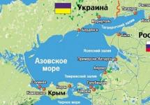
The southernmost of the Russian Far Eastern ones lies between the mainland of Asia and the Korean peninsula, and the Japanese ones, separating it from other Pacific seas and the ocean itself.
Natural boundaries prevail in the Sea of \u200b\u200bJapan, but in some areas it is limited by conventional lines.
In the north, the border between the Sea of \u200b\u200bJapan and the Sea of \u200b\u200bOkhotsk runs along the line of Cape Sushcheva - Cape Tyk.
In the La Perouse Strait, the boundary is the line of Cape Crillon - Cape Soya. In the Sangar Strait, the border runs along the line of Cape Syria - Cape Esan, and in the Korea Strait along the line of Cape Nomo (Kyushu Island) - Cape Fukae (Goto Island) - Island. Jeju-do is the Korean Peninsula.
Within these boundaries, the sea lies between parallels 51 ° 45 'and 34 ° 26' s. sh. and meridians 127 ° 20 'and 142 ° 15' in. etc.

Usually, highest peaks Sikhote-Alin have a sharply delineated contour and are covered with large-stone placers over vast areas. The relief forms resemble badly destroyed circuses and punishments of mountain glaciation.
They are composed of sandy-shale deposits with numerous intrusion breakthroughs, which led to the presence of deposits of gold, tin and base metals. In tectonic depressions within the Sikhote-Alin, there are deposits of hard and brown coal.
Basalt plateaus are common in the foothills, of which the largest plateau in area is to the west of Sovetskaya Gavan. The plateau sections are also found on the main watershed. The largest is the Zevinskoe plateau, on the watershed of the upper reaches of the Bikin and rivers flowing into the Tatar Strait. In the south and east, Sikhote-Alin is a steep mid-mountain range, in the west there are numerous longitudinal valleys and basins, at heights of more than 900 m - char. In general, Sikhote-Alin has an asymmetrical cross-section. The western macroslope is more gentle than the eastern one. Accordingly, the rivers flowing to the west are longer. This feature is reflected in the very name of the ridge. Translated from the Manchu language - the ridge of the large western rivers.
snow Mountain 
____________________________________________________________________________________________
SOURCE OF INFORMATION AND PHOTOS:
Team nomad
Far East.
The article talks about unique natural sitesthat are in this territory. Contains information about the relief, flora and fauna of the region. Gives detailed physical and geographical characteristics of the most remote but richest region of Russia.
Russian Far East
The Far East is usually called the territory of Russia, which is located off the Pacific coast. Its area is 6215.9 thousand km. sq.
If the Far East is understood as the Far Eastern Federal District, then its capital is Khabarovsk, and the capital of Primorsky Krai is Vladivostok. This question is often confusing.
This territory is located directly in the Pacific Ocean natural area, which belongs to the Kuril archipelago.

Figure: 1. Far East on the map.
The territory consists of the following parts:
TOP-3 articleswho read along with this
- mainland;
- peninsular;
- island.
In addition to the Kuril Islands, the territory includes the Kamchatka Peninsula, Sakhalin Island, the Commander Islands and other solitary islands located at the eastern borders of Russia.
In Kamchatka, there is one of the remarkable unique colleges of the Far East - the Valley of Geysers.

Figure: 2. Valley of Geysers.
This is the only region in Russia with periodically gushing geysers.
There are developed sea communications and therefore many ports are located in the Far East.
However, the presence of a large number of ports also gives rise to problems associated with illegal fishing.
The length of the region from northeast to southwest is quite large and is equal to 4.5 thousand kilometers.
The northern regions of the territories are located beyond the Arctic Circle, and there is almost always snow here.
Almost all seas washing the coast are not completely cleared of ice even in summer.
The lands of this area are dominated by the permafrost. Tundra reigns here for the most part.
In the southern part of the region, conditions are slightly milder.
The close proximity to the Pacific Ocean has a strong impact on the climate of the Far East.
The region is localized at the junction of two massive lithospheric plates. The southern Far Eastern region is characterized by a predominance of low and medium-altitude mountain ranges.
Only 1/4 of the territory of the Far East is covered by plains.
Natural resources
The geographical features include, first of all, the unique economic and geographical position of the territory. They are characterized by alienation from the main and most inhabited regions of the country.
The next factor is natural potential. The Far East is ranked among the richest regions of Russia.
Here is mined:
- diamonds - 98%;
- tin - 80%;
- boric raw materials - 90%;
- gold - 50%.
The location of the Far East on the border of the majestic continent and the largest ocean of the globe had a significant impact on the features of the natural-territorial complexes of the region, as well as on their location.
In addition to the anthropogenic factor, the environmental problems of the region include the problem of wastewater.
The inland waters of the Far East suffer greatly from this - the region is recognized as the fish treasury of Russia. And this is not surprising, since it is enough to imagine what seas the territory of the Far East is washed by. The list is pretty impressive:
- Laptevih sea;
- East-Siberian Sea;
- Chukchi Sea;
- Bering Sea;
- Sea of \u200b\u200bOkhotsk;
- Japanese Sea.
The landscape of the area began its formation in the Mesozoic and Cenozoic eras. Then folded zones and intermontane depressions appeared.
The highest parts of the mountains in the past were dominated by glaciers. This is evidenced by the preserved small relief-forming forms.
The highest height of the Kuril Mountains - 2339 m. - Alaid volcano.

Figure: 3. Volcano Alaid.
Powerful (up to 10 points) earthquakes often occur here. They are also the cause of the tsunami.
Far Eastern reserves are one of the largest in Russia. The nature in these parts is rather harsh. This is due to the fact that the mainland in the north and northeast is adjacent to the waters of the Arctic basin.
Arctic fox can often be found in the tundra, polar bear or reindeer. Squirrels, lynxes, wolverines and brown bears are common in the taiga. During the warm season, the tundra is overrun by a large number of migratory birds. In the taiga, birds are represented by hazel grouses, wood grouses, woodpeckers, nuthatches and thrush. In the highlands of animals mainly live snow leopards and musk deer.
What have we learned?
We found out what features and specific features the territory possesses. Find out what ecological problems are the most relevant. We found out which seas wash the shores of the Far Eastern region.
Test by topic
Assessment of the report
Average rating: 4.5. Total ratings received: 542.