10
- Square: 316 km 2.
- Population: 429 344 people
- Density: 1432 people / km 2
- Motto: "Valor and Constancy"
- Form of government: Parliamentary Republic, democracy
- Capital: Valletta.
Republic of Malta - island state In the Mediterranean Sea. The name comes from the Ancient Pinsky Malat ("Harbor", "Refuge").
In 1964, Malta was independence from the UK, and since 1974 the republic was proclaimed, but until 1979, when the last British naval base was eliminated in Malta, the British Queen was still considered the head of state.
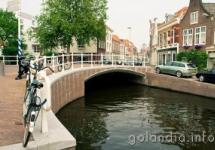
The territory of Malta is presented by the Maltese archipelago, mainly from Malta and Gozo. It also includes uninhabited Islands of St. Paul and Film, the inflexible island of Comino, as well as tiny comoinotto and phylfolete. Malta length - 27 km, width - 15 km (less than the diameter of the Moscow Ring car expensive). Gozo is half less, and Comino is only 2 km long. Malta is the only country in Europe, which lacks constant rivers and natural lakes.
9

- Square: 300 km 2.
- Population: 341 256 people
- Density: 1 359 people / km 2
- Form of government: Presidential republic
- Capital: Male
The Maldly Republic refers to the states of South Asia and is located on the group of atolls consisting of 1192 coral islands, in the Iidian Ocean to the south of India.
The islands of the slightly rise above the ocean level: the highest point of the archipelago - on the southern atoll of Addu (Siena) - 2.4 m. Thanks to this, the Maldives are known as the lowest state.
The total area is 90 thousand km², the land area is 298 km 2. The capital of Male is the only city and port of the archipelago - is located on the atoll monopho.
As for tourism, it is worth noting that all major beauty of Maldives are located below sea level, on landmarks are not observed on landmarks. There is little that the remarkable capital of Male, many similar to each other uninhabited islands, where they like to arrange picnics, as well as a kind of "action" - a fishing excursion. Perhaps the only remarkable aerial tour is "photo flying", flying over the islands on the seaplane. Other popular excursions are a cruise on a yacht or immersion on a submarine. The most common way of pastime among tourists in Maldives - Diving, the benefit of coral reefs is near every island. Also popular windsurfing, catamaran, water skiing, snorkeling, beach volleyball, tennis, billiards, squash and darts.
8

- Square: 261 km 2.
- Population: 51 538 people
- Density: 164 people / km 2
- Motto: "The state is above personal interests"
- Form of government: Parliamentary monarchy
- Capital: Baster
Island state in the Caribbean. Includes 2 Islands - Saint Christopher, he is Saint Kitts (Saint Kitts, St. Kitts), and Nevis (Nevis), from the ridge of small Antille Islands. The islands have volcanic origins, mountains. General extension coastline - 135 km.
Saint Kitts and Nevis is the smallest state of the Western Hemisphere, both in the area and population.
He is a member of the British Commonwealth, headed by the Queen of Great Britain.
Two traditional industries of Saint Kits and Nevis economy - agriculture and tourism. The main agricultural culture is a sugar cane (a third of the land processed). The island of Nevis is grown cotton, coconut palm tree, pineapples. Coffee tree, bananas, peanuts, yams, rice are cultivated. Livestock development is developed - diluted goats and sheep. Fisheries also refers to the number of traditional fishery. However, agricultural production provides no more than half of the domestic food needs.
7

- Square: 181 km 2.
- Population: 53 158 people
- Density: 293.7 people / km 2
- Motto: "Achievement through a common effort, Marshall"
- Form of government: Republic
- Capital: Majuro.
The Micronesian State of Marshall Islands is a cluster from the atolls and islands located in the Pacific A little north of the equator.
Marshall Islands are named after the British captain John Marshall (also known under the name William Marshall), who, together with another captain, Thomas Gilbert, in honor of which the neighboring Gilbert Islands were named, explored the archipelago in 1788 during the transport of prisoners to the new South Wales.
The Sushi area of \u200b\u200bMarshall Islands is only 181.3 km 2, while the area of \u200b\u200bthe territory occupied by the lagoons is 11,673 km 2. The country is located on 29 atolls and 5 remote islands, which are divided into two groups: 18 islands in the Roller chain (translated from the Marshall Language "Sunset") and 16 islands in the Ratak chain (or radar; translated from the Marshall language "Sunrise") . Both chains are approximately 250 km from each other and stretch from the North-West to the southeast of about 1200 km. The most important islands are the atolls of Quagealein and Majuro. The largest island of the Republic of Marshall Islands, Kwajalein, at the same time is the atoll with the largest lagoon in the world.
6
- Square: 160 km 2.
- Population: 37 313 people
- Density: 229,56 people / km 2
- Motto: "For God, Prince and Fatherland"
- Form of government: Nominally constitutional monarchy
- Capital: Vaduz
Principality Liechtenstein - dwarf State in Central Europe. Liechtenstein borders with Austria in the East and Switzerland in the West, its territory is completely surrounded by the territories of these states.
The principality is in the spurs of the Alps, the highest point is the mountain of gracepits (2,599 m). In the western part of the country, one of the largest rivers flows Western Europe - Rhine.
Principality Liechtenstein is a constitutional monarchy. Head of State - Prince. The legislative power belongs to the prince and Landtagu (Parliament), the executive authority is endowed with the government, which is elected by Landtag for its term of office and is approved by the prince. Most of the population speaks at the Alean Dialect of German.
This beautiful dreamlanddespite its very little sizes, famous for its ancient history and rich cultural Heritage. Picturesque natural landscapes, magnificent medieval architecture and, of course, fashionable ski resort Famous worldwide.
The heart of Liechtenstein and his "pearl" is the capital of Vaduz. It is here that most of the attractions of the country focuses. Business card Not only the cities, but the whole state is the magnificent princely castle of Vaduz. Beautiful architectural construction towers on a hill and can be seen from anywhere in the city.
5

- Square: 61 km 2.
- Population: 32,742 people
- Density: 520 people / km 2
- Motto: "Liberty"
- Form of government: parliamentary republic
- Capital:
San Marino is located in Southern Europe, from all sides is surrounded by the territory of Italy. In his current borders of San Marino - the oldest state of Europe. Country is located on the southwest slope of the truder mountain Massiva Monte Titano (738 m above sea level), towering over the hilly plain of the Forn Athennine.
The legendary base of San Marino refers to the beginning of the IV century. According to the legend, in 301, a member of one of the first Christian communities from the island of the slave in the Adriatic Sea (the territory of modern Croatia), Marino's kamenotes and friends found a refuge on Apennines, on the top of Mount Monte Titano. He opened a quarry in the mountain, and then, looking for a privacy, built a small cell on her vertex and retired from the world. The glory of his holy life was attracted to him the crowds of the Bogomoltsev, and soon near his Celly formed a small monastery. This monastery, named after its founder, St. Marina, has undoubtedly existed already at the end of the 6th century and lived an independent life, no politically dependent on any of the neighbors.
In San Marino there is a republican form of government. The heads of state are the two Captain Regent, appointed by the Great General Council.
Inbound tourism plays a significant role in the country's economy, up to 2 million people are involved in the tourism industry annually, and more than 3 million tourists visit the country every year.
4

- Square: 26 km 2.
- Population: 10 782 people
- Density: 431.00 people / km 2
- Motto: "Tuvalu - for the Almighty God"
- Form of government: monarchy
- Capital: Funafuti
Tuvalu is a tiny state in Oceania with a population of about 11,000 people. Two times a week, airplanes with Fiji arrive 2 times a week and almost certainly, in 50 years, this state will be under water, and now purposefully relocated local residents to other states such as Fiji, New Zealand and Australia.
This Pacific State is in Polynesia and until 1975 was called the Islands of Ellis. The current name of the translation from Tuvalu language means "eight standing together" (meaning eight traditionally populated Tuvalu islands; ninth - Niuluckite - was settled relatively recently). The European islands recorder, Alvaro Mendagnia de Neira, called the Lagoon Islands archipelago, and in 1819 he received the name "Islands of Ellis", which was used almost the entire colonial era
Tuvalu is a cluster from the atolls and islands located in the Pacific A little south of the equator. Sushi Tuvalu Square is only 26 km 2, while the area is occupied by the lagoons, more than 494 km 2. The country is located on 5 atolls (Nanuma, Nui, Nukulaelae, Nukuftau, Funafuta), 3 low-albertic coral islands (Nanumland, Niuluckite, Nutoo) and one atoll / reef island (Vaitupe), stretched from the North-West to southeast for 595 km .
A significant part of the population of Tuvalu lives in the capital and the only city of the country, Funafuti, - 47%.
3

- Square: 21 km 2.
- Population: 9 488 people
- Density: 473,43 people / km 2
- Motto: "God's will - above all"
- Form of government: parliamentary republic
- Capital: The official capital is not; Unofficial - the city of Yaren.
The Republic of Nauru is a dwarf state on the coral island monopho in the western part of the Pacific Ocean. The origin of the word "Nauru" is definitely unknown. Like now, the Naoero island called Naoero in the distant past.
The official capital and cities on the island are not. The president's residence is located in the Meneng district, and government agencies and parliament - in the County of Yaren. The whole population of the island lives along the coast, as well as around Lake Badad.
2
- Square: 2.02 km 2.
- Population: 30 508 people
- Density: 18,679 people / km 2
- Motto: "With God's help"
- Form of government: Dualistic constitutional monarchy
- Capital:
A dwarf state associated with France, located in the south of Europe on the coast of the Ligurian Sea near French Cote d'Azur 20 km north-east of Nice; On land borders with France. It is one of the smallest and most populous countries of the world. The principality is widely known due to the casino in Monte Carlo and the stage of the Formula 1 championship - "Gran-Monaco" held here. The length of the coastline is 4.1 km, the length of the land borders is 4.4 km. Over the past 20 years, the country's territory increased by almost 40 hectares due to the drainage of marine areas.
The first people built their settlements on the territory of Monaco in the 10th century BC. E., It was the Phoenicians. Many later joined the Greeks and Monoyes.
The history of modern Monaco begins in 1215 with the basis of the Principality of the Colony of the Genoese Republic and the construction of the fortress.
According to the data for 2014, the population of Monaco is 37,800 people, but it is worth noting that most of the full citizens of the state are Megakov. They are freed from taxes, have the right to settle in the region of the Old Town.
The monaco economy develops mainly at the expense of tourism, gambling business, the construction of new residences, as well as at the expense of media media covering the life of the princely family.
1

- Square: 0.44 km 2.
- Population: 842 people
- Density: 1900 people / km 2
- Form of government: Absolute theocratic monarchy
- Capital:
And, undoubtedly, the title of the smallest state in the world is presented by the Vatican. Vatican is a dwarf ambulance state (the most small officially recognized state in the world) within the territory of Rome associated with Italy. Vatican status in international law is auxiliary sovereign territory of the Holy See, the residence of the highest spiritual leadership of the Roman Catholic Church.
Diplomatic missions of foreign states are accredited with the Holy Throne, and not under the city of the Vatican State. Foreign embassies and representative offices accredited with the Holy Throne, in view of the small territory of the Vatican, are located in Rome (including the Italian Embassy, \u200b\u200bwhich is thus in its own capital.
In antiquity, the territory of the Vatican (lat. Ager Vaticanus) was not populated, as in Ancient Rome This place was considered holy. Emperor Claudius spent circus games on this place. In 326, after the arrival of Christianity, the Basilica of Constantine was erected over the alleged tomb of St. Peter, and since then this place began to settle.
Vatican is a theocratic state managed by the Holy Throne. The sovereignt of the Holy See, in the hands of which the absolute legislative, executive and judiciary is concentrated, is Pope, elected by cardinals for a life sentence. After the death or renunciation of the Pope and during the conclusion, up to the intronuration of the new dad's duties (with significant restrictions) performs Camerelo.
The Vatican has a non-profit planned economy. The sources of income are primarily donations to the Catholics of the whole world. Part of the funds is tourism (selling postage stamps, vatican coins euros, souvenirs, fee for visiting museums). Most of the labor force (service personnel of museums, gardeners, wipers and so on) make up citizens of Italy.
The Vatican budget is 310 million US dollars.
The Vatican has its own bank, a better known entitled "Institute of Religious Affairs".
Do you know how many times the biggest island of Russia is less than the largest island of the world? Read the post and find out.
№10. Elsmir (Canada) - 196 236 km2
Elsmir - the North Island of Canada - is among the top ten largest islands in the area in the world. Due to the harsh climate, the population of the island is about 150 people.
On the territory of Elsmir, the remains of prehistoric animals were repeatedly found. The first settlers were nomads from Siberia. In 1250, the people of Tula, the ancestors of Eskimos settled on the territory. But by the middle of the 18th century, the island became desertless.
The island was opened in 1616 by the English navigator William Buffin.

№9. Victoria (Canada) - 217 291 km2
At the ninth place in Square - Victoria Island (Canada). The island was opened in 1838 during the Expedition of the British researcher Thomas Simpson.
In the 50s of the 20th century on the island there were several settlements in which meteorologists lived. By the end of the 20th century, the population of the population will increase by the settlers of the Eskimos, who engaged here commercial activities.


№8. Honshu (Japan) - 227 970 km2
Honsel is the largest island Japanese archipelago and ranks 8 line rating the largest islands in the world. On the island of Honshu are the largest Japanese cities: Tokyo, Iokohama, Osaka, Nagoya, Kyoto, Hiroshima, etc.
The island is covered by many volcanoes, some of them valid. The population of the island is more than 103 million people.


№7. United Kingdom (United Kingdom) - 229 848 km2
The United Kingdom takes the 7th place in the list of the largest islands in the world and is the largest island among the British Isles and in Europe as a whole.
The beginning of the History of Great Britain is the period of Roman conquest in 43 BC, but the island had an earlier story.
The United Kingdom was populated by the people noto several hundred thousand years ago. Modern man He arrived at the British Islands before the start of the last glacial period, but retreated to South Europe because of glaciers covering the territory of the island. According to archaeological finds, after 12,000 BC. e. The British Islands were again populated. About 4,000 years BC. e. The island was populated by people of neolithic culture.
To date, the population is the population of the UK islar more than 61 million, which makes it the most densely populated area of \u200b\u200bEurope.


№6. Sumatra (Indonesia) - 443,066 km2
Sumatra - the sixth is the island in the world. It is located immediately in two hemispheres, since almost the middle of the island passes the equator. The island belongs to Indonesia and is part of the Malay Archipelago. It is in the zone of frequent earthquakes and tsunami.
To date, the population of the island of Sumatra is more than 50 million people. Main cities Sumatra: Medan, Palembang, Padang. People live on Sumatra, about 90% confesses Islam.
Approximately 73 thousand years ago on the island of Sumatra, there was an explosion of the Toba volcano. This event led to 1800 years of the glacial period and a reduction in the number of human population up to 2,000 people.
The name of the island comes from the Sanskrit word Samudra - "Ocean", or "Sea".


№5. Baphinova Earth (Canada) - 507 451 km2
Buffinova Earth is the first in the area among Canada Islands and the fifth in the world. Due to the harsh climatic conditions of the island, the population is about 11 thousand people. Bigger locality Islands - Ikaluit.
The first description of the island made William Buffin in 1616, in honor of him and called the island.


№4. Madagascar (Madagascar) - 587 713 km2
The fourth line of the rating is the island of Madagascar. Located in the Indian Ocean at the eastern shore of Africa. The island is the state of Madagascar (the capital of Antananarivo). To date, the population of Madagascar island is more than 24 million people.
Locals call Madagascar Red Island due to soil color. More than half of animals living in Madagascar will not meet on the mainland, and 90% of plants are endemics.


No. 3. Kalimantan (Indonesia, Malaysia and Brunei) - 748 168 km2
Kalimantan or Borneo Third largest island in the world. It is divided between 3 states: Indonesia, Malaysia and Brunhem. The island is located in the center of the Malay Archipelago.
Kalimantan in the local language means a diamond river. He is named so thanks to its rich resources, in particular a large number of diamonds.
The first people settled Calimant about 40 thousand years ago. To date, the population of about 20 million people. More than 300 ethnic groups live on the island.

№2. New Guinea (Indonesia, Papua New Guinea) - 785 753 km2
New Guinea still has places where there was no man. This place attracts researchers of flora and fauna, as they can meet here rare species Animals and plants. More than 11 thousand species of plants live here, 600 unique species of birds, over 400 types of amphibians, 455 species of butterflies and about a hundred famous mammalian species.
New Guinea Bala is populated by a person at least 45 thousand years before. e. from Asia. From the first settlers and there were more than a thousand Papuans and Melanesian tribes. The absence of large animals suitable for domestication on the island prevented the development of agriculture and made it impossible cattle breeding. This contributed to the preservation of the primitive-communal system in the large territories of New Guinea until today's days. Mountain landscape contributed to the isolation of people from each other, as a result of which a huge variety of languages \u200b\u200bappeared on the island.
The Portugal Dong George di Menezish, who landed on the island in 1526 became the discoverer of New Guinea. According to legend, he gave the island of the name "Papua", which is translated as curly, is connected with Curly hair of local aborigines.
To date, the population of New Guinea island is more than 9.5 million people.
On the territory of New Guinea, there is an ancient agricultural settlement of Cook, showing the isolated development of agriculture for 7-10 millennia and the UNESCO World Heritage List.


№1. Greenland (Denmark) - 2 130 800 km2
The biggest island in the world is Greenland. Green country, as it is also called this island, belongs to Denmark. Due to glacial coating (84% of the surface) and unfavorable climatic conditions Most of the island is not populated. To date, the population of Greenland is more than 57 thousand people. The largest settlement of the island is Nuuk (Gothob).
Several thousand years before the arrival of Europeans, Greenland Eskimos lived on the island, who call themselves inuita. Inuit adapted to the extreme conditions of the Arctic climate and feel quite comfortable. They proof of the centuries are engaged in fishing fish and hunting.
From Europeans first on the island joined Norman Gunbyorn in 875. In 982, Eric Rauda with several comrades, sent from Iceland for their crimes committed on the island. Later, Norwegian Vikings joined them. In 983, the first Norman Colony was founded in Greenland.
After the settlement of Greenland Europeans, the island was repeatedly transmitted from hand to hand. Until 1536, the island belonged to Norway, then began to belong to Denmark, in accordance with the unia between Denmark and Norway. In 1721, a Danish colony called Gothoba was officially established on the island. In 1814, after termination of UNIs between Norway and Denmark, Greenland became completely possession of Denmark.
The main activity of the population of Greenland is fisheries. But at the end of the 20th century, the breeding of reindeer and sheep and oil mining appeared. Tourism and air transport plays a major role. Greenland is visited annually more than 20 thousand tourists.


The biggest island of Russia (Sakhalin) is less than the largest island of the world (Greenland), 27 times.
The largest islands of Russia:
Sakhalin - 76600 km2
North - 48904 km2
South - 33275 km2
Boiler - 23200 km2
October Revolution - 13708 km2
Solovki is a canvas, woven from spiritual power and bodily weakness, human joy and universal grief, willpower, the strength of the will and betrayal, a beautiful lie and ugly truth, hissing of the surf and unique sunsets, silvery fish and the shelest of wings. It shocks the roots of heather and the rays of the sun, covered with snow and highlighted northern Lights, Furious blood, vodka and rains. Solovki bezed on the White Sea winds, overflowing all the colors of life, and rustle their stories to everyone who wants to hear them.
Solovetsky archipelago (Solovki) is located in the Onega Gulf, 164 kilometers from the Conditional Line of the Polar Circle. The archipelago consists of six large and about 260 small islands. The Square of the Great Solovetsky Island is 221.8 km2, and the area of \u200b\u200bthe entire archipelago exceeds 300 km2. Highest point - Mount Verbokolskaya (88.2 m) on.

Photo: Cyril Ponomarev
The geographical location of the archipelago led to the appearance of its own microclimate: there is a cherry on the islands (but not fruits) cherry, cedar pines, cocks, hazel. Most of the archipelago is covered with coniferous and deciduous forests, but individual sites are tundra and forest tundra. An important role in the formation of the archipelago played a glacier. At Solovki more than 600 fresh lakes, in which perch, roach, pike, Nalim, Trout. In the forests you can meet a hare-beyak, fox, protein. In rare years, when the White Sea freezes, enter reindeer and elk. Among marine animals - Nerpe, Beluha, Sea hare, Greenland seal. Tubat, Pinagor, Kambala, Cod, Navaga and Solovetskaya Herring are found in the sea. The coastal strip of the archipelago is unusually rich in algae plantations - sea cabbage (laminaria), Fukus and angellation, from which agar-agar is mined.

Photo: Cyril Ponomarev
The history of the development of the Solovetsky archipelago has about 7,000 years. Ancient parking, mounds and seats were found here. The most mysterious monuments are the sanctuations of the III-II millennium BC, which include famous. The main historical and architectural monuments of the archipelago are associated with the history of the existing spiritual monastery and the most northern medieval fortress of the world. , reflected in the waters of the Holy Lake or Bay of Welfare - one of the most popular and beloved views. In Soviet times, the first in the USSR was located in the USSR of a special purpose camp, which posted the beginning of Stalinist Gulag. More than 10,000,000 prisoners passed through and their branches on the mainland.
Today, the territory of the Solovetsky Archipelago and the adjacent water area is the reserve. In 1992, the historical and architectural ensemble of the Solovetsky Monastery was included in the UNESCO World Heritage List, and in 1995 it was attributed to the particularly valuable objects of the natural and historical heritage of Russia.
text: According to the materials of the guidebook "History of the Solovetsky Archipelago", the author of Oleg Kodolo
photo in the upper block: Svetlana Lanka, Anna Khazova, Igor Pavlov, Lyudmila Gagarinova, Evgeny Kondratyev, Nikolai Quartnakers, Cyril Ponomarev

Photo: Natalia Bochkareva
Archipelagoes - a complete list of archipelago countries and archipelagoes belonging to different states, broken down by the oceans and parts of the world.
What is the archipelago and what they happen
Archipelago – this is a complex located close to each other. According to the geological structure of archipelagoes are similar to each other. For its origin, they all happen:
- Mainland
This is so called the archipelagoes that were initially part of the mainland, but as a result of the movement of tectonic plates, they separated from sushi and the set of islands were formed. The most vivid example of the mainland archipelago is the British Islands. Also relate to them New Earth, New Zealand.
- Volcanic
These complexes of the islands were formed in the results of volcanic activities, or themselves are volcanoes. Most often, in this case, the island is the top of a huge underground volcano, which looks out of the water. The most vivid representatives of volcanic archipelagoes are Hawaiian Islands.
- Coral
The complex of the islands that arose as a result of the growth and dying of the underwater corals. Islands may have a rings or semicircular shape - they are called atolls. Most of the coral archipelago are located in the Pacific Ocean. The most famous coral archipelago is the Marshall Islands.
- Naming
Set of Islands Network natural origin. They are complex hydraulic structures that are installed in water sections. Wash islands formally do not possess the status of archipelagments and islands, because they are not natural objects. The most famous anthropogenic archipelago is an island of palm trees located in the Emirates.
Of course, they are not deserted and many are small states. The islands constituting the territory in contact with each other and have geographical and political unity.
At the moment, there are about 30 state-TVs located on the archipelagoes. They include Philippines, Indonesia, Fiji. For contact between the islands, archipelago lines are used. Everything water space Inside these lines belongs to the state archipelago.
The largest archipelagoes
On our planet a huge number of archipelago. The largest of them -
- Malay
- Japanese Islands
- British Isles.
The Malay Archipelago is considered the best and large in the world. Its area is 2 million kilometers, and he included more than 10,000 islands. On the lands of this giant, Malaysia, Indonesia and the Philippines are located. On the Malay archipelago there are many volcanoes and mountains, as well as many gas and oil deposits. Fisheries and agriculture prevail among the population.
The second largest world archipelago is Canadian Arctic. It is located in the Arctic Ocean. The area of \u200b\u200bthis archipelago is approximately 1.3mln.kv.km. The main population is Eskimos. This complex includes the islands of Elsmir, Victoria, Baphinova Earth. The archipelago reliefs make up various loops, mountains and a plateau.
The next large archipelago is known to everyone - these are the most Japanese islands. They included many small islets, each of which is interconnected. Most of them take the mountains and volcanoes, as well as coniferous forests. The geological situation itself is extremely unstable - there are earthquakes, tsunami. The bulk of the population is on directly Japanese island. The sea fishery is highly developed - mining of fish and crabs.
And the last on the list, but not by the significance of the archipelago is the British Islands. Its area is approximately 320t.kv.km, the archipelago includes the United Kingdom, Ireland and many other small cities. The United Kingdom and Ireland are two states that are on this territory.
List of archipelags
 This list contains all existing world archipelagoes. For our convenience, I divided them in a territorial sign - the oceans, where they are, as well as the territorial subgroups of the islands. Each of the lists is compiled in alphabetical order for your comfort. In the event that the state is located on the territory of the archipelago - this will be noted in the list. You can find every archipelago on the planet, learn about him and, perhaps, consider as a place of rest.
Archipelago of the Northern Ocean –
complex northern Islandslocated close to the Arctic. Different with cold climates and a small population density :
- Land Franz Joseph
- Canadian Arctic Archipelago
- Novosibirsk Islands
- Islands Belcher
- Northern Earth
- New Earth
- Spitsbergen
- Queen Elizabeth Islands
Archipelago of the Atlantic Ocean -
an extensive complex of clusters of the islands scattered in the Atlantic Ocean. This includes a number of European and African archipelago, as well as island complexes of North and South America. This includes the Canadian Arctic Archipelago, and the British Islands:
Archipelagos located along the coast of Europe -
- British Isles
- Internal hebrid Islands
- External hebrid Islands
- Hebrides
- Norman Islands
- Saint Kilda Saint Kild Islands
- Faroe islands
- Shetland
Archipelagos located along the coast of Africa -
- Bay of beautiful islands
- Arkipelago Shower Bihagos.
- Islands of Bajuni
- Saint Helena Islands
- Saad Ad-Dean
- Sao Tome.
- Tristan Yes Kuna
- Bermuda
- External land
- Canadian Arctic Archipelago
- Islands of Terks and Caicos
- Fire Earth
- Magdalena Islands
- SVT. Peter and Paul Rox
- Fernando di Noronaya
- Southern Sandwich Islands
- Islands
Macaresian Archipelagoes -
- Aland Islands
- Azores
- Wild Islands
- Canary Islands
- Islands Madeira
Baltic Sea Archipelago -
- Estheregetland Archipelag
- Sedermenland archipelago
- Smolend archipelago
- Calix Archipelago
- Turku archipelago.
- Archipelago Piteo
- Archipelago Lulea
- Skellefteo archipelago.
- Haparanda Archipelago.
- Archipelago Eremend
- Sea of \u200b\u200barchipelago
- Western Estonian archipelago
- Stockholm Archipelago
- Swedish Arch Lag Eastern Coast
Archipelago of the Gulf of Mexico and the Caribbean -
- Los Rockes Archipelago
- Large Antille Islands
- West India.
- Virgin Islands
- Islands
- Small antilles
- Covered Islands
- ABC Islands
- Leaded Antilles
- Puertoric O
- Revered Islands
- Florida Kisa
Mediterranean Archipelago -
- Campenien Archipelago
- Maddalen archipelago
- Balearic Islands
- Venetian Laguna
- Dodecanese
- Ionian Islands
- Cyclades
- Spraes
- Tuscan archipelago
Archipelago of the North Sea -
- Frisian o-va
Indian Ocean Archipelago -
The complex of archipelagos located in the territory Indian Ocean. They differ in tropical climates and heat. Archipelagos here consist of a large number of small islands. One of the most striking representatives is an artificial world archipelago :
- Andaman Islands
- Bonaporea Archipelago
- Pirate archipelago
- Chagos Archipelago.
- Archipelago research
- Archipelago of Mergui
- Archipelago Zanzibar
- Amyranta Islands
- Coconut Islands (O-Va Kiling)
- Comoros
- Langkavi
- Lakshavip.
- Kergelen Islands
- Mascarensky Islands
- World Archipelago
- Nicobar Islands
- Islands of Mozambik Strait
- Socotra
- Houghman Abrolhos.
Archipelago of the Red Sea -
- Hurghada archipelago
- Islands Farasan.
- Archipelago Dakhlak
Pacific archipelagoes -
this is the largest complex of archipelago. This includes a huge set of islands and all the largest world archipelagoes. Of particular interest are Asian archipelagoes - the number of islands that make up them are the largest in the world. This complex includes both the archipelagos of America and the aforementioned Asian, as well as the archipelagoes of inchotropic countries. The climate varies from moderate to tropical:
Archipelagos located along the coast of America -
- Andreyan Islands
- Aleutian about
- Archipelago Alexander
- Chile archipelago
- Guacekas Archipelag
- Archipelag Guayanko
- Chonos Archipelago.
- Archipelago Patagonik
- England Wellington
- Queen Adelaide Archipleago
- Fox Islands
- Norman Islands California
- Islands of four mountains
Archipelagos located along the coast of Asia -
- Archipelago Ryuku
- Asian Islands
- Archipelago Gorong
- Rio Archipelago
- Archipelago Tambelan
- Tadjuch archipelago.
- Woodubel Archipelago
- Archipelago QUI
- Archipelago Sulu.
- Chumphon Archipelago.
- Solar archipelago
- Large Sonda Islands (Zonda)
- Arc Gang
Work on the world islands began in 2003 on the initiative of Dubai Emir Mohammed Ben Rashid Al-McTwum, also known by other ambitious projects (for example, the famous Sail Hotel). The idea of \u200b\u200bcreating an artificial archipelago appeared after it became clear that the coastline of the Persian Gulf was not enough for everyone to acquire a piece of sushi near the water. The first swallow became Palm-Jumeira - the same "Palma", which today is one of the characters. Almost followed her in 4 kilometers from the shore, Nakheel began to build The World (peace).
Unlike Palm-Jumeira, the world islands do not have land with the mainland, so all building materials were delivered here only with water and air. The sand for creating an islands ranging from 14 to 83 thousand m 2 was taken from the bottom of the Persian Gulf, and so that it was not blurred, the wave-rolled system was built around.
Material for the construction of the islands took a photo of the construction period of one of the islands from the bottom of the Persian Gulf
Initially, it was planned to create 7 "continents", but since such large parts of the sushi were in the pocket, they decided to divide them for dozens of islets, which could acquire individuals. The very first appeared in 2004, "Dubai" called him. By 2006, the world's Archipelago was almost ready, and two years later, private investors were repaid about 70% of territories.

However, the construction boom on the world islands lasted not long. In 2008, a large-scale financial crisis began, whose consequences are noticeable in so far. Construction sites were frozen, and projects for the creation of hotels and luxury resorts were partly realized only on the island "Lebanon". The situation was revived only in 2018, when Kleindienst decided to modernize the part of the archipelago, adding objects with artificial snow and ice. But how much it will be possible to realize these plans - the future will show.
How to get to the Archipelago "Mir" in Dubai
Getting to the world islands, without being the owner of one of them, is almost impossible. Even water walks in this place are prohibited, except for the transfer to Lebanon, where the Beach Club "The Royal Island" is located. For him, every hour leaves a boat from the pier Fishing Harbor 1. For an excursion you need to purchase a ticket, including a trip to the boat and visiting the club itself.
The exact address:boulevard La Rambla (La Rambla), structure 19.
How to get from Dubai airport:
Option 1
Underground:from the stop from the terminal 3 on the red line to go to the Business Bay station 27 minutes.
Bus:the metro station is to transfer to Bus number 9 and go to Al Aroba Street 1, on the way for 10 minutes.
On foot:commier 1 km.
Option 2.
Bus:from the stop at Terminal 1 to go by bus number 32c to Satwa Roundabout 1, on the way 28 minutes.
Bus:put on the route number 88 and go to Suhil Bin Jumaa Masjid 23 minutes.
On foot:commier 1 km.
How to get from Al-Maktum Airport:
Option 1
Bus:route №F55 go to the stop of IBN Battuta, on the way 37 minutes.
Underground:from the station IBN Battuta to drive to Business Bay in 25 minutes.
Bus:route №9 Get to Al Aroba Street 1 in 10 minutes.
On foot:commier 1 km.
Option 2.
Bus:route №F55 Getting to stop IBN Battuta for 37 minutes.
Bus:put on route number 8 and go to Rashid Al Hadees Masjid 2, on the way of 1.5 hours.
Archipelago "World" in Dubai on the map
What to see
The world's largest archipelago of artificial origin "Peace" occupies a territory of about 55 km 2, on which some islands are collected by groups, others are on distance from each other. It was originally planned that this place would be a "resort for chosen" - will be filled with elite villas, hotels and beach clubs for the most famous and rich people of the world. Several companies, buying out some of the islets, really tried to implement such projects.

On the island of Aquitainia, 5-star hotels were built and a whole group of luxury villas, and Isla Moda planned to devote entirely to fashion. In addition to the resort infrastructure, it wanted to open the boutiques of the most famous brands, the hotel with the design of Karl Lagerfeld and several playgrounds for fashionable shows. On the 19 islands of Australia and New Zealand, Kuwaiti investors were going to launch huge complex "Ocean". Within the framework of such a resort, the construction of residential buildings on the coast and piles, SPA hotels with pools and private villas. However, all these projects "frozen" at different stages of implementation.

At the same time, part of the territory of the Archipelago "World" remained non-commercial. For example, Ethiopia Island was bought by Brad Pitt and Angelina Jolie at that time, when they were still married, Antarctica belongs to Michael Shumacher, and the United Kingdom is a billionaire Richard Branson. Russian businessmen bought most of the group "Russia", with the exception of St. Petersburg, which is owned by Kleindienst Group.

But the high cost of building on the islands, which communicate with the mainland only by air and water, led to the fact that only "Lebanon" managed to open for the general public. The Beach Club "The Royal Island" works here, which includes:
- Huge pool;
- Volleyball playground;
- Two beach with panoramic views;
- Bar for parties and discos;
- Mediterranean restaurant.
There are rooms for recreation, but they are only available in the afternoon - during the work of the beachclub. Therefore, only the island is held one-day excursionsWhile you can sunbathe, swim in the pool or go for a short water trip around the surrounding area. From the advantages of such excursions, you can mark a small number of people, on some days of the club visitors it is easy to recalculate on the fingers of one hand.
Opening hours and ticket costs
Beach Club "The Royal Island" on the island "Lebanon" works:
- Daily from 11:00 to 18:00.
Ticket price, including boat travel:
- For adults - 300 AED ( ~ 6 393 rubles. );
- For children under 10 years - 150 AED ( ~ 3 197 rub. ).
- The largest artificial archipelago was planned to be done even more - with the help of new islands, they wanted to turn it into the "Universe" (The Universe project).
- You can purchase one of the islands directly from the company-developer only at a personal invitation that are sent to the most famous people in the world.
- When construction, coral reefs were transferred to new places. It is planned that they will gradually settle down with water inhabitants so that in a few years this formation looked completely natural.
- In order to avoid stagnation of water in the straits, there is a system of forced circulation - special volatile blades form artificial flows.
- On the island "Sweden" is currently actively built ski resort. There are already completed objects in which closed presentations were conducted.